The best MTB trails in Toca
4.4
(8)
42
riders
4
rides
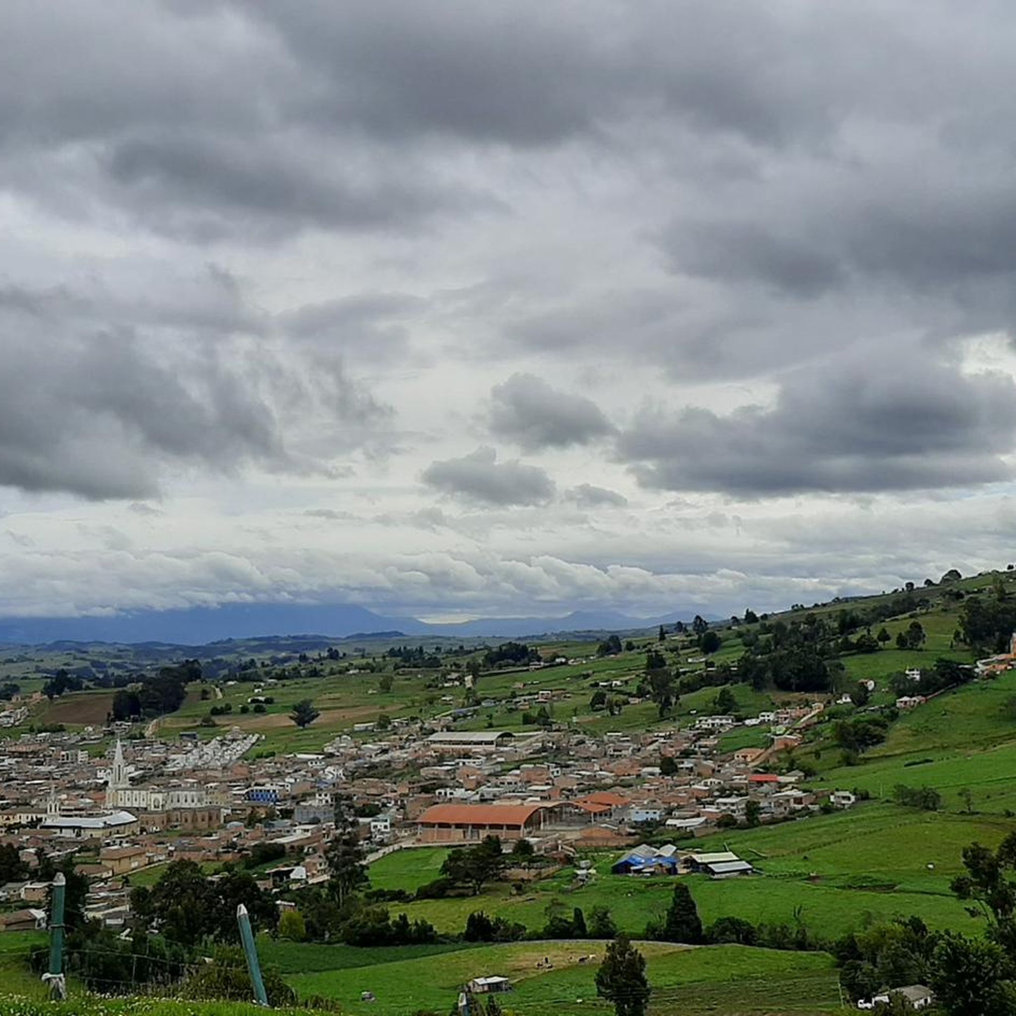
Mountain bike trails in Toca are situated in a mountainous region of Boyacá, Colombia, characterized by significant elevation changes and diverse terrain. The landscape includes both paved and unpaved sections, offering varied riding conditions. Elevations can reach up to 2,900 meters above sea level, providing challenging climbs and expansive views. The area features a network of trails and junctions connecting to neighboring towns and historical sites.
Best mountain bike trails in Toca
- The most popular mountain bike trail is Las…
Last updated: July 28, 2026
4.9
(7)
23
riders
Moderate mountain bike ride. Good fitness required. Suitable for all skill levels.
4.0
(1)
5
riders
Hard mountain bike ride. Very good fitness required. Suitable for all skill levels.

Sign up for free
3
riders
Hard mountain bike ride. Very good fitness required. Suitable for all skill levels.
4
riders
38.7km
03:45
770m
770m
Moderate mountain bike ride. Good fitness required. Suitable for all skill levels.
3
riders
19.6km
02:09
600m
600m
Moderate mountain bike ride. Good fitness required. Suitable for all skill levels.
Our route recommendations are based on thousands of hikes, rides, and runs completed by other people on komoot.
Start today with a free account
Your next adventure awaits.
Login or Signup
Popular around Toca
Tips from the Community

The Vargas swamp monument is a beautiful place, an incredibly accomplished work of art in the middle of the beautiful landscape of the altiplano, a symbol of Colombia's struggle for independence.
0
0


Detour to Making Biafra. At this point there is a house of the national army called the Casa del Soldado. There is a large eucalyptus.
0
0
Place to share and have a snack in Pesca
0
0
Natural lagoon surrounded by frailejones of more than 3 meters. Birth of the Pesca River
0
0
Butagá educational institution headquarters Chaguatá
0
0
Domes of Miguel Angel "Superman" Lopez
0
0
Beer sales. Detour to Iza through the hot springs
0
0
Frequently Asked Questions
What kind of terrain can I expect on mountain bike trails in Toca?
Mountain bike trails in Toca are characterized by significant elevation changes and diverse terrain, as the region is quite mountainous. You'll encounter both paved and unpaved sections, offering varied riding conditions. Elevations can reach up to 2,900 meters above sea level, providing challenging climbs and expansive views.
Are there mountain bike trails suitable for beginners in Toca?
While Toca's terrain is generally mountainous and offers challenging climbs, there are routes with varying difficulty. For example, the Las Cruces de Firavitoba – Curies Summit loop from Iza is rated as moderate. It's always recommended to check the specific route details on komoot to match your skill level.
Are there any advanced or challenging mountain bike trails in Toca?
Yes, Toca offers several challenging routes for experienced mountain bikers. Trails like the Main Park of Tibasosa – First Viewpoint of Tibasosa loop from Tibasosa, the Three Crosses of Pesca – Cyclists' Stop in Pesca loop from Iza, and the Main Park of Sotaquirá – Abandoned Bus at Alto de Siome loop from Río Jordán are rated as difficult, featuring significant elevation gains and technical sections.
What are some notable landmarks or points of interest I can see along the mountain bike trails in Toca?
You'll find several interesting points along the trails. The Curies Summit is a popular mountain pass reaching 2,900 meters, offering stunning views. The Cyclists' Stop in Pesca is a great spot for a break and local snacks. The region also features various trail junctions like Junction to 4 Esquinas and Guatika and Intersection to Pesca, Pantano Grande (Zetaquira), and Toca, which connect to neighboring towns and historical sites.
Are there any loop trails for mountain biking in Toca?
Yes, many of the mountain bike routes in Toca are designed as loops, allowing you to start and end at the same point. Examples include the Las Cruces de Firavitoba – Curies Summit loop from Iza, the Three Crosses of Pesca – Cyclists' Stop in Pesca loop from Iza, and the Main Park of Tibasosa – First Viewpoint of Tibasosa loop from Tibasosa.
What is the typical duration for mountain bike trails in Toca?
The duration of mountain bike trails in Toca varies depending on the route and your pace. For instance, the Main Park of Tibasosa – First Viewpoint of Tibasosa loop from Tibasosa typically takes around 3 hours and 19 minutes, while the longer Three Crosses of Pesca – Cyclists' Stop in Pesca loop from Iza can take approximately 4 hours and 57 minutes.
Are there cafes or places to stop for refreshments along the mountain bike routes?
Yes, a notable stop for cyclists is the Cyclists' Stop in Pesca. This cafe offers local snacks and is conveniently located near the main fishing park, providing a cultural and gastronomic experience for riders. The Three Crosses of Pesca – Cyclists' Stop in Pesca loop from Iza route specifically includes this stop.
What do other mountain bikers enjoy most about Toca?
The mountain biking experience in Toca is highly rated by the komoot community, with an average score of 4.4 stars from over 7 reviews. Riders often praise the challenging mountainous topography, the high-altitude passes like Curies Summit, and the well-developed system of trails and junctions that connect to various towns and historical sites.
What is the best time of year for mountain biking in Toca?
Toca's mountainous climate means conditions can vary. While specific seasonal recommendations aren't provided, the region's high elevations suggest that weather can change rapidly. It's always advisable to check local weather forecasts before heading out, especially for routes ascending to higher points like Curies Summit.
Are there any family-friendly mountain bike trails in Toca?
The mountain bike trails in Toca are generally characterized by significant elevation changes and are often rated as moderate to difficult. While there are no specific trails highlighted as 'easy' or 'family-friendly' in the data, some moderate routes might be suitable for families with older, experienced children. Always review the route's elevation profile and distance carefully on komoot to determine suitability for your family.
How many mountain bike trails are available in Toca?
There are several mountain bike routes available in Toca, with at least four distinct tours detailed on komoot. The komoot community has explored many more, with over 40 mountain bikers having used komoot to discover the varied terrain of the region.
Most popular routes in Toca
Most popular attractions in Toca

Get inspired with the komoot mobile app


Explore more
Browse the best MTB trails in other regions.
