The best walks and hikes around Hattersheim
4.4
(491)
2,995
hikers
141
hikes
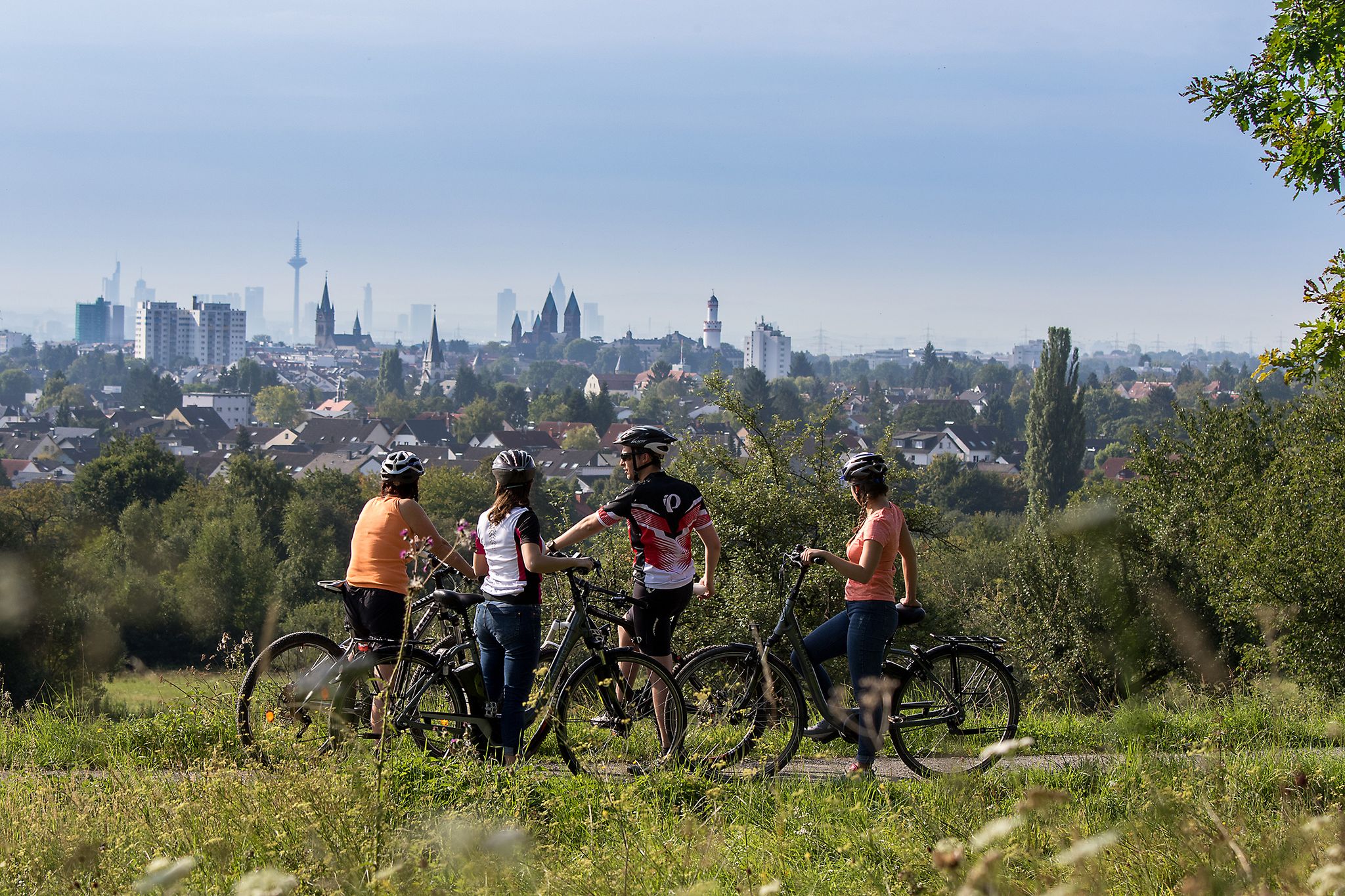
Hiking around Hattersheim offers diverse landscapes along the Main River, extending into surrounding fields and forests. The region is characterized by its flat river plains, gentle hills, and proximity to the Taunus mountains, providing varied terrain for outdoor activities. This area is part of the expansive RheinMain Regional Park, featuring a network of paths through natural woodlands, meadows, and cultivated areas.
Best hiking trails around Hattersheim
- The most popular hiking route is Poet's House – Schwarzbach Observation Tower loop from Hattersheim am Main, a 5.7 miles (9.2 km) trail that takes 2 hours 23 minutes to complete. This moderate route offers views of the Schwarzbachpark and its observation tower.
- Another top favourite among local hikers is Speierlingallee Hattersheim – View of the Weilbacher gravel pit loop from Hattersheim am Main, an easy 4.5 miles (7.2 km) path. This trail leads through the distinctive Speierlingsallee and offers views towards the Weilbacher Kiesgruben Nature Reserve.
- Local hikers also love the Eddersheim Lock – Mönchhof Chapel loop from Eddersheim, a 9.7 miles (15.5 km) trail leading through riverside landscapes, often completed in about 3 hours 56 minutes.
- Hiking around Hattersheim is defined by the Main River banks, the varied terrain of the RheinMain Regional Park, and the distant views of the Taunus mountains. The network offers options for different ability levels, from easy riverside strolls to more moderate paths through fields and forests.
- The routes in Hattersheim are highly rated by the komoot community with an average score of 4.4 stars from more than 380 reviews. More than 2700 hikers have used komoot to explore Hattersheim's varied terrain.
Last updated: October 4, 2026
4.5
(111)
411
hikers
10.0km
02:35
60m
60m
Moderate hike. Good fitness required. Easily-accessible paths. Suitable for all skill levels.
4.8
(36)
152
hikers
Easy hike. Great for any fitness level. Easily-accessible paths. Suitable for all skill levels.

4.8
(23)
94
hikers
15.5km
03:55
30m
30m
Moderate hike. Good fitness required. Easily-accessible paths. Suitable for all skill levels.
4.6
(25)
104
hikers
28.2km
07:15
130m
130m
Hard hike. Very good fitness required. Easily-accessible paths. Suitable for all skill levels.
4.7
(13)
42
hikers
26.4km
06:45
100m
100m
Hard hike. Very good fitness required. Easily-accessible paths. Suitable for all skill levels.
Get access to more routes and recommendations from other explorers.
Already have an account?
Our route recommendations are based on thousands of hikes, rides, and runs completed by other people on komoot.
Start today with a free account
Your next adventure awaits.
Popular around Hattersheim


Tips from the Community

I can highly recommend it. The new tenant has brought some more life back into it. The food is good (the fried potatoes are the best in town) and, above all, it is equipped with a good price-performance ratio, which has become quite rare. Gladly again!
0
0

The Flörsheimer Warte, a former watchtower, was part of the Kasteler Landwehr in the 15th century, which the Archbishopric of Mainz had established to protect its possessions on the right bank of the Rhine. After secularization (1803), the Landwehr lost its importance, as there was nothing left to defend due to lack of substance. The Flörsheimer Warte gradually fell into ruin. In 1996, a reconstruction based on historical models was built next to the relics of the medieval defensive tower. From here, there are magnificent panoramic views in all four cardinal directions over the Rheingau and the Taunus to the Frankfurt skyline. The popular excursion restaurant "Flörsheimer Warte" with a wine garden and weekend winter lounge invites you to enjoy Spundekäs, Handkäs, and Bauernsalat, accompanied by the best drops from the vineyards in Wicker and Hochheim. More information: https://www.rheingau.com/infosystem/floersheimer-warte/poi.html.
1
0

The Iron Tree near Flörsheim am Main is a widely visible, artificial landmark of the RheinMain Regional Park. The striking, 18-meter-high steel structure stands on a hill in the middle of a scenically attractive nature reserve between Flörsheim and Hochheim – in the immediate vicinity of the local Jewish cemetery. It functions simultaneously as an accessible observation tower and a modern work of art intended to address humanity's laborious replication of nature. A spiral staircase leads visitors to a nine-meter-high viewing platform, which offers a spectacular panoramic view over the entire Rhine-Main area, the Taunus ridge, the Odenwald forest, and as far as Rüsselsheim. The special feature of the sculpture is its solar-powered sound system: The Iron Tree has leaves with integrated solar cells in its upper section. As soon as the sun shines during the day and someone steps onto the platform, an audio system is activated. The tree then begins to speak and provides visitors with information about its own construction, the surrounding landscape, and societal issues such as genetic engineering. The steel sculpture is constructed from a thick trunk and ten large, artificial main branches. Each of these branches is composed of 29 precisely bolted individual parts and carries a total of 92 steel leaves. Following an extensive renovation phase, during which all aged and rusty metal leaves were completely renewed in three stages, the talking observation tower has been shining in new splendor again since summer 2024 and is a popular destination for hikes and bike tours.
13
0
The Hochheim vineyards are world-famous and beautiful. When Riesling from Germany was the most sought-after and expensive wine in the world during the Victorian era (mid to late 19th century) (even ahead of Burgundy and Bordeaux), it was also the latest "craze" in England. Due to the German roots of the English royal family and the connections to Hochheim, "Hochheimer" became synonymous with German Riesling. Since the English tended to pronounce "ch" as "k", "Hochheimer" quickly became "Hockheimer" and ultimately a short form "the Hock". Hock is still a fixed term in English traditional wine bars today.
0
0

It's always nice to let your gaze wander over the vineyards.
2
0
With a total length of 527 kilometers, the Main is the longest right-hand tributary of the Rhine and flows as a lifeline through the heart of the entire Rhine-Main region. It officially originates near Kulmbach in Bavaria through the confluence of its two source rivers, the Red Main and the White Main. On its westward journey, the river winds in characteristic loops through Franconia and Hesse, past major metropolises such as Würzburg, Offenbach, and Frankfurt, before finally flowing into the Rhine near Mainz-Kastel (opposite Mainz). For the region, the Main holds immense economic importance as a major shipping route, as it forms a continuous waterway from the North Sea to the Black Sea via the Main-Danube Canal. In addition to its industrial role, the river has been transformed over the past decades into one of the most important areas for local recreation and culture. Kilometers of green spaces stretch along its banks, such as the Frankfurt Mainufer or the promenades in Rüsselsheim and Höchst, offering space for sports, gastronomy, and relaxation. The popular, largely flat Main Cycle Path accompanies the river along its entire length, connecting historic old towns, wine regions, and modern cityscapes. Furthermore, the river significantly shapes the region's climate and nature and serves as a habitat for numerous protected water birds and fish species.
10
0

Mönchhof Restaurant new tenant and open again since May 13, 2026. Closed on Mondays, otherwise open from 11:30 AM to 10 PM. from Kreisblatt
0
0
Overall a very nice meeting point, especially if you are traveling with children. Playground, tower, pond and possibly also something to eat or drink - what more could parents want?!
0
0
Frequently Asked Questions
What types of landscapes can I expect to see while hiking around Hattersheim?
Hiking around Hattersheim offers a varied experience, from flat paths along the Main River banks to gentle hills, forests, and open fields. The area is part of the expansive RheinMain Regional Park, featuring natural woodlands, meadows, and cultivated areas, with distant views of the Taunus mountains to the north.
Are there any easy hiking trails suitable for beginners or leisurely strolls?
Yes, Hattersheim has many easy trails. For example, the Speierlingallee Hattersheim – View of the Weilbacher gravel pit loop from Hattersheim am Main is an easy 4.5-mile (7.2 km) path that takes you through the distinctive Speierlingsallee and offers views towards the Weilbacher Kiesgruben Nature Reserve. Overall, there are over 100 easy routes available.
What are some interesting landmarks or attractions I can find along the hiking routes?
Along the trails, you can discover various points of interest. The Poet's House – Schwarzbach Observation Tower loop from Hattersheim am Main offers views of the Schwarzbachpark and its observation tower. You might also encounter artistic installations and historic buildings within the RheinMain Regional Park. For panoramic views, consider visiting the Großer Mannstein (Staufenschwur Lookout) or the View of the Frankfurt skyline from Oberwaldberg.
Are there any family-friendly hiking options in Hattersheim?
Yes, Hattersheim offers family-friendly options. The Mainuferpark provides accessible paths along the river, perfect for tranquil walks. For a more interactive experience, the "Wilderness Farm" is recommended for families, where children can engage with animals and explore nature playfully.
Can I find circular hiking routes around Hattersheim?
Absolutely. Many trails in the region are designed as circular routes. The Der Rabe Sculpture – Speierlingallee Hattersheim loop from Okriftel is a moderate 5.6-mile (9 km) circular hike. The Weilbacher Kiesgruben Nature Reserve also features easy circular hiking trails.
What is the best time of year to go hiking in Hattersheim?
Spring and autumn are generally considered the most ideal seasons for hiking in Hattersheim. During these times, you'll experience mild temperatures and vibrant natural colors, making for a pleasant outdoor experience.
How many hiking trails are available in the Hattersheim area?
There are over 145 hiking trails recorded around Hattersheim, catering to various difficulty levels and preferences. This includes over 100 easy routes, 37 moderate routes, and a few more challenging options.
What do other hikers enjoy most about the trails in Hattersheim?
The trails in Hattersheim are highly rated by the komoot community, with an average score of 4.4 stars from over 380 reviews. Hikers often praise the diverse terrain, from riverside paths to forest trails, and the well-maintained network of paths within the RheinMain Regional Park.
Are there any trails that offer views of the Main River?
Many trails in Hattersheim run directly along the Main River. The Eddersheim Lock – Mönchhof Chapel loop from Eddersheim is a 9.7-mile (15.5 km) trail that leads through scenic riverside landscapes, offering continuous views of the Main.
Are there options for more challenging hikes, perhaps with more elevation?
While much of Hattersheim's immediate surroundings are relatively flat, the nearby Taunus Mountains to the north offer more challenging trails and rewarding vistas. Peaks like Judenkopf and Oberwaldberg provide distant views of the Taunus, Odenwald, and even the Frankfurt skyline.
Are there places to eat or rest along the hiking routes?
Yes, within the RheinMain Regional Park and in nearby areas, you can find facilities. The Weilbacher Kiesgruben Nature Reserve, for instance, has a Regionalpark Portal with a visitor center and gastronomy. You might also find local pubs or cafes in the charming villages along the Main River.
What is the average length of hiking trails around Hattersheim?
Trail lengths vary significantly. You can find shorter, easy walks like the 4.5-mile (7.2 km) Speierlingallee Hattersheim loop, up to longer routes such as the 9.7-mile (15.5 km) Eddersheim Lock – Mönchhof Chapel loop, providing options for different time commitments.
Most popular routes around Hattersheim
Most popular attractions around Hattersheim

Get inspired with the komoot mobile app


Explore more
Browse the best Hikes in other regions.
