The best walks and hikes in Jaramillo
4.4
(491)
2,513
hikers
25
hikes
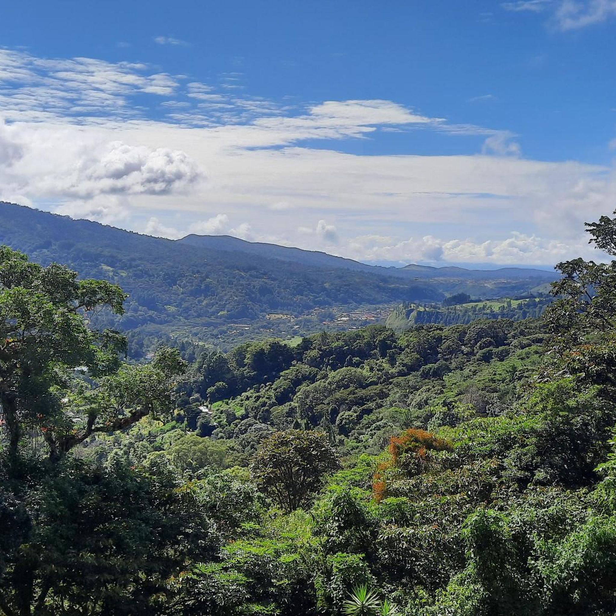
Hiking in Jaramillo offers diverse landscapes, characterized by mountainous terrain and lush cloud forests. The region features significant elevation changes, numerous waterfalls, and scenic river crossings. Trails range from accessible paths to more challenging routes, often providing panoramic views of the surrounding environment.
Best hiking trails in Jaramillo
- The most popular hiking route is Cool bridge – Cerro Piedra de Lino loop from Los Naranjos, a 7.1 miles (11.4 km) trail that takes 3 hours 24 minutes to complete. This moderate route includes scenic bridges and offers views of the local landscape.
- Another top favourite among local hikers is Suspension Bridge – San Ramón Waterfall loop from Los Naranjos, a difficult 14.7 miles (23.7 km) path. This trail leads through varied terrain to a waterfall, requiring good fitness.
- Local hikers also love the Cool bridge – El Pianista loop from Jaramillo Arriba, a 9.0 miles (14.5 km) trail leading through cloud forest and past river features, often completed in about 4 hours 52 minutes.
- Hiking in Jaramillo is defined by mountainous terrain, dense cloud forests, and numerous waterfalls. The network offers options for different ability levels, from easy strolls to difficult climbs.
- The routes in Jaramillo are highly rated by the komoot community with an average score of 4.5 stars from nearly 400 reviews. More than 1900 hikers have used komoot to explore Jaramillo's varied terrain.
Last updated: August 12, 2026
4.3
(21)
75
hikers
11.3km
03:22
320m
320m
Moderate hike. Good fitness required. Easily-accessible paths. Suitable for all skill levels.
4.7
(19)
85
hikers
23.3km
07:35
860m
860m
Hard hike. Very good fitness required. Sure-footedness, sturdy shoes and alpine experience required.

Sign up for free
4.3
(16)
57
hikers
10.7km
03:11
300m
310m
Moderate hike. Good fitness required. Easily-accessible paths. Suitable for all skill levels.
4.7
(17)
71
hikers
13.6km
04:41
710m
710m
Moderate hike. Good fitness required. Easily-accessible paths. Suitable for all skill levels.
3.6
(14)
48
hikers
12.8km
03:59
480m
480m
Moderate hike. Good fitness required. Easily-accessible paths. Suitable for all skill levels.
Get access to more routes and recommendations from other explorers.
Sign up for free
Already have an account?
Our route recommendations are based on thousands of hikes, rides, and runs completed by other people on komoot.
Start today with a free account
Your next adventure awaits.
Login or Signup
Popular around Jaramillo


Tips from the Community

Super Nice place for do a many rutes, of You come here is bether in summer season Will enjoy Beter the experiece
0
0

Good shoes will help you master the challenging trail. Turn back at the "Mirador Pianista."
1
0

Hiking boots recommended and sure-footedness required.
0
0
Frequently Asked Questions
How many hiking trails are there in Jaramillo?
Jaramillo offers a diverse network of over 25 hiking trails. These routes vary significantly in difficulty and length, catering to different preferences and fitness levels.
What types of landscapes can I expect to see while hiking in Jaramillo?
Hiking in Jaramillo, Panama, immerses you in lush cloud forests and mountainous terrain. You'll encounter significant elevation changes, numerous waterfalls, and scenic river crossings, often with panoramic views of the surrounding natural beauty.
Are there any easy hiking trails suitable for beginners or families in Jaramillo?
Yes, Jaramillo has several easy trails. For instance, the Retro-Style Buses of Boquete – Viewpoint loop from Bajo Boquete is an easy 3.7-mile (6 km) hike that takes about 1 hour 45 minutes, offering accessible views.
Are there any trails with waterfalls in Jaramillo?
Absolutely. Jaramillo is known for its beautiful waterfalls. The Suspension Bridge – San Ramón Waterfall loop from Los Naranjos is a challenging 14.7-mile (23.7 km) trail that leads directly to a waterfall. You can also explore highlights like the Third Waterfall, Parque Internacional La Amistad or the First waterfall.
Are there any circular hiking routes in Jaramillo?
Many trails in Jaramillo are designed as loops, allowing you to start and end at the same point. Examples include the popular Cool bridge – Cerro Piedra de Lino loop from Los Naranjos and the Cool bridge – El Pianista loop from Jaramillo Arriba.
What are some notable attractions or landmarks I can see along the hiking trails?
Beyond the natural beauty, you can discover unique landmarks. The Cool bridge – Cerro Piedra de Lino loop features scenic bridges. You might also encounter the ancient Cenizo (Ulmus Mexicana) – The 1,000-Year-Old Tree or enjoy breathtaking views from various viewpoints, such as those found on the Viewpoint – Cerro La Popa loop from Los Naranjos.
What do other hikers enjoy most about hiking in Jaramillo?
The area is highly rated by the komoot community, with an average score of 4.5 stars from nearly 400 reviews. Hikers frequently praise the diverse terrain, the stunning cloud forest scenery, and the rewarding views from various points along the trails.
Is parking available at the trailheads in Jaramillo?
While specific parking details vary by trailhead, many popular starting points for hikes in Jaramillo, especially those originating from areas like Los Naranjos or Jaramillo Arriba, typically offer designated or informal parking options. It's advisable to check local information for your chosen trailhead.
What is the best time of year to go hiking in Jaramillo?
Jaramillo's cloud forest environment means it can be misty and humid year-round. However, the dry season (roughly December to April) generally offers more predictable weather with less rain, making it a popular time for hiking. The wet season brings lush greenery and powerful waterfalls but also more mud and potential for sudden downpours.
Are dogs allowed on the hiking trails in Jaramillo?
Policies regarding dogs can vary by specific trail or protected area within Jaramillo. While some trails may be dog-friendly, it's always best to check local regulations or signage at the trailhead to ensure pets are permitted and if they need to be on a leash.
What is the typical duration and distance of hikes in Jaramillo?
Hikes in Jaramillo range widely. Easy trails like the Retro-Style Buses of Boquete – Viewpoint loop can be under 4 miles and take less than 2 hours. More challenging routes, such as the Suspension Bridge – San Ramón Waterfall loop, can be over 14 miles and require more than 7 hours to complete, demanding good fitness.
Do I need a permit to hike in Jaramillo?
Most general hiking trails in Jaramillo do not require a permit. However, if you plan to enter specific protected areas, national parks (like parts of Parque Internacional La Amistad), or private reserves, there might be entrance fees or permit requirements. It's recommended to verify for your specific destination.
Most popular routes in Jaramillo
Most popular attractions in Jaramillo

Get inspired with the komoot mobile app


Explore more
Browse the best Hikes in other regions.
