The best MTB trails around Parada De Monteiros
4.3
(4)
92
riders
5
rides
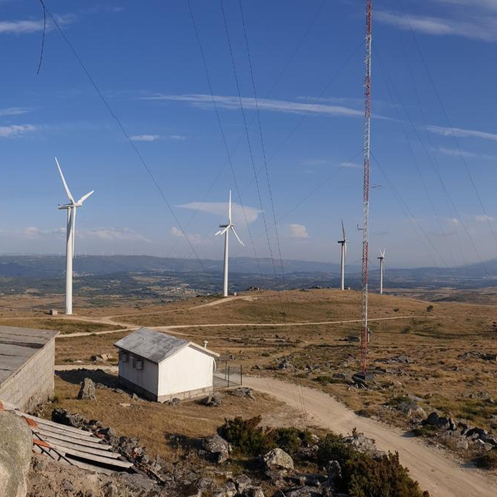
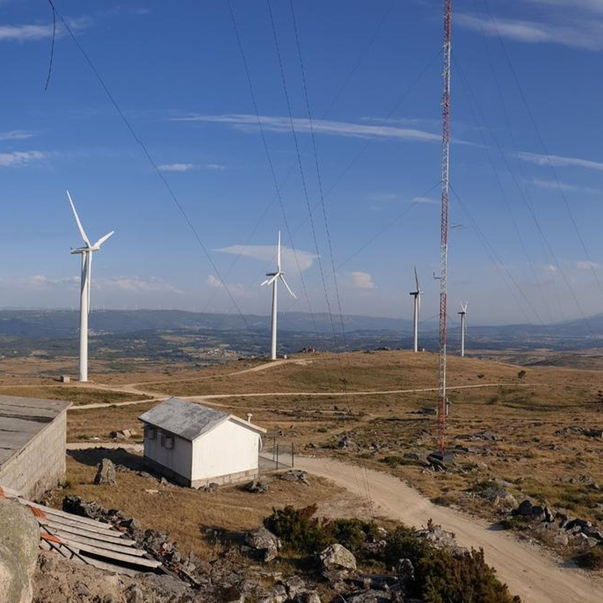
Mountain biking around Parada De Monteiros offers diverse terrain across rolling hills and mountainous landscapes within northern Portugal. The region, part of the Serra do Alvão and near the Serra do Marão, provides challenging ascents and descents. An extensive network of trails, including those around Vila Pouca de Aguiar, caters to various skill levels. This area is characterized by its natural features and varied topography, making it suitable for active outdoor pursuits.
Best mountain bike trails around Parada De Monteiros
…Last updated: October 7, 2026
5.0
(1)
33
riders
55.5km
04:52
1,270m
1,280m
Hard mountain bike ride. Very good fitness required. Suitable for all skill levels.
3.0
(1)
20
riders
69.5km
06:26
1,630m
1,630m
Hard mountain bike ride. Very good fitness required. Suitable for all skill levels.

5.0
(2)
21
riders
Hard mountain bike ride. Very good fitness required. Suitable for all skill levels.
16
riders
69.5km
06:27
1,560m
1,560m
Hard mountain bike ride. Very good fitness required. Suitable for all skill levels.
2
riders
62.6km
06:00
1,660m
1,660m
Hard mountain bike ride. Very good fitness required. Suitable for all skill levels.
Our route recommendations are based on thousands of hikes, rides, and runs completed by other people on komoot.
Start today with a free account
Your next adventure awaits.
Popular around Parada De Monteiros
Tips from the Community

The Bridge of Trajan (often simply called the Roman Bridge) is, without a doubt, the most important monument in Chaves. It is worth visiting because it is not just an "old stone bridge"; it is a masterpiece of engineering that defines the city's identity. Here are the 4 main reasons why: 1. Walking on 2,000 Years of History This is one of the best-preserved Roman bridges in the entire Iberian Peninsula. It was built between the late 1st and early 2nd century AD, during the reign of Emperor Trajan. The Feeling: Crossing it on foot (cars are forbidden) means you are literally walking on the same stones as Roman legions, medieval merchants, and Napoleonic troops. It is an instant trip back in time. 2. Engineering that Defies Time It is worth looking closely at the structure to understand why it is still standing. The Tâmega River is known for its violent floods, yet the bridge has withstood them for two millennia. The Secret: If you go down to the riverbank, notice the cutwaters (the triangular structures at the base of the pillars). They were designed to "cut" the force of the water and prevent the bridge from collapsing. It is a live lesson in ancient architecture. 3. The Stones that "Speak" (Milestones) In the middle of the bridge, you will find two cylindrical stone columns (milestones) with Latin inscriptions. One of them is particularly important: the "Padrão dos Povos" (Standard of the Peoples). The inscription lists the 10 local tribes of the region (the "Aquiflavienses") who contributed to the construction of the bridge. It is a historical document carved in stone that has survived to this day. 4. The Photogenic Scenery The bridge connects the historic center to the Madalena neighborhood and is set within a beautiful public garden (Jardim do Tabolado). It is the perfect spot to watch the sunset, seeing the reflection of the arches in the water with the Castle of Chaves dominating the landscape high above. Visitor Tip: After crossing the bridge coming from the historic center, turn left and walk along the landscaped riverbanks. There are stepping stones (pedras poldras) nearby in the water that allow you to see the grandeur of Trajan's Bridge from an impressive low angle.
2
0

It's always good to know where we have water :)
0
0
The Tâmega and Corgo Ecovia is the Cross-Border Ecological Corridor that connects Chaves and Verín, always along the riverbank. A route to explore on foot or by bike, enjoying contact with the landscape.
0
0
The Pedras Salgadas Railway Station is a closed junction of the Corgo Line, which served the town and the spa of Pedras Salgadas, in the Vila Real District, Portugal. A decree of 13 September 1905 approved the project for the section between Ribeiro de Varges and Pedras Salgadas Station.[ The section between Vila Real and Pedras Salgadas of the Corgo Line was opened on 15 July 1907, while the next section, to Vidago, opened on 20 March 1910.
0
0
everything around is beautiful to appreciate
1
0
Tâmega and Corgo International Ecovia "Poldrado de Curalha - 1889. Designed by Engineer Augusto Xavier Teixeira, this granite bridge (poldras or walkway) is very well preserved and is used for people and animals to cross the river.
0
0

The 140 metre-long Ponte Trajano (Trajan Bridge) in Chaves in the Trás-os-Montes region of north eastern Portugal dates from the reign of the Emperor Trajan (53-117) in the early second century AD. The Emperor Trajan was known as a great promoter of public works including the Trajan Forum and Trajan Column in Rome.
6
0
The Roman Bridge of Chaves, also known as Trajan's Bridge, is located over the River Tâmega and was built between the end of the 1st century and the beginning of the 2nd century. Along with the development of the thermal baths, it constitutes one of the best Roman legacies of the ancient Águas Flávias, which still stands today, withstanding historic floods and the strong currents of the river. Approximately one hundred and fifty metres long and with a dozen visible arches, the works carried out in the 1930s covered some of the arches and others were still buried in the construction of the houses built there and overlooking the river.[citation needed] In 2008 it became a pedestrian bridge.
6
0
Frequently Asked Questions
How many mountain bike trails are available around Parada de Monteiros?
There are 7 mountain bike trails around Parada de Monteiros listed on komoot. These routes offer diverse terrain across rolling hills and mountainous landscapes.
What are the typical difficulty levels of mountain bike trails in this region?
The mountain bike trails around Parada de Monteiros primarily cater to experienced riders. There is 1 moderate route and 6 difficult routes, offering challenging ascents and descents through varied terrain.
Are there any family-friendly mountain bike trails in Parada de Monteiros?
Currently, the komoot selection of mountain bike trails around Parada de Monteiros does not include any easy routes specifically designated as family-friendly. The available trails are generally moderate to difficult, featuring significant elevation changes and technical sections.
What kind of terrain can I expect on the mountain bike trails around Parada de Monteiros?
You can expect a mix of rolling hills and mountainous terrain. The region is part of the Serra do Alvão and near the Serra do Marão, providing challenging ascents, thrilling descents, and technical sections that mountain bikers often seek. Trails frequently pass through natural landscapes and offer diverse scenery.
What is the best time of year for mountain biking in Parada de Monteiros?
Parada de Monteiros experiences a mild, Mediterranean climate. Hot, dry summers and cool, damp winters generally provide favorable conditions for outdoor activities for a significant portion of the year. Spring and autumn are often ideal, offering pleasant temperatures and vibrant landscapes.
Are there any circular mountain bike routes available?
Yes, many of the mountain bike routes around Parada de Monteiros are circular. For example, you can try the Tourencinho Water Fountain – Sabarú Old Train Station loop from Vila Pouca de Aguiar or the Carril Fountain loop from Vila Pouca de Aguiar, both offering extensive loops through the local landscape.
What do other mountain bikers enjoy most about the trails in Parada de Monteiros?
The trails in Parada de Monteiros are highly rated by the komoot community, with an average score of 4.4 stars from 15 reviews. Mountain bikers often praise the varied terrain, the challenging nature of the routes, and the opportunity to explore the authentic interior of the Trás-os-Montes region.
Are there any particularly scenic mountain bike routes?
Yes, several routes offer scenic views. The Albufeira de Daivões – Miradouro de Santa Bárbara loop from Ribeira de Pena is a difficult route known for its panoramic views from the Miradouro de Santa Bárbara. The region's rolling hills and natural parks provide a picturesque backdrop for your ride.
Can I find long-distance mountain bike routes in the area?
Absolutely. The region offers several long-distance routes. The Poldrado de Curalha – Palácio de Vidago loop from Vila Pouca de Aguiar is a difficult route spanning over 85 kilometers, while the Carril Fountain loop from Vila Pouca de Aguiar covers nearly 70 kilometers.
Are there any specific landmarks or points of interest along the mountain bike trails?
While specific highlights are not detailed for every route, the region is known for its natural features and historical points. The Tourencinho Water Fountain – Sabarú Old Train Station loop from Vila Pouca de Aguiar, for instance, explores local landscapes and passes by historical points of interest. The broader Vila Real district also features natural parks and viewpoints like Miradouro de Santa Bárbara.
Is there public transport access to the mountain biking areas around Parada de Monteiros?
Parada de Monteiros is a smaller locality, and while the region has a network of trails, direct public transport to specific trailheads might be limited. Many routes start from nearby towns like Vila Pouca de Aguiar or Ribeira de Pena, which may have better transport links. Planning for personal transport or checking local bus schedules for these larger towns is advisable.
Are there any cafes or places to stop for refreshments near the mountain bike trails?
While Parada de Monteiros itself is a smaller settlement, the wider Vila Real municipality and nearby towns like Vila Pouca de Aguiar offer amenities. It's recommended to check for cafes or small shops in the villages you pass through or at the start/end points of your chosen route, especially if starting from a larger town.
Most popular routes around Parada De Monteiros

Get inspired with the komoot mobile app


Explore more
Browse the best MTB trails in other regions.
