The best walks and hikes around Santa Leocádia
4.4
(426)
1,660
hikers
3
hikes
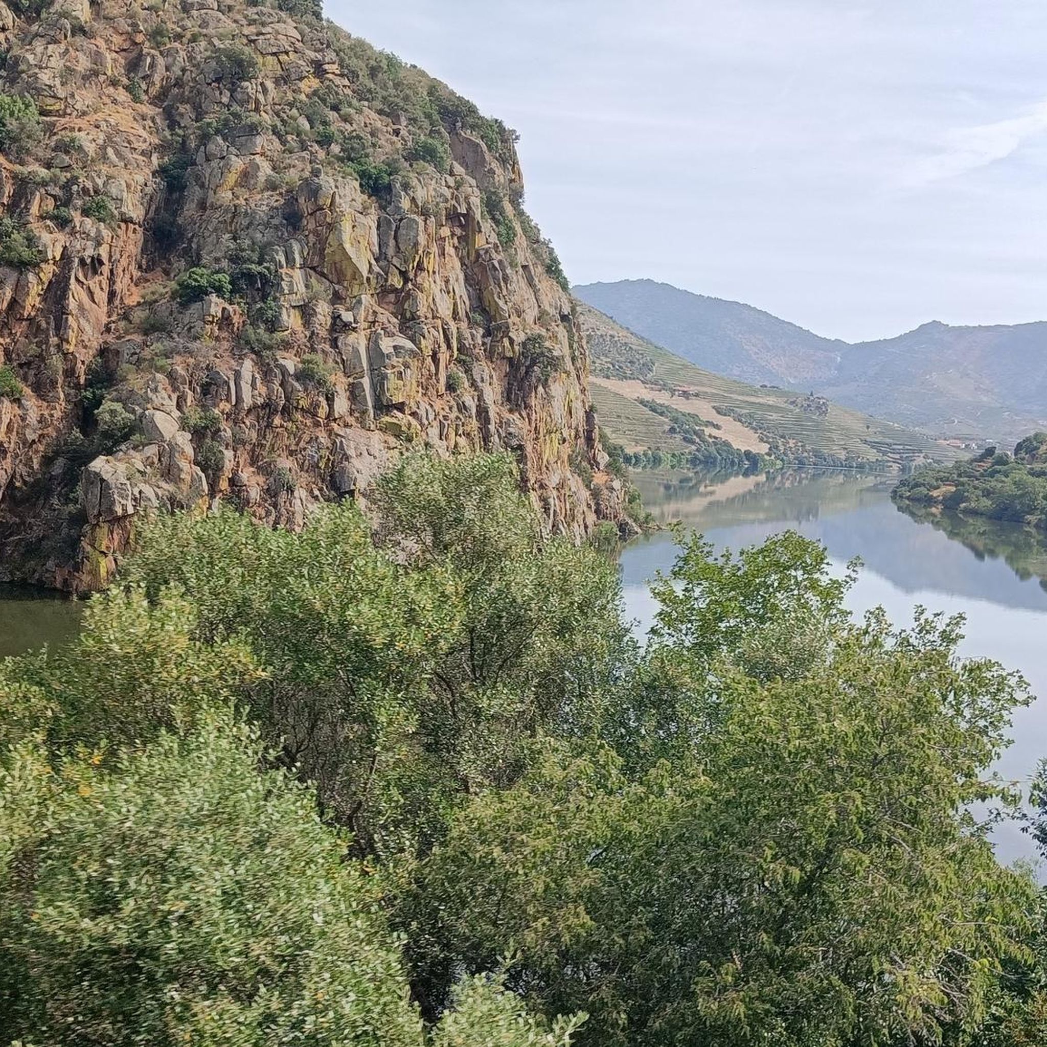
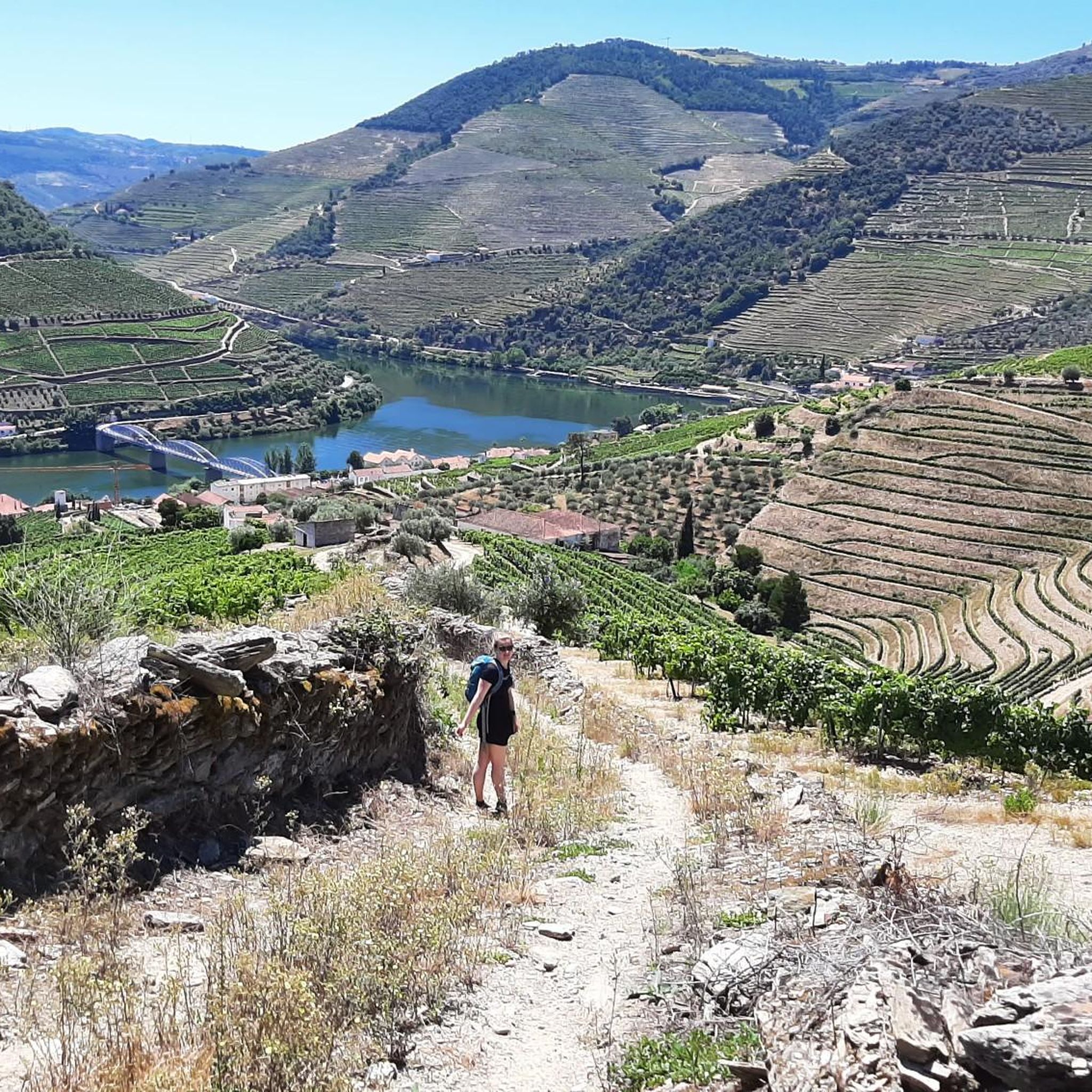
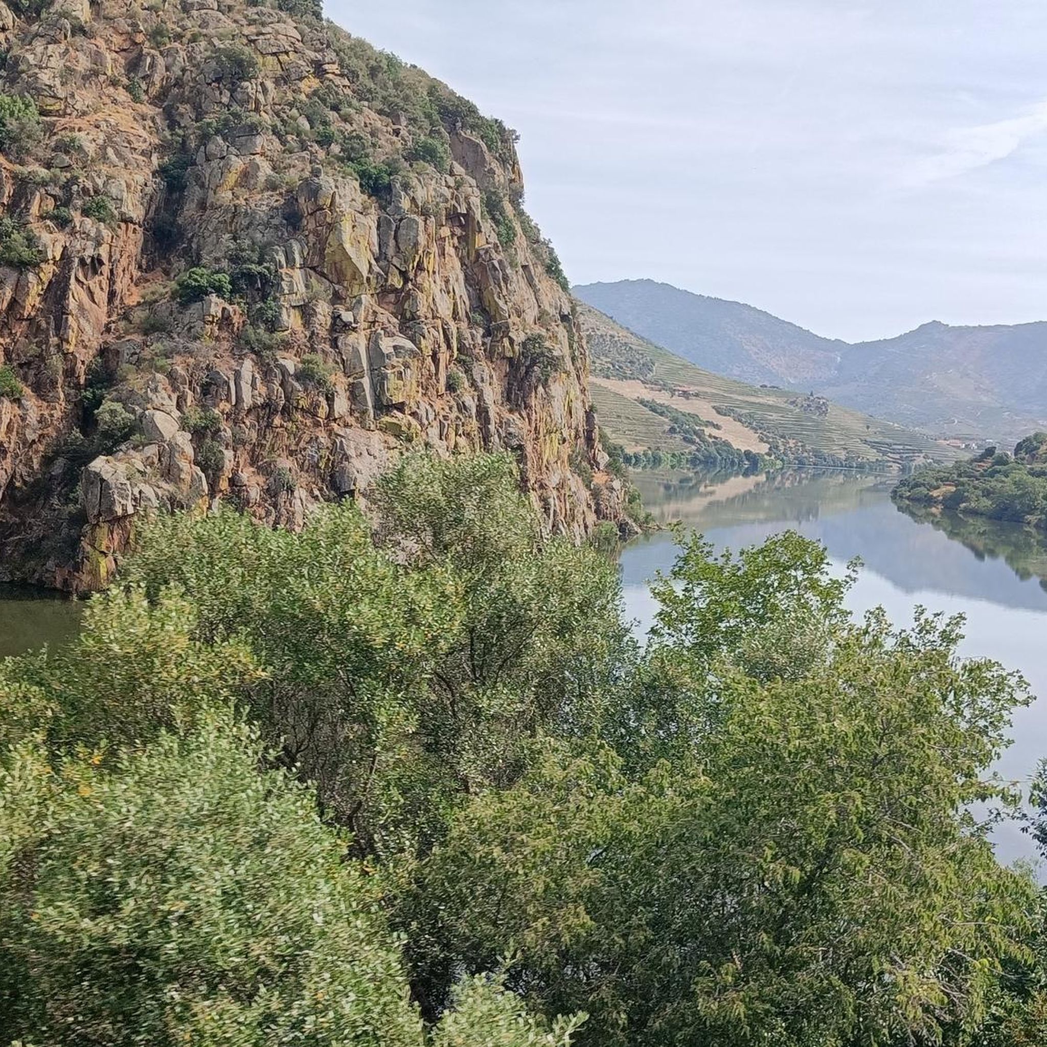
Hiking around Santa Leocádia offers routes through the Douro Valley, characterized by the Douro River and its tributaries, extensive green areas, and forests. The terrain includes hills and valleys, providing varied elevation changes suitable for hiking. This region features a landscape shaped by river systems and agricultural terraces, particularly vineyards.
Best hiking trails around Santa Leocádia
- The most popular hiking route is Marco Pombalino – View of the Douro Valley loop from Covelinhas, a 8.3 miles (13.4 km) trail…
Last updated: October 11, 2026
4.7
(92)
323
hikers
6.25km
02:10
340m
340m
Moderate hike. Good fitness required. Easily-accessible paths. Suitable for all skill levels.
4.5
(46)
161
hikers
13.5km
04:23
590m
590m
Moderate hike. Good fitness required. Easily-accessible paths. Suitable for all skill levels.

4.0
(23)
76
hikers
7.80km
02:31
350m
350m
Moderate hike. Good fitness required. Easily-accessible paths. Suitable for all skill levels.
4.5
(37)
115
hikers
Moderate hike. Good fitness required. Easily-accessible paths. Suitable for all skill levels.
4.6
(5)
89
hikers
Easy hike. Great for any fitness level. Easily-accessible paths. Suitable for all skill levels.
Our route recommendations are based on thousands of hikes, rides, and runs completed by other people on komoot.
Start today with a free account
Your next adventure awaits.

Tips from the Community

Particularly from the terrace of the nice restaurant, there are beautiful views of the Douro River, the village of Covelinhas and the village of Folgosa lying on the slope on the other side of the river.
1
0

The São Leonardo de Galafura viewpoint is one of the most emblematic and beautiful observation points in the Douro Valley, Portugal. Located at the highest point of Monte de São Leonardo, in the parish of Galafura, it offers an unparalleled view over the Douro landscape, classified as a World Heritage Site by UNESCO. Highlights and Information Panoramic View: From the viewpoint, it is possible to see the confluence of the Pêgo River with the Douro River in a curve that resembles a comma, a beautiful spot and perfect for watching an unforgettable sunset. Poetic Inspiration: The place served as inspiration for the Portuguese writer Miguel Torga, who described it poetically, highlighting the "excess of nature" in the landscape. Chapel: At the highest point of the viewpoint is the Chapel of São Leonardo, which complements the natural and historical scenery of the place. Activities: The area is suitable for hiking, and there are trails nearby that can be explored, such as those listed on Wikiloc. Location Address: Estrada São Leonardo - Galafura, Peso da Régua, 5050-044 Portugal. Access: Access is by road, and the viewpoint is a common stopping point on tours and excursions through the Douro region. For more details about the region and other attractions, you can consult the Douro Itinerary.
2
0

Spectacular views of the Douro River and the valley. A small bar invites you to enjoy the view with a glass of wine.
4
0
Spectacular views of the Douro River and the valley. A small bar invites you to enjoy the view with a glass of wine.
6
0

This region, bathed by the Douro River and part of the so-called Douro Wine Region, has been producing wine for over 2,000 years, including the world-famous Port wine. Its origins date back to the second half of the 17th century, when Port wine began to be produced and exported in large quantities, especially to England. Spectacular landscapes, which, in addition to the highly appreciated Port wine, have recently been the scene of a huge boom in tourism development. It has several pedestrian and cycling trails, allowing visitors to enjoy places that are difficult to access by car. 👍🥾🦯
0
0
It's a lovely place to stroll. Excursions on the replica Rabelo boats also depart from here.
4
0
The Rio Pinhao, a tributary of the Duoros, flows into this place.
5
0
Just before the bridge on the left there is a good restaurant with typical regional dishes.
5
0
Frequently Asked Questions
What types of hiking trails can I find in Santa Leocádia?
Santa Leocádia offers a diverse range of hiking experiences, from serene waterside paths along the Estorãos River and São Pedro Lagoon in Geraz do Lima, to mountain treks in the Serra da Aboboreira in Baião. You'll find routes through extensive green areas, forests, and river valleys, with options suitable for various fitness levels, including easy and moderate paths.
Are there any family-friendly hiking options in Santa Leocádia?
Yes, Santa Leocádia provides trails that are suitable for families. The region's diverse landscapes include easy routes, particularly those along riversides or through less challenging terrain. For example, the Pinhão Riverside Promenade – View of the Pinhão Valley loop from Pinhão offers a pleasant 7 km walk with scenic views that can be enjoyed by families.
Can I find circular hiking routes in Santa Leocádia?
Many of the trails in Santa Leocádia are designed as loops, offering convenient circular walks. For instance, the Marco Pombalino – View of the Douro Valley loop from Covelinhas is a popular 13.4 km circular route providing expansive views of the Douro Valley. Another option is the Casal de Loivos Viewpoint – Pinhão Railway Station loop from Pinhão, a moderate 7.6 km loop.
What historical or archaeological sites can I explore while hiking in Santa Leocádia?
Santa Leocádia is rich in history. In Baião, you can explore the Aboboreira Megalithic Complex, which features numerous prehistoric burial mounds (*mamoas*). Hiking trails like the PR4 Dolmens Trail connect to these significant archaeological sites. In Briteiros, the Citânia de Briteiros, an Iron Age fortified settlement, offers a unique opportunity to walk among well-preserved stone houses and defensive walls, providing insights into pre-Roman life.
Are there any notable viewpoints or landmarks along the hiking trails?
Absolutely. The region is known for its stunning vistas. The Saint Leonardo of Galafura Viewpoint offers breathtaking panoramic views. You can also visit the Marco Pombalino, a historical landmark. The Citânia de Briteiros also provides spectacular views of the Ave River Valley and surrounding mountains from its hilltop setting.
What are the best times of year to go hiking in Santa Leocádia?
The diverse landscapes of Santa Leocádia make it suitable for hiking across different seasons. Spring and autumn offer pleasant temperatures and vibrant scenery, ideal for exploring the green areas and forests. Summer can be warm, but riverside trails or higher altitude routes in the Serra da Aboboreira might provide cooler conditions. The Camino del Norte segment through Santa Leocádia is particularly beautiful with autumn leaves.
What do other hikers enjoy most about hiking in Santa Leocádia?
The area is highly rated by the komoot community, with an average score of 4.4 stars from over 300 reviews. Hikers often praise the region's diverse natural beauty, including the serene river valleys, rolling hills, and lush green forests. The expansive views of the Douro Valley and the blend of natural and historical attractions are frequently highlighted as favorite aspects.
Are there any trails that follow rivers or lakes?
Yes, several areas in Santa Leocádia feature beautiful waterside paths. In Geraz do Lima, you can find trails along the Estorãos River and the São Pedro Lagoon. In Baião, the Douro, Teixeira, and Ovil rivers contribute to the natural beauty, with the Ovil River being known for its clean waters. The Douro River Promenade is also a popular spot for a stroll.
What is the typical difficulty level of hikes in Santa Leocádia?
Hiking routes in Santa Leocádia cater to various abilities. While there are easy routes perfect for a relaxed walk, most of the trails are considered moderate. These moderate trails often involve varied elevation changes as they traverse hills and valleys, offering a good challenge without being overly strenuous. There are no difficult-rated trails in the immediate area.
Is there public transport available to reach hiking areas in Santa Leocádia?
While specific public transport details vary by the exact Santa Leocádia location, regions like Baião and areas near the Douro Valley often have local bus services connecting towns. For trails starting from places like Pinhão, it's advisable to check local transport schedules in advance. Parking is generally available near trailheads in more rural areas, but it's always good to plan ahead.
Are there any specific attractions near the Pinhão area?
Yes, the Pinhão area offers several points of interest. You can visit the historic Pinhão Railway Station, known for its beautiful azulejo tiles depicting scenes from the Douro Valley. The Douro River Promenade offers a pleasant walk along the river, and the Pinhão Railway Station – Douro River Promenade loop from Pinhão is a great way to explore both.
What kind of natural landscapes can I expect to see?
Santa Leocádia's natural landscapes are diverse and captivating. You'll encounter the lush green areas and extensive forests of Baião, including the significant Reixela Woods. Mountain ranges like the Serra da Aboboreira offer higher altitudes and granite geology. The region is also defined by its river systems, such as the Douro, Teixeira, and Ovil, and the picturesque agricultural terraces, particularly vineyards, that shape the Douro Valley.
Most popular attractions around Santa Leocádia

Get inspired with the komoot mobile app


Explore more
Browse the best Hikes in other regions.
