The best cycling routes around Sørmarka
4.4
(430)
4,192
riders
133
rides
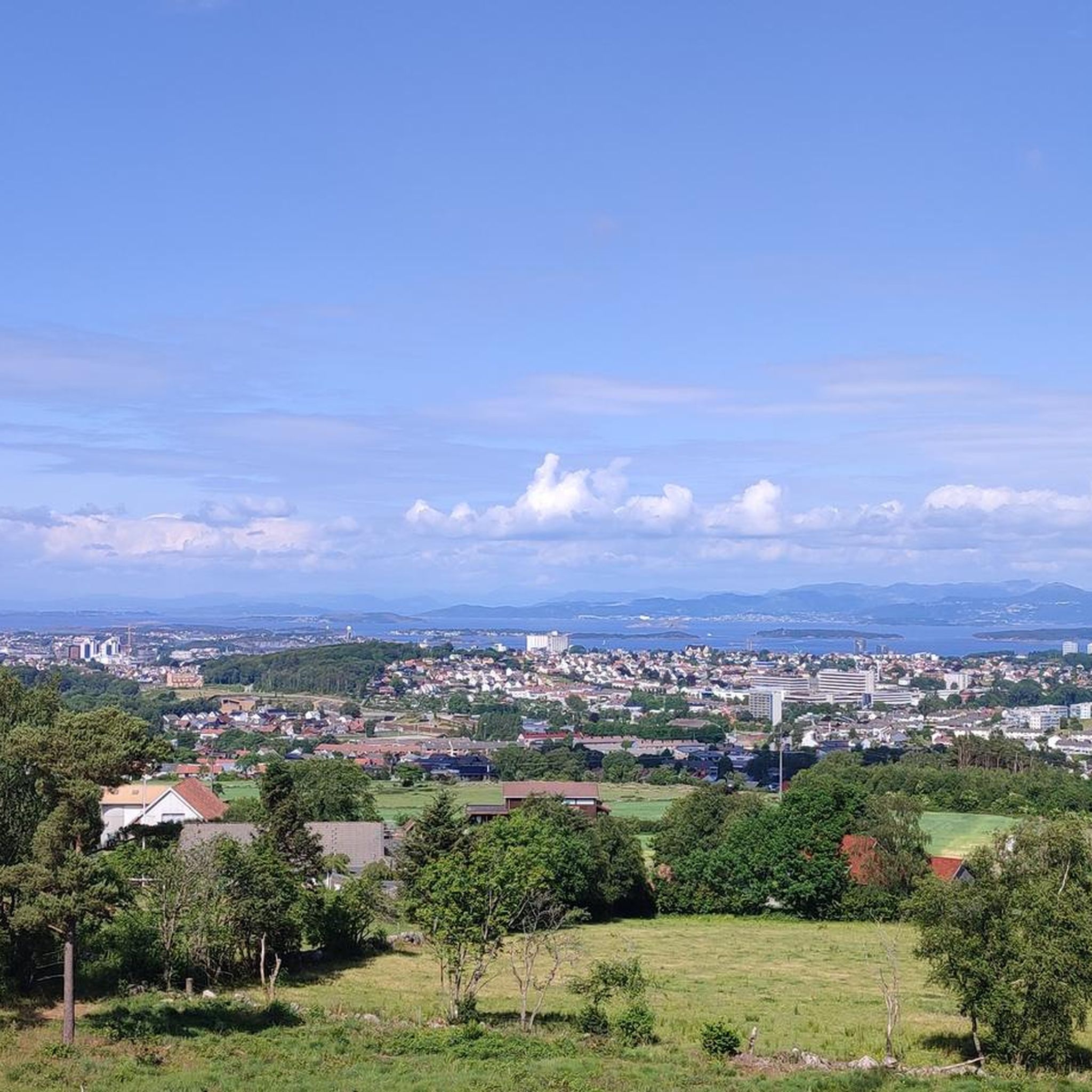
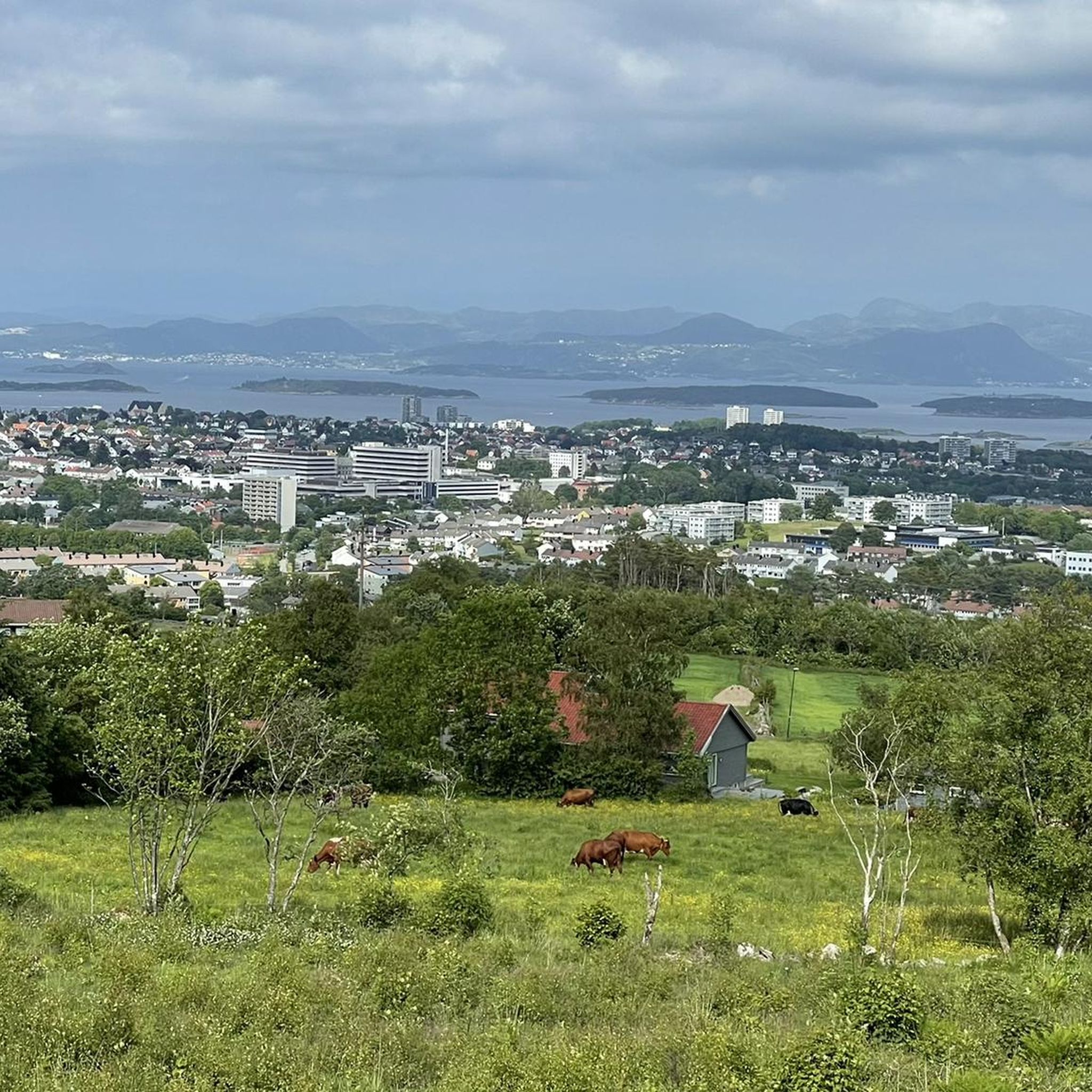
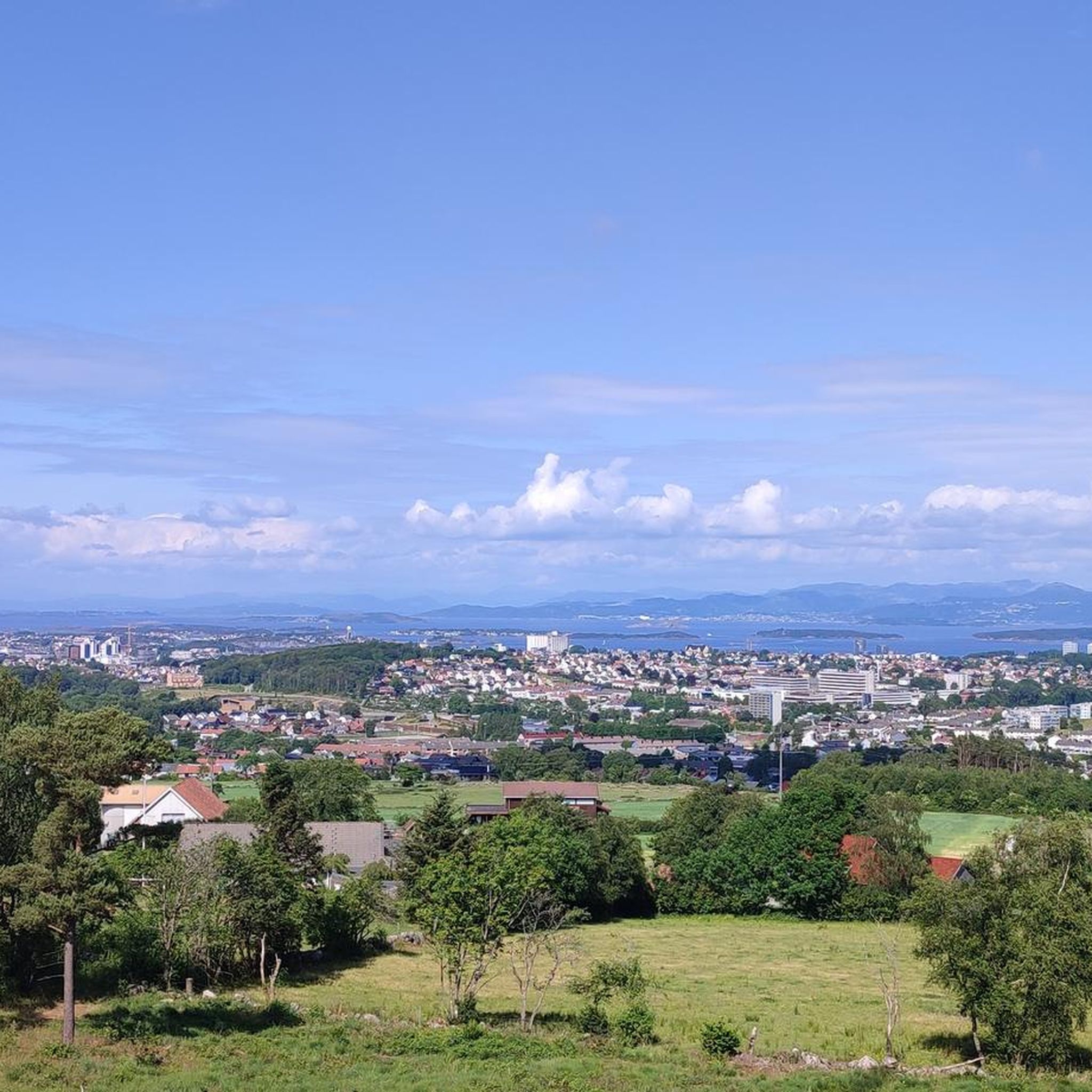
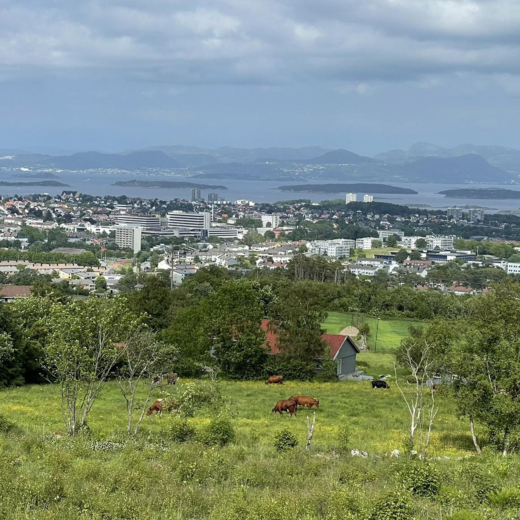
Touring cycling around Sørmarka offers routes through a diverse landscape located south of Stavanger city center. The area features hilly terrain, with Ullandhaug reaching 139 meters above sea level, and includes dense forests, agricultural land, and open plains. Natural features like Hinnadammen Pond and various historical traces add to the varied experience for cyclists.
Best touring cycling routes around Sørmarka
- The most popular touring cycling route is Norwegian Petroleum Museum loop from Auglend, a 7.0 miles (11.2 km) trail…
Last updated: October 30, 2026
4.0
(1)
101
riders
16.0km
00:57
100m
100m
Easy bike ride. Mostly paved surfaces.
5.0
(2)
36
riders
37.2km
02:16
230m
230m
Moderate bike ride. Good fitness required. Mostly paved surfaces.

5.0
(1)
27
riders
10.8km
00:39
70m
70m
Easy bike ride. Mostly paved surfaces.
17
riders
52.9km
03:17
350m
350m
Moderate bike ride. Good fitness required. Mostly paved surfaces.
14
riders
Easy bike ride. Mostly paved surfaces.
Get access to more routes and recommendations from other explorers.
Already have an account?
Our route recommendations are based on thousands of hikes, rides, and runs completed by other people on komoot.
Start today with a free account
Your next adventure awaits.
Tips from the Community

Fantastic cycling road. As of this writing, I doubt there's better cycling infrastructure in Norway.
0
0

Breiavatnet is a small, shallow lake. It is fed by a stream that flows largely underground through the city. The body of water is a popular meeting place and recreation area right in the city center, south of the cathedral. Numerous seagulls, ducks, and swans can be found there. There are many benches surrounding the lake for those seeking peace and quiet, and a decorative fountain sits in the center of the pond.
0
0
Stavanger Cathedral is the oldest and only medieval cathedral in Norway. It is located in the city center of Stavanger and is the seat of the Evangelical Lutheran Diocese of Stavanger. Opening hours: daily from 10:00 a.m. to 3:00 p.m.
0
0

What a wonderful church! Unfortunately, it was closed, but a visit here is a must!
0
0
Beautiful shallow water can be found here… perfect for families with small children.
0
0
Magnificent beach with perfect water.
0
0

Be careful with the sand on the bike path
0
0
Frequently Asked Questions
How many touring cycling routes are available in Sørmarka?
Sørmarka offers a wide selection of touring cycling routes, with over 140 options available. These routes cater to various skill levels, including easy, moderate, and challenging rides.
What kind of terrain can I expect when touring cycling in Sørmarka?
Touring cycling in Sørmarka features a diverse landscape. You'll encounter hilly terrain, with notable points like Ullandhaug (139 meters) and Hinnaberget (112 meters) offering potential views. The routes often pass through dense forests, agricultural land, and open plains, providing a varied visual experience.
Are there any significant viewpoints or landmarks along the cycling routes in Sørmarka?
Yes, Sørmarka offers several points of interest. The Ullandhaugtårnet, located at the highest point of Ullandhaug, is a prominent landmark and offers scenic views. You might also encounter historical traces like old trenches and remnants of radio masts. The Hinnadammen Pond is another natural feature known for its salamander population.
What do other touring cyclists think about the routes in Sørmarka?
The touring cycling routes in Sørmarka are highly regarded by the komoot community, holding an average rating of 4.4 stars from over 350 reviews. More than 3000 touring cyclists have explored the area using komoot, often praising the varied terrain and accessibility.
Are there family-friendly touring cycling routes in Sørmarka?
Yes, Sørmarka has several easy routes suitable for families. For instance, the Norwegian Petroleum Museum loop from Auglend is an easy 7.0-mile (11.2 km) ride near urban landmarks, and the Old Town Stavanger – Port of Stavanger loop from Universitetet i Stavanger (UiS) is a gentle 5.1-mile (8.2 km) urban and port area route.
What is the best time of year to go touring cycling in Sørmarka?
While specific seasonal conditions can vary, the mild climate of the region generally makes spring, summer, and early autumn ideal for touring cycling in Sørmarka. These seasons typically offer pleasant temperatures and good trail conditions for exploring the diverse landscapes.
Are there any circular touring cycling routes in Sørmarka?
Many of the touring cycling routes in Sørmarka are designed as loops, allowing you to start and end at the same point. Examples include the Sandnes–Stavanger Bicycle Road loop from Bekkefaret, which offers a smooth journey between cities, and the longer Swords in Rock – Old Town Stavanger loop from Jåttåvågen.
How accessible is Sørmarka for cyclists coming from Stavanger?
Sørmarka is highly accessible, located approximately 4 km south of Stavanger city center. Its close proximity makes it convenient for both locals and tourists to reach by bike or public transport, offering a quick escape into nature.
Are there options for parking near the cycling routes in Sørmarka?
Given its popularity as an outdoor recreation area, there are likely designated parking areas at various entry points to Sørmarka, especially for those driving to the starting points of longer routes. It's advisable to check local signage or specific route descriptions for detailed parking information.
Can I reach the cycling routes in Sørmarka using public transport?
Yes, Sørmarka's close proximity to Stavanger city center means it is well-served by public transport. You can likely use local buses to get close to various entry points of the cycling network, making it easy to access the routes without a car.
Are there more challenging routes for experienced touring cyclists in the Sørmarka area?
While Sørmarka offers many easy and moderate options, there are also routes for more experienced touring cyclists. For example, the Swords in Rock – Old Town Stavanger loop from Jåttåvågen is a moderate 35.6-mile (57.3 km) route with significant elevation gain, providing a more demanding ride.
Are there places to eat or drink along the cycling routes in Sørmarka?
While Sørmarka itself is a natural area, its proximity to Stavanger and surrounding residential zones means you'll find cafes and restaurants nearby, especially at the start or end points of routes that venture into urban areas. For routes like the Old Town Stavanger – Port of Stavanger loop, you'll pass directly through areas with dining options.
Most popular routes around Sørmarka

Get inspired with the komoot mobile app


Explore more
Browse the best Cycling routes in other regions.
