The best walks and hikes around Elizabeth Lake
5.0
(1)
73
hikers
14
hikes
Hikes around Elizabeth Lake explore the landscape of the Sierra Pelona Mountains on the edge of the Angeles National Forest. The region is defined by its unique geology as a sag pond on the San Andreas Fault, which has created a terrain of mountains and canyons. Many routes in the area utilize sections of the Pacific Crest Trail (PCT), offering varied hiking experiences.
Best hiking trails around Elizabeth Lake
- The most popular hiking route is Bouquet Canyon loop via the…
Last updated: October 2, 2026
6
hikers
7.33km
02:24
350m
350m
Moderate hike. Good fitness required. Easily-accessible paths. Suitable for all skill levels.
3
hikers
15.6km
04:47
550m
540m
Moderate hike. Good fitness required. Easily-accessible paths. Suitable for all skill levels.

2
hikers
17.4km
04:44
260m
260m
Moderate hike. Good fitness required. Easily-accessible paths. Suitable for all skill levels.
1
hikers
5.06km
01:28
150m
100m
Easy hike. Great for any fitness level. Easily-accessible paths. Suitable for all skill levels.
1
hikers
9.67km
02:53
320m
210m
Moderate hike. Good fitness required. Easily-accessible paths. Suitable for all skill levels.
Get access to more routes and recommendations from other explorers.
Already have an account?
Our route recommendations are based on thousands of hikes, rides, and runs completed by other people on komoot.
Start today with a free account
Your next adventure awaits.
Popular around Elizabeth Lake
Tips from the Community

Grass Mountain is a short, peaceful summit just off the PCT. You will most-likely get to enjoy the summit in solitude, taking in sweeping views of the Antelope Valley and western edge of the Mojave desert in peace.
0
0

San Francisquito Canyon South via Pacific Crest Trail is a 6.5 mile return trail located near Santa Clarita, California that offers the chance to see wildlife and is rated as moderate. The trail is primarily used for hiking, walking, running, and nature trips.
0
2

State park parking is $15 per car. Parking on the main street is free, it takes about 2 x 10 minutes longer walk. Most flowers can be seen in spring from March to April. Otherwise you have a fantastic view over the country.
1
0

After crossing the slope near the spring, the trail stays along the contours below the ridge, while this seasonal contributor to San Franciscquito Creek cuts a canyon downhill.
2
0
Start of the seasonal stream that carved the entire canyon from here all the way down to the paved road and beyond.
3
0
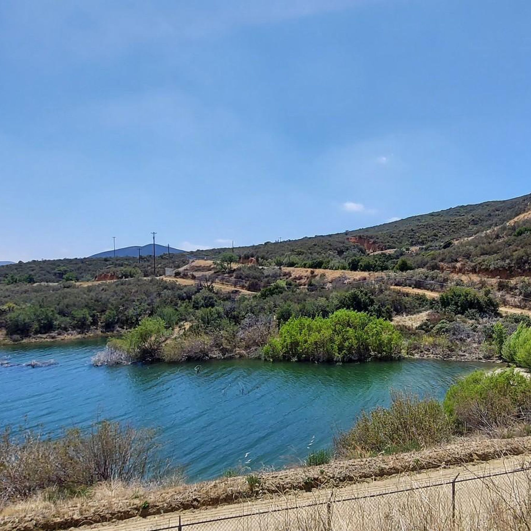
Nice view of the reservoir in the valley to the west, best in the morning light
2
0
The PCT and the Forest Route continue parallel along the ridge to the west, whereas Joey Road drops to the North at Elisabeth Lake, and to the South to a paved road.
2
0
Beautiful views across the surprisingly forested hills to the desert in the north.
4
0
Frequently Asked Questions
Are there any easy, family-friendly hikes around Elizabeth Lake?
Yes, the area offers several easier hikes suitable for families. While most trails involve some elevation change due to the mountainous terrain, you can find routes with less strenuous climbs. The region has 2 designated easy trails, often following fire roads or gentler sections of larger trail networks.
Can I bring my dog on the trails near Elizabeth Lake?
Dogs are generally permitted on trails within the Angeles National Forest, provided they are on a leash. However, be aware that some areas, like the Antelope Valley California Poppy Preserve, have restrictions to protect wildlife and flora. Always check the specific regulations for the trail you plan to hike and ensure you bring enough water for your pet, as the climate can be dry.
Are there any circular or loop hikes available?
Yes, there are several loop trails that allow you to enjoy a varied hike without backtracking. A great example is the Piped Bear Spring – Bouquet Canyon Overlook loop from Palmdale. This moderate route offers a complete circuit with consistent views.
What is the best time of year to hike around Elizabeth Lake?
Spring and fall are the ideal seasons for hiking near Elizabeth Lake. In spring, you may be treated to wildflower blooms, especially in areas like the Antelope Valley. Fall offers pleasant, cooler temperatures. Summer can be very hot and dry, so if you hike then, start early in the morning and carry plenty of water. Winter can bring cooler weather and occasional snow at higher elevations.
Are there any particularly challenging hikes for experienced hikers?
For those seeking a challenge, the area provides some strenuous options. The Grass Mountain from Hughes Canyon via the PCT — Angeles National Forest hike is a difficult, 13-mile trek with significant elevation gain, offering a rewarding workout and expansive views for seasoned hikers.
How do I get to the trailheads and is there parking?
Most trailheads in the Elizabeth Lake area are accessible by car. The Elizabeth Lake Day-Use Area in the Angeles National Forest is a common starting point and offers parking, picnic tables, and restrooms. Other trailheads, particularly for the Pacific Crest Trail, can be found along roads like San Francisquito Canyon Road. Parking is typically available at or near these access points, but it can be limited during peak times.
What kind of scenery can I expect on the trails?
The landscape is defined by its unique position on the San Andreas Fault, creating a dramatic mix of mountains and canyons. You'll hike through the Sierra Pelona Mountains on the edge of the Angeles National Forest, with many trails offering expansive views. Depending on the route, you might see the lake itself, traverse parts of the Mojave Desert, or walk through forested sections. A trail known for its scenery is the Antelope Loop Trail — Antelope Valley California Poppy Preserve, which is spectacular during the spring bloom.
Are there any hikes with waterfalls in the Elizabeth Lake area?
The region around Elizabeth Lake is generally arid, especially being on the edge of the Mojave Desert, so prominent, year-round waterfalls are not a common feature of the local trails. Water flow is highly dependent on recent rainfall and seasonal changes. Your best chance to see flowing water is during the spring after a wet winter.
What are the typical trail conditions like?
Trails are often dry, dusty, and exposed to the sun, with surfaces ranging from packed dirt to rocky sections. Many routes utilize parts of the well-maintained Pacific Crest Trail (PCT) or local fire roads. Due to the area's geology, some paths can be steep and rugged. It's always a good idea to wear sturdy hiking boots with good grip.
Can I access the Pacific Crest Trail from here?
Yes, the Elizabeth Lake area is an excellent access point for the Pacific Crest Trail (PCT). Several local hikes incorporate segments of this famous long-distance trail. For example, the Grass Mountain loop via the PCT — Angles National Forest allows you to experience a beautiful section of the PCT as part of a shorter day hike.
What is the elevation of Elizabeth Lake and how does it affect hiking?
Elizabeth Lake sits at an elevation of 3,389 feet (1,033 meters). While this altitude is not high enough to cause altitude sickness for most people, it means the air is thinner and drier than at sea level. You may find yourself getting breathless more easily, so be sure to pace yourself and stay well-hydrated, especially on strenuous climbs.
Is public transportation available to reach the hiking trails?
There is no direct public transportation to most of the trailheads around Elizabeth Lake. The area is relatively remote, and accessing the trail networks within the Angeles National Forest requires a private vehicle. Plan to drive to your chosen starting point.
Most popular routes around Elizabeth Lake
Most popular attractions around Elizabeth Lake

Get inspired with the komoot mobile app


Explore more
Browse the best Hikes in other regions.
