The best road cycling routes around Clarksburg
3.0
(3)
131
riders
9
rides
Road cycling routes around Clarksburg are characterized by a landscape of rolling hills, forested areas, and river valleys. The terrain features numerous climbs and descents, offering varied challenges for road cyclists. While dedicated paved loops within Clarksburg are not extensively documented, the broader North Central West Virginia area provides conditions suitable for road biking on rural paved roads. These routes often include elevation changes and scenic views of the Appalachian landscape.
Best road cycling routes around Clarksburg
- The most popular road cycling route is Sacramento Zoo – Sacramento River loop from John F Kennedy High School, a 14.7 miles (23.7 km) trail that takes 1 hour 5 minutes to complete. This route features minimal elevation gain, making it accessible for many riders.
- Another top favourite among local road cyclists is Courtland – River Road Bridge loop from Whispering Pines Apartments, a moderate 33.9 miles (54.6 km) path. This route includes some gentle climbs and descents along river roads.
- Local road cyclists also love the Sacramento River Bike Trail – Frank Seymour Park loop from John F Kennedy High School, a 10.6 miles (17.0 km) trail leading through riverfront areas, often completed in about 50 minutes.
- Road cycling around Clarksburg is defined by rolling hills, forested areas, and river valleys. The network offers options for different ability levels, from easy, flatter routes to more challenging paths with greater elevation changes.
- The routes in Clarksburg are highly rated by the komoot community with an average score of 4.5 stars from over 2 reviews. More than 100 road cyclists have used komoot to explore Clarksburg's varied terrain.
Last updated: May 21, 2026
1.0
(1)
31
riders
Moderate road ride. Good fitness required. Mostly well-paved surfaces and easy to ride.
20
riders
Easy road ride. Great for any fitness level. Mostly well-paved surfaces and easy to ride.

Sign up for free
5
riders
54.6km
02:04
50m
50m
Moderate road ride. Good fitness required. Mostly well-paved surfaces and easy to ride.
7
riders
16.0km
00:53
20m
20m
Easy road ride. Great for any fitness level. Mostly well-paved surfaces and easy to ride.
5
riders
Easy road ride. Great for any fitness level. Mostly well-paved surfaces and easy to ride.
Get access to more routes and recommendations from other explorers.
Sign up for free
Already have an account?
Our route recommendations are based on thousands of hikes, rides, and runs completed by other people on komoot.
Start today with a free account
Your next adventure awaits.
Login or Signup
Popular around Clarksburg

Tips from the Community


This small Delta town is surrounded by orchards and scenic levee roads, perfect for a peaceful. Known for its summer Pear Fair and farming heritage, Courtland offers a quiet slice of rural California life.
0
0

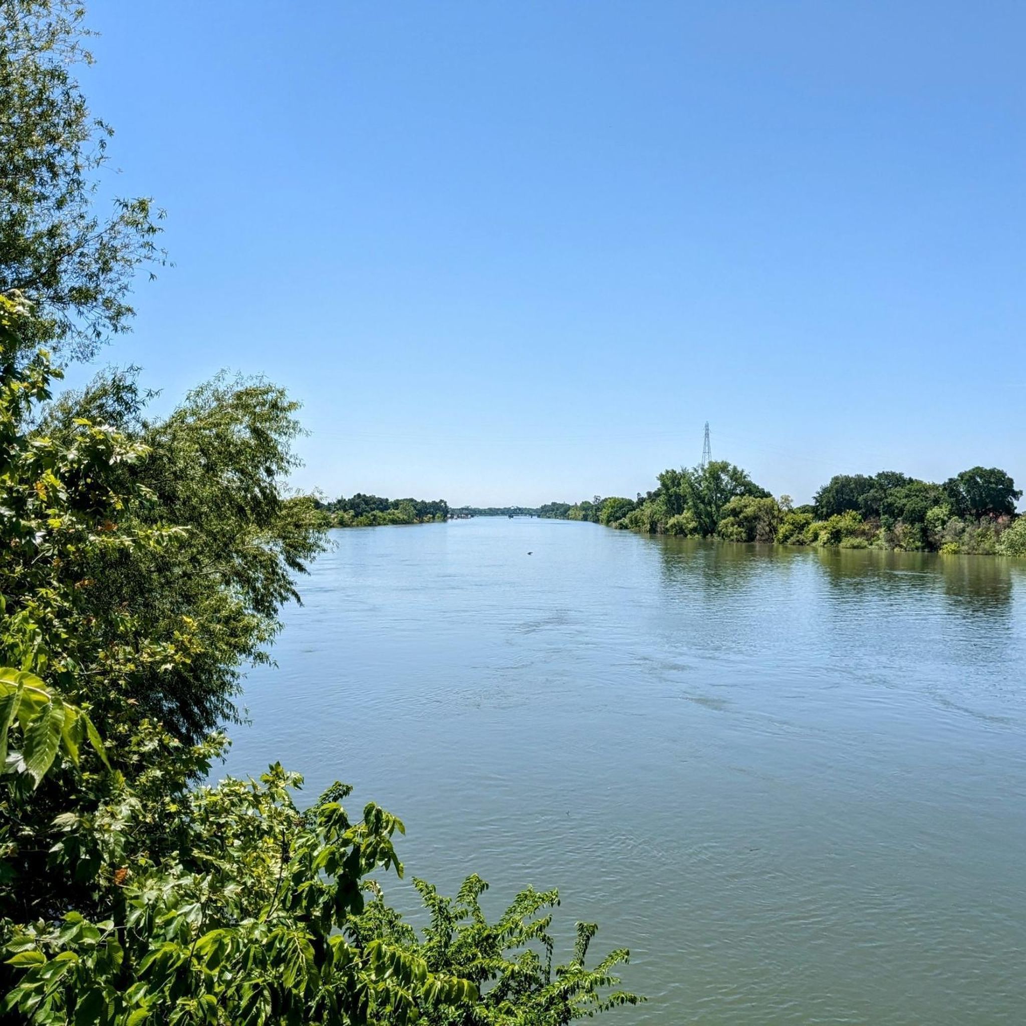
The Sacramento River Bike Trail is a completely paved path that totals over 12 miles in one direction. There are a few small breaks in the trail where you have to use sidewalk and roads to connect the path, but these sections are really short. You pass by several riverside parks and levees while covering the trail, and this specific section offers some great views of the river.
0
0
The Sacramento River Bike Trail is a completely paved path that totals over 12 miles in one direction. There are a few small breaks in the trail where you have to use sidewalk and roads to connect the path, but these sections are really short. You pass by several riverside parks and levees while covering the trail, and this specific section offers some great views of the river.
0
0
The Pocket Canal Parkway is a smooth paved trail circling around a section of one of the canals connected to the Sacramento River. There are some other commuter trails that connect to the path that can take you to other canals and parts of the city.
0
0

This park features a well-maintained path that is mostly shaded, with minimal elevation changes, providing a smooth running experience. The path is paved, but there's also a grassy area available, allowing you to choose the surface that suits your preference for running.
0
0
There are nearly 5 miles of trails that run alongside the canal through the Pocket-Greenhaven Area. These trails connect Frank Seymour Park, Portuguese Community Park, Tony Court Park, and Charter Point Park, providing plenty of spots along the way where you can take a quick break.
0
0

Seymour Park covers 43.5 acres and is complete with lighted walking paths. The abundance of trees provide great shaded areas to rest while walking along. A pedestrian bridge over Florin Road enables visitors to safely travel from the river to the park.
0
0
Frequently Asked Questions
How many road cycling routes are available around Clarksburg?
There are over 8 road cycling routes available around Clarksburg, offering a variety of experiences for different skill levels. These routes are highly rated by the komoot community, with an average score of 4.5 stars from over 2 reviews.
What kind of terrain can I expect on road cycling routes in Clarksburg?
Road cycling routes around Clarksburg are characterized by a landscape of rolling hills, forested areas, and river valleys. You can expect numerous climbs and descents, providing varied challenges and scenic views of the Appalachian landscape. While dedicated paved loops within Clarksburg are not extensively documented, the broader North Central West Virginia area offers suitable rural paved roads.
Are there easy road cycling routes for beginners in Clarksburg?
Yes, Clarksburg offers several easy road cycling routes suitable for beginners. For instance, the Sacramento Zoo – Sacramento River loop from John F Kennedy High School is an easy 14.7-mile (23.7 km) trail with minimal elevation gain, making it accessible for many riders. Another easy option is the Sacramento River Bike Trail – Frank Seymour Park loop from John F Kennedy High School, which is 10.6 miles (17.0 km) and leads through riverfront areas.
What are some challenging road cycling routes near Clarksburg?
For those seeking more challenging rides, the region's terrain of rolling hills and river valleys provides routes with significant elevation changes. The Courtland – River Road Bridge loop from Whispering Pines Apartments is a moderate 33.9-mile (54.6 km) path that includes gentle climbs and descents along river roads, offering a good step up in challenge.
What natural features or landmarks can I see along road cycling routes in Clarksburg?
While road cycling, you'll encounter forested areas and river valleys characteristic of West Virginia's 'Mountain State' landscape. You can also explore nearby attractions such as the Sacramento River Bike Trail, Stone Lakes National Wildlife Refuge, and the Bartholomew Park Footbridge and Fountain. The Clarksburg Path and North Laguna Creek Parkway also offer scenic sections.
Are there any loop road cycling routes in the Clarksburg area?
Yes, many of the road cycling routes around Clarksburg are designed as loops. Popular options include the Sacramento Zoo – Sacramento River loop from John F Kennedy High School, the Courtland – River Road Bridge loop from Whispering Pines Apartments, and the Sacramento River Bike Trail – Frank Seymour Park loop from John F Kennedy High School.
What is the best time of year for road biking in Clarksburg?
The best time for road biking in Clarksburg is generally during spring, summer, and fall. The region is known for vibrant fall colors, which can make for particularly scenic rides. Winter conditions can be challenging due to cold temperatures and potential for snow or ice on roads, especially in higher elevations.
Are there family-friendly road cycling options in Clarksburg?
While many routes feature rolling hills, there are easier, flatter options suitable for families. The Sacramento River Bike Trail loop from John F Kennedy High School is an easy 7.6-mile (12.3 km) route with minimal elevation, making it a good choice for a family outing. The nearby Bridgeport Rail Trail also offers a short, paved option.
Where can I find parking for road cycling routes in Clarksburg?
Specific parking information varies by route starting point. For routes originating from John F Kennedy High School, parking is typically available at or near the school. For other routes, it's advisable to check the individual route details on komoot for designated parking areas or nearby public parking facilities.
What amenities like cafes or accommodation are available along road cycling routes?
While specific cafes or pubs directly on rural road cycling routes may be limited, you'll find amenities in Clarksburg itself and in nearby towns. For longer rides, planning your route to pass through these areas will allow for stops. State parks like Tygart Lake State Park and Stonewall Resort State Park, within a reasonable distance, offer amenities including accommodation and dining options.
What do other road cyclists enjoy most about road cycling in Clarksburg?
The road cycling experience in Clarksburg is highly rated by the komoot community, with an average score of 4.5 stars. Cyclists often praise the scenic views of the Appalachian landscape, the varied terrain with rewarding climbs and descents, and the opportunity to explore less-traveled rural paved roads in North Central West Virginia.
Are there any specific permits needed for road cycling in Clarksburg?
Generally, no specific permits are needed for road cycling on public roads in and around Clarksburg. However, if you plan to cycle within state parks or on specific trails, it's always a good idea to check their individual regulations for any entry fees or specific rules.
Most popular routes around Clarksburg
Most popular attractions around Clarksburg

Get inspired with the komoot mobile app


Explore more
Browse the best Road cycling routes in other regions.
