Routes

Planner

Features

Updates

App

Login or Signup

Get the App

Login or Signup

Routes
Hikes
United States
California
San Diego County

Bonita

The best walks and hikes around Bonita

4.5

(26)

315

hikers

43

hikes

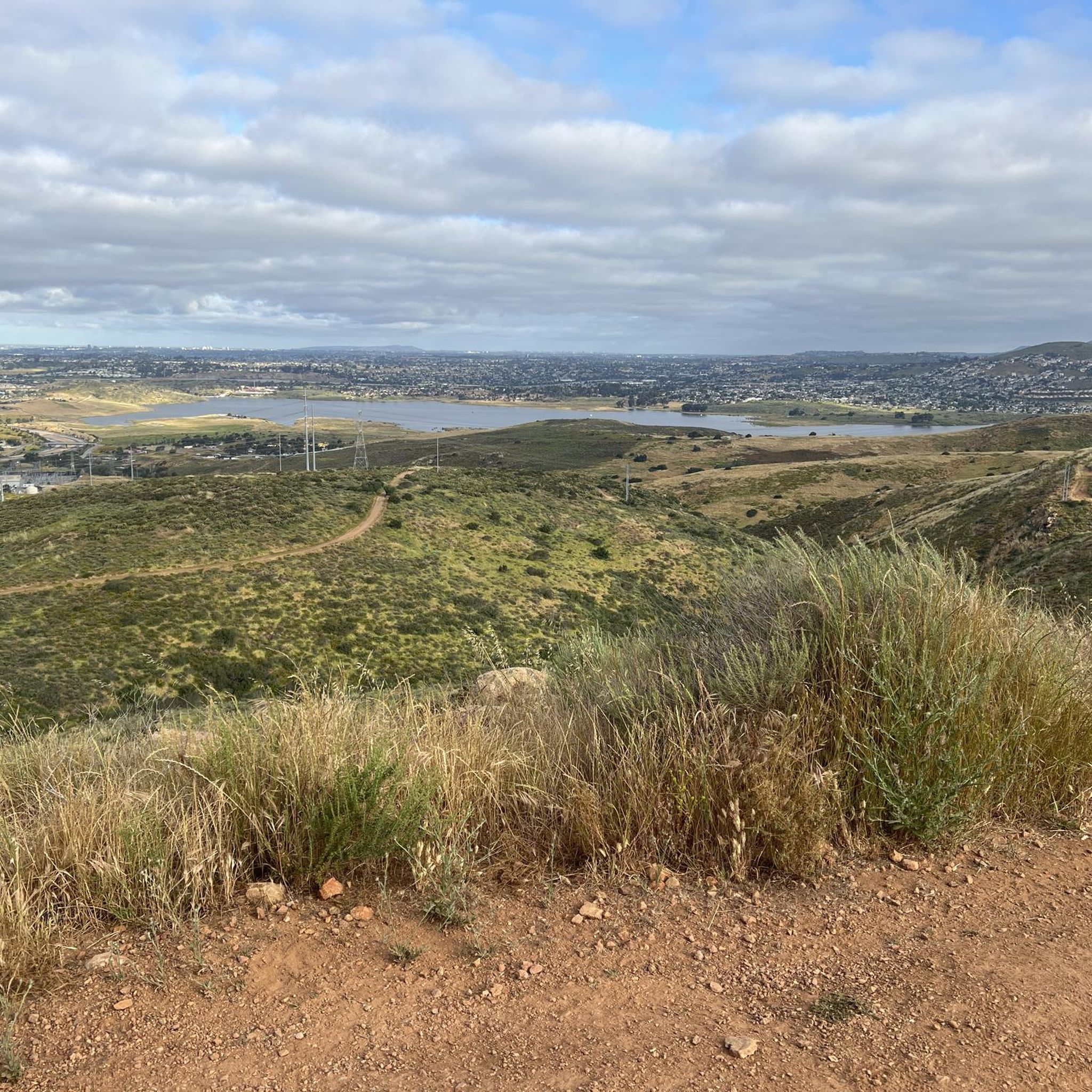
Hiking around Bonita offers routes through rolling hills and alongside the Sweetwater Reservoir. The landscape in this part of San Diego County includes a mix of open parkland, river valleys, and chaparral-covered slopes. Many trails are located within regional parks, providing varied terrain from flat paths to moderate climbs.

Best hiking trails around Bonita

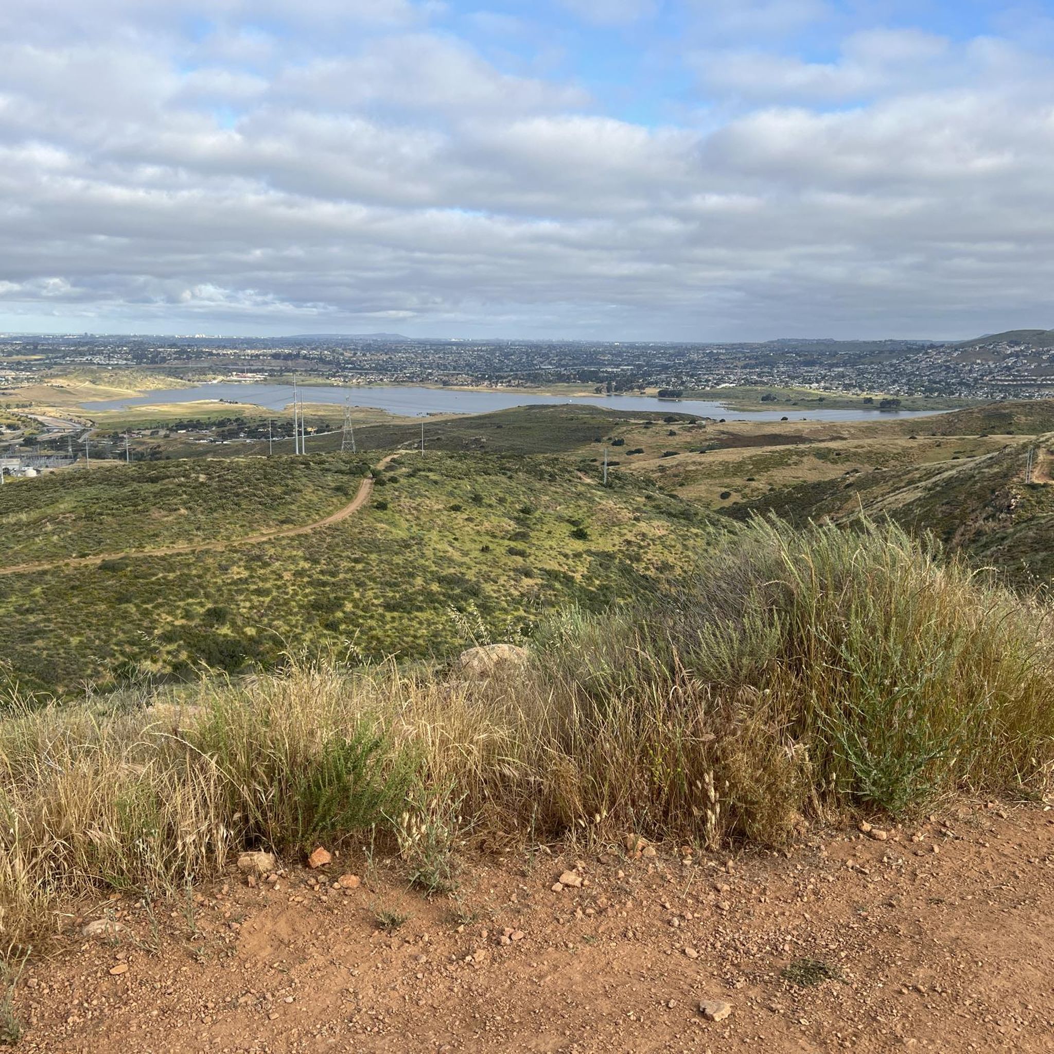
  • The most popular hiking route is Sweetwater Reservoir to Cactus Hill, a 4.7 miles (7.6 km) trail that takes about 2 hours 8 minutes to complete. This moderate route provides views of the reservoir and surrounding landscape.
  • Another top favourite among local hikers is Mother Miguel Mountain via Sweetwater Park, a moderate 4.3 miles (6.9 km) path. The trail involves a steady ascent with an elevation gain of 875 feet (267 m).
  • Local hikers also love the Sweetwater Park Trail, a 1.8 miles (3.0 km) trail leading through open parkland, often completed in about 45 minutes.
  • Hiking around Bonita is defined by reservoir-side paths, rolling hills, and trails through open space preserves. The network of more than 40 routes offers options for different ability levels.
  • The routes in Bonita are highly rated by the komoot community with an average score of 4.4 stars from more than 20 reviews. More than 250 hikers have used komoot to explore Bonita's varied terrain.

Last updated: July 21, 2026

2

hikers

#1.

Sweetwater Reservoir to Cactus Hill

7.59km

02:08

150m

160m

The Sweetwater Reservoir trails offer a delightful escape into San Diego's natural beauty, leading you on a moderate 4.7-mile (7.6 km) journey to Cactus Hill. With 505 feet (154 metres) of elevation gain, this hike takes about 2 hours and 8 minutes, guiding you through varied terrain from wide paths to narrower dirt trails. You'll pass through green meadows, encounter native sage and cacti, and cross wooden footbridges, all while enjoying the scenic backdrop of the Sweetwater Reservoir.

To make the most of your visit, plan to hike during the cooler months or start early in the morning during summer, as the trail offers very little shade. Access is convenient via Sweetwater Summit Regional Park, and while specific Sweetwater Reservoir Cactus Hill parking details aren't always highlighted, arriving early is generally a good strategy for popular trailheads. Always bring ample water to stay hydrated on this exposed route.

Beyond the stunning views from the Tiki Hut at Cactus Hill, this area is ecologically rich. During the wet season, temporary vernal pools form, providing vital habitats for endangered species like the San Diego fairy shrimp. The trail system is multi-use, welcoming hikers, bikers, and equestrians, and connects to a broader network, including the California Riding and Hiking Trail, making it a versatile outdoor destination.

Navigate with device

Send to Phone

Save

Moderate

The SD Aqueduct and Sweetwater Dam Service Roads offer a moderate 4.6-mile (7.4 km) hike, providing a unique blend of natural chaparral scenery and impressive historical infrastructure. You'll navigate compacted dirt and gravel paths, enjoying panoramic views of the Sweetwater Reservoir and its surrounding rolling grasslands, dotted with sage, pepper trees, and various cacti. Keep an eye out for local wildlife, including coyotes, rabbits, and soaring hawks, as you gain 571 feet (174 metres) in elevation over approximately 2 hours and 4 minutes.

Planning your visit is straightforward, as the Sweetwater Reservoir area provides convenient amenities like parking, restrooms, and picnic spots. The trails are multi-use, accommodating hikers, cyclists, and sometimes horseback riders, so be prepared to share the path. While there are no specific warnings about permits or closures, it's always wise to arrive early to secure parking, especially on weekends.

This route offers a tangible connection to San Diego's past, utilizing service roads that once maintained the vital SD Aqueduct system. The historic Sweetwater Dam, built in 1888, is a central feature, providing a scenic backdrop to your journey. The area's diverse landscape, from chaparral to grasslands, also serves as a habitat for various wildlife, making it a rewarding experience for nature enthusiasts and history buffs alike.

Moderate
guide_signup
Let us show you the way with the komoot mobile app
With a free komoot account, you can easily find, customize, and navigate endless outdoor adventures.

Sign up for free

The hike up Mother Miguel Mountain via Sweetwater Park offers a dynamic experience, transitioning from sagebrush and wild grass to rocky, steep sections as you climb. You'll enjoy increasingly impressive views of the Sweetwater Reservoir and the surrounding San Diego National Wildlife Refuge, culminating in a breathtaking panorama from the summit's distinctive Rock House. This route provides a great workout with diverse scenery, making it a local favorite.

Planning your visit means preparing for a challenging ascent with little to no shade; always carry plenty of water, especially on sunny days. The trailhead is easily accessible from Sweetwater Park, and while it's a popular spot, arriving earlier in the day can help you beat the heat and potential crowds. The trail is open to hikers, mountain bikers, equestrians, and leashed dogs.

Mother Miguel Mountain is a notable landmark within the San Diego National Wildlife Refuge, offering one of the few easily accessible trails in Chula Vista with significant elevation gain. The unique Rock House at the summit provides a memorable destination, and the trail's multi-use nature and ongoing redesign efforts highlight its importance as a community resource for outdoor recreation.

Moderate

2.96km

00:45

0m

10m

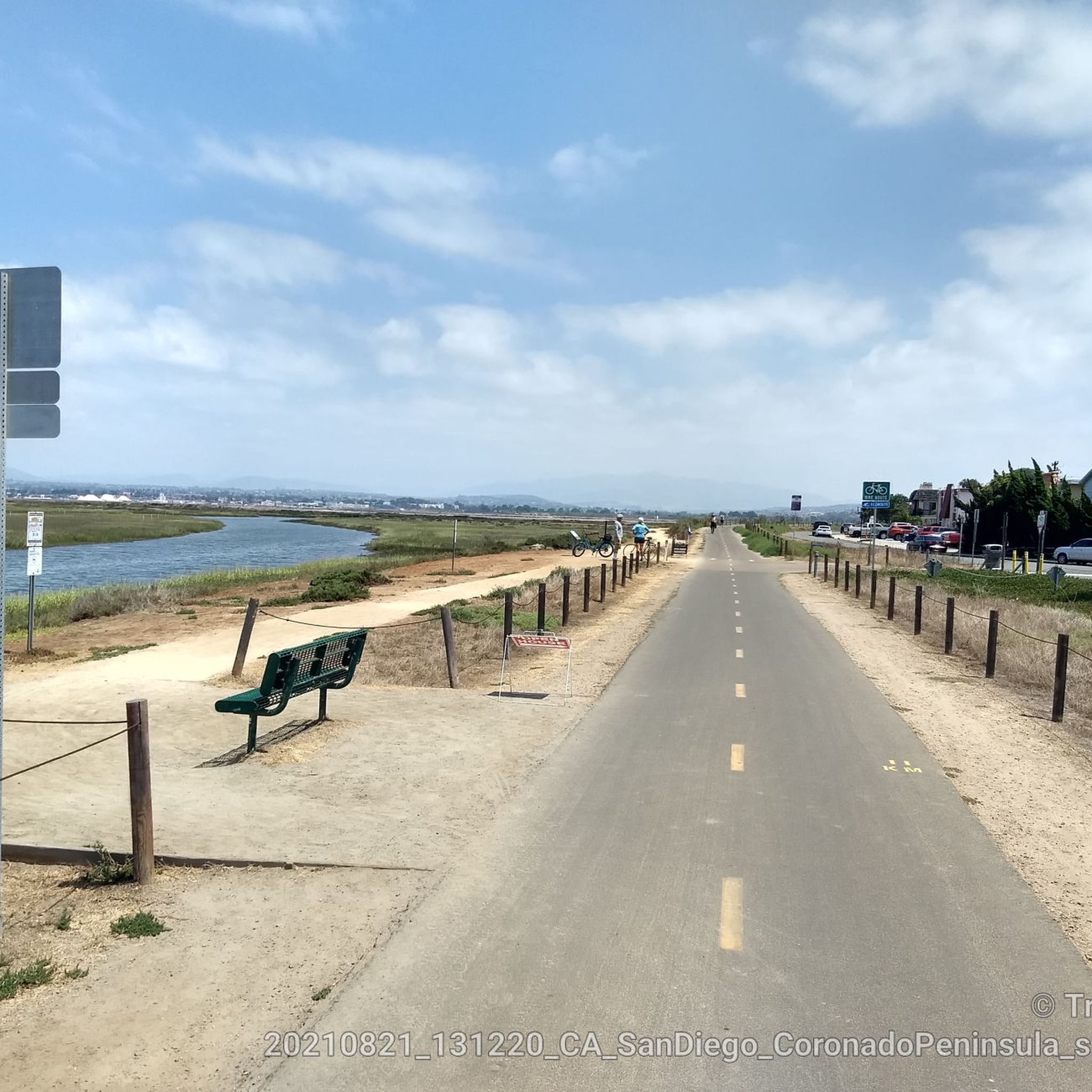
Embark on an easy hike along the Sweetwater Park Trail, a gentle route spanning 1.8 miles (3.0 km). You will encounter diverse scenery, from views of a golf course to tranquil thick woodlands. The trail offers a minimal elevation gain of just 10 feet (3 metres), making it a perfect choice for a quick 44-minute outdoor escape. As you walk, you might spot birds like egrets and ducks near the creek and sandy shorelines, especially around Rohr Park.

Accessing the Sweetwater Park Trail is straightforward, with parking typically available in designated areas within Sweetwater Regional Park. This convenient setup ensures you can easily reach the trailhead and begin your adventure without hassle. The trail is generally accessible year-round, offering a pleasant outing in most seasons. Plan your visit during daylight hours to fully enjoy the natural surroundings.

Beyond its natural beauty, the Sweetwater Park Trail offers unique features that enhance your journey. It connects to the Sweetwater Bikeway Tunnel, providing an interesting point along your route. The presence of a creek and sandy shorelines contributes to a diverse ecosystem, attracting various bird species. This trail stands out as an accessible option for a refreshing outdoor experience within the region.

Easy

32.1km

08:12

110m

120m

The Sweetwater Bike Route offers a challenging hiking experience across 19.9 miles (32.1 km) within Sweetwater Regional Park. You will encounter a diverse landscape, from paved sections alongside the Sweetwater River where you can spot birdlife, to more rugged natural paths. The trail presents a difficult journey, gaining 356 feet (108 metres) in elevation, and typically takes around 8 hours and 12 minutes to complete. As you hike, you will pass through open grasslands, streamside vegetation, and even chunky rock canyons, with impressive views towards San Miguel Mountain. Keep an eye out for the Sweetwater Bikeway Tunnel, a distinctive landmark along the way. This route provides a substantial adventure for those seeking a longer, demanding hike.

Planning your hike on the Sweetwater Bike Route is straightforward, as there are numerous access points with available parking. You will find restrooms conveniently located at spots like Pepper Park, especially if you start near the western end of the trail. While many sections are paved and generally accessible, be prepared for some of the natural paths to be rugged and uneven. Always check local conditions before you head out, especially if recent weather might have affected trail surfaces.

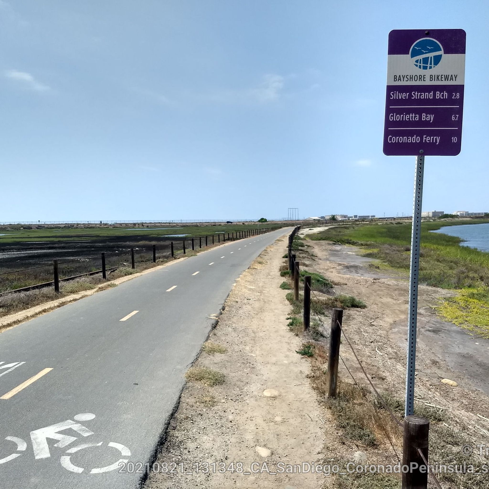
This route is notable for its connection to other major paths, such as the Bayshore Bikeway, allowing for extended adventures if you wish to explore further. The diverse environment of Sweetwater Regional Park means you will experience varied ecosystems, from riverine habitats to open grasslands. Observing the changing tides along the Sweetwater River adds a unique dynamic to your journey, making this trail a compelling option for a full day of exploration.

Hard
Sign up for free to see 39 more hikes around Bonita.

Get access to more routes and recommendations from other explorers.

Sign up for free

Already have an account?

Our route recommendations are based on thousands of hikes, rides, and runs completed by other people on komoot.

Start today with a free account

Your next adventure awaits.

Login or Signup
Popular around Bonita

Running Trails around Bonita

Road Cycling Routes around Bonita

MTB Trails around Bonita

Cycling around Bonita

Gravel biking around Bonita

Tips from the Community

Luis Alcantara
August 3, 2025, Rohr Park

Nice long peaceful walk.

0

0

The paths around Sweetwater Reservoir are primarily well-worn dirt, with most junctions clearly signed, though some of the less frequented routes can become overgrown. As you near San Miguel Mountain, the terrain becomes increasingly rugged and challenging, while open views of the reservoir and surrounding hills remain a constant backdrop.

1

0

Sweetwater Bike Park offers a variety of features for mountain bikers of all skill levels, including four jump lines ranging from beginner to expert, a kid's pump track, a skill zone, two flow trails, and a perimeter trail.

0

0

San Diego National Wildlife Refuge encompasses diverse habitats across 3,920 acres, providing a sanctuary for native plants and wildlife. Visitors can explore its trails, promoting conservation awareness and appreciation.

0

0

Will
September 5, 2023, Sweetwater Reservoir

Sweetwater Reservoir is a man-made lake created by the Sweetwater Dam in 1888. It is a popular location for hiking and you can enjoy awesome scenery and wildlife in the surrounding trails.

2

0

Will
September 4, 2023, Rohr Park

This 59.9 Acre park has walking trails and lots of amenities. It is located along the Sweetwater Park Trail, making it a convenient stop along your hike or a great starting point for a hike along the river.

0

0

The Sweetwater Summit Regional Park offers some nice views of the Sweetwater Reservoir and entrance to a couple of hiking trails, picnic areas and campgrounds.

0

0

The trails bordering Sweetwater Reservoir are mostly smooth dirt paths. Most of the intersections are marked, but the lesser used trails get overgrown at times. As you run closer to San Miguel Mountain, the trails get progressively rockier, steeper, and much more technical. All of the trails are pretty open with views of the reservoir and foothills nearly the entire time.

1

0

Frequently Asked Questions

Are hiking trails in Bonita dog-friendly?

Many trails in the Bonita area are dog-friendly, but policies can vary between parks. Trails within Sweetwater Summit Regional Park and Rohr Park generally welcome dogs on a leash. Always check the specific regulations for the park you plan to visit before you go and be prepared to clean up after your pet.

What are some good easy, family-friendly hikes in the Bonita area?

For a gentle and accessible outing, the Sweetwater Park Trail loop — Rohr Park is an excellent choice. It's a flat path through expansive green fields and eucalyptus groves, making it suitable for all ages and fitness levels.

Are there any difficult hikes near Bonita?

Yes, while most trails are easy to moderate, there is at least one difficult hike available for those seeking a challenge. The terrain around Bonita is varied enough to offer strenuous climbs with significant elevation gain, providing a solid workout for experienced hikers.

What are the trails in Sweetwater Summit Regional Park like for beginners?

Sweetwater Summit Regional Park is quite suitable for beginners. It offers a variety of trails, including shorter, relatively flat options. For an easy introduction, consider the Summit Park Trail and Lake View Trail loop, which is a short walk with minimal elevation change but still provides lovely views.

How many hiking trails are there around Bonita?

You can explore over 20 different hiking routes around Bonita. The network includes a mix of easy, moderate, and difficult trails, offering plenty of options for everyone from casual walkers to seasoned hikers.

Are there any circular or loop hikes available?

Yes, many of the popular hikes in Bonita are loop trails, allowing you to enjoy a varied route without backtracking. A great example is the Snake Trail and Rice Canyon Trail loop, which takes you through the scenic Rice Canyon Open Space Preserve.

What do other hikers think of the trails in Bonita?

The trails around Bonita are well-regarded by the komoot community, earning an average rating of over 4 stars. Hikers often praise the beautiful views of the Sweetwater Reservoir and the well-maintained paths through the region's rolling hills.

Are there any hiking trails with waterfalls in Bonita?

The hiking trails in Bonita are primarily known for their rolling hills and reservoir views, not for waterfalls. The local climate is quite dry, so significant waterfalls are not a feature of the landscape in this part of San Diego County.

Are Bonita Falls or the Bonita Canyon Trail located in Bonita, San Diego?

No, this is a common point of confusion. Bonita Falls is located in the San Bernardino National Forest, and the Bonita Canyon Trail is in Newport Beach. Neither of these popular trails is located in the Bonita community within San Diego County.

What is the terrain like on the trails in Rice Canyon Open Space Preserve?

The trails in Rice Canyon generally feature gentle, rolling terrain with some flat sections. You'll be walking on dirt paths through a mix of native chaparral and grasses. It's a relatively easy-going environment, making it popular for walking, hiking, and trail running.

Are any of the trails in Rohr Park suitable for strollers?

Yes, Rohr Park has paved and flat dirt trails that are generally suitable for strollers. The park's wide-open spaces and gentle paths make it a popular spot for families with young children.

What kind of scenery can I expect when hiking to Mother Miguel Mountain?

The hike up to Mother Miguel Mountain via the Rock House Trail involves a steady climb through chaparral-covered hills. As you gain elevation, you'll be rewarded with expansive views of the Sweetwater Reservoir, the surrounding communities, and the broader San Diego landscape.

Most popular routes around Bonita

Easy hikes around Bonita

Most popular attractions around Bonita

Places to see

Store rating

Get inspired with the komoot mobile app

With a free komoot account, you can easily find, customize, and navigate endless outdoor adventures.

or

Join komoot Now

Store rating

Explore more

Browse the best Hikes in other regions.

San DiegoCleveland National ForestLaguna MountainsMission Trails Regional ParkAnza-Borrego Desert State ParkLake San MarcosSan MarcosAnza-Borrego Desert State WildernessCarlsbadCuyamaca Rancho State ParkFairbanks RanchSan Diego National Wildlife RefugeChula VistaGranite HillsHarbison CanyonEscondidoNational CitySanteeAlpinePowayEncinitasWinter GardensSan Diego Country EstatesValley CenterCuyamaca Mountain State WildernessBostoniaLakesideElfin ForestLemon GroveDel DiosRamonaVallecito MountainsLa PresaCrestPine Creek WildernessHidden MeadowsEucalyptus HillsRainbowSanta Rosa MountainsOtay Mountain WildernessFallbrookJamulRancho San DiegoMount LagunaSan Diego Bay National Wildlife RefugeBorrego SpringsRancho Santa FeDescansoJulianPine ValleyCampoHauser WildernessBlack Mountain Open Space ParkLa MesaOceansideSanta Rosa Mountains State WildernessImperial BeachSawtooth Mountains WildernessCamp Pendleton MainsideEl CajonSawtooth Mountains A Wilderness Study AreaSan Ysidro Mountain Wilderness Study AreaVistaSan Felipe Hills Wilderness Study AreaBorder Field State ParkTijuana Slough National Wildlife RefugeSpring ValleyHarmony GroveAgua Tibia WildernessCabrillo National MonumentCasa De Oro-Mount HelixBonsallHauser Mountain Wilderness Study AreaBeauty Mountain Wilderness Study AreaCoronadoAgua Caliente County ParkSolana BeachPalaDel MarCarrizo Gorge WildernessCamp Pendleton SouthSawtooth Mountains C Wilderness Study AreaCarrizo Gorge Wilderness Study Area

Nearby adventure guides

Things to Do around Chula Vista

background

Get ready to conquer new peaks

Sign up for Free

Explore
RoutesRoute plannerFeaturesRedeem a voucherHikesMTB TrailsRoad cycling routesBikepackingSitemap
Download the app
Follow Us on Socials

© komoot GmbH

Privacy Policy