The best MTB trails in Hyalite-Porcupine-Buffalo Horn Wilderness Study Area
60
riders
9
rides
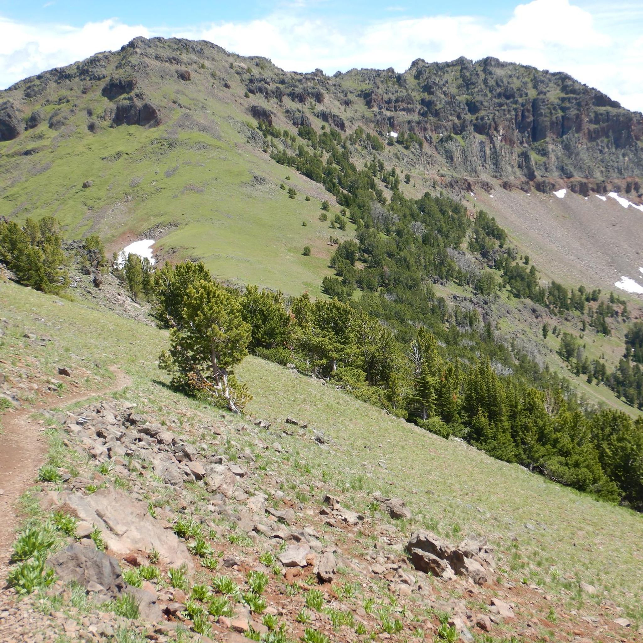
Mountain biking in Hyalite-Porcupine-Buffalo Horn Wilderness Study Area offers diverse terrain across 155,000 acres of the northern Gallatin Range. The region is characterized by glaciated landscapes, deep valleys, cirque basins, and jagged peaks, with elevations ranging from 5,500 to over 10,000 feet. Riders will encounter varied ecosystems, transitioning from grasslands to dense Douglas fir forests, providing a dynamic backdrop for mountain bike trails. This area is also a vital wildlife corridor and an important water source.
Best mountain bike trails in Hyalite-Porcupine-Buffalo Horn Wilderness Study Area
- The most popular mountain bike trail is Blackmore Trail, an 11.1 miles (17.8 km) difficult trail that takes about 2 hours 38 minutes to complete, featuring significant elevation gain through forested slopes.
- Another top favourite among local mountain bikers is Ousel Falls Trail loop from Big Sky, a moderate 22.0 miles (35.5 km) path. This route offers a mix of terrain with notable elevation changes, often completed in around 3 hours 9 minutes.
- Local mountain bikers also love the Crescent Lake & Maxey Cabin loop, a 6.0 miles (9.6 km) trail leading through varied landscapes, often completed in about 49 minutes.
- Mountain biking in Hyalite-Porcupine-Buffalo Horn Wilderness Study Area is defined by glaciated valleys, forested slopes, and high mountain peaks. The network offers options for different ability levels, from easier loops to challenging climbs.
- The routes in Hyalite-Porcupine-Buffalo Horn Wilderness Study Area are highly rated by the komoot community with an average score of 4.0 stars. More than 60 mountain bikers have used komoot to explore Hyalite-Porcupine-Buffalo Horn Wilderness Study Area's varied terrain.
Last updated: August 4, 2026
1
riders
17.8km
02:38
1,070m
1,070m
Embark on the Blackmore Trail, a difficult mountain biking route that challenges you with its substantial 3497 feet (1066 metres) of elevation gain over 11.1 miles (17.8 km). As you climb, you'll navigate through the dense Gallatin Forest, experiencing a mix of alpine singletrack and sections of loose rock. The journey culminates with panoramic views from the saddle, offering a stunning perspective of surrounding peaks like Alex Lowe Peak and the Hyalite Reservoir below, all within an estimated 2 hours and 38 minutes of riding.
Planning your ride on the Blackmore Trail requires preparation, as it is rated as an expert-level route with extreme physical demands. Be aware that snow can persist on the mountainsides well into late summer, so check conditions before you go. You should also expect to share the trail with hikers and horses, particularly on weekends, so ride considerately. This route is typically ridden as an out-and-back, but experienced riders might explore connecting to South Cottonwood for a longer adventure.
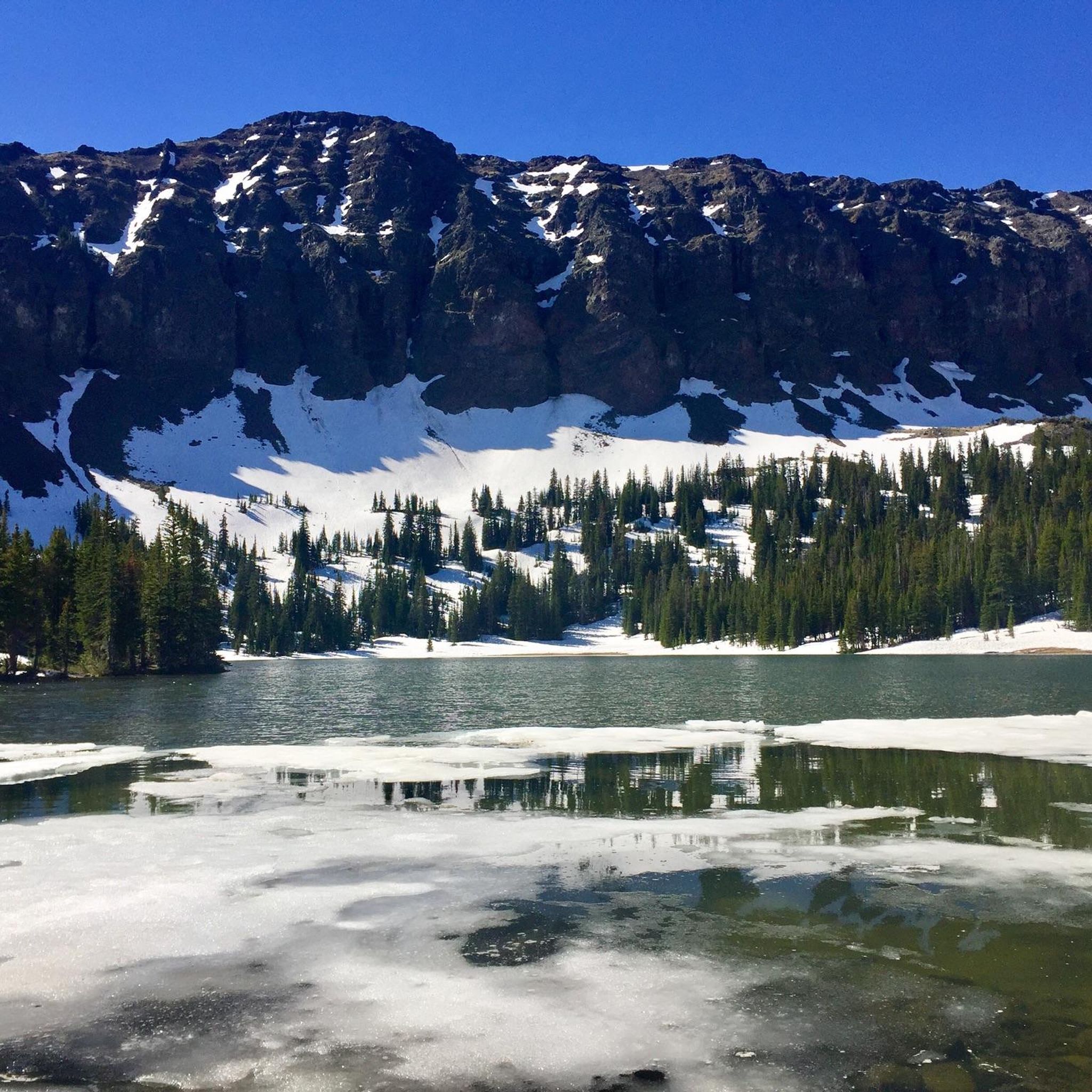
The Blackmore Trail is a notable feature within the Custer Gallatin National Forest, known for its rigorous ascent towards Mount Blackmore. The trail passes by Blackmore Lake, adding a scenic element to the demanding climb. Its reputation for varied terrain and significant physical challenge makes it a standout option for mountain bikers seeking a true test of skill and endurance in this rugged region.
9.62km
00:50
140m
140m
This easy 6.0-mile mountain biking loop in Custer-Gallatin National Forest takes you to Maxey Cabin, gaining 456 feet.

Sign up for free
7.01km
00:49
250m
250m
The Hidden Lakes Trail offers a diverse mountain biking experience through Northern Wisconsin's classic Northwoods, winding past numerous pristine lakes like Butternut and Franklin. You'll encounter a mix of singletrack and old logging roads, with undulating terrain, roots, and rocks underfoot, all set amidst dense pine and hemlock forests.
This easy 4.4-mile (7.0 km) route, with 808 feet (246 metres) of elevation gain, can be completed in about 49 minutes. The trail is well-marked and dog-friendly, though you should be prepared for potential fallen trees due to its older growth forested area. It's a great choice for those seeking a scenic, varied ride without a huge time commitment.
Originally built by the US Forest Service, the trail works well for mountain biking and hiking, despite not being purpose-built for bikes. It's maintained by local volunteers and sees relatively little use, ensuring a peaceful and solitary ride. Keep an eye out for the headwaters of the Pine River, a state-designated wild and scenic river, which you'll find along the route.
7.24km
00:41
140m
140m
Enjoy an easy 4.5-mile mountain bike loop through Custer Gallatin National Forest, featuring views of Hyalite Reservoir and Maxey Cabin.
12.6km
01:35
550m
550m
The Rat Lake Trail offers a dynamic mountain biking experience near Gallatin Gateway, Montana, leading you through varied terrain to a scenic lake. You'll navigate a mix of singletrack and dirt roads, passing through dense forests and alongside streams, with the highlight being the tranquil Rat Lake. Expect a challenging ride with 1819 feet (555 metres) of elevation gain over 7.8 miles (12.6 km), including some notably steep and loose sections, making it a difficult route that takes about 1 hour and 35 minutes to complete.
This multi-use trail is a popular access route for those looking to explore Garnet Mountain or embark on longer rides in the area. Motorized use typically opens on June 16th, so consider this for your visit, and be mindful of free-range cattle. The trail is also considered family-friendly due to its destination, but riders should be prepared for the physical demands of the climb.
Located within the breathtaking Gallatin National Forest, the Rat Lake Trail is known for its vibrant ecosystem and opportunities to spot wildlife like diverse bird species, elk, and deer. The surrounding mountains and valleys provide stunning viewpoints, making it a natural treasure in the Gallatin Gateway area and a key part of the region's mountain biking network.
32
riders
23.0km
02:11
550m
550m
The Lake Levinsky loop from Big Sky offers a taste of the region's diverse mountain biking, guiding you through varied terrain with stunning backdrops. You'll pedal past meadows bursting with wildflowers, through the shade of pine and aspen forests, and along sections that open up to panoramic views of the Spanish Peaks and Gallatin Range, with Lone Peak often dominating the horizon. Expect a mix of flowing descents and natural features like roots and rocks under your tires, making for an engaging ride.
This moderate 14.3-mile (23.0 km) route involves a respectable 1793 feet (547 metres) of elevation gain, typically taking around 2 hours and 10 minutes to complete. While specific trailhead parking for this exact loop isn't widely publicized, Big Sky is well-equipped with local bike shops for rentals and advice. The best times to ride are generally summer for vibrant flora or fall for the spectacular golden foliage, but always check local conditions before you go.
Big Sky stands out as a mountain biking hub due to its extensive and less crowded trail network, catering to various skill levels. This area is known for its exceptional natural beauty, offering a combination of high-alpine singletrack and forest trails. Many routes are multi-use, allowing you to connect different pathways for longer, customized adventures, and the local community is very supportive of the sport.
19
riders
42.9km
03:41
990m
990m
Hard mountain bike ride. Very good fitness required. Advanced riding skills necessary.
8
riders
35.5km
03:09
850m
850m
Moderate mountain bike ride. Good fitness required. Advanced riding skills necessary.
Our route recommendations are based on thousands of hikes, rides, and runs completed by other people on komoot.
Start today with a free account
Your next adventure awaits.
Login or Signup
Popular around Hyalite-Porcupine-Buffalo Horn Wilderness Study Area
Tips from the Community

Great nontechnical hike to the summit of one of Bozeman's iconic southern peaks. A few stream crossings for filtration if you want to go light. Some steeper grades just up from the lake, but mostly very manageable grades, gorgeous views! Mountain goats were seen as well. Highly recommended.
1
0

Ousel Falls Trail in Big Sky offers a short, scenic hike along the South and West Forks of the Gallatin River, crossing three bridges before reaching the stunning waterfall. At the trail split, hikers can choose from four paths: the South Fork Overlook, the top of the falls via a natural footpath, the base of the falls with a picnic area, or the rocky Ousel Falls Overlook. This popular trail is best hiked between May and October, and dogs are welcome. Do note that roads to the trailhead may be seasonally closed.
0
0

Easily accessible and beautiful Crescent Lake is a great spot to ride if you're limited on time.
0
0
The final stretch to the summit can be a slog and may end up being more of a hike than a bike, however, the views more than make up for the effort. Also, the fire lookout at the summit is available for overnights so check recreation.gov if you plan to do some bikepacking.
0
0

Chestnut Mountain tops out at 7,627 feet. It has great views of Mount Ellis and other peaks in Custer Gallatin National Forest, and you can sometimes even see down to Mystic Lake. On the other side of the highway, you have open views of the Bridger Peaks and Crazy Mountains.
0
0

Hyalite Reservoir is a large artificial lake that affords opportunities for day-use hiking, easy strolls, or the perfect launching point for more aggressive, big-mountain singletrack riding. Even if a bit busy, plenty of parking is available.
0
0
Maxey Cabin stands just off Hyalite Canyon Trail and within a short walk or ride of Hyalite Reservoir. It sleeps up to 4 in the winter, and two bunks are available in summer in a second structure. Information and reservations can be found through the Forest Service website.
0
0
Rat Lake sits at just over 6,500 feet and can be linked with several hiking, running, or mtb routes in this area. Be sure to check on local fishing regulations if you're interested in angling in this popular spot.
0
0
Frequently Asked Questions
How many mountain bike trails are there in Hyalite-Porcupine-Buffalo Horn Wilderness Study Area?
There are 10 mountain bike trails listed in the Hyalite-Porcupine-Buffalo Horn Wilderness Study Area on komoot, offering a range of experiences from easy to difficult.
What is the best time of year to go mountain biking in the Hyalite-Porcupine-Buffalo Horn Wilderness Study Area?
The best time for mountain biking is generally from June 16 to March 31, as many trails are seasonally open during this period. Trails are typically closed from April 1 to June 15 to protect the trail resource during wet conditions and wildlife activity. Always check local conditions before you go.
Are there any easy mountain bike trails suitable for beginners or families?
Yes, there are several easier options. For instance, the Crescent Lake & Maxey Cabin loop is an easy 6.0-mile trail. Another good choice is the Hidden Lakes Trail, which is 4.3 miles long and also rated as easy.
What kind of terrain can I expect on mountain bike trails in this area?
The Hyalite-Porcupine-Buffalo Horn Wilderness Study Area features diverse terrain, transitioning from grasslands to dense Douglas fir forests. You'll encounter glaciated landscapes, deep valleys, cirque basins, and jagged peaks with significant elevation changes. Trails can range from smooth paths to challenging climbs over rugged ground.
Are there any loop mountain bike trails available?
Yes, several trails offer loop configurations. The Crescent Lake & Maxey Cabin loop is a 6.0-mile easy trail. For a longer, more challenging option, consider the Chestnut Mountain loop from Mystic Heights, which spans over 26 miles and is rated difficult.
What points of interest or scenic views can I find along the mountain bike trails?
The area is known for its dramatic glaciated landscape. You can expect stunning views of mountain peaks like Mount Chisholm and Hyalite Peak. Popular destinations include beautiful lakes such as Emerald Lake, Heather Lake, Golden Trout Lake, and Crater Lake, often accompanied by streams and waterfalls. The region also features diverse ecosystems and is home to the historic Gallatin Petrified Forest.
What should I know about wildlife when mountain biking here?
The Hyalite-Porcupine-Buffalo Horn WSA is a vital wildlife corridor, home to elk, moose, mountain goats, bighorn sheep, grizzly bears, black bears, wolverines, and pikas. It's crucial to be bear aware and carry bear spray. Always stay on designated trails to minimize disturbance to wildlife and their habitats.
Are there any specific trail closures or restrictions for mountain bikers?
Yes, certain trails have seasonal closures. Trails like Hidden Lake Divide #66, Storm Castle #185, Porcupine #199, Porcupine Creek #34, and Buffalo Horn #1 are closed from April 1 to June 15. Additionally, a portion of the Hyalite Trail (#434) has specific bicycle closures on Fridays and Saturdays from July 16 to September 4, and bicycles are prohibited year-long south of its junction with Storm Castle Trail #185. Always check current regulations before heading out.
Where can I find parking for mountain bike trailheads?
Access to the Hyalite-Porcupine-Buffalo Horn Wilderness Study Area is generally well-established, with trailheads often having designated parking areas. Specific parking information can usually be found on individual trail pages or local forest service websites. It's advisable to arrive early during peak seasons.
What do other mountain bikers enjoy most about the trails in Hyalite-Porcupine-Buffalo Horn Wilderness Study Area?
The trails in Hyalite-Porcupine-Buffalo Horn Wilderness Study Area are highly rated by the komoot community, with an average score of 4.0 stars. Reviewers often praise the diverse terrain, from forested slopes to high mountain peaks, and the challenging yet rewarding climbs that offer spectacular views of the glaciated valleys.
Are there any particularly challenging mountain bike trails for advanced riders?
Absolutely. For advanced riders seeking a challenge, the Blackmore Trail is an 11.1-mile difficult route with significant elevation gain through forested slopes. Another demanding option is the Rat Lake Trail, a 7.8-mile difficult trail with substantial climbing.
Can I bring my dog on the mountain bike trails?
While the region is generally dog-friendly, specific regulations may apply within the Wilderness Study Area and on certain trails. It's always best to check the current rules for each trail and ensure your dog is under control, especially given the presence of diverse wildlife, including bears. Leash laws are often in effect.
Most popular routes in Hyalite-Porcupine-Buffalo Horn Wilderness Study Area

Get inspired with the komoot mobile app


Explore more
Browse the best MTB trails in other regions.
