The best running trails around Sault Ste. Marie
66
runners
13
runs
Jogging around Sault Ste. Marie offers routes that explore the region's unique landscape, characterized by its position on the St. Marys River and proximity to Lake Superior. The area features trails along waterways, through natural creek systems, and near historical lock gates. Runners can find paths that traverse both urban-adjacent green spaces and more secluded natural environments.
Best jogging routes around Sault Ste. Marie
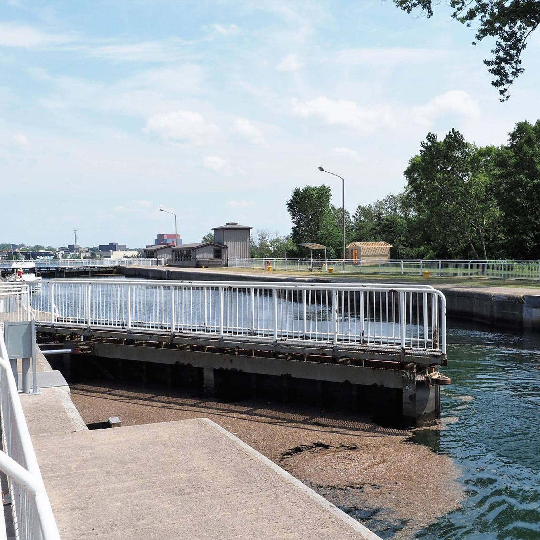
- The most popular jogging route is Across the lock gates loop from Sault Ste. Marie, a 4.3 miles (7.0 km) trail that takes 43 minutes to complete. This route offers views of the St. Marys River and the historic lock system.
- Another top favourite among local runners is Running loop from Sault Ste. Marie/Partridge Point Seaplane Base, a moderate 4.3 miles (7.0 km) path. This trail provides a waterside running experience near Partridge Point.
- Local runners also love the Fort Creek loop from Emmaus Anglican Church, a 14.6 miles (23.5 km) trail leading through the Fort Creek natural area, often completed in about 2 hours 27 minutes.
- Jogging around Sault Ste. Marie is defined by riverfront paths, creek-side trails, and urban green spaces. The network offers options for different ability levels, from easy loops to more challenging longer runs.
- The guide includes highly-rated routes that showcase the best of the region's landscape. More than 30 runners have used komoot to explore Sault Ste. Marie's varied terrain.
Last updated: November 8, 2026
10
runners
7.00km
00:44
20m
20m
Moderate run. Good fitness required. Mostly paved surfaces.
4
runners
8.57km
00:53
20m
20m
Moderate run. Good fitness required. Mostly paved surfaces.

6
runners
3.82km
00:28
20m
20m
Easy run. Mostly paved surfaces.
7
runners
Moderate run. Good fitness required. Mostly paved surfaces.
5
runners
23.0km
02:24
100m
100m
Hard run. Very good fitness required. Mostly paved surfaces.
Get access to more routes and recommendations from other explorers.
Already have an account?
Our route recommendations are based on thousands of hikes, rides, and runs completed by other people on komoot.
Start today with a free account
Your next adventure awaits.
Other adventures around Sault Ste. Marie

Tips from the Community

Due to damage, the Sault Ste. Marie Canal was decommissioned in 1987. Only in 1998 was the lock reopened, but with a length of only 77 meters instead of the original 274 meters. The lock is now open from mid-May to mid-October for recreational activities. (Visit on May 27, 2026) https://parks.canada.ca/lhn-nhs/on/ssmarie/culture/histoire-history
0
0
On the Canadian side, two islands lie in the river, St. Marys Island and Whitefish Island. The islands were an important meeting place for the Anishinaabe First Nation for fishing and trade between Lake Huron and Lake Superior until colonization by Europeans and were called Baawaating, place of the rapids. To make the St. Marys River navigable for trade, especially with furs, a huge canal was built through St. Marys Island at the end of the 19th century; it was the longest lock in the world at the time. There is a height difference of approx. 7 meters between Lake Superior and Lake Huron. (Visit on May 27, 2026)
0
0

St. Mary's Island is a popular tourist destination in the Whitefish Channel on the St. Mary's River. There are many wild animals to see on the island, such as beavers, muskrats and minks. You can also observe numerous water birds and songbirds. It's worth packing your binoculars.
1
0
Your way to South St. Mary's Island takes you through one of the lock gates. The Visitor Center is located right next to the lock, where you can find out more about the island and its walking trails.
1
0
Frequently Asked Questions
How many running routes are available in Sault Ste. Marie?
There are over 9 dedicated running routes around Sault Ste. Marie, offering a variety of distances and terrains for different preferences.
Are there any easy running routes suitable for beginners in Sault Ste. Marie?
Yes, Sault Ste. Marie offers easy running options. For instance, the Running loop from Thayer Reservoir is an easy 2.4-mile (3.8 km) path, perfect for a relaxed jog.
Can I find circular running routes in Sault Ste. Marie?
Absolutely. Many of the running paths in Sault Ste. Marie are circular. A popular choice is the Across the lock gates loop from Sault Ste. Marie, which is 4.3 miles (7.0 km) and offers scenic views.
What kind of scenery can I expect on the running trails in Sault Ste. Marie?
Runners in Sault Ste. Marie can enjoy diverse scenery, including riverfront paths along the St. Marys River, views of the historic lock system, and trails winding through natural creek systems like the Fort Creek area. You'll find a mix of urban-adjacent green spaces and more secluded natural environments.
Are there any longer, more challenging running routes in the area?
For those seeking a longer challenge, the Fort Creek loop from Emmaus Anglican Church is a difficult 14.6-mile (23.5 km) trail that takes you through the extensive Fort Creek natural area.
Are the running routes in Sault Ste. Marie suitable for families?
While specific 'family-friendly' designations aren't always explicit, many of the easier, shorter loops, particularly those in urban green spaces or along paved riverfronts, are generally suitable for families. Consider routes with minimal elevation gain and good accessibility.
What is the best time of year for running in Sault Ste. Marie?
The best time for running in Sault Ste. Marie is typically from late spring through early autumn (May to October), when the weather is mild and the trails are clear. Summer offers lush greenery and pleasant temperatures, while fall brings beautiful foliage along the routes.
Are there running routes near water in Sault Ste. Marie?
Yes, many routes in Sault Ste. Marie feature water views. The Running loop from Sault Ste. Marie/Partridge Point Seaplane Base offers a waterside running experience near Partridge Point, and other routes provide views of the St. Marys River.
Can I find a running route that is approximately 5 miles long?
Yes, several routes are close to or exceed 5 miles. The Across the lock gates loop from Sault Ste. Marie is 4.3 miles (7.0 km), and the Fort Creek loop from Sault Area Hospital is 4.8 miles (7.8 km), both offering excellent running experiences.
What do other runners say about the trails in Sault Ste. Marie?
The running routes in Sault Ste. Marie are well-regarded by the komoot community, with over 30 runners having explored the varied terrain. Users often praise the scenic riverfront paths and the unique experience of running near the historic lock gates.
Are there any running trails that go through natural areas?
Definitely. The Fort Creek natural area is a prominent feature for runners. Routes like the Fort Creek loop from Sault Area Hospital take you directly through this green space, offering a refreshing natural environment.
Most popular attractions around Sault Ste. Marie

Get inspired with the komoot mobile app


Explore more
Browse the best Running Trails & Routes in other regions.
