The best walks and hikes around Kootenay Boundary E
4.5
(23)
345
hikers
6
hikes
Hiking around Kootenay Boundary E offers diverse outdoor experiences within the West Boundary region of British Columbia. The area features varied terrain, including mountains, rivers, and forests, shaped by glacial activity. Hikers can explore wide valleys, high mountain slopes, and the significant Kettle River basin, which supports lush cedar forests and wetlands. This landscape provides a range of natural environments for exploration.
Best hiking trails around Kootenay Boundary E
- The most popular hiking route is Little White Mountain via Okanagan…
Last updated: July 28, 2026
19
hikers
10.9km
03:42
580m
580m
Moderate hike. Good fitness required. Easily-accessible paths. Suitable for all skill levels.
4
hikers
10.5km
03:39
560m
560m
Moderate hike. Good fitness required. Easily-accessible paths. Suitable for all skill levels.

Sign up for free
11.8km
03:45
510m
510m
Moderate hike. Good fitness required. Easily-accessible paths. Suitable for all skill levels.
4.7
(18)
183
hikers
6.72km
02:11
290m
290m
Moderate hike. Good fitness required. Easily-accessible paths. Suitable for all skill levels.
4.4
(5)
130
hikers
Easy hike. Great for any fitness level. Easily-accessible paths. Suitable for all skill levels.
Our route recommendations are based on thousands of hikes, rides, and runs completed by other people on komoot.
Start today with a free account
Your next adventure awaits.
Login or Signup
Popular around Kootenay Boundary E
Tips from the Community

Big White Mountain rewards a steady singletrack climb with ever-changing alpine meadow colours and wide-open skies. After a few early switchbacks, the trail follows the rim above Rhonda Lake, revealing views across the Monashee Ranges. At the summit cairn, the panorama stretches over Christian Valley and the Okanagan Valley.
0
0
Falcon Ridge is a rewarding longer hike up Big White, with steady climbing, little stream crossings and colourful wildflowers along the way. Near the top, the trees shrink into the snow ghosts of winter, before a short scramble opens onto wide views from the saddle. If you're feeling fresh, add the Jamieson Loop at the top for an extra challenge. And if you prefer less climbing, you can take the Bullet Chair up and hike down to the Village.
0
0
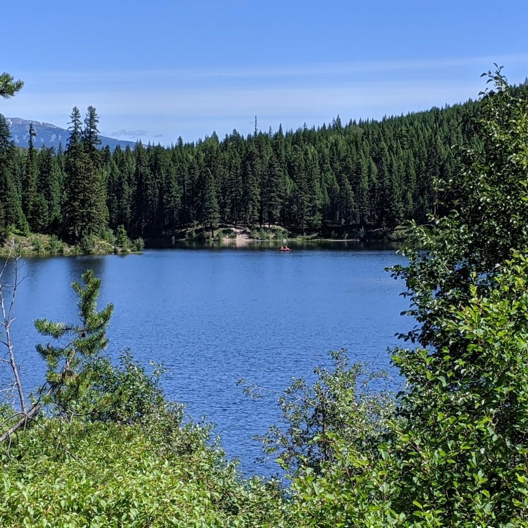
At the foot of Cliff Bowl, Rhonda Lake is a peaceful place to slow down beneath dramatic mountain walls. The trail winds through Engelmann spruce and lodgepole pine, with lovely picnic spots and clear views across the lake, a landscape completely transformed under snow in winter.
0
0

Starting early is worth it. It was more than 5 degrees colder on the trail than in the valley. There is a trail guide that can be downloaded as a PDF.
0
0

Little White Trail starts at Gillard FSR and leads you through a mix of open clearings and forest. A 4WD vehicle is recommended to reach the trailhead. The trail climbs steadily until you reach the open terrain near Little White Mountain and Crawford Lake, where the forest gradually thins as you gain elevation, revealing sweeping views of the Okanagan Valley. Eventually, the trail meets the Okanagan Highland Trail, which can be used for you to reach this trail. In autumn and winter, expect snow patches near the top.
0
0
Crawford Lake is a hidden lake in the forested hills of Myra-Bellevue Provincial Park. It sits among rocky slopes in an open clearing, giving it a quiet, secluded feel. You can reach it via the Okanagan Highland Trail or the Little White Trail (Crawford Trail). Take a moment to climb one of the rocky slopes above the water; the elevated view gives a true sense of calm and a nice view of the surroundings.
0
0

Myra-Bellevue Provincial Park protects a diverse range of ecosystems east of Kelowna, spanning 7,677 hectares of rugged terrain. It’s best known for the dramatic granite summit of Little White Mountain and the historic Myra Canyon section of the Kettle Valley Railway, with its wooden trestles and tunnels. The park offers over 100 kilometres of multi-use trails for hiking and biking, and it is home to an abundance of wildlife, including mule deer, black bears, and mountain goats.
0
0
Little White Mountain rises to 2,171 metres in Myra-Bellevue Provincial Park, forming one of the highest points in the central Okanagan Highland. Its summit is an impressive granite dome with fantastic expansive views of Kelowna, Okanagan Lake, and distant ranges to the south and east. The mountain’s upper slopes are dotted with beautiful alpine wildflowers, exposed rock, and scattered trees. It is the perfect spot, with plenty of room to stay for a while and take in the vast scenery, appreciating its beauty.
0
0
Frequently Asked Questions
How many hiking trails are available in Kootenay Boundary E?
Kootenay Boundary E offers a selection of hiking trails, with over 5 routes documented on komoot. These trails cater to various skill levels, from easy walks to more challenging ascents, allowing you to explore the region's diverse landscapes.
Are there easy hiking options suitable for beginners or families?
Yes, Kootenay Boundary E provides easy hiking options. For instance, the Information pavilion – View of Myra Canyon loop from Myra Bellevue Protected Area is an easy 3.5-mile (5.6 km) path, perfect for a leisurely stroll with family. The region's varied terrain includes wide valleys and less strenuous paths.
What kind of terrain can I expect on hikes in Kootenay Boundary E?
The terrain in Kootenay Boundary E is quite diverse, shaped by glacial activity. You can expect a mix of mountainous areas, river valleys, and forests. Trails often feature high mountain slopes, wide valleys, and the significant Kettle River basin, which includes lush cedar forests and wetlands. Some routes, like those near Myra Canyon, may also include historical railway features.
Are there any loop trails in the area?
Yes, there are loop trails available. A notable example is the View of Myra Canyon – Information pavilion loop from Myra Bellevue Protected Area, which is a moderate 4.2-mile (6.7 km) route. This allows hikers to experience the scenery without retracing their steps.
What are some notable natural features or attractions I can see while hiking?
While hiking in Kootenay Boundary E, you can explore several significant natural and historical attractions. The area is known for Myra Canyon and its impressive Wooden Trestle Bridges, which are part of the historic Kettle Valley Rail Trail. You might also encounter specific structures like Steel Trestle #9. These features offer unique scenic views and a glimpse into the region's past.
When is the best time of year to go hiking in Kootenay Boundary E?
The best time for hiking in Kootenay Boundary E is generally during the warmer months, from late spring through early autumn, when trails are clear of snow and weather conditions are mild. This allows full access to the diverse landscapes, including mountain trails and river valleys. Always check local weather conditions before heading out.
Is there public transport available to reach trailheads in Kootenay Boundary E?
Public transport options directly to specific trailheads in Kootenay Boundary E can be limited due to the rural nature of the region. It is generally recommended to have personal transportation to access many of the hiking routes and provincial parks in the area.
Where can I park when visiting the hiking trails?
Many trailheads in Kootenay Boundary E, especially those associated with provincial parks or popular routes like the Kettle Valley Rail Trail, offer designated parking areas. For example, the Myra Station - Kettle Valley Trailhead provides parking for hikers accessing that section of the trail. It's always advisable to check specific route details for parking information.
What do other hikers say about the trails in Kootenay Boundary E?
The hiking trails in Kootenay Boundary E are highly rated by the komoot community, with an average score of 4.5 stars from more than 20 reviews. Hikers often praise the varied forest scenery, the unique experience of the Kettle Valley Rail Trail, and the rewarding views towards peaks like Little White Mountain.
Are there opportunities for wildlife spotting on the trails?
Yes, the diverse ecosystems of the Kootenay Boundary region support a rich variety of wildlife. Hikers have opportunities to spot over 700 species of birds, mammals, fish, and reptiles. Keep an eye out for species like Bald Eagles, Ospreys, and various owls, especially in areas near the Kettle River and within protected habitats.
Are there any challenging hikes for experienced hikers?
For experienced hikers seeking a challenge, the Myra Canyon Tunnels – Steel Trestle #9 loop from Angel Springs is a difficult 11.5-mile (18.6 km) route. This trail offers a longer and more strenuous experience, traversing significant elevation changes and showcasing the region's rugged beauty.
What communities are near the hiking areas in Kootenay Boundary E?
Kootenay Boundary E, also known as West Boundary, includes communities such as Rock Creek, Bridesville, and Beaverdell. These towns serve as access points and provide local amenities for visitors exploring the surrounding hiking trails and natural areas.
Can I find places to eat or stay near the trails?
While Kootenay Boundary E is a more rural area, you can find amenities in the nearby communities like Rock Creek, Bridesville, and Beaverdell. These towns may offer local cafes, pubs, or accommodation options. For more extensive services, larger centers within the broader Kootenay Boundary Regional District would be available.
Are there any trails that feature the Kettle Valley Rail Trail?
Yes, the historic Kettle Valley Rail Trail is a significant feature in the region. While the full trail is extensive, sections of it are accessible for hiking in Kootenay Boundary E. For example, the Myra Canyon Tunnels – Steel Trestle #9 loop from Angel Springs incorporates parts of this historic railway, offering unique views and structures like the famous trestle bridges.
Most popular routes around Kootenay Boundary E
Most popular attractions around Kootenay Boundary E

Get inspired with the komoot mobile app


Explore more
Browse the best Hikes in other regions.
