The best cycling routes around Area C (Pemberton Valley/Mount Currie/D'Arcy)
4.1
(74)
1,661
riders
31
rides
Touring cycling around Area C (Pemberton Valley/Mount Currie/D'Arcy) features diverse landscapes, from lush farmland in the Pemberton Valley to the rugged mountain scenery dominated by Mount Currie. The region includes extensive trail networks and serene natural environments around lakes such as Anderson Lake near D'Arcy. This area offers a mix of flat valley routes and more challenging mountain ascents, providing varied terrain for touring cyclists.
Best touring cycling routes around Area C (Pemberton Valley/Mount Currie/D'Arcy)
- The most popular touring cycling…
Last updated: October 4, 2026
4.8
(28)
354
riders
31.2km
02:11
400m
400m
Moderate bike ride. Good fitness required. Mostly paved surfaces. Suitable for all skill levels.
4.5
(2)
263
riders
21.0km
01:50
250m
250m
Moderate bike ride. Good fitness required. Mostly paved surfaces. Suitable for all skill levels.

4.6
(9)
193
riders
20.6km
01:26
190m
190m
Moderate bike ride. Good fitness required. Mostly paved surfaces. Suitable for all skill levels.
4.9
(10)
155
riders
35.4km
02:22
440m
440m
Hard bike ride. Good fitness required. You may need to push your bike for some segments of this route.
4.7
(3)
73
riders
9.44km
00:37
100m
100m
Easy bike ride. Great for any fitness level. Mostly paved surfaces. Suitable for all skill levels.
Get access to more routes and recommendations from other explorers.
Already have an account?
Our route recommendations are based on thousands of hikes, rides, and runs completed by other people on komoot.
Start today with a free account
Your next adventure awaits.
Popular around Area C (Pemberton Valley/Mount Currie/D'Arcy)

Vancouver roundtrip — Bikepacking British Columbia

Pacific charm and peak happiness in British Columbia

Forests, desert, wilderness - day tours in British Columbia

Breathtaking British Columbia — hikes near Squamish & Whistler

MTB Road Trip Sea-to-Sky – dream trails in British Columbia
Hiking around Area C (Pemberton Valley/Mount Currie/D'Arcy)
MTB Trails around Area C (Pemberton Valley/Mount Currie/D'Arcy)
Running Trails around Area C (Pemberton Valley/Mount Currie/D'Arcy)
Road Cycling Routes around Area C (Pemberton Valley/Mount Currie/D'Arcy)
Other adventures around Area C (Pemberton Valley/Mount Currie/D'Arcy)


Tips from the Community

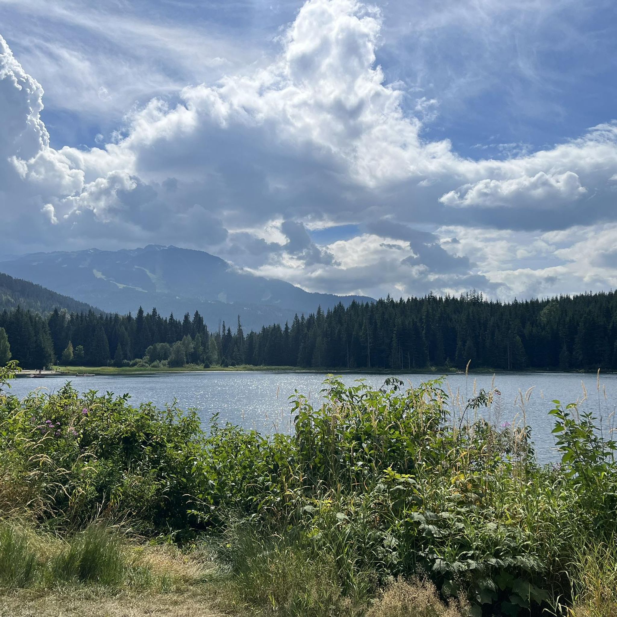
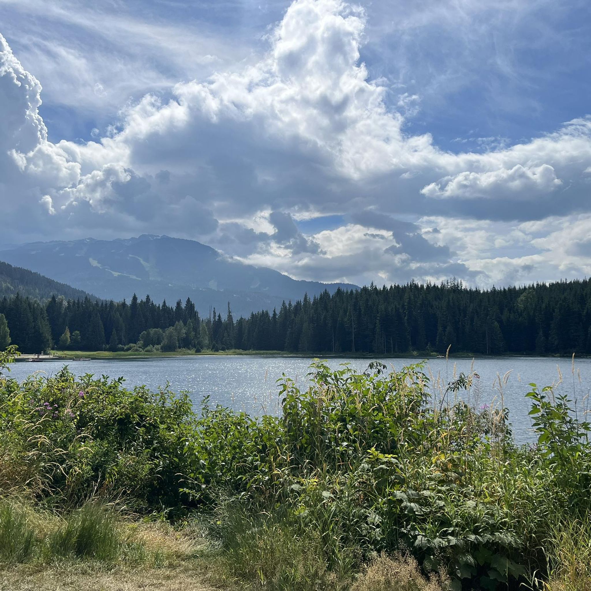
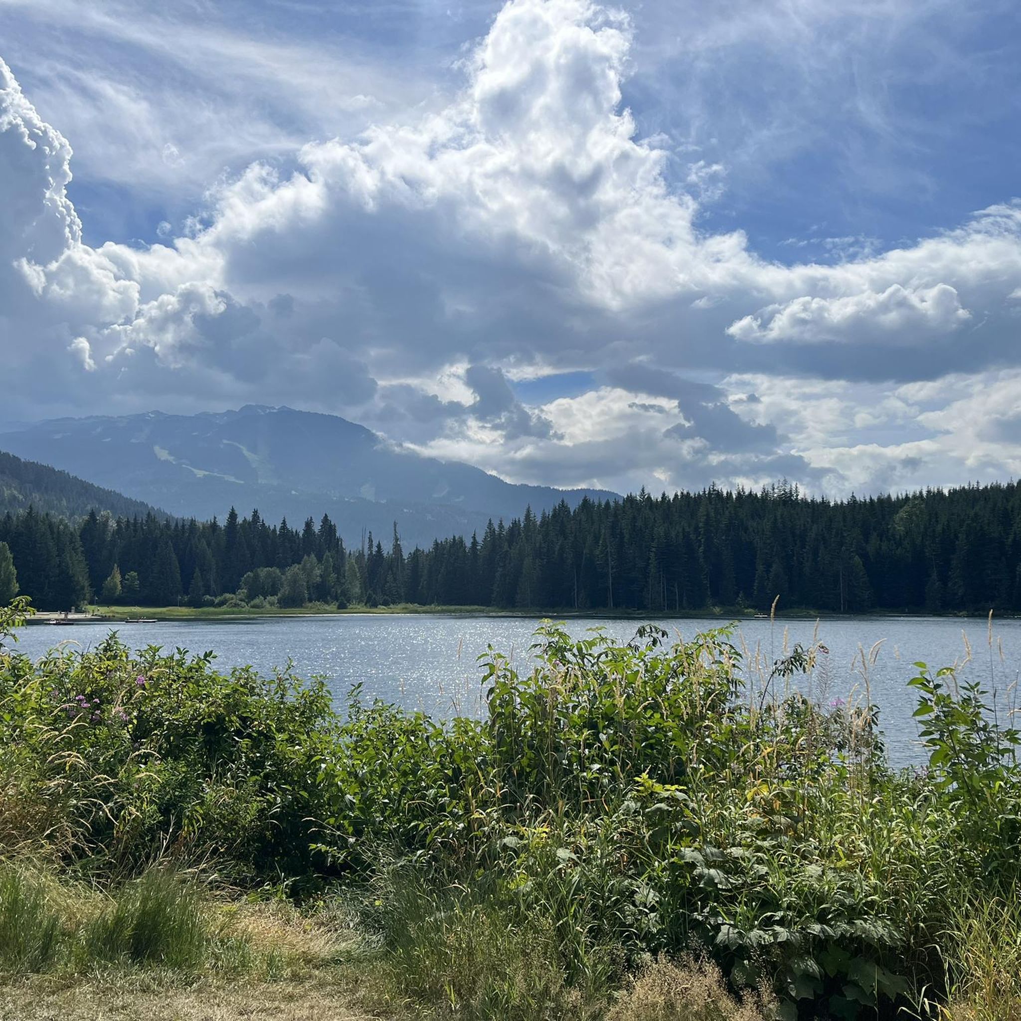
Lost Lake Beach is part of Lost Lake Park, with a sandy beach bordered by a grassy lawn. Swimming is allowed, but it will be refreshing! Other amenities the park has to offer include picnic areas, BBQs, and restrooms as well as a parking area.
1
0
The Elephant Bridge spans 75 meters and is used by hikers and mountain bikers. The bridge was built in the 1940s to transport timber to a sawmill. Today, it's a scenic and historical site that still functions to transport people.
0
0
The Cheakamus River is known for its blue and turquoise water and the dramatic canyon it thunders through. The color comes from glacial melt from the nearby Coast Mountains. Hikers and bikers will pass rock cliffs and gorges carved by centuries of rushing water. The Cheakamus River is often dotted with fly fishers fishing for rainbow trout and bull trout. When the water is flowing strongly, whitewater paddlers brave the cold waters. In the fall, the surrounding trees turn amazing colors.
1
0

Tucked in the forest just outside Whistler Village, Lost Lake is a beautiful, quiet spot surrounded by tall evergreens and mountain views. It’s a popular spot for swimming and paddleboarding in summer, with trails around its perimeter perfect for hiking and biking. In winter, the area transforms into a snowy network of cross-country ski and snowshoe trails, offering a quiet escape just minutes from town.
1
0

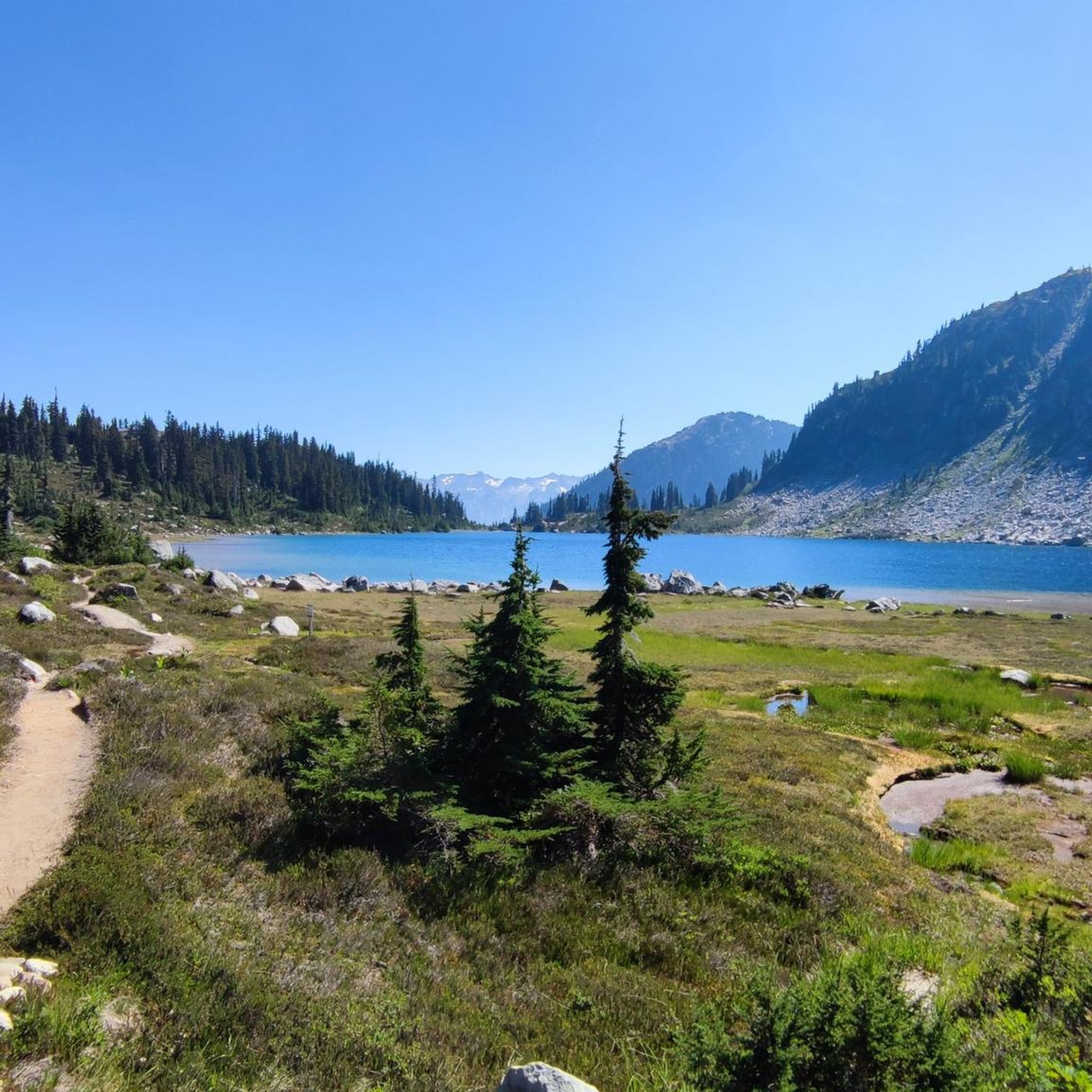
The lakes around Whistler, Alta Lake, Nita Lake, and Lost Lake, aren't that great to look at: swimming lakes, built-up areas, etc. Canada has something completely different to offer.
0
0

Lakeside Park is located on the southeast shore of Alta Lake. During the summer months, the beach is used for swimming. https://www.whistler.ca/parks-recreation-culture/parks/lakeside-park/
2
0
Alta Lake was formed by glacial retreat and subsequent sediment deposition, creating depressions that filled with meltwater. Alta Lake and other nearby lakes, such as Green Lake, are part of a large watershed whose waters flow north to the Lillooet River and south to the Cheakamus River. Historically, water flowed both north and south from Alta Lake, which lies at the top of the pass. This natural dual drainage system of the lake ended with the arrival of settlers. https://fireandicegeoregion.ca/geosite/whistler-valley-lakes-and-watershed-divide/
2
0
Green Lake is the largest lake in the Whistler region. To the north, it is the source of the Green River, which drains into the Lillooet River. Green Lake was formed during the last Ice Age, when sediment was deposited in the U-shaped valley, forming lake basins. The lake's green color is due to the glacial silt of Fitzsimmons Creek. From the wooden boardwalk on the southwest shore, we have a magnificent view of the lake and the seaplane landing. In the background, we can see the peaks of the Garibaldi Range, from Wedge Mountain to Mount Currie, including Mount Weart with the Armchair Glacier. https://www.piquenewsmagazine.com/local-news/naturespeak-awesome-geology-sites-around-whistlergreen-lake-part-2-7576124
2
0
Frequently Asked Questions
How many touring cycling routes are available in Area C (Pemberton Valley/Mount Currie/D'Arcy)?
There are over 35 touring cycling routes available in Area C, offering a diverse range of experiences. These include 14 easy routes, 10 moderate routes, and 12 difficult routes, catering to various skill levels.
What do other touring cyclists enjoy most about touring cycling in Area C (Pemberton Valley/Mount Currie/D'Arcy)?
The area is highly rated by the komoot community, with an average score of 4.4 stars from over 55 reviews. Touring cyclists often praise the diverse landscapes, from the lush Pemberton Valley to the rugged mountain scenery dominated by Mount Currie, and the variety of routes available for different abilities.
Are there easy touring cycling routes suitable for beginners or families in Area C?
Yes, Area C offers 14 easy touring cycling routes, many of which are suitable for beginners and families. The flat Pemberton Valley Road is a popular choice, providing picturesque views of Mount Currie and local farms. Routes around lakes like One Mile Lake also offer gentle terrain.
Are there any circular touring cycling routes in Area C?
Yes, several circular routes are available. For example, the Alta Lake – Whistler Village Stroll loop from Rainbow is a moderate 36.2 km route that takes you around scenic Alta Lake and through Whistler Village. Another option is the Rainbow Falls Trailhead – Elephant Bridge loop from Whistler Station, a 31.8 km moderate trail.
What kind of natural attractions can I see along the touring cycling routes in Area C?
Area C is rich in natural beauty. You can encounter impressive waterfalls like Nairn Falls and Rainbow Falls. The region also features numerous lakes such as One Mile Lake, Mosquito Lake, Ivey Lake, and Anderson Lake, offering scenic views and opportunities for relaxation.
When is the best time of year for touring cycling in Area C?
The warmer and drier conditions of the Pemberton Valley make it appealing for outdoor activities. While specific months aren't detailed, generally late spring through early fall offers the most favorable weather for touring cycling, avoiding snow and heavy rain.
Are there challenging touring cycling routes for experienced riders in Area C?
Absolutely. Area C features 12 difficult touring cycling routes. A particularly challenging option extends from Pemberton to the Joffre Lakes parking lot, which includes a relatively flat initial section followed by a steep 13-kilometer climb with switchbacks. The Nita Lake – Whistler Train Wreck loop from Whistler Station is another difficult route, covering over 105 km with significant elevation changes.
Are there any unique cycling events in the Pemberton Valley?
Yes, the Pemberton Valley hosts the unique "Slow Food Cycle Sunday" event. During this event, a 40-kilometer stretch of Pemberton Meadows Road transforms into a car-free route, allowing cyclists to visit local farms and enjoy fresh produce. More information can be found at tourismpembertonbc.com.
What are the options for parking when touring cycling in Area C?
While specific parking locations for each route are not detailed, many trailheads and community areas in Pemberton Valley, Mount Currie, and D'Arcy offer parking facilities. For routes starting near Whistler, public parking lots are generally available.
Can I find amenities like cafes or restaurants along the touring cycling routes in Area C?
Pemberton and Whistler, which are connected by some touring routes, offer various cafes, restaurants, and shops. While routes through more rural areas like D'Arcy might have fewer options, you can typically find amenities in the main communities to refuel and relax.
What kind of wildlife might I encounter on touring cycling routes in Area C?
Area C is home to diverse wildlife. Birkenhead Lake Provincial Park near D'Arcy, for instance, protects habitats for spotted owls, mountain goats, black bears, and grizzly bears. While cycling, it's always advisable to be aware of your surroundings and respect wildlife.
Most popular routes around Area C (Pemberton Valley/Mount Currie/D'Arcy)
Most popular attractions around Area C (Pemberton Valley/Mount Currie/D'Arcy)

Get inspired with the komoot mobile app


Explore more
Browse the best Cycling routes in other regions.
