The best walks and hikes around Abbotsford
4.7
(53)
806
hikers
24
hikes
Hiking around Abbotsford offers diverse landscapes, from the prominent Sumas Mountain to the scenic Fraser River. The region is characterized by a mix of forests, wetlands, and meadows, providing varied terrain for outdoor activities. Hikers can experience significant elevation gains on mountain trails or enjoy flat, riverside paths, all set against a backdrop of views of Mount Baker and the Coast Mountains.
Best hiking trails around Abbotsford
- The most popular hiking route is Mill Lake Park Trail, a 1.5 miles (2.4 km) trail that takes about 40 minutes to complete, offering a leisurely loop around the lake.
- Another top favourite among local hikers is Abby Grind Trail — Sumas Mountain Regional Park, a moderate 2.0 miles (3.2 km) path. This route features a steep climb to a viewpoint with vistas across the Fraser Valley.
- Local hikers also love the Discovery Trail loop — Abbotsford, a 7.3 miles (11.7 km) trail leading through forests and ponds, often completed in about 3 hours.
- Hiking around Abbotsford is defined by mountain ascents, riverside paths, and diverse ecosystems including forests and wetlands. The network offers options for different ability levels, from easy strolls to challenging climbs.
- The routes in Abbotsford are highly rated by the komoot community with an average score of 4.6 stars from over 50 reviews. More than 800 hikers have used komoot to explore Abbotsford's varied terrain.
Last updated: August 18, 2026
48
hikers
2.43km
00:38
10m
10m
Easy hike. Great for any fitness level. Easily-accessible paths. Suitable for all skill levels.
4.7
(3)
19
hikers
3.19km
02:05
390m
390m
Moderate hike. Good fitness required. Mostly accessible paths. Sure-footedness required.

Sign up for free
11
hikers
5.57km
01:24
10m
10m
Easy hike. Great for any fitness level. Easily-accessible paths. Suitable for all skill levels.
6
hikers
4.55km
01:17
100m
100m
Easy hike. Great for any fitness level. Easily-accessible paths. Suitable for all skill levels.
6
hikers
11.7km
03:02
70m
70m
Moderate hike. Good fitness required. Easily-accessible paths. Suitable for all skill levels.
Get access to more routes and recommendations from other explorers.
Sign up for free
Already have an account?
Our route recommendations are based on thousands of hikes, rides, and runs completed by other people on komoot.
Start today with a free account
Your next adventure awaits.
Login or Signup
Tips from the Community

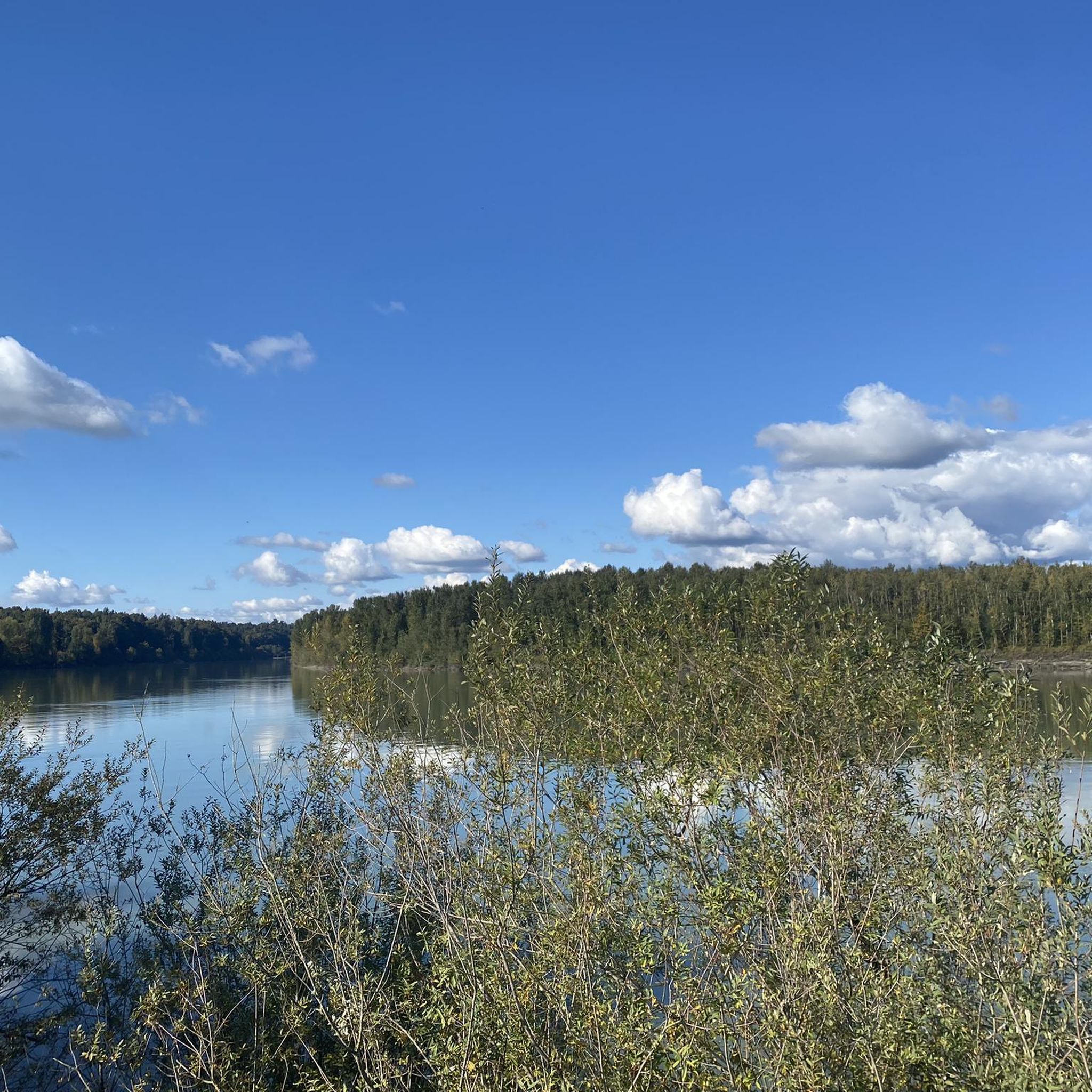
The Fraser River is the longest in British Columbia, flowing more than 1,300 kilometres from the Rocky Mountains to the Strait of Georgia near Vancouver. Along this section, the river cuts through a wide valley backed by forested hills and mountain views, creating a picturesque natural setting along the trail. The Fraser is also home to salmon, sturgeon, and plenty of birdlife, so keep an eye out as you walk along its banks.
0
0
Matsqui Trail is an easy, flat riverside gravel path that follows the Fraser River through Matsqui Trail Regional Park. The trail passes towering cottonwoods and along wetlands, with plenty of views across the river and opportunities to spot eagles, herons, and other wildlife. It’s a peaceful path to enjoy the natural beauty of the Fraser Valley, whether you’re walking, cycling, or simply taking in the scenery.
0
0

Clayburn Creek Park is a thickly forested area, full of western red cedar, western hemlock, and bigleaf maple trees. The area gets its name from the history of the Clayburn Brick Factory, whose bricks can still be seen in some old buildings today. The Clayburn Creek Trail, which is open to hiking and biking, was once the path used by the railway for delivering and transporting bricks from the factory.
0
0
Clayburn Creek Trail is a packed dirt and gravel trail. It's wide and easy to follow, and starting at the trail's western end, there will be a gentle downhill the entire way. There is one short staircase made of wood along the way. Locals mention resident bears who are seen regularly here, so be bear aware while hiking on this wooded trail.
0
0
Straiton Road is the western end of the Clayburn Creek Trail. It's not an ideal starting place, though there are 2-3 unoffical spots for cars, the better starting place for an adventure on the Clayburn Creek Trail is at its eastern end on Blauson Boulevard, where just a few yards north of the trailhead is official street parking.
0
0

Located on the south bank of the Fraser River, the compact Matsqui Trail Regional Park provides visitors with a network of multi-use trails, picnic tables, and stunning views of the Cascade Mountains.
0
0

Abbotsford Exhibition Park offers 148 acres of green space perfect for walking a loop, enjoying a picnic, or playing a game on one of the sports fields. With a network of nicely paved and unpaved paths winding through woodlands, open fields, and a duck‑filled pond, it’s a relaxed stop for a gentle stroll or a break during a longer walk. Be aware that occasional events may close sections of the park, so check the schedule if you’re passing through.
0
0
The Discovery Trail in Abbotsford offers a scenic pathway featuring a couple of small lakes, boardwalk sections, and paved paths suitable for walking or cycling. Stay alert and courteous to other trail users, including cyclists and dogs.
0
0
Frequently Asked Questions
How many hiking trails are available in Abbotsford?
Abbotsford offers a diverse network of over 15 hiking trails, catering to various skill levels. These include everything from leisurely strolls around lakes to challenging mountain ascents.
What do other hikers enjoy most about hiking in Abbotsford?
The hiking trails in Abbotsford are highly rated by the komoot community, with an average score of 4.6 stars from over 50 reviews. Hikers frequently praise the diverse landscapes, from serene lakeside paths to challenging mountain climbs, and the stunning views of Mount Baker and the Fraser Valley.
Are there easy hiking trails suitable for beginners or leisurely walks?
Yes, Abbotsford has several easy trails perfect for beginners or those seeking a relaxed walk. The Mill Lake Park Trail offers a paved 2.3-kilometer loop around the lake, ideal for a leisurely stroll. Another great option is the Matsqui Trail Loop, providing a flat, scenic walk along the Fraser River.
Which trails offer the best scenic views in Abbotsford?
For panoramic vistas, the Abby Grind Trail — Sumas Mountain Regional Park provides a steep climb to a viewpoint overlooking the Fraser Valley. The McKee Peak Trail also offers gradual inclines through meadows and forests, culminating in expansive views of the surrounding area.
Are there any family-friendly hiking options in Abbotsford?
Many trails in Abbotsford are suitable for families. The Mill Lake Park Trail is excellent for all ages, featuring playgrounds and picnic areas. The Discovery Trail, with its extensive paved system, is also great for families with children, offering interpretive signage about the local ecosystem.
Are there dog-friendly trails in Abbotsford, and are off-leash areas available?
Abbotsford offers several dog-friendly trails. While specific off-leash areas vary, many parks and trails, such as the Discovery Trail and parts of Sumas Mountain, welcome dogs on leash. Always check local park regulations for specific rules regarding off-leash areas.
What are some good circular walking routes in Abbotsford?
The Discovery Trail loop — Abbotsford is a popular circular route spanning nearly 12 kilometers through forests and ponds. The Mill Lake Park Trail also offers a shorter, easy loop around the lake.
What kind of natural attractions can I see along the trails in Abbotsford?
Abbotsford's trails wind through diverse ecosystems, including forests, wetlands, and meadows. You can observe local flora and fauna, especially numerous bird species at places like Willband Creek Park. Highlights include the Fishtrap Creek Park wetlands and the scenic Sumas Mountain Regional Park.
Are there any trails accessible by public transport in Abbotsford?
Many of Abbotsford's urban parks and trails, such as Mill Lake Park and sections of the Discovery Trail, are generally accessible via local public transport routes. It's advisable to check the BC Transit Abbotsford schedules and maps for the most current information on bus stops near specific trailheads.
Where can I find parking information for hiking trails in Abbotsford?
Most major trailheads and parks in Abbotsford, including Sumas Mountain Regional Park, Mill Lake Park, and access points for the Discovery Trail, offer designated parking areas. Parking availability and regulations can vary, so it's recommended to check specific park websites or local signage upon arrival.
What is the best season for hiking in Abbotsford?
Abbotsford offers hiking opportunities year-round. Spring and fall provide pleasant temperatures and vibrant scenery, while summer is ideal for longer excursions. Even in winter, many lower elevation trails remain accessible, though conditions can be wet, and higher trails on Sumas Mountain may require more preparation.
Are there any less crowded hiking spots in Abbotsford?
While popular trails like the Abby Grind can see more traffic, exploring the extensive network of the Discovery Trail or venturing into less frequented sections of Sumas Mountain can offer a more secluded experience. The Hiking loop from McKee is another option that might offer a quieter experience.
Most popular routes around Abbotsford
Most popular attractions around Abbotsford

Get inspired with the komoot mobile app


Explore more
Browse the best Hikes in other regions.
