The best running trails around Area B (South Fraser Canyon/Sunshine Valley)
4.5
(4)
183
runners
11
runs
Jogging around Area B (South Fraser Canyon/Sunshine Valley) offers diverse landscapes for runners, characterized by rugged canyon scenery, towering mountains, rushing rivers, and serene lakes. This region provides varied terrains, with trails often leading through peaceful forests and opening up to panoramic views of the surrounding BC wilderness. The area caters to different fitness levels, featuring routes that range from moderate paths to challenging trails with significant elevation gains.
Best jogging routes around Area B (South Fraser Canyon/Sunshine Valley)
- The…
Last updated: July 24, 2026
28
runners
6.15km
00:45
80m
80m
Moderate run. Good fitness required. Mostly paved surfaces. Suitable for all skill levels.
25
runners
27.3km
04:33
1,240m
1,240m
Hard run. Very good fitness required. Sure-footedness, sturdy shoes and alpine experience required.

Sign up for free
24
runners
20.0km
02:56
850m
850m
Hard run. Very good fitness required. Mostly paved surfaces. Suitable for all skill levels.
22
runners
21.3km
03:53
1,120m
1,120m
Hard run. Very good fitness required. Sure-footedness, sturdy shoes and alpine experience required.
12
runners
6.55km
00:46
70m
70m
Moderate run. Good fitness required. Mostly paved surfaces. Suitable for all skill levels.
Get access to more routes and recommendations from other explorers.
Sign up for free
Already have an account?
Our route recommendations are based on thousands of hikes, rides, and runs completed by other people on komoot.
Start today with a free account
Your next adventure awaits.
Login or Signup
Popular around Area B (South Fraser Canyon/Sunshine Valley)


Other adventures around Area B (South Fraser Canyon/Sunshine Valley)


Tips from the Community

Lightning Lake Trail runs along the lake shore. At the Rainbow Bridge there is a sign warning of a bear in the area (May 2018). We cross the narrow part of the lake on the bridge and walk back to the car park at the Lightning Lake Day Use Area. https://en.wikipedia.org/wiki/Lightning_Lake
2
0

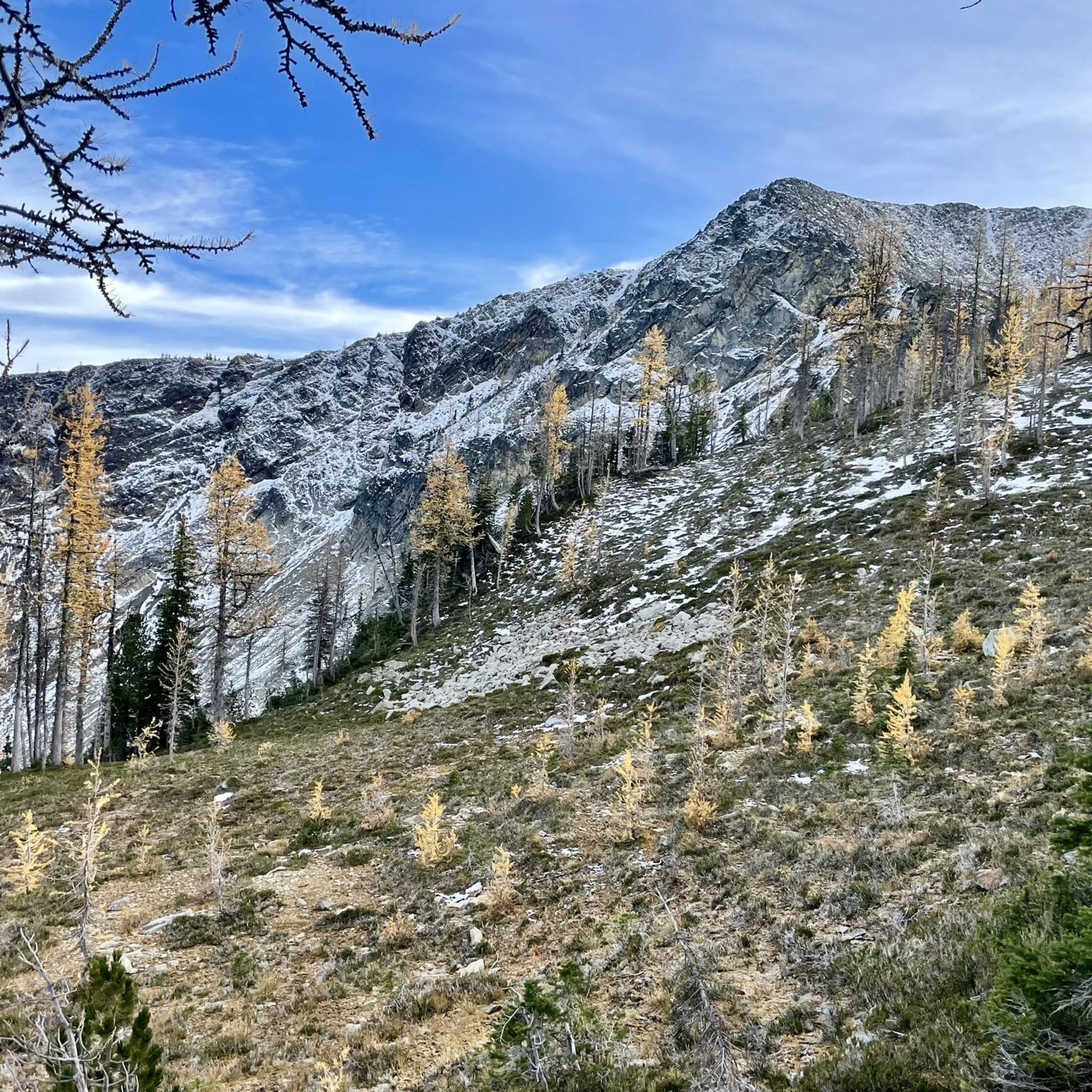
If you descent from Frosty Mountain, this is the first glimpse you get on the beautiful turquoise Lightning Lake deep in the valley and Snow Camp Mountain in the distance to your left.
4
0
If you want to climb Frosty Mountain, it's best to start at Lightning Lake and choose the ascent from the west. This is not as steep and arduous as the climb from the east from Windy Joe. Also, you can spend a night at Frosty Creek Camp at about 1,900 meters and climb the summit the next day. With Frosty Creek flowing, this is also your closest water source. To spend the night in the backcountry, you'll need a permit that costs $5 a night per person. Also note: In winter and even in fall, Frosty Mountain can be snow covered. If you descend to the west, you should have microspikes in your backpack for this case.
3
0
Frosty Creek Camp is a nice stop before you climb to the summit of Mount Frosty. There is room for three tents, an outhouse, and a wind shelter for inclement weather. If you want to camp here, you need a camping permit from BC Parks, which costs 5 Dollar per night per person. BC Parks allows for your backcountry camping permits to be pre-purchased online up to two weeks in advance of your arrival date. Find more information here: https://bcparks.ca/explore/parkpgs/ecmanning/backcountry-camping.html
4
0

There is space for 2-3 tents for emergency situations. But be prepared: The next watersource is a difficult climb away at the Frosty Mountain glacier (small creek). Also: It can get very cold at night: -5 and snowstorm mid September (When I went there). But definitely fun and adventurous camping up there!
2
0

The lake is lined with a 9 km long flat hiking trail, which can be halved over the Rainbow Bridge at the narrows. Other hiking trails (starting from the day parking lot at the lake) lead to Windy Joe Mountain and Frosty Mountain as well as over the Lightning Lakes Chain.
0
0
The lake is lined with a 9 km long flat hiking trail, which can be halved over the Rainbow Bridge at the narrows. Other hiking trails (starting from the day parking lot at the lake) lead to Windy Joe Mountain and Frosty Mountain as well as over the Lightning Lakes Chain.
0
0

Frequently Asked Questions
How many running routes are available in Area B (South Fraser Canyon/Sunshine Valley)?
There are over a dozen dedicated running routes in Area B (South Fraser Canyon/Sunshine Valley) listed on komoot. These routes offer a variety of distances and difficulties, catering to different fitness levels.
What kind of terrain can I expect on running trails in the South Fraser Canyon?
Runners in the South Fraser Canyon can expect a diverse landscape featuring rugged canyon scenery, towering mountains, and rushing rivers. Trails often lead through peaceful forests, including lush coastal rainforests, and open up to bald mountaintops with panoramic views of the surrounding BC wilderness. The ground can frequently be covered in a mossy carpet, adding to the natural ambiance.
Are there routes suitable for beginners or those looking for an easier run?
Yes, Area B offers several moderate running paths ideal for beginners or those seeking a less strenuous experience. For example, a shorter loop around Lightning Lake, like the Start of Lightning Lake Trail loop from Skyview Campground (6.2 km), provides a pleasant run through forest scenery without significant elevation gain.
What about more challenging running routes for experienced trail runners?
For experienced trail runners, Area B provides several challenging routes with significant elevation gains. The Frosty Mountain Summit – Frosty Creek Camp loop from Lightning Lake Beach is a demanding 27.3 km trail leading through mountainous terrain, often completed in about 4 hours 32 minutes. Another option is the Frosty Mountain loop from Lightning Lake Beach, which is 21.3 km with over 1,100 meters of elevation gain.
Are there any circular running routes in the Sunshine Valley?
Many of the running routes in the Sunshine Valley are circular, allowing you to start and finish at the same point. A popular option is the Start of Lightning Lake Trail loop from Skyview Campground, a 10 km route offering beautiful views around Lightning Lake.
What natural features or landmarks can I see while running in this region?
While running in Area B, you can encounter stunning natural features like the turquoise waters of Lightning Lake and the serene Twenty-Minute Lake. Some trails also feature unique structures such as the Rainbow Bridge on the Lightning Lake Trail. The region is also characterized by its majestic mountain peaks and the powerful Fraser River.
Are there any historical sites or cultural points of interest near the running trails?
The Fraser Canyon has a rich history, including the 1858 Fraser Canyon Gold Rush and Indigenous heritage. While running, you might be near sites like the Hell's Gate Airtram, which offers a unique perspective on the canyon, or the historic Othello Tunnels, a series of old railway tunnels that are now part of a scenic trail. For more historical context, you can explore the region's past at sites like the Yale Historic Site or Tuckkwiowhum Village.
Can I bring my dog on the running trails in Sunshine Valley?
Many trails in E.C. Manning Provincial Park, which encompasses parts of Sunshine Valley, are dog-friendly, but it's crucial to check specific trail regulations before you go. Dogs are generally permitted on leash in most areas, but some sensitive ecological zones or designated swimming areas may have restrictions. Always ensure your dog is under control and pack out any waste.
Are there family-friendly running options in Area B?
Yes, Area B offers family-friendly running options, particularly around the lakes. Trails like the shorter loops around Lightning Lake or the paths near Twenty Minute Lake are generally well-maintained and have minimal elevation, making them suitable for families with children. The Beaver Pond Nature Trail is another gentle option that can be enjoyed by all ages.
What is the best time of year to go running in the South Fraser Canyon?
The spring, summer, and fall months generally offer the best conditions for running in the South Fraser Canyon, with pleasant temperatures and accessible trails. Summer provides warm weather for lake activities, while fall brings stunning foliage. Spring offers lush greenery and blooming wildflowers. Always check local weather and trail conditions before heading out, especially during shoulder seasons.
Are there options for winter running in Area B?
While many trails in Area B are multi-use and suitable for snowshoeing or cross-country skiing in winter, dedicated winter running can be challenging due to snow and ice. Some lower elevation or paved sections might be runnable, but for higher trails, specialized gear like traction devices (microspikes) or trail running shoes with aggressive grip would be essential. Always prioritize safety and check current conditions.
What do other runners say about the trails in Area B?
The running routes in Area B (South Fraser Canyon/Sunshine Valley) are highly rated by the komoot community, with an average score of 4.5 stars from over 4 reviews. Runners often praise the diverse landscapes, from rugged canyon views to serene lake loops, and appreciate the variety of terrains available for different fitness levels.
Most popular routes around Area B (South Fraser Canyon/Sunshine Valley)
Most popular attractions around Area B (South Fraser Canyon/Sunshine Valley)

Get inspired with the komoot mobile app


Explore more
Browse the best Running Trails & Routes in other regions.
