The best cycling routes in Boone County
4.3
(5)
109
riders
4
rides
Touring cycling in Boone County, Kentucky, features routes along the Ohio River and through varied landscapes. The region includes riverfront paths, rolling terrain, and areas with historical significance. Elevations are generally moderate, with some routes offering more significant climbs.
Best touring cycling routes in Boone County
- The most popular touring cycling route is Purple People Bridge – Ohio River Trail loop from Cincinnati Union Terminal, an 18.2 miles (29.3 km) trail that takes 1 hour 45 minutes to complete. This easy route follows the Ohio River Trail.
- Another top favourite among local touring cyclists is Incinerator Trail loop from Bromley, a moderate 7.2 miles (11.6 km) path. This trail features a mix of terrain and can be completed in about 1 hour 10 minutes.
- Local touring cyclists also love the Serpentine Wall – Kroger Hills loop from Cincinnati Union Terminal, a 69.6 miles (112.1 km) trail leading through riverfront areas and hills, often completed in about 6 hours 30 minutes.
- Touring cycling in Boone County is defined by riverfront paths, historical sites, and rolling hills. The network offers options for different ability levels, from easy family friendly bike trails Boone County to more advanced cycling routes Boone County.
- The routes in Boone County are highly rated by the komoot community with an average score of 5.0 stars from over 3 reviews. More than 80 touring cyclists have used komoot to explore Boone County's varied terrain.
Last updated: July 29, 2026
3.0
(1)
34
riders
55.3km
03:14
160m
160m
Moderate bike ride. Good fitness required. Mostly paved surfaces. Suitable for all skill levels.
5.0
(3)
25
riders
Easy bike ride. Great for any fitness level. Mostly paved surfaces. Suitable for all skill levels.

Sign up for free
14
riders
9.89km
00:59
210m
210m
Moderate bike ride. Good fitness required. Mostly paved surfaces. Suitable for all skill levels.
5.0
(1)
14
riders
Easy bike ride. Great for any fitness level. Mostly paved surfaces. Suitable for all skill levels.
10
riders
This Cincinnati cycling route offers a delightful blend of urban exploration and scenic riverfront views, perfect for a touring bicycle. You'll start near the architectural grandeur of Cincinnati Union Terminal, then follow the Ohio River Trail past vibrant parks like Smale Riverfront Park and Sawyer Point. Keep an eye out for the whimsical Flying Pig Statues, including 'Lucius Quinctus Pigasus,' which add a unique local flavor to the journey.
This moderate 23.1-mile (37.2 km) loop with 1099 feet (335 metres) of elevation gain takes approximately 2 hours and 21 minutes. The trail is largely flat and paved, making it accessible for most cyclists. While the core of the route is on dedicated paths, be prepared for some city street navigation when connecting from Union Terminal to the riverfront.
The route is notable for seamlessly integrating two of Cincinnati's most recognizable symbols: the Ohio River and the beloved Flying Pig Statues, which celebrate the city's historical nickname, "Porkopolis." It offers a captivating blend of urban attractions and the natural beauty of the river, providing a rich cultural and scenic experience.
2
riders
37.1km
02:14
200m
200m
The Ohio River Trail – Serpentine Wall loop offers a delightful touring bicycle experience right in the heart of Cincinnati. You'll pedal along a predominantly flat and paved path, enjoying continuous views of the Ohio River and the city's impressive skyline. The route takes you past the unique Serpentine Wall, through the lively Smale Riverfront Park, and offers fantastic photo opportunities of the John A. Roebling Suspension Bridge, making it an easy cycling route with high scenic payoff.
This moderate 23.0-mile (37.1 km) loop, with a gentle 663 feet (202 metres) of elevation gain, is perfect for a two-hour and thirteen-minute ride. Starting conveniently from Cincinnati Union Terminal, it's an ideal choice for families or anyone looking for an accessible bike path. For the best experience, aim for a ride during the morning or late afternoon to avoid peak heat and crowds, especially around the popular riverfront attractions.
Beyond the immediate riverfront beauty, this trail is notable for its connection to the much longer Ohio to Erie Trail, an epic 300-mile route stretching to Lake Erie. The loop also passes by major sports stadiums and the vibrant "The Banks" entertainment district, offering a blend of natural beauty and urban landmarks. Keep an eye out for the whimsical Cincinnati Flying Pig Statues and the educational Geologic Timeline along the way.
6
riders
15.7km
01:02
80m
80m
Easy bike ride. Great for any fitness level. Mostly paved surfaces. Suitable for all skill levels.
2
riders
Easy bike ride. Great for any fitness level. Mostly paved surfaces. Suitable for all skill levels.
2
riders
66.0km
04:00
560m
560m
Hard bike ride. Very good fitness required. Mostly paved surfaces. Suitable for all skill levels.
Our route recommendations are based on thousands of hikes, rides, and runs completed by other people on komoot.
Start today with a free account
Your next adventure awaits.
Login or Signup
Popular around Boone County
Tips from the Community

Lots of hills! But stop mid run at Coffee emporium before you run back to your car!
0
0


As the name suggests this trail connects the towns of Aurora and Lawrenceburg. Running along the Ohio River the trail offers great vies across the water and has some interesting wooden rail bridges along the way as well.
0
0

The Aurora–Lawrenceburg Trail is a wide, paved multiuse path that runs from Aurora to Lawrenceburg. The path is mostly flat, so it is not a challenging trail.
0
0

https://www.americansignmuseum.org/ Wednesday – Sunday 10 am – 4 pm
0
0

The view of the surrounding river from the Taylor-Southgate Bridge is particularly wonderful at sunset.
0
0
Weekends on nice days draws many folk that are walking on this part of the trail. Slowly is the best way to enjoy the Ohio River vistas this trail section provides.
0
0

The Little Miami Scenic Trail is a 78-mile multi-use trail that runs through southwestern Ohio, connecting Newtown to other communities and scenic areas. The trail is part of the larger Ohio to Erie Trail network, offering a paved, multi-use path for cyclists, walkers, and runners. In Newtown, the trail runs right alongside the Little Miami River, providing nice views and a peaceful setting. It features well-maintained, paved surfaces, making it suitable for all ages and fitness levels.
0
1
Frequently Asked Questions
How many touring cycling routes are available in Boone County?
Boone County offers a selection of 8 touring cycling routes, catering to various skill levels. You'll find 3 easy routes, 3 moderate routes, and 2 more challenging options to explore.
Are there any easy, family-friendly touring cycling routes in Boone County?
Yes, Boone County has several easy routes suitable for families. One such option is the Aurora–Lawrenceburg Trail loop from Lawrenceburg, which is 9.3 miles (14.9 km) long and features minimal elevation gain, making it a pleasant ride for all ages.
What are some of the longer touring cycling routes in Boone County?
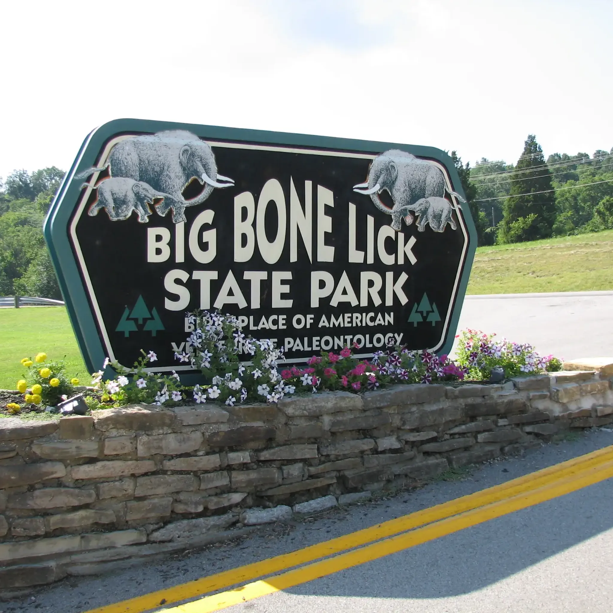
For those seeking a longer ride, the Serpentine Wall – Kroger Hills loop from Cincinnati Union Terminal covers 69.6 miles (112.1 km) and is considered difficult. Another substantial option is the Big Bone Lick State Park – Rabbit Hash Historic District loop from Publix, a difficult 41 miles (66 km) route that offers significant elevation changes.
Are there any circular touring cycling routes in Boone County?
Many of the touring cycling routes in Boone County are loops, offering convenient circular journeys. Examples include the popular Purple People Bridge – Ohio River Trail loop from Cincinnati Union Terminal, an easy 18.2-mile ride, and the moderate Incinerator Trail loop from Bromley, which is 7.2 miles long.
What kind of terrain can I expect on touring cycling routes in Boone County?
Boone County's touring cycling routes feature a mix of terrain. You'll find riverfront paths, such as those along the Ohio River, as well as rolling hills and varied landscapes. Elevations are generally moderate, though some routes, like the Serpentine Wall – Kroger Hills loop, include more significant climbs.
What can I see along the touring cycling routes in Boone County?
Boone County's routes often pass by historical sites and natural attractions. You might encounter the Rabbit Hash Historic District, known for its unique charm, or the significant Big Bone Lick State Park, a site of paleontological importance. Some routes also feature the Mammoth statues, adding an interesting visual element to your ride.
Are there any touring cycling routes that are considered challenging in Boone County?
Yes, for experienced touring cyclists seeking a challenge, Boone County offers routes with more significant climbs and longer distances. The Serpentine Wall – Kroger Hills loop from Cincinnati Union Terminal is a difficult 69.6-mile route, and the Big Bone Lick State Park – Rabbit Hash Historic District loop from Publix is another difficult option spanning 41 miles.
What do other touring cyclists enjoy most about touring cycling in Boone County?
The touring cycling routes in Boone County are highly rated by the komoot community, with an average score of 5.0 stars. Cyclists often praise the varied terrain, which includes scenic riverfront paths and rolling hills, as well as the historical significance found along many of the routes.
Are there any routes that pass by historical landmarks?
Absolutely. The region is rich in history. For instance, the William Henry Harrison Tomb – Shawnee Lookout Park loop from Miami Township takes you past a significant historical site. Additionally, the Big Bone Lick State Park – Rabbit Hash Historic District loop includes the charming Rabbit Hash Historic District.
What is the best season for touring cycling in Boone County?
While specific conditions can vary, the spring and fall months generally offer the most pleasant weather for touring cycling in Boone County, with milder temperatures and beautiful scenery. Summer can be enjoyable, but be prepared for warmer temperatures and potential humidity.
Are there any touring cycling routes along the Ohio River?
Yes, several routes in Boone County feature sections along the Ohio River, offering scenic waterfront views. The Serpentine Wall – Ohio River Trail loop from Cincinnati Union Terminal and the Ohio River Trail – Serpentine Wall loop from Cincinnati Union Terminal are both moderate options that allow you to experience the riverfront paths.
Most popular attractions in Boone County

Get inspired with the komoot mobile app


Explore more
Browse the best Cycling routes in other regions.
