The best walks and hikes in Kittitas County
4.7
(221)
5,264
hikers
146
hikes
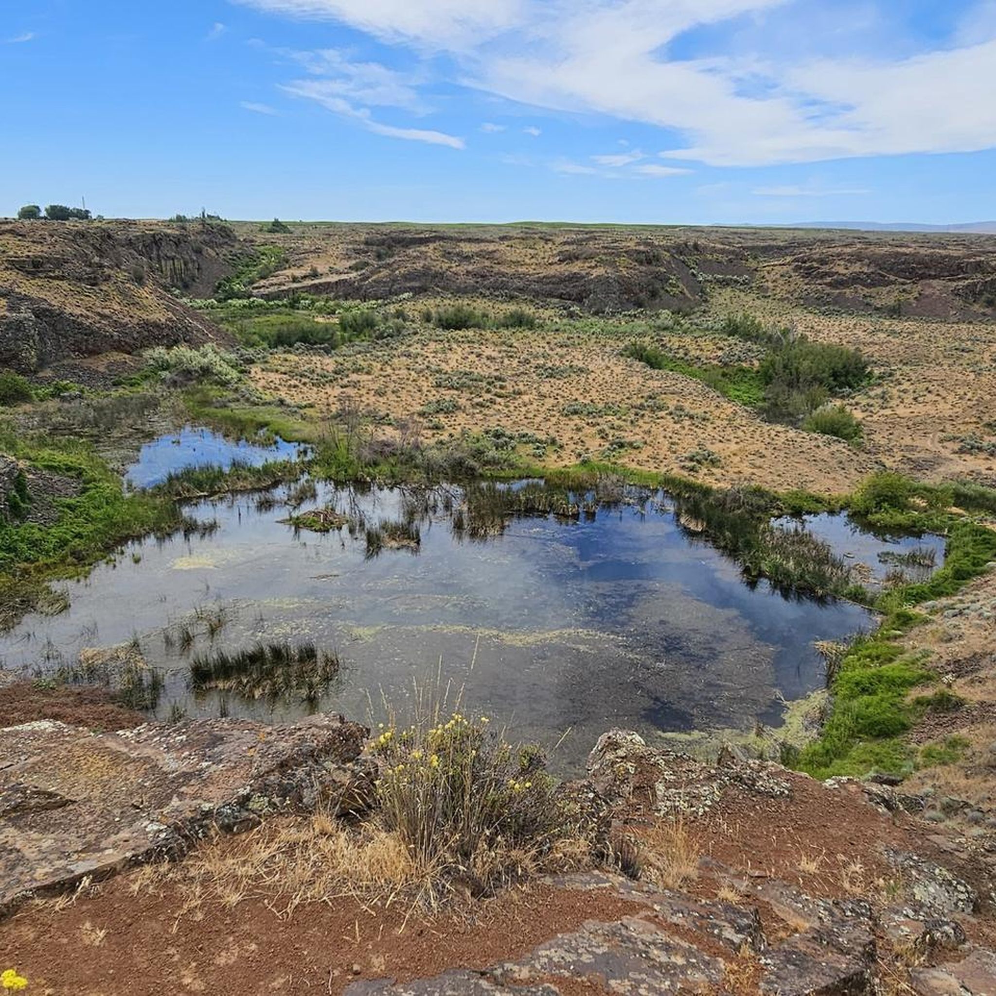
Hiking in Kittitas County, Washington, features diverse landscapes, transitioning from the snow-capped Cascade Mountains in the west to the semi-arid shrub-steppe of the Columbia Plateau in the east. The region is characterized by towering peaks, glaciated valleys, and an extensive network of trails through national forests and wilderness areas. Numerous pristine alpine lakes and the Yakima River contribute to the area's natural features, offering varied terrain from high alpine environments to lush forests. This geographical diversity supports a wide range…
Last updated: October 11, 2026
43
hikers
16.5km
05:24
950m
280m
Prepare for a challenging hike to two stunning alpine lakes on the Marmot Lake and Jade Lake via Deception Pass Trail. This difficult route covers 10.3 miles (16.5 km) with…
32
hikers
15.5km
04:17
120m
550m
Embark on the Spectacle Lake Trail, a moderate hike spanning 9.6 miles (15.5 km) with an elevation gain of 393 feet (120 metres). This route takes you through varied landscapes,…

26
hikers
6.67km
01:46
50m
100m
Embark on an easy hike along the Pete Lake Trail, a 4.1 miles (6.7 km) route that winds through an ancient forest of towering western white pine, Douglas fir, and…
5.0
(2)
19
hikers
7.80km
02:52
730m
0m
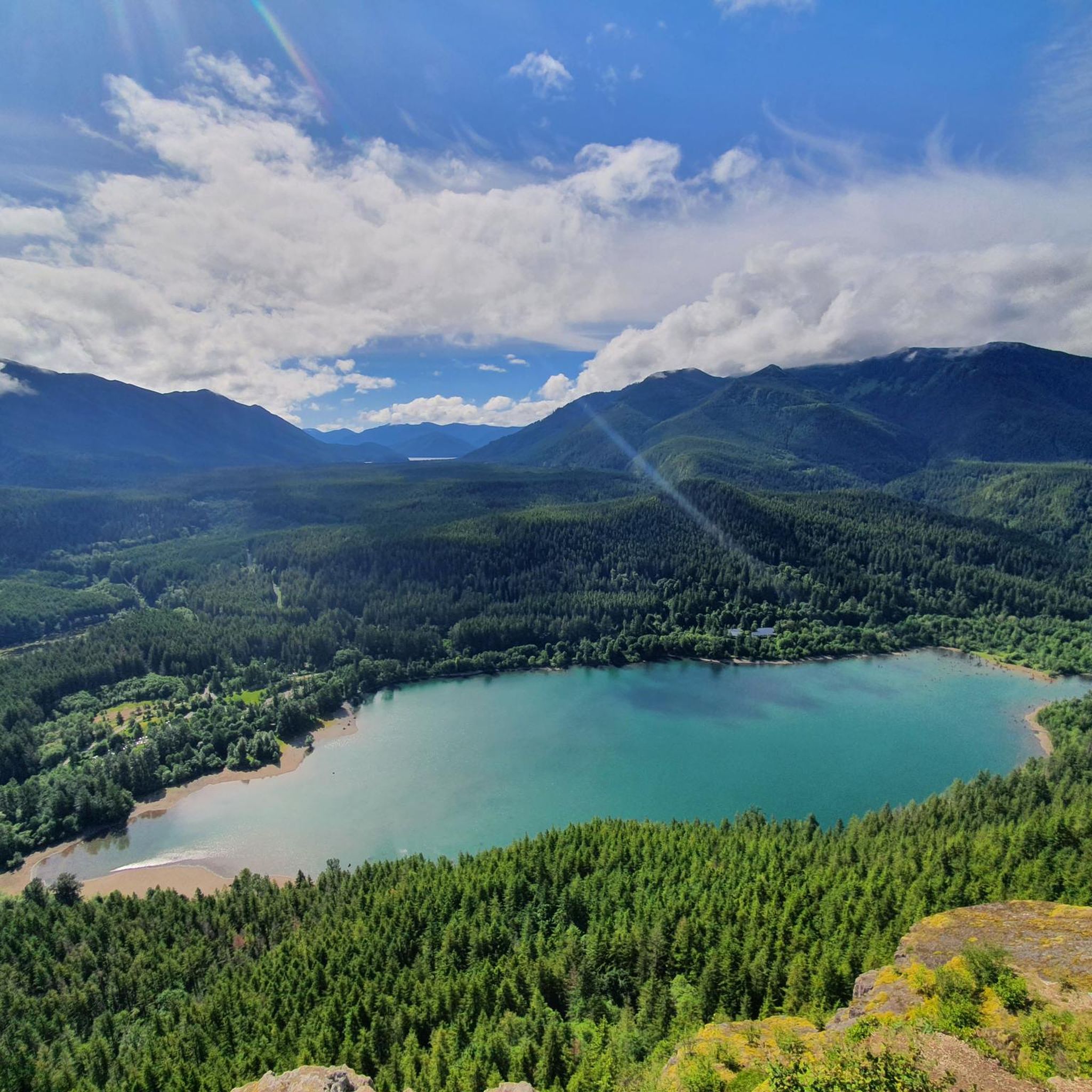
Embark on the Rachel and Rampart Lakes Trail, a moderate hike spanning 4.8 miles (7.8 km) with a significant elevation gain of 2383 feet (726 metres). This route typically takes…
18
hikers
7.60km
02:07
20m
340m
Hiking the Deception Pass Trail takes you on a moderate journey through the scenic Alpine Lakes Wilderness. You will experience diverse terrain, from rugged mountain views to peaceful forest sections,…
16
hikers
17.0km
05:01
420m
220m
Embark on the Waptus River Trail, a difficult 10.6-mile (17.0 km) hiking adventure that takes approximately 5 hours and 1 minute to complete. You will gain 1367 feet (417 metres)…
5.0
(1)
12
hikers
9.05km
03:13
890m
0m
Embark on the moderate Navaho Peak via Stafford Creek Trail, a 5.6-mile (9.0 km) hike that gains 2923 feet (891 metres) over an estimated 3 hours and 12 minutes. You…
10
hikers
16.0km
07:23
1,430m
1,000m
Embark on a challenging hike along the Rampart Lakes and Alta Mountain Trail, a difficult route spanning 9.9 miles (16.0 km). You will ascend a significant 4703 feet (1433 metres)…
7
hikers
6.88km
02:29
650m
80m
Embark on the Lake Ann via Esmeralda Basin Trail, a moderate hike covering 4.3 miles (6.9 km) with an elevation gain of 2148 feet (655 metres). You can expect to…
5
hikers
12.2km
05:17
1,440m
90m
Embark on a challenging hike along the Mount Daniel and Peggy's Pond via Cathedral Pass Trail, a difficult route that spans 7.6 miles (12.2 km). You will ascend a significant…
Get access to more routes and recommendations from other explorers.
Already have an account?
Our route recommendations are based on thousands of hikes, rides, and runs completed by other people on komoot.
Start today with a free account
Your next adventure awaits.
Popular around Kittitas County




Other adventures in Kittitas County

Tips from the Community


The Deception Pass Trail passes along the eastern shores of Hyas Lake and offers pretty continuous views of the shallow reservoir. There are some popular camping areas near the clear lake that also make for great stopping points if you are just looking for somewhere to take a break during your hike.
0
0
Nosh Nosh Wahtum is a small reservoir within the Alpine Lakes Wilderness. It's just off the side of the Cathedral Pass Trail and is a popular lake since it's such a short trip from the trailhead to get here.
0
0

Spectacle is a beautiful high lake nestled in the Alpine Lakes Wilderness. The 80 acre lake sits at an elevation of 4,239 feet. There is a population of naturally reproducing Eastern Brook Trout, but they may be difficult to catch. Various fly patterns or small spinners/spoons can be effective.
0
0
Alta Peak is a classic summit that is located in the Alpine Lakes Region. Home to stellar views, Alta Peak is a popular destination for those want to bag a beautiful peak along with checking out the amazing Rachel Lake. One of the major advantages of this mountain is that it is only 12 miles roundtrip and the technical difficulty of this peak during summer is barely Class 2, with only one small section of exposure on a narrow ridge near the top. In summer this narrow ridge will only require one to use a little caution on their way to the summit. However with a coating of snow this mountain can get very sketchy very quick. It is an ideal late summer-early fall summit to go for because the trail up is then snow-free and the berries are out towards the high country. As you pass Lake Lillian, there is a short steep pitch that travels along the lakes edge and requires more sure-footedness.
0
0
Once you get to Marmot there are a bunch of great campsites along the eastern shore, some right on the water and some a bit above. From here you can either spend the night and enjoy the sunset at Marmot or continue up to Jade Lake, taking another 1.5 hours or so. Marmot lake is great for swimming, with an actual beachfront and lots of shallow water for wading and bathing, and although the mosquitoes are pretty bad, there are some beautiful views around the lake and it's a great place to view mountain goats.
0
0
Jade Lake, named after its color, is attributed to the fine, almost talcum-powder-fine crushed rock worn down by the scouring of the glaciers and carried into the lake by the meltwater.
0
0
Peggy's Pond, located beneath Cathedral Rock, is a trout filled pond with magnificent views. Mountaineers can enjoy the loose and steep trails just beyond the pond. Be mindful to not build rock stacks or fire rings in the area as the meandering water is already having a difficult time draining to the lakes below.
0
0
Frequently Asked Questions
How many hiking trails are available in Kittitas County?
Kittitas County offers a wide variety of hiking experiences, with over 100 routes available. These trails cater to all skill levels, from easy strolls to challenging mountain ascents.
What do other hikers enjoy most about the trails in Kittitas County?
The komoot community highly rates the hiking in Kittitas County, with an average score of 4.6 stars. Reviewers often praise the diverse landscapes, from pristine alpine lakes and river valleys to the dramatic Cascade Mountain peaks, and the well-maintained network of trails.
Are there easy hiking trails suitable for beginners or those seeking a relaxed experience?
Yes, Kittitas County has several easy trails perfect for beginners or a leisurely walk. A popular option is the Gold Creek Pond Trail loop, which is a tranquil 1.4-mile path through a scenic pond area. Other gentle paths can be found in Iron Horse State Park and the Coal Mines Trail.
Where can I find challenging hikes with significant elevation gain in Kittitas County?
For experienced hikers seeking a challenge, Kittitas County offers several demanding routes. The Lake Ingalls loop from Esmeralda Trailhead is a difficult 8.6-mile trail with substantial elevation gain, offering stunning alpine lake and mountain views. Another challenging option is the Lila Lake trail in the Alpine Lakes Wilderness.
Are there family-friendly hiking options in Kittitas County?
Absolutely. Many trails in Kittitas County are suitable for families. The Gold Creek Pond Trail loop is an excellent choice, offering a short, easy walk around a beautiful pond. The Swauk Forest Discovery Trail and portions of Iron Horse State Park also provide gentle, accessible paths for all ages.
Which trails in Kittitas County are dog-friendly?
Many trails in Kittitas County welcome dogs, though leash laws and specific regulations may apply, especially within wilderness areas or state parks. Generally, trails in national forests and state parks are dog-friendly. Always check local signage or park websites for the most current rules before heading out with your pet.
What kind of natural features and landmarks can I expect to see while hiking in Kittitas County?
Kittitas County is rich in natural beauty. You can explore towering peaks like Silver Peak, pristine alpine lakes such as Lake Ingalls, Rachel and Rampart Lakes, and Gold Creek Pond. The region also features impressive rock formations, lush forests, and scenic rivers like the Yakima and Cle Elum. Don't miss the unique Kendall Katwalk for breathtaking views.
Are there any trails that offer panoramic viewpoints?
Yes, Kittitas County is known for its stunning panoramic views. Trails like the Manastash Ridge Trail offer rewarding vistas. The Kendall Katwalk, part of the Pacific Crest Trail, provides breathtaking expansive views of the surrounding mountains and valleys, though hikers should be mindful of the drop-offs.
What is the best time of year to go hiking in Kittitas County?
The best time for hiking in Kittitas County is generally from late spring through early fall (May to October), when trails are mostly snow-free and weather conditions are favorable. The region's location on the 'dry side of the mountains' often means more sunshine. However, some lower elevation trails remain accessible for winter hiking, offering a different kind of beauty.
Are there any circular hiking routes in Kittitas County?
Yes, several trails in Kittitas County are designed as loops, offering varied scenery without retracing your steps. The Lake Ingalls loop is a popular and challenging option, while the Gold Creek Pond Trail loop provides an easy, scenic circular walk.
Are permits required for hiking in certain areas of Kittitas County?
Yes, some areas within Kittitas County, particularly those in wilderness areas like the Alpine Lakes Wilderness or certain national forest lands, may require permits or a Northwest Forest Pass for parking at trailheads. It's always best to check with the specific land management agency (e.g., Okanogan-Wenatchee National Forest, Mt. Baker-Snoqualmie National Forest) for the latest permit requirements before your hike.
Are there any trails that follow a river or offer waterside views?
Yes, Kittitas County's landscape is shaped by rivers like the Yakima River and Cle Elum River, offering scenic routes. The Pete Lake Trail, for example, leads to a beautiful lake, and many trails in the region feature streams and smaller bodies of water, providing refreshing waterside views and sounds.
Most popular routes in Kittitas County
Most popular attractions in Kittitas County

Get inspired with the komoot mobile app


Didn’t find what you were looking for?
Check out more Hikes throughout Kittitas County below and find the perfect route in your destination.
Explore more
Browse the best Hikes in other regions.
