The 12 Most Amazing Peaks in Mariposa County
Best mountain peaks in Mariposa County are primarily located within Yosemite National Park, offering a diverse landscape of granite monoliths and high-elevation areas. The region features over 200 named mountains, providing varied terrain for exploration. These peaks contribute to the county's natural environment, characterized by deep valleys and sub-alpine meadows. Mariposa County is a destination for those seeking mountain experiences.
Best mountain peaks in Mariposa County
- The most popular mountain peaks is Sentinel Dome, a summit that offers views…
Last updated: August 3, 2026
Half Dome Summit
Highlight • Summit
Tip by

Eagle Peak
Highlight • Summit
Tip by

Sign up now to discover places like this
Get recommendations on the best single tracks, peaks, & plenty of other exciting outdoor places.
Sign up for free
Clouds Rest ⛰️ (9,930 feet) Yosemite National Park
Highlight • Summit
Tip by

Taft Point
Highlight • Viewpoint
Tip by
Clouds Rest trail 🏔 from Tioga Pass Road
Highlight (Segment) • Summit
Tip by
Olmsted Point
Highlight • Viewpoint
Translated by Google •
Tip by

View of Half Dome and Nevada Fall from John Muir Trail
Highlight • Viewpoint
Tip by

Valley View from Panorama Trail
Highlight • Viewpoint
Tip by

Diving Board Vista above Snake Dike ⛰️ Half Dome
Highlight • Viewpoint
Tip by
Union Point Viewpoint
Highlight • Viewpoint
Tip by

Start today with a free account
Your next adventure awaits.
Login or Signup
Popular around Mariposa County

John Muir Trail – Along the legendary trail through the magical Sierra Nevada

California to Nevada – hiking between Volcanoes, Water & Forest

The pristine beauty of the US National Parks
Hiking in Mariposa County
Cycling in Mariposa County
MTB Trails in Mariposa County
Road Cycling Routes in Mariposa County
Running Trails in Mariposa County
Other adventures in Mariposa County


Tips from the Community

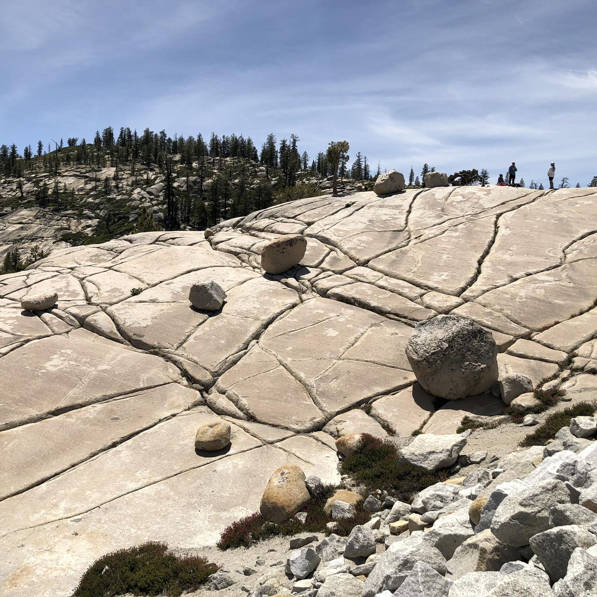
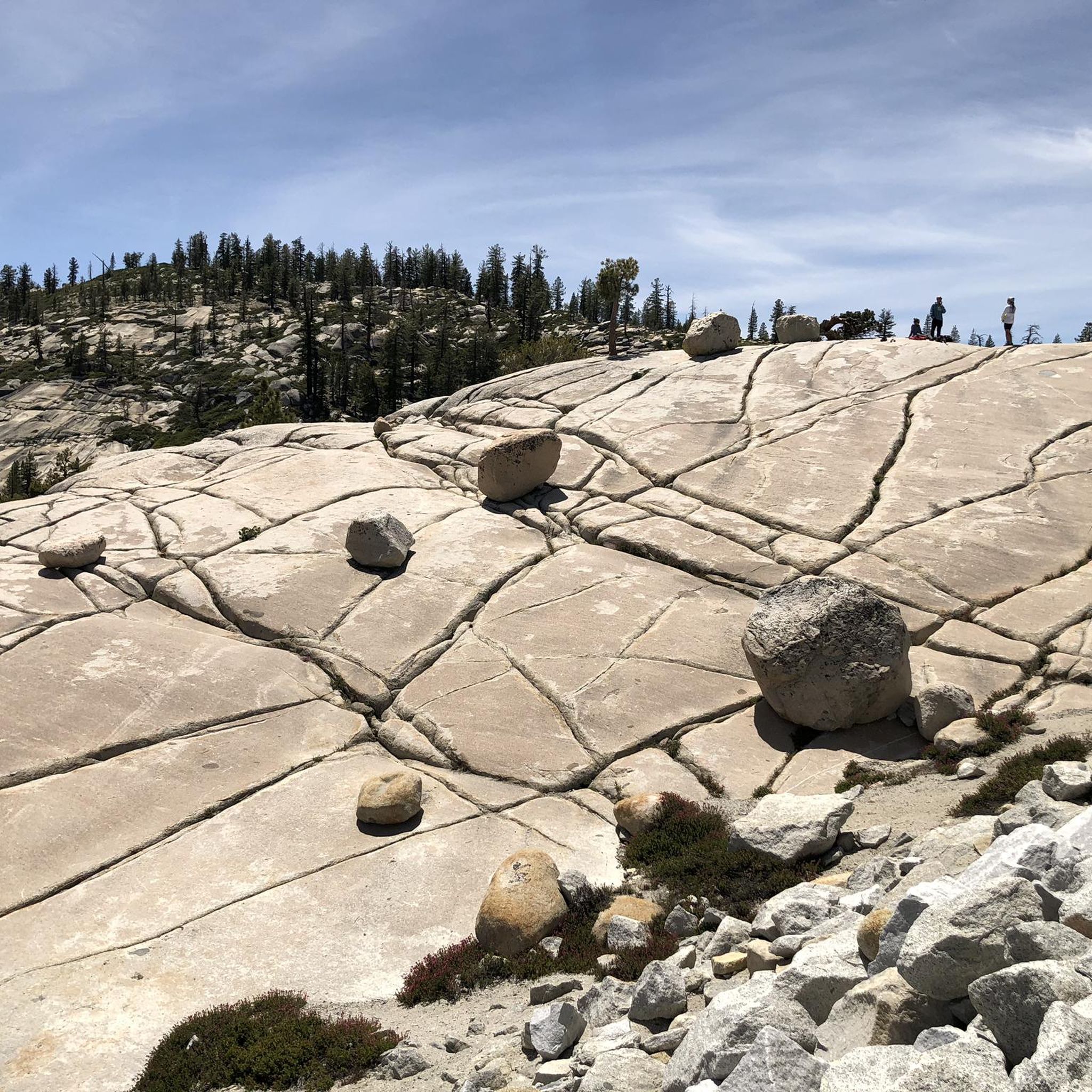
Olmsted Point is a famous viewpoint of the north side of Half Dome, Tenaya Canyon, and Tenaya Lake to the east from Tioga Pass off State Highway 120 in Mariposa County. Olmsted Point is a must-see on the way over Tioga Pass. We admire the "erratic" boulders staggered around the granite slopes. These huge boulders were left behind when the last glacier broke through. Olmsted Point is named after landscape architects Frederick Law Olmsted and Frederick Law Olmsted, Jr. Olmsted was instrumental in protecting Yosemite National Park in the 1860s when he worked with Senator John Conness of California to declare Yosemite Valley and the Mariposa Big Tree Grove as public land under state protection. This was the first land set aside by Congress for public use and laid the foundation for what would become the National Parks.
4
0

From this spot on the Panorama Trail, you get fantastic views down the iconic Yosemite Valley. This is a great spot to pause, snap some photos, and sip some water before continuing on your hike.
0
0


To reach this point, you'll follow the historic Four Mile Trail, which dates back to 1872 as an old toll trail. The views of the park are stunning, offering great vistas of Half Dome.
1
0

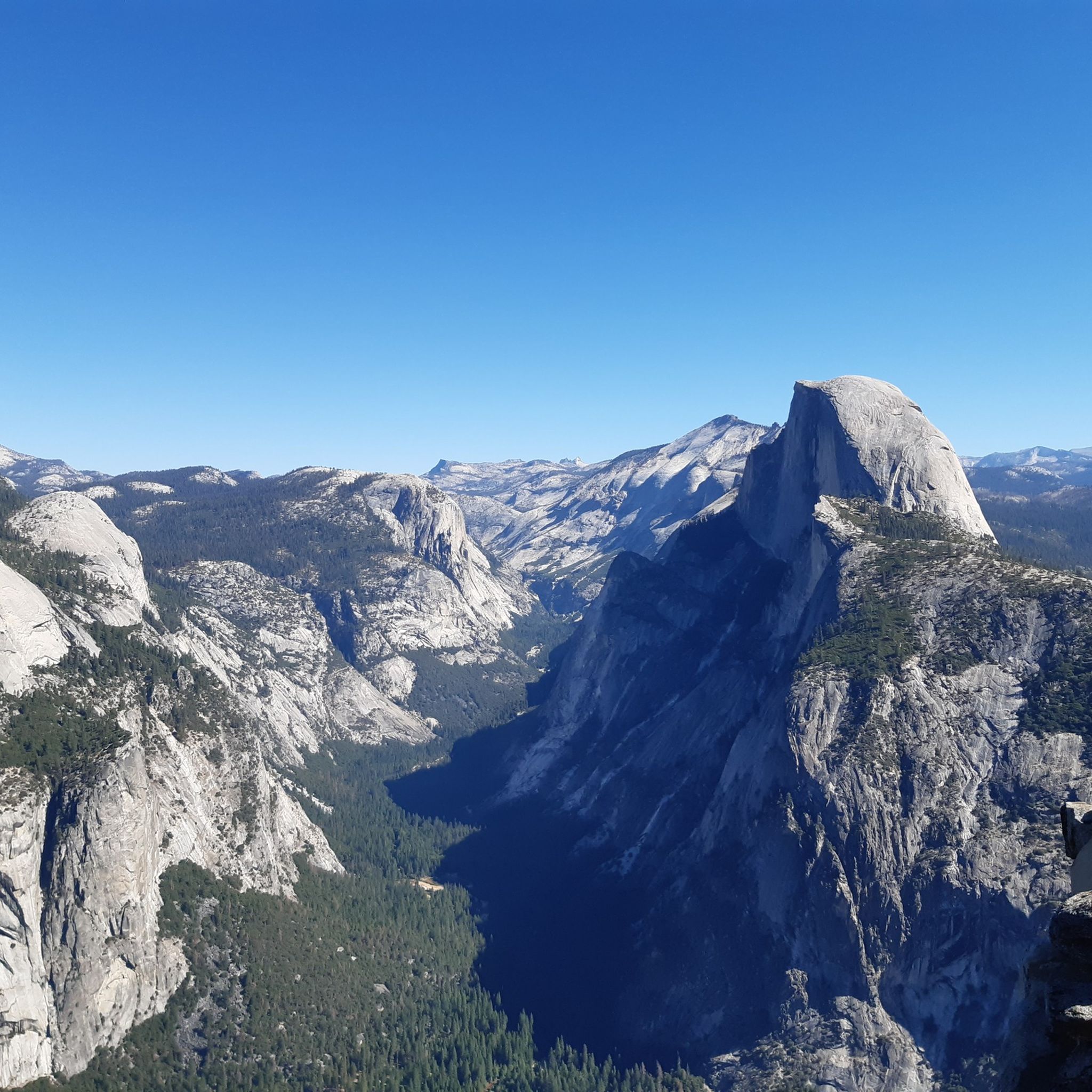
Depending on your direction of travel, Olmstead Point offers your first, or last, view of Yosemite's iconic Half Dome. Also visible from here is Clouds Rest and Tenaya Canyon.
2
0

Long before you set foot in Yosemite National Park, you'll see the majestic Half Dome. Its silhouette, a striking peak that stretches 9,700 feet into the clear California sky, is not only the park's symbol, but has also found its way into pop culture and technology. Any Apple user with OS X Yosemite will recognize this symbol, and outdoor enthusiasts will recognize the shapes of this impressive mountain in The North Face logo. Viewed from the valley floor, Half Dome may seem unreachable, but it can be conquered - if you're willing to take on the challenge. It's a path that challenges both body and mind, taking you through an ever-changing landscape: from dense forests to bubbling streams to sheer rock faces. If you want to attempt the climb, note that a special permit is required, which is awarded annually in March. But even without a permit, Yosemite National Park, with its 3,000 square kilometers of untouched nature, offers an almost endless variety of hiking routes to explore. The final 120 meters of elevation of Half Dome pose a particular challenge: a steep, almost smooth piece of rock with an incline of up to 45 degrees. Here, wire ropes help to secure the way up. And even if the cables inspire respect in some people - they look worse than they are. With the right technique, gloves and a bit of courage, this section becomes an unforgettable experience. For those who prefer something a little more leisurely or are traveling in the company of family and friends, the park has a variety of less challenging routes. And after a long day of hiking, you can look forward to watching the picturesque sunset in one of the most breathtaking settings in the world before a shuttle bus takes you back to the starting point.
1
0

Clouds Rest is a prominent mountain along the icon John Muir Trail and a true gem in Yosemite National park. Although it is not the highest peak with an elevation of 9,930 feet, the views from the knife-shaped back that was shaped by glaciers are just breathtaking. If the trail is buried under deep snow, there is a Bypass Trail that leads you around the summit at a lower elevation.
2
2

Olmsted Point offers a unique view of Tenaya Canyon and Half Dome.
1
0
Frequently Asked Questions
What are some of the most popular mountain peaks to visit in Mariposa County?
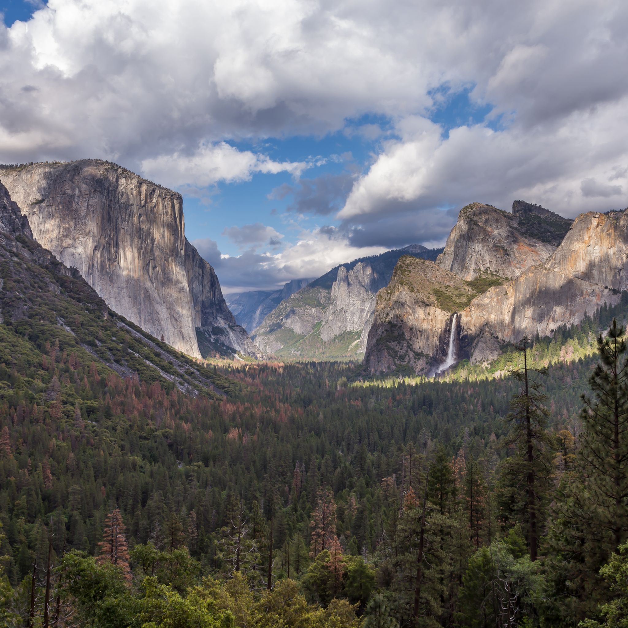
Mariposa County, largely within Yosemite National Park, offers several highly regarded peaks. Among the most popular are Sentinel Dome, known for its excellent views and accessibility, and Clouds Rest ⛰️ (9,930 feet) Yosemite National Park, which provides expansive 360-degree panoramas. Half Dome Summit and El Capitan Summit are also iconic, attracting visitors for their challenging ascents and unique perspectives of Yosemite Valley.
Which mountain peak is the highest point in Mariposa County?
The highest point in Mariposa County is Parsons Peak, reaching an elevation of 12,153 feet (3,704 m). It is located within Yosemite National Park's Cathedral Range and is primarily sought after by peakbaggers looking for a true wilderness experience.
Are there any easily accessible mountain peaks in Mariposa County for visitors seeking less strenuous hikes?
Yes, for those seeking easier access and rewarding views, Sentinel Dome is an excellent choice. It's known for being easily accessible with a relatively short hike from the Glacier Point parking lot. Olmsted Point also offers accessible viewpoints with stunning vistas.
Which mountain peaks offer the best panoramic views of Yosemite Valley?
For breathtaking panoramic views of Yosemite Valley, several peaks stand out. Clouds Rest ⛰️ (9,930 feet) Yosemite National Park is highly regarded for its 360-degree views, including Half Dome and the high Sierra. Eagle Peak, the highest point on the north rim of Yosemite Valley, also provides spectacular views of El Capitan and Yosemite Falls. Sentinel Dome offers outstanding views of the eastern valleys, including Half Dome, El Capitan, and Yosemite Falls.
What are some challenging mountain peaks for experienced hikers in Mariposa County?
Experienced hikers looking for a challenge will find several options. The ascent to Half Dome Summit is strenuous and requires permits, involving cables for the final push. Reaching El Capitan Summit also involves a strenuous hiking trail, offering a unique perspective of Yosemite Valley. The hike to Clouds Rest ⛰️ (9,930 feet) Yosemite National Park is also considered challenging, especially from Happy Isles.
What outdoor activities can I do near the mountain peaks in Mariposa County?
Mariposa County offers a wide range of outdoor activities. You can find numerous hiking trails, from easy walks like the Lower Yosemite Fall Trail to more difficult routes such as Vernal and Nevada Falls via the Mist Trail. For running enthusiasts, there are challenging trails like the Half Dome Loop via Clouds Rest. Mountain biking is also popular, with routes like the Yosemite Valley Loop Trail. You can explore more options in the Easy hikes in Mariposa County, Running Trails in Mariposa County, and MTB Trails in Mariposa County guides.
What is the best time of year to visit the mountain peaks in Mariposa County?
The best time to visit the mountain peaks in Mariposa County, especially those within Yosemite National Park, is typically from late spring through early fall (May to October). During this period, trails are generally clear of snow, and the weather is more favorable for hiking and outdoor activities. Some higher elevation areas, like those near Tioga Pass Road, may only be accessible from late May or June through October, depending on snowmelt.
Are there any specific permits required for hiking certain mountain peaks in Mariposa County?
Yes, for some of the more popular and challenging peaks, permits are required. Most notably, a wilderness permit is required for overnight stays in Yosemite's backcountry, and a specific day-use permit is required to hike to the summit of Half Dome Summit. It's crucial to check the official Yosemite National Park website for the most current permit requirements and application processes before planning your trip.
What unique natural features can I expect to see when visiting the mountain peaks?
Mariposa County's mountain peaks are renowned for their unique natural features. You'll encounter towering granite monoliths like Half Dome Summit and El Capitan Summit, deep valleys, and high-elevation sub-alpine meadows. Taft Point is famous for its giant fissures in the granite rock, offering dramatic views directly down to the valley floor.
What do visitors enjoy most about the mountain peaks in Mariposa County?
Visitors consistently praise the unparalleled views and the sense of accomplishment from reaching the summits. Many highlight the 360-degree spectacle from places like Sentinel Dome, offering vistas of Half Dome, El Capitan, and Yosemite Falls. The challenge of the climb to peaks like Half Dome Summit and the unique perspectives of Yosemite Valley are also frequently mentioned as highly rewarding experiences.
Can I find family-friendly viewpoints or short hikes near the mountain peaks?
Yes, several spots offer family-friendly access and stunning views without requiring extensive hiking. Olmsted Point is a great example, providing accessible viewpoints. While many peaks require more effort, areas around them often have shorter, well-maintained trails suitable for families, such as the Lower Yosemite Fall Trail, which is an easy hike nearby.
Are there any historical or cultural insights related to the mountain peaks in Mariposa County?
Many of the peaks in Mariposa County, particularly within Yosemite National Park, hold significant historical and cultural value. For instance, El Capitan was named by the Mariposa Battalion in 1851, a loose Spanish translation of the local Native American name. John Muir, the renowned naturalist, also extensively documented and praised the views from peaks like Clouds Rest ⛰️ (9,930 feet) Yosemite National Park and Eagle Peak, contributing to their iconic status.
Most popular routes in Mariposa County
Most popular attractions in Mariposa County

Get inspired with the komoot mobile app


Didn’t find what you were looking for?
Discover Mariposa County’s best peaks and summits by region:
Explore more
See even more amazing summits in Mariposa County with these guides:
