The best walks and hikes around Oberer Murgsee
4.6
(2018)
13,967
hikers
228
hikes
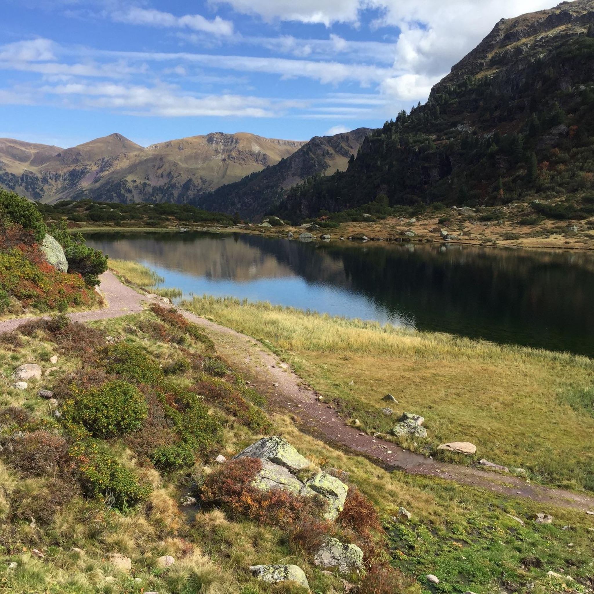
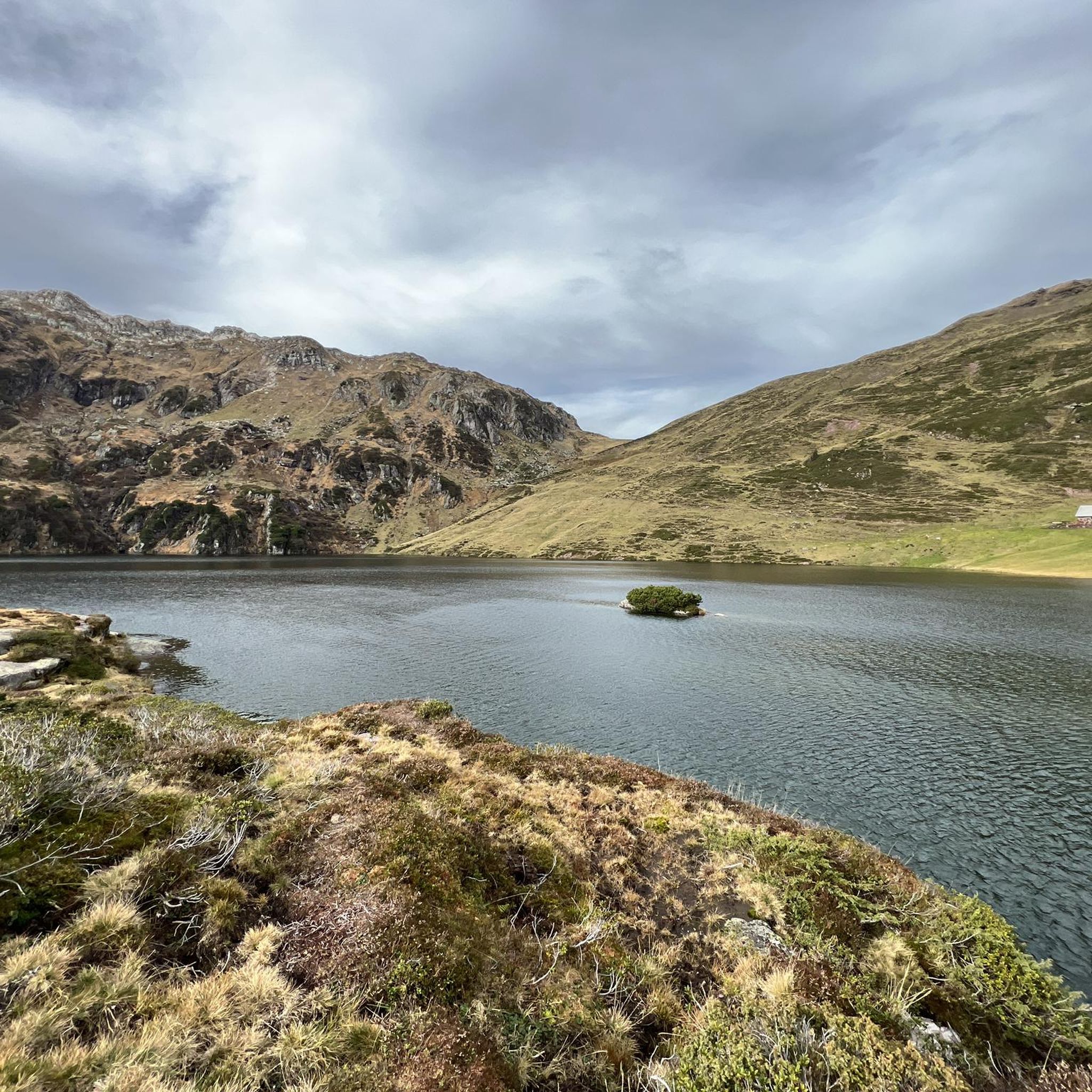
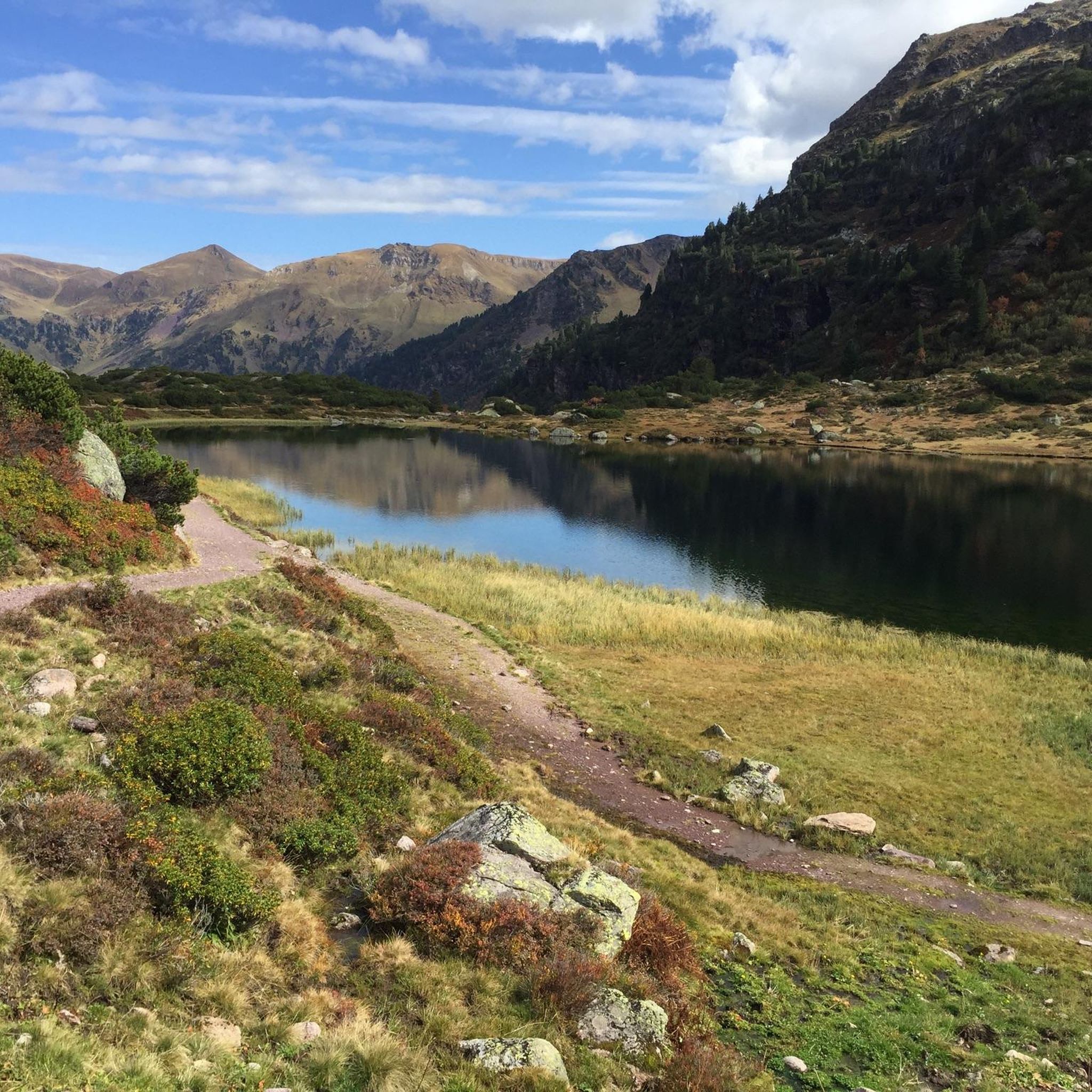
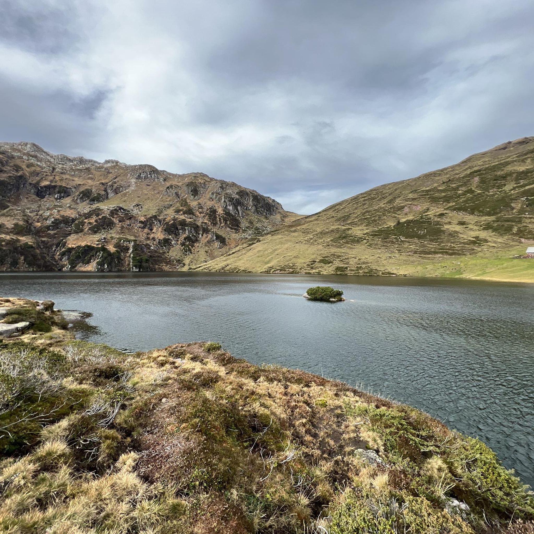
Hiking around Oberer Murgsee offers diverse trails within a wild and romantic alpine valley basin. The region is characterized by three pristine mountain lakes, with Oberer Murgsee being the largest at 1,816 meters elevation. Rugged mountains, extensive pine forests, and the Murgtal, through which the Murgbach stream flows, define the landscape. Hikers can explore a variety of terrain, from valley paths to ascents towards the Murgseefurggl Pass.
Best hiking trails around Oberer Murgsee
- The most popular hiking route is View of the Upper Murgsee – Upper Murg Lake loop from Gufelstock, a 6.4 miles (10.3 km) trail that takes 4 hours 59 minutes to complete. This moderate loop offers views of Oberer Murgsee.
- Another top favourite among local hikers is Murgsee pleasure tour, a moderate 6.1 miles (9.9 km) path. This trail provides an immersive experience of the Murg Lakes valley.
- Local hikers also love the View of the Upper Murgsee – Upper Murg Lake loop from Hochmättli, a 7.8 miles (12.6 km) trail leading through alpine terrain, often completed in about 6 hours 24 minutes.
- Hiking around Oberer Murgsee is defined by pristine mountain lakes, rugged mountains, and extensive pine forests within an alpine valley. The network offers options for various ability levels, from moderate walks to more challenging alpine expeditions.
- The routes in Oberer Murgsee are highly rated by the komoot community with an average score of 4.7 stars from more than 1,600 reviews. More than 12,000 hikers have used komoot to explore Oberer Murgsee's varied terrain.
Last updated: October 1, 2026
1
hikers
10.3km
05:01
760m
760m
Hard hike. Very good fitness required. Mostly accessible paths. Sure-footedness required.
5.0
(2)
7
hikers
12.6km
06:24
920m
920m
Hard hike. Very good fitness required. Sure-footedness, sturdy shoes and alpine experience required.

4.8
(98)
698
hikers
9.90km
03:28
550m
550m
Moderate hike. Good fitness required. Mostly accessible paths. Sure-footedness required.
4.7
(10)
57
hikers
14.5km
06:18
1,000m
1,000m
Hard hike. Very good fitness required. Mostly accessible paths. Sure-footedness required.
5.0
(8)
83
hikers
7.01km
02:33
440m
440m
Moderate hike. Good fitness required. Easily-accessible paths. Suitable for all skill levels.
Get access to more routes and recommendations from other explorers.
Already have an account?
Our route recommendations are based on thousands of hikes, rides, and runs completed by other people on komoot.
Start today with a free account
Your next adventure awaits.


Other adventures around Oberer Murgsee

Tips from the Community

Anyone stopping here had to do something for it. The path from Murg is partly extremely steep.
0
0

Very beautiful forest with sparse pine/stone pine stands
1
0

For me, this section of the valley has a southern Alpine character thanks to the Swiss stone pines.
0
0

The Murgbach, also called the Murg, is a river about 13 kilometers long
11
0
Waterfall from the Middle Murgsee to the Lower Murgsee The stream babbles along the edge of the forest and sings its eternal song. It brings me joy from the rock face, thank you, I love you so much. Text Kurt Küng 2001
11
0
Middle Murgsee 1808 m Murg lakes (Upper Murgsee / Middle Murgsee / Lower Murgsee) Three mountain lake pearls in the Murg Valley (Upper Murgsee / Middle Murgsee / Lower Murgsee) in Eastern Switzerland SG / GL The three Murg lakes are nestled in a wild, romantic valley basin. The lower Murgsee is in the middle of a protected pine reserve, the scenery is reminiscent of the wilderness of Canada. Between the middle and upper Murgsee is the Murgsee mountain inn, which accommodates not only hikers but also fishermen. The Murgsee trout are known for their pink, salmon-like flesh. The shortest, best and easiest way to Murgsee leads via Murg on Lake Walen, on the Zurich - Chur route, either by car or the Murgtal bus (register for bus trips with Taxi Walensee, Tel. 079 735 30 00) to the Mornen car park (P2) at around 1200 m above sea level. The route via Murg is well signposted. From Mornen, a natural gravel path approx. 1.5 m wide leads directly to the Murgsee mountain restaurant at 1825 m above sea level. The hike takes around 1.5 to 2 hours. The Murgsee - Mürtschen area circular hike is particularly recommended, with the starting point being the Merlen car park (P1) in the Murgtal. The hiking trails are well marked and are also suitable for hikers with little experience. Text / Source: Eastern Switzerland Tourism, Fürstenlandstrasse 53, CH-9000 St.Gallen https://ostschweiz.ch/de/map/detail/murgseen-d178b0e4-cf43-46c1-9f5e-29501dbf8262.html
10
0
Berggasthaus Murgsee at 1818 m The restaurant at the upper Murgsee is open during the summer and autumn seasons. The house has always retained its simple and rustic character. It serves as a summer season mountain restaurant and is mainly a rest stop for hikers or sport fishermen who seek relaxation by the crystal-clear waters. Description Here you can eat very well and relax overnight in a cozy shared room for the next day (pre-reservation for overnight stay recommended). You can reach the inn in 2 to 6 hours walking time from Murg or Maschgenkamm (Flumserberg). https://www.myswitzerland.com/de-ch/unterkuenfte/berggasthaus-murgsee/ http://www.schweizer-bergseen.ch/st.gallen/quarten/murgseen/restaurant-murgsee.html
14
0
Frequently Asked Questions
How many hiking trails are available around Oberer Murgsee?
The Oberer Murgsee region offers a wide selection of hiking opportunities, with over 230 routes available. These range from easy strolls to more challenging alpine expeditions, ensuring options for various fitness levels.
Are there hiking trails suitable for families or beginners around Oberer Murgsee?
Yes, the area provides options for all skill levels. There are 74 easy routes perfect for families or those new to hiking, allowing everyone to enjoy the beautiful alpine scenery. For example, the Murgbach Stream – Lower Murgsee loop from Mornen is a moderate option that explores the lower lake.
What natural features or landmarks can I expect to see while hiking around Oberer Murgsee?
Hikers can explore a landscape defined by the three pristine Murg Lakes, with Oberer Murgsee being the largest. You'll also encounter rugged mountains, extensive pine forests, and the Murgtal valley where the Murgbach stream flows, featuring a waterfall plunging towards the Unterer Murgsee. The ascent to the Murgseefurggl Pass offers breathtaking panoramic views.
Are there any circular hiking routes in the Oberer Murgsee area?
Yes, circular routes are a popular way to experience the region's beauty. The View of the Upper Murgsee – Upper Murg Lake loop from Gufelstock is a moderate 6.4-mile (10.3 km) loop offering views of Oberer Murgsee. Another option is the more challenging View of the Upper Murgsee – Upper Murg Lake loop from Hochmättli, covering 7.8 miles (12.6 km) through alpine terrain.
Can I bring my dog on the hiking trails around Oberer Murgsee?
Many trails in the Oberer Murgsee region are dog-friendly, allowing you to enjoy the alpine scenery with your canine companion. However, it's always recommended to keep dogs on a leash, especially in nature protection areas or near grazing livestock, and to check specific trail regulations before you go.
Are there any waterfalls to see on the hikes?
Yes, the Murgtal valley features the Murgbach stream, which includes a waterfall plunging towards the Unterer Murgsee. The Murgbach Waterfall – Middle Murgsee loop from Mornen is a challenging 14.5 km route that allows you to experience this natural spectacle.
What is the best time of year to hike around Oberer Murgsee?
The prime hiking season around Oberer Murgsee typically runs from late spring to early autumn (May to October), when trails are generally free of snow and weather conditions are most favorable. During warmer days, the crystal-clear waters of Oberer Murgsee even invite swimming. Winter hiking is possible, but requires appropriate gear and awareness of snow conditions.
Are there places to stay overnight or get refreshments along the trails?
Yes, for those looking to extend their adventure, the privately run Murgseehütte guesthouse is conveniently located directly on the shore of Oberer Murgsee, offering overnight accommodation and refreshments. It's situated between the middle and upper Murgsee, making it a great stop for hikers.
What do other hikers enjoy most about hiking in Oberer Murgsee?
The komoot community highly rates the hiking experience in Oberer Murgsee, with an average score of 4.7 stars from over 1,600 reviews. Hikers often praise the pristine mountain lakes, the wild and romantic alpine valley, and the diverse trails that cater to various abilities, offering an immersive experience of the natural beauty.
Is there parking available for hikers near the trails?
While the guide does not specify exact parking locations, the region is a popular hiking destination, and access points to trails typically have designated parking areas. It's advisable to research specific trailheads for parking information before your visit.
Are there any moderate hikes that offer a good overview of the Murg Lakes?
The Murgsee pleasure tour is a moderate 6.1-mile (9.9 km) path that provides an immersive experience of the Murg Lakes valley, making it an excellent choice for those seeking a balanced challenge and scenic views.
What kind of terrain can I expect on the hiking trails?
The terrain around Oberer Murgsee is diverse, ranging from valley paths to ascents towards the Murgseefurggl Pass. You'll encounter rugged mountains, extensive pine forests, and areas where trees have been uniquely shaped by glacial activity, offering varied landscapes and surfaces.
Most popular routes around Oberer Murgsee

Get inspired with the komoot mobile app


Explore more
Browse the best Hikes in other regions.
