The best walks and hikes around Embalse de Beninar
4.0
(22)
100
hikers
13
hikes
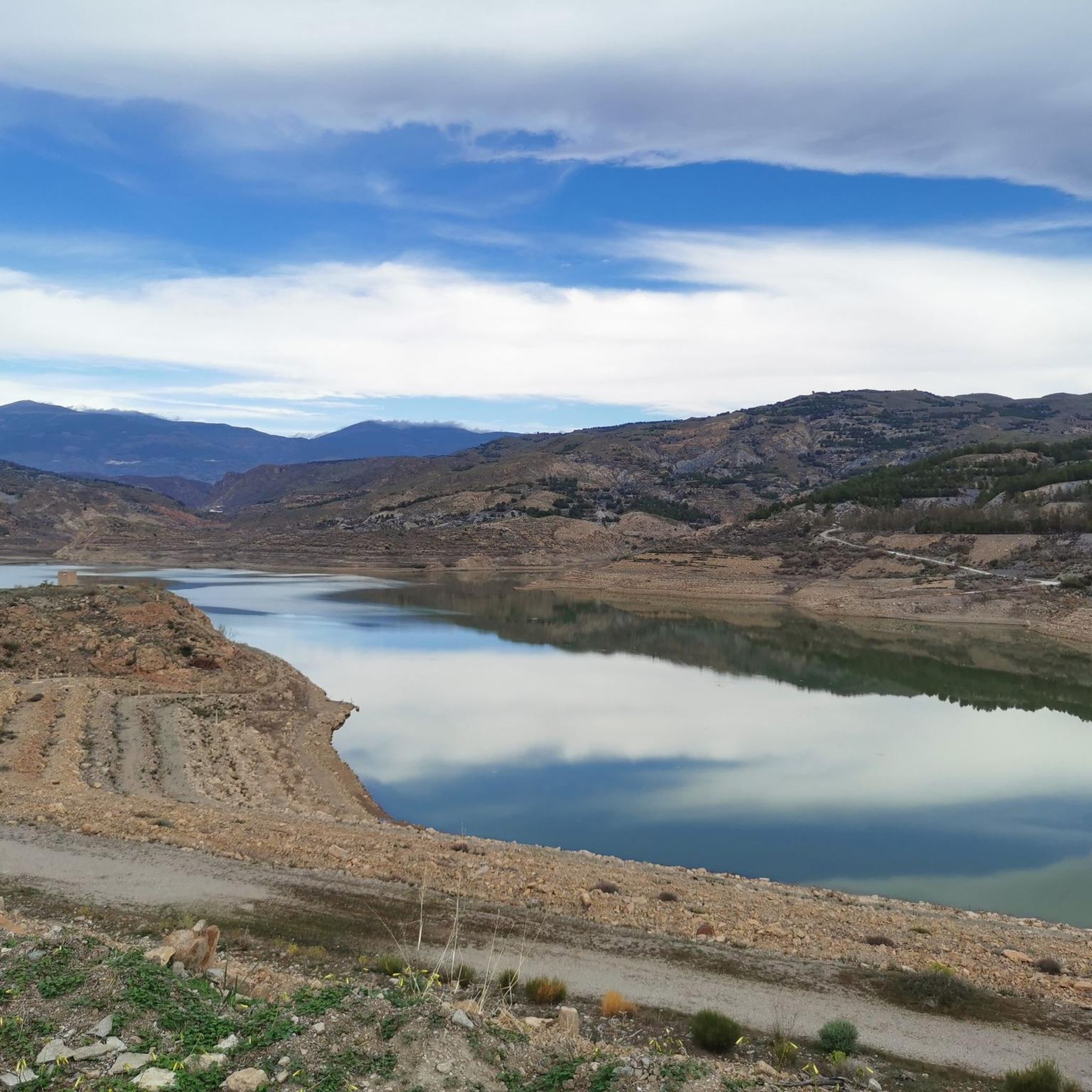
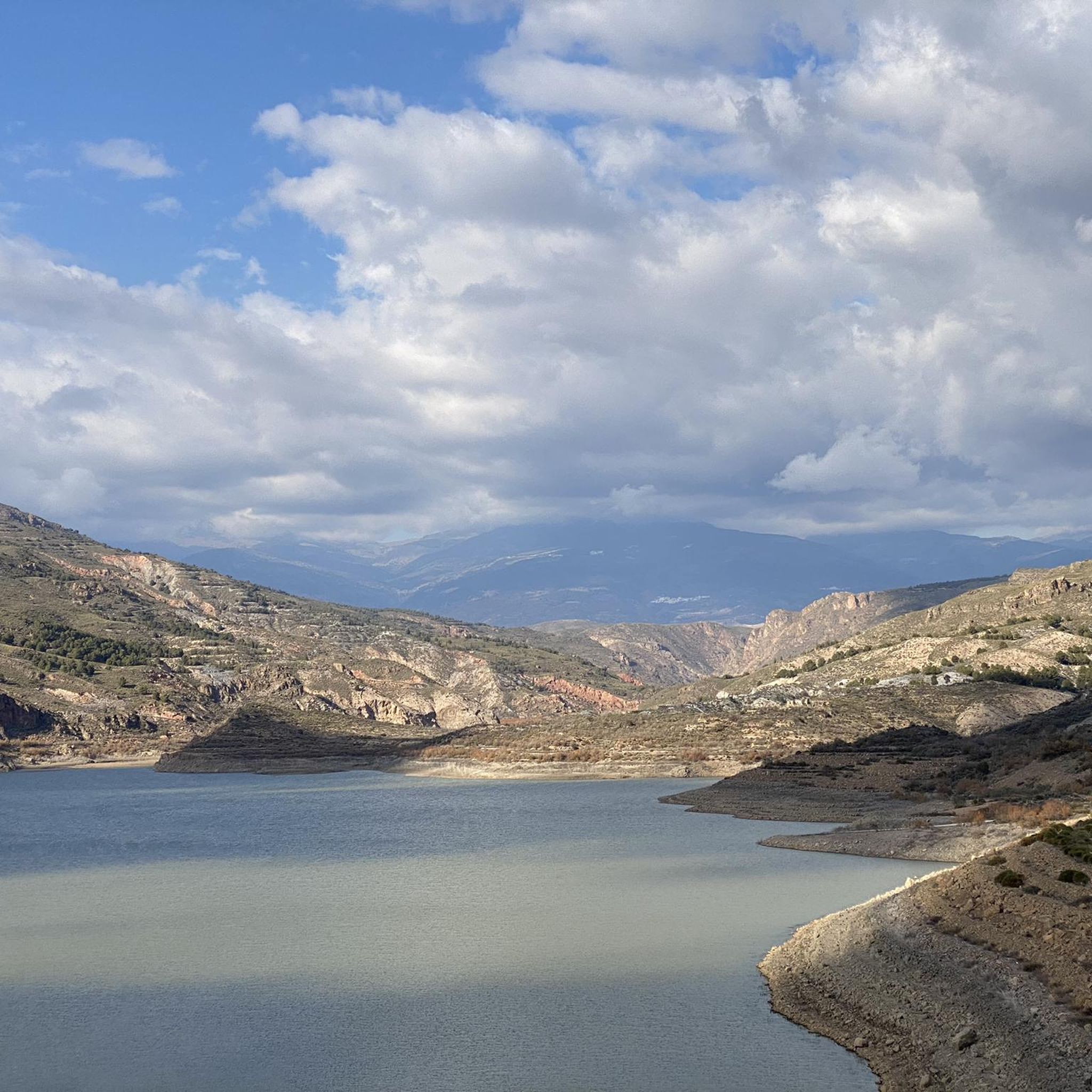
Hiking around Embalse de Beninar offers diverse landscapes within the province of Almería, Andalusia. The region is characterized by a mountainous backdrop, including the Sierra Nevada Natural Park and Sierra de Gádor, providing varied terrain. The reservoir itself, formed by the damming of the Río Grande de Adra, extends for 3.1 miles (5 km) and creates a significant body of water amidst agricultural land. This area provides a range of trails suitable for different fitness levels.
Best hiking trails around…
Last updated: October 21, 2026
1
hikers
20.2km
06:01
640m
630m
Hard hike. Very good fitness required. Easily walkable paths.
4.6
(7)
23
hikers
6.16km
01:50
180m
180m
Easy hike. Easily walkable paths.

6
hikers
4.02km
01:20
190m
190m
Easy hike. Easily walkable paths.
3
hikers
4.47km
01:19
140m
130m
Easy hike. Easily walkable paths.
3.0
(1)
4
hikers
10.7km
03:11
330m
330m
Moderate hike. Good fitness required. Easily walkable paths.
Get access to more routes and recommendations from other explorers.
Already have an account?
Our route recommendations are based on thousands of hikes, rides, and runs completed by other people on komoot.
Start today with a free account
Your next adventure awaits.


Tips from the Community

In the Sierra de la Contraviesa and in the southeastern part of the Alpujarra of Granada is the small municipality of Murtas, right at the foot of its famous Cerrajón. Archaeological remains show human settlements from the Neolithic.
2
0
At 1,500 meters above sea level, imposingly located in the municipality of Murtas, there is a wonderful viewpoint where you can enjoy impressive views of a large part of the Alpujarra. On clear days you can even see the coast of Africa.
2
0

Population geographically located in the center of the Alpujarras, and where it is one of the centers that make up this well-known area of the province of Granada. From this point you can go to a large number of surrounding towns, headed by Sierra Nevada.
1
0
Murtas is one of the last municipalities in the province of Granada on its southern side, where it is located above the valley of the Río Turón, with great views of the valley and the slopes of the Sierra de Gádor.
0
0

Beautiful view of the hills on the slopes of La Alpujarra
1
1
This town was the capital of the Nasrid taha of the same name and had a flourishing weaving industry (in La Alpujarra a lot of mulberry was cultivated to feed the silkworms). About her, a Swiss once wrote: "Ugíjar will provide an ineffable memory to those who love and understand the language of stones, of houses steeped in history and of the town that carries in its soul the nostalgia of an almost fabled past".
3
0
Birthplace of Abén Humeya, promoter and first leader of the Moorish rebellion in 1568. He was born into a Moorish family converted to Christianity after the conquest of Granada in 1492. He left Christianity in favor of Islam and fought against the repression of the Muslim faith and customs and breach of the Capitulations of Granada and the laws of Carlos I and Felipe II. Said rebellion, which lasted three years and spread throughout the province, was violently controlled by the latter monarch.
3
0
Frequently Asked Questions
How many hiking trails are available around Embalse de Beninar?
There are 9 hiking routes documented on komoot for the Embalse de Beninar area. These include 6 easy, 2 moderate, and 1 difficult trail, offering options for various fitness levels.
What kind of terrain can I expect on hikes around Embalse de Beninar?
The terrain around Embalse de Beninar is diverse, characterized by a mountainous environment and lush plant life, fed by the Grande de Adra river. You'll find paths winding through picturesque scenery, with some routes offering expansive views of the Alpujarras mountain range. The reservoir itself is nestled in a narrow calcareous canyon, adding a dramatic geological element to the landscape.
Are there any easy, family-friendly hikes in the area?
Yes, there are several easy routes suitable for families. For example, the Ugíjar – Ugíjar Town Center loop from Ugíjar is an easy 6.2 km path that provides a gentle walk with views of the surrounding area. Another accessible option is the Berja Hiking Route loop from Berja, a 5.0 km trail.
Are there any circular walks around Embalse de Beninar?
Many of the routes in the area are circular, allowing you to start and end in the same location. A notable circular route is La Alpujarra – circular between Ugíjar and Válor, which is a challenging 20.2 km loop offering expansive mountain views. For an easier option, consider the Plaza Porticada – Berja loop from Berja.
What are some interesting landmarks or points of interest to see while hiking?
The Embalse de Beninar itself is a significant landmark, formed in a narrow calcareous canyon. A unique, albeit somber, historical point of interest is the submerged village of Benínar, which lies beneath the reservoir's waters, adding a reflective aspect to the landscape. While hiking, you'll also encounter the natural beauty of the Grande de Adra river and the surrounding mountainous backdrops.
What do other hikers say about the trails around Embalse de Beninar?
The hiking routes around Embalse de Beninar are highly rated by the komoot community, with an average score of 4.2 stars from over 10 reviews. Hikers often praise the diverse landscapes, ranging from mountainous backdrops to the tranquil reservoir and agricultural areas, and appreciate the variety of options for different ability levels.
Are there any longer, more challenging hikes for experienced trekkers?
Yes, for experienced trekkers seeking a challenge, the La Alpujarra – circular between Ugíjar and Válor is a difficult 20.2 km route that takes approximately 6 hours to complete. This trail involves significant elevation gain and offers expansive views of the Alpujarras mountain range, requiring good fitness and sturdy shoes.
Is there parking available near the hiking trailheads?
While specific parking locations for every trailhead are not detailed, areas like Ugíjar and Berja, which serve as starting points for several routes, typically offer parking facilities. It's advisable to check local information for specific parking availability at your chosen starting point.
What is the best time of year to hike around Embalse de Beninar?
The region's climate generally allows for hiking throughout much of the year. However, spring and autumn often provide the most pleasant temperatures for outdoor activities. Summers can be hot, especially at lower elevations, while winters are generally mild but can bring cooler temperatures to the mountainous areas.
Are dogs allowed on the hiking trails?
While specific regulations for dogs on every trail are not provided, many natural areas in Spain are dog-friendly, especially if dogs are kept on a leash. It's always recommended to check local signage or specific park rules for the particular trail you plan to hike to ensure compliance and respect for wildlife and other hikers.
Are there any moderate difficulty hikes available?
Yes, if you're looking for something between easy strolls and challenging treks, the Berja – Plaza Porticada loop from Berja is a moderate 10.4 km route. This trail offers a good balance of distance and elevation, typically taking around 2 hours and 50 minutes to complete.
Most popular routes around Embalse de Beninar

Get inspired with the komoot mobile app


Explore more
Browse the best Hikes in other regions.
