The best running trails around Carballeda De Valdeorras
4.5
(2)
76
runners
15
runs
Jogging routes around Carballeda De Valdeorras traverse a diverse landscape, ranging from approximately 400 meters along the Sil River to over 2,000 meters in its mountainous peaks. The region features a spectrum of environments, including lush river valleys and high-mountain scenery, with some areas often snow-capped in winter. Natural landmarks like the ancient Teixadal de Casaio yew forest and the picturesque Sil River shape the terrain, offering varied running experiences. This geographical diversity provides numerous possibilities for outdoor enthusiasts.
Best…
Last updated: May 16, 2026
4.5
(2)
16
runners
9.65km
01:23
330m
330m
Jog the difficult 6.0-mile La Mirada Circular Trail in Las Médulas, gaining 1081 feet with views from Mirador de Orellán.
8
runners
9.43km
01:00
60m
60m
Moderate run. Good fitness required. Mostly paved surfaces. Suitable for all skill levels.

Sign up for free
5.0
(1)
7
runners
24.1km
03:37
1,050m
1,050m
Hard run. Very good fitness required. Sure-footedness, sturdy shoes and alpine experience required.
4
runners
7.06km
00:54
240m
240m
Hard run. Good fitness required. Sure-footedness, sturdy shoes and alpine experience required.
4
runners
3.64km
00:25
100m
100m
Easy run. Great for any fitness level. Mostly paved surfaces. Suitable for all skill levels.
Get access to more routes and recommendations from other explorers.
Sign up for free
Already have an account?
Our route recommendations are based on thousands of hikes, rides, and runs completed by other people on komoot.
Start today with a free account
Your next adventure awaits.
Login or Signup
Tips from the Community

The Mirador de Orellán is a spectacular observation point located in the town of Orellán, in the municipality of Borrenes, León. This viewpoint offers stunning panoramic views of the cultural landscape of Las Médulas, an ancient Roman gold mining complex declared a World Heritage Site by UNESCO. Near the viewpoint, you can visit the underground galleries that were part of the Roman gold mining system. Entry costs €3 and a helmet with headlamp is provided for the visit.
7
0

The summit of Galicia, with very good 360º views
0
0
Pico de Placias is another impressive place for hiking and nature lovers. A popular route starts from the parking lot next to the archaeological classroom. The route is circular, following the perimeter path to the Orellán viewpoint and then linking with the Valiñas path in the direction of La Cuevona and La Encantada. I hope you have an amazing experience exploring Placias Peak! 🏞️🚶♂️
9
0
The Orellán Gallery is an ancient underground water conduit that extends for about 100 meters. Its original function was to transport water from inside the mountain to burst it from within. The conduit ends at a viewpoint located in a vertical cut of the mountain, offering an impressive view. These galleries were part of the mining exploitation system known as Ruinae Montium. The Romans used these structures to extract minerals and natural resources. I hope you enjoy this historical and natural experience! 😊
9
0

The path avoids the curves of the meanders that form the main course of the Tera River, and many more of other streams, and without gaining hardly any positive slope it reaches the meadows of Majada Trevinca, at the foot of the imposing east face of the mountain, at the confluence of the torrents that flow down the slopes of Peña Maseirón, Peña Negra, Alto Ladeira da Medias and Peña Surbia, creating a fantastic mountain setting at the sources of the Tera. The path to the top does not let up, it goes straight up the side of the mountain to the summit, the geographical roof of Galicia and the province of Zamora.
0
0

When looking at the rock formations of LAS MEDULAS, one must remember that this landscape is not natural, but rather the (sad) remains of a mountain that was ruthlessly exploited even during the times of the Roman Empire. A quarter-hour film documentary (in German) is available in the ARD media library as part of the highly recommended series "Treasures of the World - Heritage of Humanity": https://www.zdf.de/swr/schaetze-der-welt/page-video-ard-las-mdulas-und-seine-goldminen-spanien-100.html
4
0

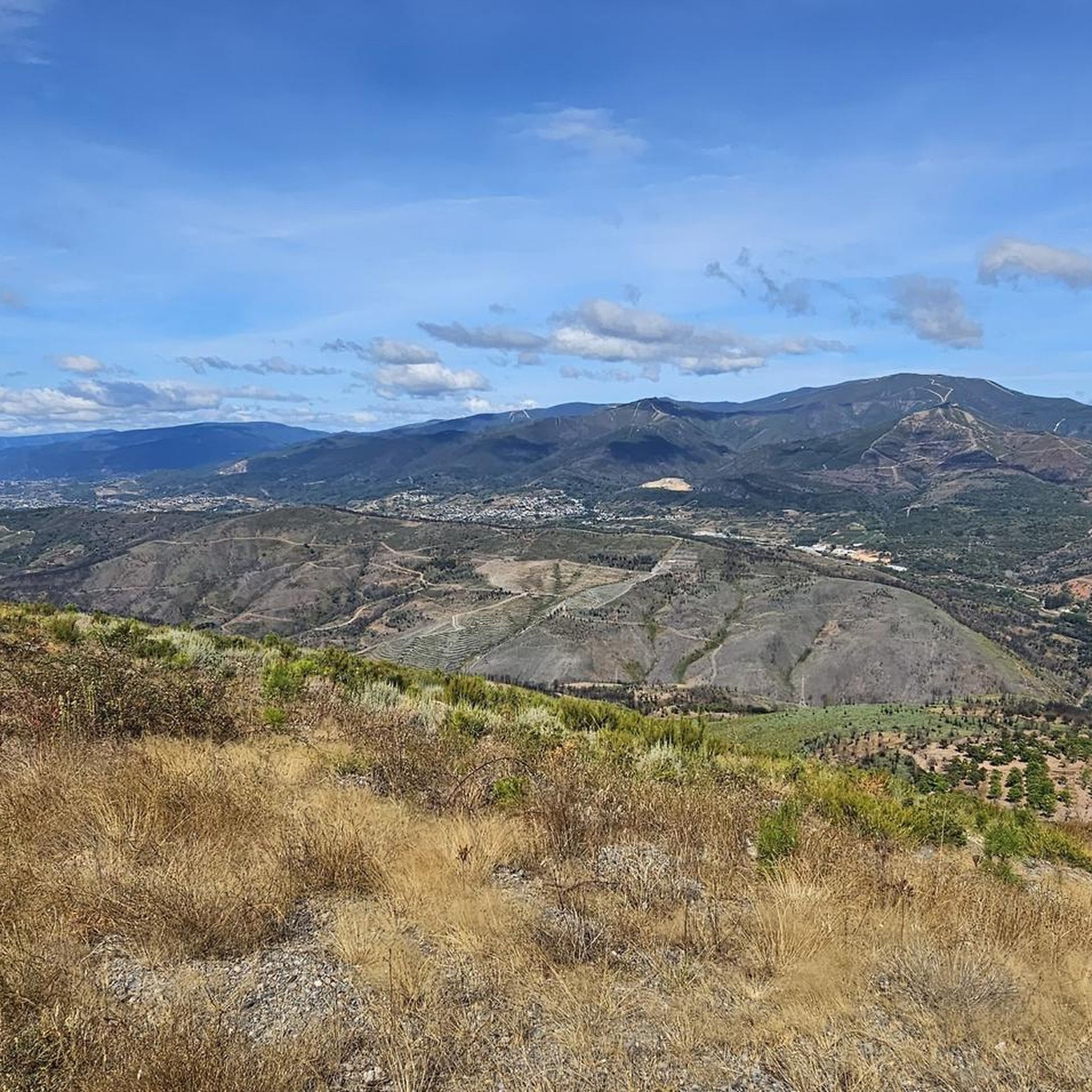
Located at 1,022 meters above sea level, from Pico de Placias, we have another point of view of the landscape monument of Las Médulas. A great section to run.
1
0
Frequently Asked Questions
How many running routes are available in Carballeda De Valdeorras?
There are over 15 running routes documented in Carballeda De Valdeorras, offering a diverse range of experiences from riverside paths to challenging mountain ascents. The komoot community has explored these varied terrains extensively.
Are there any easy jogging routes suitable for beginners in Carballeda De Valdeorras?
Yes, Carballeda De Valdeorras offers some easier options. For instance, the Las Médulas loop from Las Médulas is an easy 3.6 km (2.2 miles) route, perfect for a relaxed run. Many routes along the Sil River also provide gentler terrain.
What are the best running routes with scenic viewpoints in the region?
Many routes in Carballeda De Valdeorras offer breathtaking views due to the dramatic altitudinal changes. The La Mirada Circular Trail is particularly noted for its significant elevation gain and impressive vistas from Mirador de Orellán. Additionally, the ancient Roman Orellán Galleries lead to a viewpoint with stunning panoramas.
Can I find circular running routes in Carballeda De Valdeorras?
Yes, several circular running routes are available. A popular choice is the La Mirada Circular Trail, which is a challenging 9.7 km (6.0 miles) loop. Another option is the Peña Trevinca Summit loop from Vilanova, a longer 24.1 km (15.0 miles) route through high-mountain scenery.
Are there any running trails suitable for families with children?
While specific 'family-friendly' jogging trails are not explicitly categorized, routes with less elevation gain and shorter distances, such as the Las Médulas loop from Las Médulas, could be suitable for families looking for a gentle run or walk. The riverine areas along the Sil River also tend to offer flatter, more accessible paths.
What natural landmarks or historical sites can I explore along the running routes?
Carballeda De Valdeorras is rich in natural beauty and history. You can run near the ancient Teixadal de Casaio yew forest or along the picturesque Sil River. Historical sites include the Orellán Galleries, ancient Roman underground channels, and the remnants of old wolfram mines like Orellán Galleries loop from Las Médulas, which offers a glimpse into the region's past.
What do other runners enjoy most about jogging in Carballeda De Valdeorras?
The running routes in Carballeda De Valdeorras are highly rated by the komoot community, with an average score of 4.5 stars. Runners often praise the dramatic altitudinal changes, the diverse landscapes ranging from river valleys to high mountains, and the unique natural features like ancient yew forests. The variety of terrain caters to different ability levels, making it appealing to many.
Are there any running routes along the Sil River?
Yes, the Sil River is a defining natural feature of the region, and several routes offer pleasant runs along its banks. The Running loop from O Barco de Valdeorras is a moderate 9.4 km (5.9 miles) path that provides a lovely experience along the Sil River.
What is the best season for running in Carballeda De Valdeorras?
Carballeda De Valdeorras offers diverse conditions throughout the year. While some high-mountain areas can be snow-capped in winter, the lower altitudes and river valleys are generally accessible. Spring and autumn provide pleasant temperatures and vibrant scenery, making them ideal for running. Summer can be warm, but early morning or late evening runs are enjoyable, especially near the river.
Are there any specific trails that lead to lakes or reservoirs?
While the region features the Embalse de Pumares (Pumares Reservoir) for recreation, specific running routes directly to it are not detailed in the guide. However, the wider area around Carballeda De Valdeorras includes several beautiful lakes such as Laguna de los Peces and Laguna de las Yeguas, which can be incorporated into longer trail runs or explored separately.
Is public transport available to access the running trails?
Information on specific public transport links directly to trailheads is limited. However, major towns like O Barco de Valdeorras, which serves as a starting point for routes like the Running loop from O Barco de Valdeorras, are generally more accessible by regional transport. For more remote trails, personal vehicle access is often recommended.
Where can I find parking for the running routes?
Parking availability varies by trailhead. For routes starting from towns or popular attractions like Las Médulas, designated parking areas are usually available. For example, the Las Médulas loop starts directly from Las Médulas, where parking facilities are typically present for visitors to the historical site. It's advisable to check specific route details for parking recommendations.
Most popular attractions around Carballeda De Valdeorras

Get inspired with the komoot mobile app


Explore more
Browse the best Running Trails & Routes in other regions.
