The best cycling routes around Parco Lura
4.4
(1966)
15,314
riders
531
rides
Touring cycling routes around Parco Lura are characterized by gentle terrain, primarily following waterways and parkland. The region features the Lura stream and the Villoresi Canal, offering mostly flat paths suitable for various skill levels. The landscape is composed of green areas within the park, with some routes extending into surrounding areas that may include minor elevation changes.
Best touring cycling routes around Parco Lura
- The most popular touring cycling route is Canale Villoresi Cycle Path – Villoresi Canal loop…
Last updated: November 3, 2026
4.0
(1)
17
riders
Moderate bike ride. Good fitness required. Mostly paved surfaces.
7
riders
83.5km
05:35
1,210m
1,210m
Hard bike ride. Very good fitness required. Mostly paved surfaces.

4
riders
9.61km
00:34
20m
20m
Easy bike ride. Mostly paved surfaces.
4.5
(68)
395
riders
Moderate bike ride. Good fitness required. Mostly paved surfaces.
4.6
(11)
89
riders
Moderate bike ride. Good fitness required. Mostly paved surfaces.
Get access to more routes and recommendations from other explorers.
Already have an account?
Our route recommendations are based on thousands of hikes, rides, and runs completed by other people on komoot.
Start today with a free account
Your next adventure awaits.

Tips from the Community

The Villoresi canal takes water from the river Ticino, in the locality of Panperduto, in the municipality of Somma Lombardo. After travelling 86 kilometers, through the provinces of Milan and Monza Brianza, it flows into the river Adda in the municipality of Cassano d’Adda. Construction work began in 1881 and was completed in 1891 based on the project by Eugenio Villoresi. Originally intended exclusively for irrigation, following the crisis in crops related to silk production, the canal now allows water distribution in a plain area of approximately 85,000 hectares, through a network that totals about 3,000 kilometers. The routes, which are free of difficulties, accessible to everyone and certainly of interest, are part of the investments made to enhance the towpaths of the waterways, and are also considered a fast connection route between the various Municipalities touched by the canal.
4
0

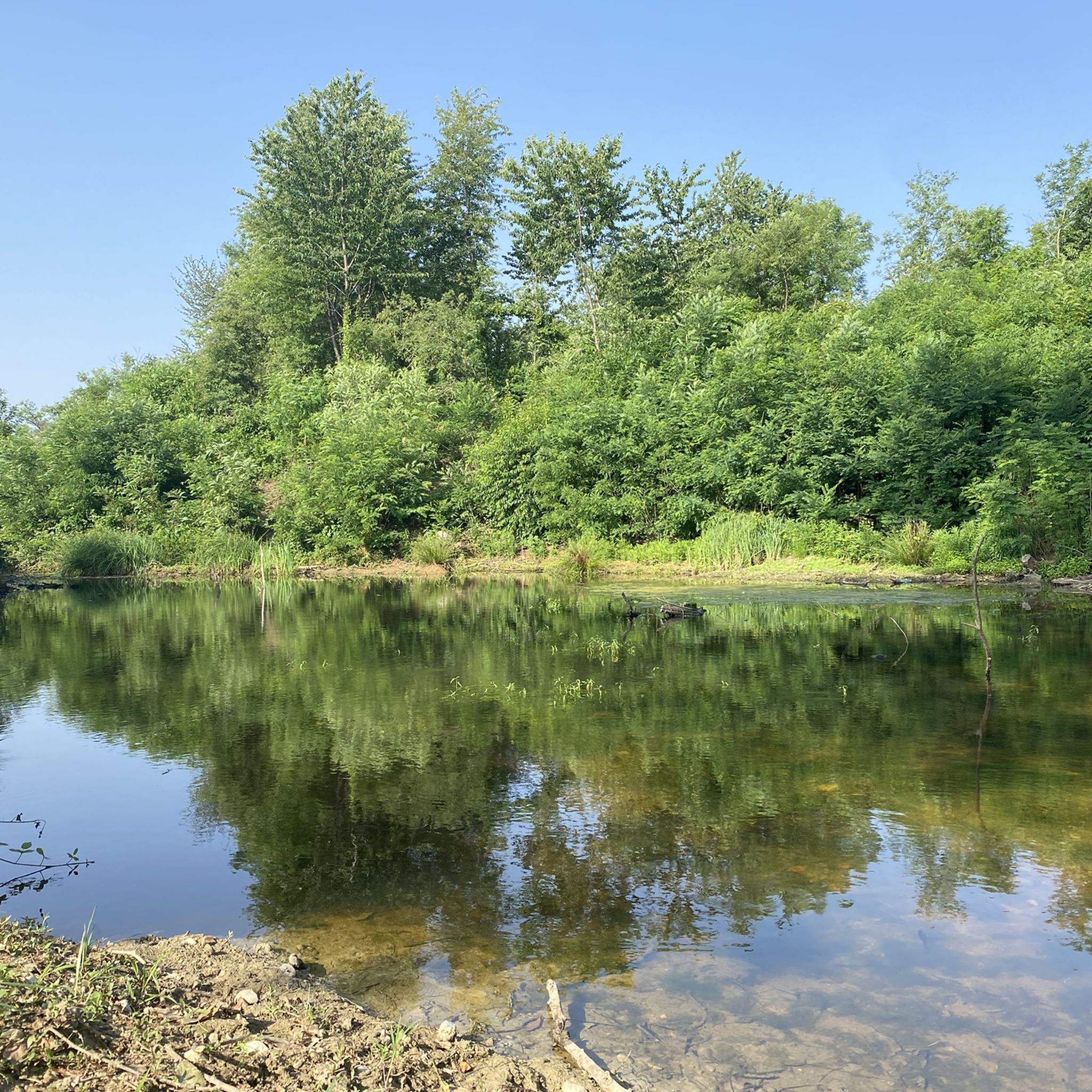
The Lura is a stream in Lombardy that originates near the Italian-Swiss border, in the municipality of Uggiate con Ronago, at an altitude of about 400 m. The Lura has a total length of 46.2 km and a drainage basin of 120 km², and is today the largest tributary of the Olona river.
0
0
The main historic bridge over the Villoresi Canal in Garbagnate Milanese is located on Via Peloritana. Dating back to 1877, it is a fundamental infrastructure for city traffic and is situated near the local station, the starting point of the famous Villoresi Canal Cycle Path.
0
0
The climb to Alpe del Viceré from Albavilla is a classic ascent of the Larian Triangle. It measures about 5.4 km with an elevation gain of 465 meters and an average gradient of 8.5%. It features challenging sections with gradients up to 12%, followed by more rideable sections before the finish. Route details Start: Albavilla Centre (approx. 430 m a.s.l.). Finish: Alpe del Viceré Park (903 m a.s.l.). Average gradient: 8.5%. Maximum gradient: Approx. 12% (located around the 3rd kilometer).
0
0
The Villa Visconti Borromeo Arese Litta, located in Lainate (on the outskirts of Milan), is one of the most famous and spectacular "delight villas" in Northern Italy. Conceived at the end of the 16th century by Count Pirro I Visconti Borromeo, the residence is universally famous for its extraordinary Nymphaeum with water features, a masterpiece of hydraulic engineering and artistic decoration unique in Europe, designed to amaze, refresh, and entertain the nobles of the time.
0
0
The Parco della Rosa Camuna in Lainate (MI) is a green area of 52,000㎡ known for its artificial pond in the shape of a Rosa Camuna, the symbol of Lombardy. Fed by the Villoresi canal, the park offers cycle and pedestrian paths, wooden walkways, and wooded areas, consolidating the relationship between the Lura stream and the Villoresi canal. The Rosa Camuna is one of the most famous rock carvings in Valcamonica, dating back to the Iron Age (7th-6th century BC). It represents a four-armed whirligig with 9 cupels (dots) and often symbolizes a star, and has been adopted by the Lombardy Region as its own emblem.
1
0
The Villoresi Canal cycle path runs through the Lombardy countryside, along the entire length of the Villoresi Canal, the historic waterway built for irrigation in the late 19th century by engineer Eugenio Villoresi. The canal draws water from the Ticino River near Somma Lombardo and, after an 86 km journey, returns it to the Adda River near Groppello.
1
0
The Villoresi Canal cycle path runs through the Lombardy countryside, along the entire length of the Villoresi Canal, the historic waterway built for irrigation in the late 19th century by engineer Eugenio Villoresi. The canal draws water from the Ticino River near Somma Lombardo and, after an 86 km journey, returns it to the Adda River near Groppello.
4
0
Frequently Asked Questions
How many touring cycling routes are available in Parco Lura?
There are over 560 touring cycling routes recorded in Parco Lura, offering a wide range of options for different skill levels and preferences.
Are there easy or family-friendly touring cycling routes in Parco Lura?
Yes, Parco Lura is well-suited for easy and family-friendly rides, with over 280 routes classified as easy. A great option is the Canale Villoresi Cycle Path – Villoresi Canal loop from Pagliera, which is 12.1 km long and follows the flat terrain of the historic Villoresi Canal.
What are some longer touring cycling routes for experienced cyclists?
For those seeking a longer challenge, Parco Lura offers several routes. The Lura Park – View of Brienno loop from Saronno Sud is a demanding 87.2 km trail, while the Bridge over the Lura Stream – Along the Lura stream loop from Saronno Sud covers 84.2 km, both offering significant distances and varied terrain.
Are there any circular touring cycling routes in Parco Lura?
Many of the touring cycling routes in Parco Lura are designed as loops, allowing you to start and finish in the same location. Examples include the popular Along the Lura stream – Lura River in the Parco del Lura loop from Saronno Sud and the shorter Villoresi Canal – Lura Cycle Path loop from Caronno Pertusella.
What kind of terrain can I expect on touring cycling routes in Parco Lura?
The terrain in Parco Lura is generally gentle, characterized by flat paths along the Lura stream and Villoresi Canal. While most routes are within the park's green areas, some extend into surrounding regions which may introduce minor elevation changes, particularly on longer routes.
What can I see along the touring cycling routes in Parco Lura?
Along the routes, you can enjoy the natural beauty of the park and its waterways. Notable points of interest include the serene Rosa Camuna Pond. The Lura Cycle Path itself is a highlight, offering scenic stretches through the park.
What do other touring cyclists enjoy most about cycling in Parco Lura?
The touring cycling routes in Parco Lura are highly rated by the komoot community, with an average score of 4.4 stars from over 1600 reviews. Cyclists often praise the well-maintained paths, the peaceful natural environment, and the accessibility of routes for various skill levels.
Is Parco Lura suitable for advanced touring cyclists?
Yes, Parco Lura offers over 100 routes classified as difficult, catering to advanced touring cyclists. These routes often feature longer distances and more varied terrain, providing a greater challenge while still allowing you to explore the region's landscapes.
Can I bring my dog on the touring cycling trails in Parco Lura?
Parco Lura is generally dog-friendly, with many paths suitable for cycling with a leashed dog. However, it's always recommended to check specific trail regulations or local signage for any restrictions, especially in more sensitive natural areas.
What is the best season for touring cycling in Parco Lura?
The spring and autumn months typically offer the most pleasant conditions for touring cycling in Parco Lura, with mild temperatures and beautiful scenery. Summer can also be enjoyable, especially along shaded canal paths, but be prepared for warmer weather. Winter cycling is possible, though some paths might be less maintained or colder.
Are there amenities like cafes or rest stops along the routes?
While the park itself is primarily natural, many routes pass through or near towns and villages where you can find cafes, restaurants, and other services. It's advisable to plan your route and check for available amenities beforehand, especially on longer rides.
How accessible are the touring cycling trails by public transport?
Many towns bordering Parco Lura, such as Saronno Sud and Caronno Pertusella, have train stations or bus stops, making it possible to access various starting points for the cycling routes via public transport. Check local transport schedules for specific connections to your desired starting location.
Most popular routes around Parco Lura

Get inspired with the komoot mobile app


Explore more
Browse the best Cycling routes in other regions.
