The best walks and hikes around Parada De Sil
4.6
(229)
1,346
hikers
33
hikes
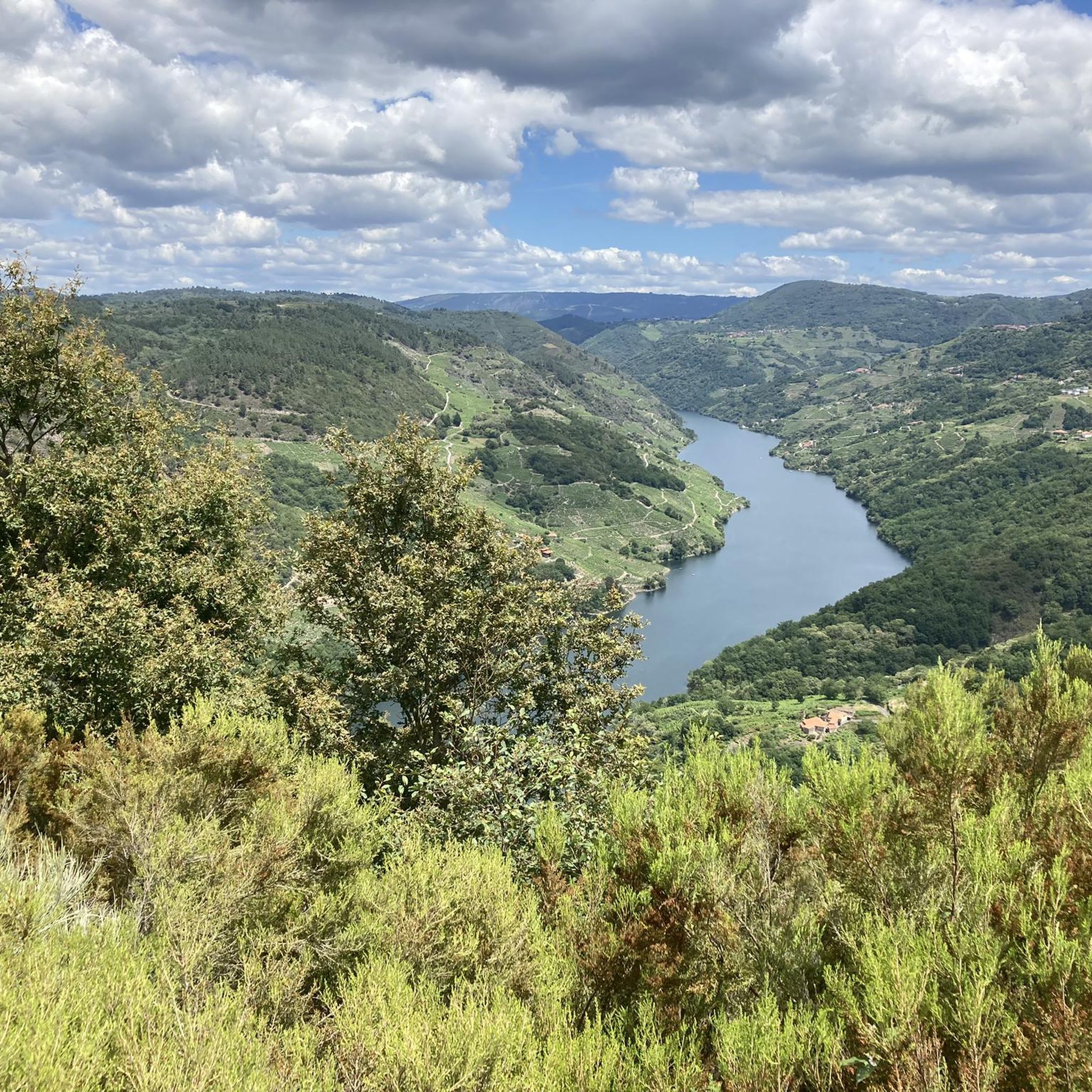
Hiking around Parada De Sil offers exploration of the dramatic Sil Canyon, where the Sil River carves a deep gorge with cliffs reaching up to 500 meters. The region features lush forests, including ancient chestnut groves, and the picturesque Mao River canyon with its wooden boardwalks. Numerous viewpoints provide expansive vistas of the river valleys and terraced vineyards. The terrain ranges from riverside paths to higher-altitude trails within the Serra de Cabeza de Meda.
Best hiking trails around Parada De Sil
- The most popular hiking route is PR-G 98 Sil Canyon - Santa Cristina Trail, a 12.0 miles (19.4 km) difficult trail that takes 6 hours 21 minutes to complete. This route offers stunning canyon views and leads to the historic Santa Cristina Monastery.
- Another top favourite among local hikers is Río Mao Canyon Route, an easy 3.2 miles (5.1 km) path. This trail features wooden boardwalks along the Mao River, providing accessible riverside views.
- Local hikers also love the Monastery of Santa Cristina – Xariñas de Castro Viewpoint loop from Parada de Sil, a 7.5 miles (12.1 km) trail leading through forests and to panoramic viewpoints, often completed in about 4 hours 1 minute.
- Hiking around Parada De Sil is defined by deep river canyons, ancient chestnut forests, and numerous viewpoints overlooking the Sil and Mao rivers. The network offers options for various ability levels, from easy riverside strolls to challenging canyon routes.
- The routes in Parada De Sil are highly rated by the komoot community with an average score of 4.6 stars from over 160 reviews. More than 1100 hikers have used komoot to explore Parada De Sil's varied terrain.
Last updated: October 10, 2026
4.7
(15)
102
hikers
19.4km
06:21
720m
720m
Hike the difficult 12.0-mile PR-G 98 Sil Canyon - Santa Cristina Trail, featuring stunning canyon views and the historic Santa Cristina Mona
4.2
(11)
61
hikers
5.11km
01:45
250m
250m
Hike the easy 3.2-mile Río Mao Canyon Route in Ribeira Sacra, featuring boardwalks, river views, and 829 feet of elevation gain.

4.6
(5)
20
hikers
16.8km
04:57
490m
490m
Hike the moderate 10.4-mile Ribeira Sacra trail to the Pé do Home viewpoint for spectacular views of the Sil Canyon and terraced vineyards.
4.7
(47)
289
hikers
12.1km
04:01
420m
430m
Moderate hike. Good fitness required. Mostly accessible paths. Sure-footedness required.
4.4
(21)
121
hikers
3.70km
01:06
110m
110m
Easy hike. Great for any fitness level. Easily-accessible paths. Suitable for all skill levels.
Get access to more routes and recommendations from other explorers.
Already have an account?
Our route recommendations are based on thousands of hikes, rides, and runs completed by other people on komoot.
Start today with a free account
Your next adventure awaits.


Tips from the Community

The PR-G 98 takes the Santa Cristina detour along an ancient country path dug into the mountainside centuries ago in remote and steep places, like the remains of the stone villages that appear during the journey through this enchanted world. Remains of mills, houses, wineries, “sequeiros” and a multitude of constructions with mossy walls emerge from the small natural steps of the terrain that are suitable for building a building. The rest of the surroundings are a forest of chestnut and oak trees, old and gnarled, forgotten by man and time, placed everywhere forming a magnificent forest of enormous trees that hide the views of the Sil gorge. The river is close but practically unreachable.
0
0
The As Fontiñas viewing point is an excellent window into the best-preserved natural ecosystems in the Sil Canyon, a mysterious and balanced mix of water, stone, forest and space. The course of the Gavias stream reaches the edge of the cliffs from the fields of Requián and before entering the Sil River it plunges down a crazy and dizzying succession of rocky steps. In one of them it creates the Pozo da Ovella waterfall, a giant's cauldron that demonstrates the energy of the water when it falls furiously down the walls of the great Sil gorge.
0
1
In the surroundings of Parada de Sil there are several paths marked by old “carriozas” or traditional paths that run through beautiful “castiñeiros” (chestnut) forests, with centuries-old specimens, buildings and ethnographic remains linked to chestnut cultivation. The “souto” of chestnut trees is a living symbol of the rural world of the Galician interior. The itinerary is a thematic walk in the chestnut culture, an open-air museum among centuries-old specimens that serves to protect resources and maintain the cultural and environmental value of the rural environment.
1
0
The Balconies of Madrid have a history that speaks of emigration, dreams and human adventures in unknown lands. The original name of Os Torgás was changed when the people of the Ourense villages of the Ribeira Sacra hung themselves from the cliffs of the River Sil to say goodbye to their loved ones who were leaving for Madrid and other lands in the south with the dream of a new life. The viewing points form small steps hanging over the river gorge and cause a special fascination. The breeze in the air carries the aromas of vineyards hanging on steep rocky terraces and melodies of elves emerging from enchanted forests, descendants of the primitive mythological beings who resisted the sacralisation of their plant kingdom by the monks and long before by the Roman legions. The walls of the Sil Canyon are a monumental sculpture five hundred metres high made of fierce, bare granite, a fortress of living rock up to the edge of the viewing points that filter the wind, the lights and the eternal songs of all the people who have passed through this fantastic natural balcony to say goodbye or find someone.
1
1
It is a magnificent example of rural Galician Romanesque architecture. The original building is from the 12th century, and preserves carvings from the 16th century and baroque altarpieces from the 18th century. The entrance to the cloister has a Romanesque doorway with lobed arches and a magnificent sculptural pantheon. The economic power of the monks of the Sil reached a notable splendour in the 12th century, when they received royal privileges and papal protection to expand the monasteries and sanctuaries on both banks of the Sil, a territory with a strong historical and cultural personality, called Rivoyra Sacrata at that time and known since then as Ribeira Sacra.
1
0

The walkway route from the Mao River to the Sil Canyon is one of the most beautiful areas to see in the Ribeira Sacra (and, in general, of everything there is to see in Ourense) The total distance of the Mao walkways is 1.8 kilometers and the difference in level to be overcome (using stairs) is 41 meters.
2
0

These are two wooden walkways that go several meters into the canyon, providing us with spectacular views.
4
0
The Torgás recreational area is in an area where a bush called heather abounds, it is also close to leafy groves of century-old chestnut trees. Mountainous hiking area, with viewpoints that offer panoramic views of a river valley.
5
1
Frequently Asked Questions
How many hiking trails are available around Parada De Sil?
There are over 30 hiking trails around Parada De Sil, offering a diverse range of experiences. These include routes through the dramatic Sil Canyon, along the picturesque Mao River, and through ancient chestnut groves. You'll find options for various fitness levels, from easy riverside strolls to more challenging canyon routes.
Are there easy hiking trails suitable for families in Parada De Sil?
Yes, Parada De Sil offers several easy and family-friendly options. The Río Mao Canyon Route is an easy 3.2-mile (5.1 km) path featuring wooden boardwalks along the Mao River, providing accessible riverside views. Another great choice is the "Sendero de Castaños y Carriozas," a 2.5 km circular trail of low difficulty that winds through ancient chestnut forests.
What are the most challenging hikes in the Parada De Sil area?
For those seeking a challenge, the PR-G 98 Sil Canyon - Santa Cristina Trail is a difficult route, approximately 12.0 miles (19.4 km) long, taking over 6 hours to complete. This trail offers stunning canyon views and leads to the historic Santa Cristina Monastery, with significant elevation changes as it navigates the dramatic gorge.
Are there any circular hiking routes in Parada De Sil?
Yes, many routes in Parada De Sil are circular, allowing you to start and end in the same location. A popular option is the Monastery of Santa Cristina – Xariñas de Castro Viewpoint loop from Parada de Sil, a 7.5-mile (12.1 km) trail through forests and to panoramic viewpoints. The PR-G 177 Ruta del Cañón del Río Mao also offers circular options, including a 16 km version or a shorter 11.5 km route.
What kind of natural features and viewpoints can I expect to see on the trails?
Hiking in Parada De Sil is defined by its spectacular natural features. You'll encounter the deep Sil Canyon with cliffs up to 500 meters high, the picturesque Mao River canyon with its boardwalks, and lush forests including ancient chestnut groves. The region is famous for its numerous viewpoints (miradores) offering breathtaking vistas, such as the iconic Balcones de Madrid Viewpoint, Cividade Viewpoint, and Pé do Home Viewpoint.
Are there historical or cultural landmarks along the hiking routes?
Absolutely. The region is rich in history. You can visit the 10th-century Romanesque Monastery of Santa Cristina, nestled within a beautiful forest, which can be incorporated into several hiking routes. The Necropolis of San Víctor, with its anthropomorphic tombs carved into stone, also provides an intriguing historical element to some trails.
What is the best time of year to go hiking in Parada De Sil?
The best time for hiking in Parada De Sil is generally during spring (April to June) and autumn (September to October). During these seasons, the weather is mild, the landscapes are vibrant with spring blooms or autumn colors, and the temperatures are comfortable for longer walks. Summer can be hot, especially in the canyons, while winter can bring cooler temperatures and occasional rain.
What do other hikers enjoy most about the trails in Parada De Sil?
The trails in Parada De Sil are highly rated by the komoot community, with an average score of 4.6 stars from over 160 reviews. Hikers frequently praise the breathtaking panoramic views of the Sil Canyon, the unique experience of walking the Mao River boardwalks, and the serene beauty of the ancient chestnut forests. The well-marked paths and diverse terrain for all abilities are also commonly highlighted.
Are there any trails that feature waterfalls?
Yes, the powerful energy of the water in the region creates impressive natural features. The course of the Gavias stream, reaching the edge of the cliffs, forms the notable Pozo da Ovella waterfall, which plunges into the Sil gorge. While not explicitly on every trail, the dramatic river canyons themselves offer many cascades, especially after rainfall.
Can I find places to eat or drink near the hiking trails?
While the focus of Parada De Sil is its natural beauty, you can find local establishments in the villages. It's advisable to carry sufficient water and snacks, especially on longer routes. Some trailheads or nearby villages may have small cafes or restaurants where you can refuel after your hike, offering local Galician cuisine.
What are the typical durations for hikes in Parada De Sil?
Hiking durations vary significantly depending on the trail's length and difficulty. Easy routes like the Río Mao Canyon Route can take around 1.5 to 2 hours. Moderate trails, such as the Monastery of Santa Cristina – Xariñas de Castro Viewpoint loop, typically range from 3 to 4 hours. More difficult and longer routes, like the PR-G 98 Sil Canyon - Santa Cristina Trail, can take 6 hours or more to complete.
Most popular attractions around Parada De Sil

Get inspired with the komoot mobile app


Explore more
Browse the best Hikes in other regions.
