The best walks and hikes around Ith
4.6
(12483)
37,780
hikers
51
hikes
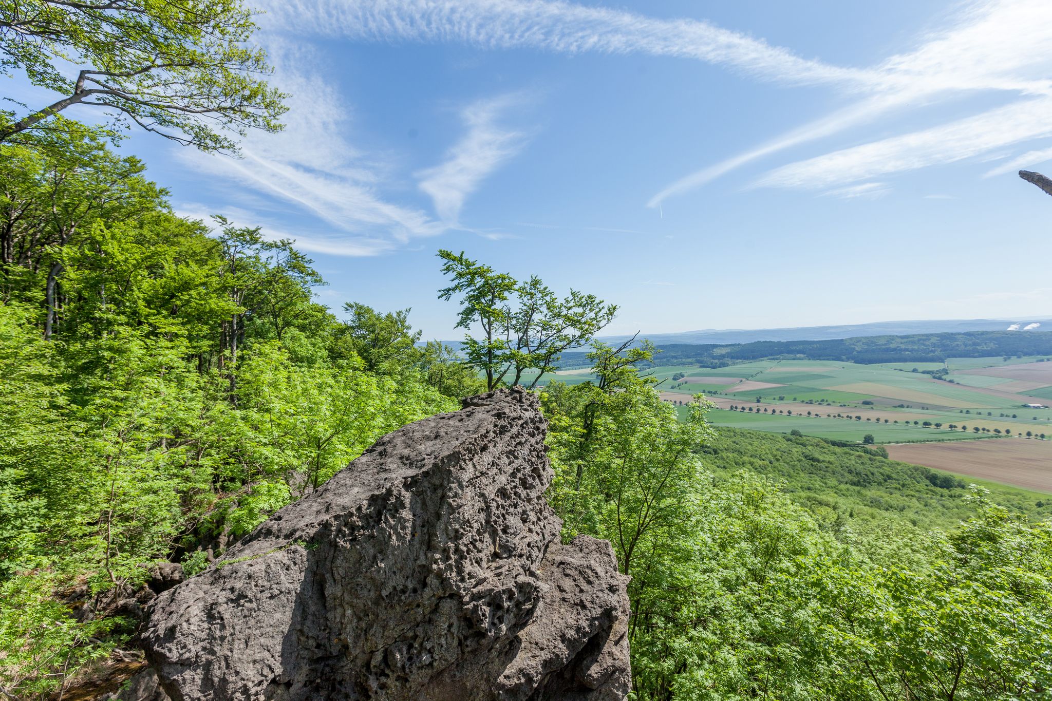
Hiking around Ith features a diverse landscape characterized by limestone cliffs, dense woodlands, and rolling hills. This 22-kilometer-long ridge is the longest line of crags in North Germany, offering a unique blend of geological formations and extensive forests. The region is part of a natural park, providing numerous viewpoints and distinctive rock formations for outdoor enthusiasts.
Best hiking trails around Ith
- The most popular hiking route is Ith Cliffs and the Ith‑Hils Trail – Mönchstein rock formation loop from Lauenstein…
Last updated: November 9, 2026
4.7
(533)
1,365
hikers
Moderate hike. Good fitness required. Easily walkable paths.
4.7
(108)
344
hikers
Moderate hike. Good fitness required. Easily walkable paths.

4.7
(32)
123
hikers
8.28km
02:27
220m
220m
Moderate hike. Good fitness required. Easily walkable paths.
4.4
(35)
117
hikers
Moderate hike. Good fitness required. Easily walkable paths.
4.7
(56)
157
hikers
5.01km
01:28
130m
130m
Easy hike. Easily walkable paths.
Get access to more routes and recommendations from other explorers.
Already have an account?
Our route recommendations are based on thousands of hikes, rides, and runs completed by other people on komoot.
Start today with a free account
Your next adventure awaits.


Other adventures around Ith

Tips from the Community

Following the construction of observation towers on the Deister and Süntel mountain ranges, Wilhelm Falke, a quarry owner from Hanover, planned a similar structure on the Lauensteiner Kopf, the highest point of the Ith (439 m). A first wooden tower, the "Wilhelm Tower," was inaugurated on May 24, 1885. The new stone Ith Tower was built from dolomite by Fr. Schucht from Bisperode and opened on May 16, 1912. The tower is 13.80 m high, and the staircase has 63 steps. The tower is open to visitors at all times, but there is no staff on site.
1
0

Great tour even in the fog
0
0

A beautiful, nearly 2-kilometer-long hiking trail. Only accessible on foot, with a good level of fitness and surefootedness. Definitely not recommended for use with a stroller, stroller, or dog! There are often steep drops along the edge, which I find a bit dangerous (it's best to keep dogs on a leash!)
0
0
A beautiful, nearly 2-kilometer-long hiking trail. Only accessible on foot, with a good level of fitness and surefootedness. Definitely not recommended for use with a stroller, stroller, or dog! There are often steep drops along the edge, which I find a bit dangerous (it's best to keep dogs on a leash!)
0
0

One of the staircases runs along the crocodile, connecting the two paths on the ridge and under the rocks. Please stay on the path to avoid further erosion.
1
0
Beautiful path along the top of the Ith ridge - still surprisingly natural.
0
0
From the upper path, the rock head is easily accessible for hikers.
2
0
Frequently Asked Questions
How many hiking trails are available in Ith?
Ith offers a diverse network of over 50 hiking trails. These routes cater to various skill levels, from easy strolls to more challenging expeditions through its unique landscape.
Are there easy hiking trails suitable for beginners in Ith?
Yes, Ith has plenty of options for beginners. There are 29 easy trails available, perfect for those new to hiking or looking for a relaxed walk. These routes allow you to enjoy the natural beauty without significant challenges.
What kind of natural features or geology can I expect to see while hiking in Ith?
Ith is characterized by its distinctive limestone cliffs, dense woodlands, and rolling hills. You'll encounter unique rock formations like the Adam and Eve Rock Formations and the Mönchstein rock formation, as well as the impressive Ith Cliffs. The area is part of a natural park, offering varied terrain and scenic viewpoints.
Are there any circular hiking routes in Ith?
Many of the trails in Ith are designed as circular routes, allowing you to start and end at the same point. For example, the popular Mönchstein rock formation – Adam and Eve Rock Formations loop from Lauenstein is an 8.9-mile (14.4 km) circular trail, and the Presidents' Grotto – View from the Ith Tower loop from Lauenstein is a shorter 4.4-mile (7.1 km) option.
What are some notable landmarks or attractions to see along the trails in Ith?
Along the trails, you can discover several interesting landmarks. Besides the unique rock formations, you might visit the View from the Ith Tower for panoramic vistas, or explore the Rothestein Cave. There are also tranquil spots like the Josserbeeke Trout Ponds and various shelters for a break.
What do other hikers enjoy most about hiking in Ith?
The komoot community highly rates hiking in Ith, with an average score of 4.6 stars from over 1,000 reviews. Hikers frequently praise the diverse landscape, the well-maintained trails, and the stunning viewpoints offered by the limestone cliffs and dense forests. The variety of routes for different skill levels is also a common highlight.
Are there any challenging or difficult hikes in Ith?
Yes, for experienced hikers seeking a challenge, Ith offers 4 difficult trails. One such route is the Ith Cliffs and the Ith‑Hils Trail – Mönchstein rock formation loop from Lauenstein, which spans over 20 km and features significant elevation changes, providing a more strenuous experience.
Can I bring my dog on the hiking trails in Ith?
While specific regulations for dogs on Ith's trails are not detailed, generally, dogs are welcome on many hiking paths in natural park areas, often requiring them to be on a leash. It's always advisable to check local signage at trailheads for any specific restrictions or requirements regarding pets.
What is the best time of year to go hiking in Ith?
Ith offers enjoyable hiking experiences throughout much of the year. Spring brings lush greenery and blooming wildflowers, while autumn showcases vibrant foliage. Summer is popular for longer days, and even winter can be beautiful, though conditions may require appropriate gear. Always check local weather forecasts before heading out.
Are there family-friendly hiking options in Ith?
Yes, Ith provides several family-friendly hiking options. Many of the easy and moderate trails are suitable for families with children, offering manageable distances and interesting sights. Look for routes that are shorter in duration and have less elevation gain for a more comfortable family outing.
Is public transport available to access hiking trails in Ith?
Access to specific trailheads in Ith via public transport can be limited, as is common in many natural park regions. While some larger towns nearby may have bus connections, reaching the more remote starting points often requires personal transportation. It's recommended to research local bus schedules for the Hameln-Pyrmont region if you plan to rely on public transport.
What are the parking options for trailheads in Ith?
Parking is generally available at or near popular trailheads and villages surrounding Ith, such as Lauenstein. These designated parking areas provide convenient access to the hiking routes. Always look for official parking signs and be mindful of local regulations.
Most popular routes around Ith
Most popular attractions around Ith

Get inspired with the komoot mobile app


Explore more
Browse the best Hikes in other regions.
