The best mountain hikes around Santa Cruz De La Palma
4.6
(7)
57
hikers
10
hikes
Mountaineering routes around Santa Cruz de La Palma traverse a dramatic volcanic landscape, characterized by high peaks, deep ravines, and diverse forests. The region features the immense Caldera de Taburiente National Park, an erosion crater with alpine-like scenery, and the island's highest point, Roque de los Muchachos, at 2,426 meters. These challenging terrains offer varied experiences, from lush laurel forests to arid volcanic ridges.
Best mountaineering routes around Santa Cruz De La Palma
- The most popular mountaineering route is El…
Last updated: August 11, 2026
4.5
(2)
18
hikers
14.5km
05:47
690m
690m
Hard mountaineering route. Very good fitness required. Mostly accessible paths. Sure-footedness required.
8
hikers
Moderate mountaineering route. Great for any fitness level. Mostly accessible paths. Sure-footedness required.

Sign up for free
5.0
(1)
7
hikers
Moderate mountaineering route. Good fitness required. Mostly accessible paths. Sure-footedness required.
5.0
(1)
10
hikers
Moderate mountaineering route. Good fitness required. Mostly accessible paths. Sure-footedness required.
3.5
(2)
6
hikers
16.9km
06:43
990m
990m
Hard mountaineering route. Very good fitness required. Mostly accessible paths. Sure-footedness required.
Get access to more routes and recommendations from other explorers.
Sign up for free
Already have an account?
Our route recommendations are based on thousands of hikes, rides, and runs completed by other people on komoot.
Start today with a free account
Your next adventure awaits.
Login or Signup
Popular around Santa Cruz De La Palma
Other adventures around Santa Cruz De La Palma

Tips from the Community

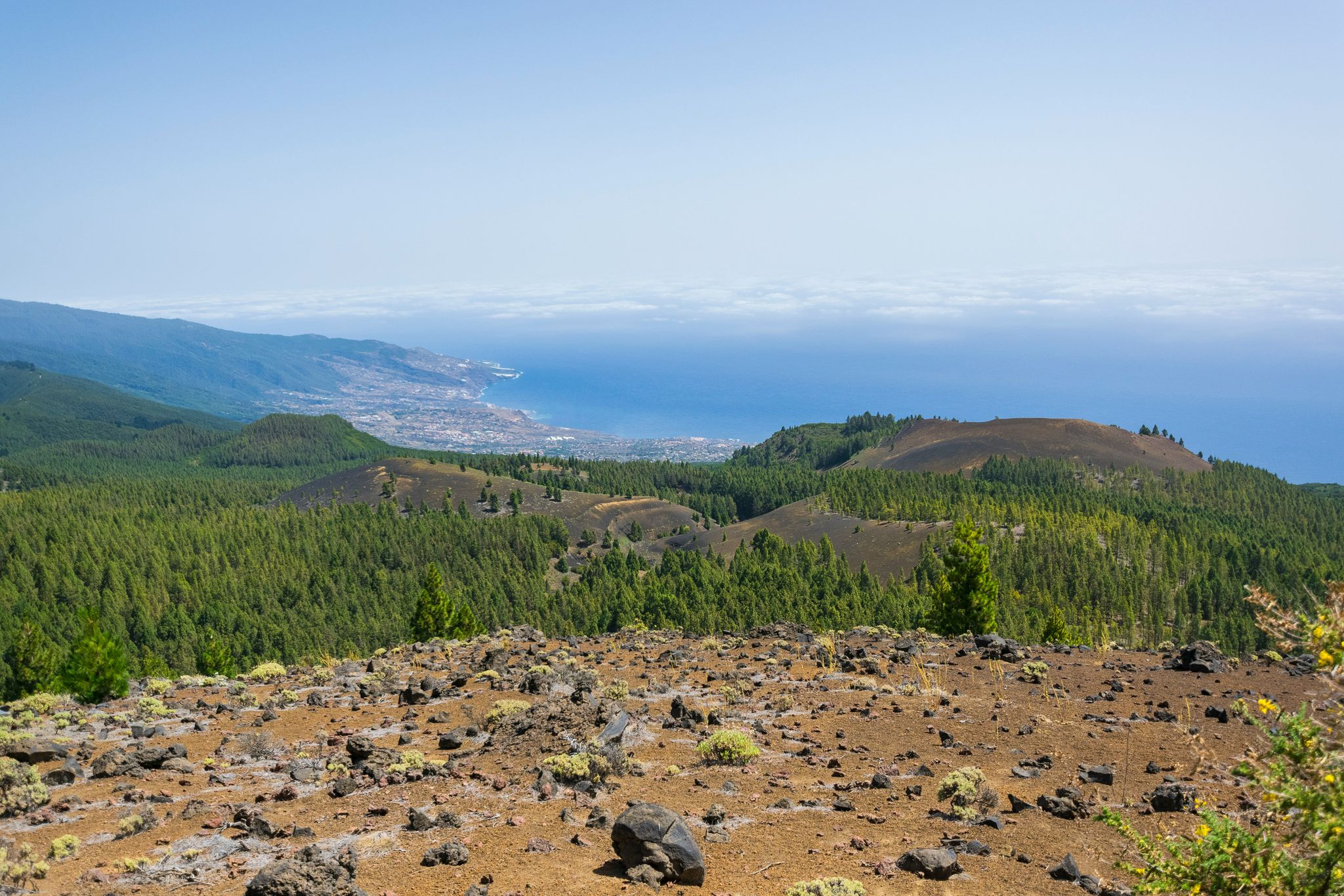
This spectacular volcanic ridge offers, on either side of the trail, wide views of the Atlantic and the pine-covered slopes. Looking ahead, you can also admire the rugged relief of the ridge.
0
0

Take your time while hiking here. The views are beautiful.
0
0

The highest peak on the volcano route, offering a magnificent panoramic view: of the caldera, Tenerife with Mount Teide, and the next volcanic craters along the route. Caution: it can be quite windy on the ascent.
0
0

Highest point of the Ruta de los Volcanos from El Pilar to Fuencaliente
0
0
This is an easy trail that offers a good view of the caldera of the vulcano.
0
0
From this viewpoint, the Ruta de los Vulcanos curves to the right of the Volcán Duráznero, but there is another trail that takes you straight over the top of this volcano and the next one, the Deseada.
0
0
Just after the start of the 17 km long Ruta de los Vulcanos from El Pilar to Fuencaliente, you will pass the only viewpoints of the Caldera de Taburiente.
0
0

From the summit of Pico de la Cruz, there's a beautiful view that's well worth every effort! You won't be at the summit long before the summit lords come looking to see if they can find anything. In any case, I consider a visit to the summit a must.
0
0
Frequently Asked Questions
How many mountaineering routes are available around Santa Cruz De La Palma?
There are 17 mountaineering routes around Santa Cruz De La Palma listed on komoot, offering a diverse range of experiences across the island's dramatic volcanic landscape. These routes are highly rated by the komoot community, with an average score of 4.6 stars.
Are there any easy mountaineering routes for beginners near Santa Cruz De La Palma?
Yes, there are a few easier options. For instance, the Roque de los Muchachos loop from Roque de los Muchachos Observatory is an easy 1.2 km trail that takes about 27 minutes to complete, offering a taste of the high-altitude volcanic terrain without significant challenge. Overall, komoot lists 1 easy route and 7 moderate routes in the area.
What kind of natural attractions can I expect to see along the mountaineering routes?
The routes around Santa Cruz De La Palma offer breathtaking natural beauty. You can encounter stunning waterfalls like the Colorful Waterfall or the Los Tilos Waterfall. Many trails also feature dramatic mountain passes and ridges, such as the Ascent to Roque de los Muchachos from Santa Cruz de la Palma or the Cumbre Nueva Ridge Trail, providing panoramic views of the island's volcanic landscape and the Caldera de Taburiente.
Are there any circular mountaineering routes available?
Yes, many routes are designed as loops, allowing you to start and end at the same point. A popular example is the El Rodeo – Pico Bejenado loop from Start of Pico Bejenado hike, a challenging 11.7 km route. Another option is the Rocky Cliffs – Laurisilva Gorge Trail loop from Cubo de La Galga B, which takes you through a unique laurel forest.
What is the best time of year for mountaineering in Santa Cruz De La Palma?
La Palma enjoys a mild climate year-round, making mountaineering possible in most seasons. However, the best time is generally from spring to autumn (April to November) when the weather is most stable and skies are clear, especially for high-altitude routes like those around Roque de los Muchachos. Winter can bring more rain and cooler temperatures, particularly at higher elevations, but also offers lush green landscapes.
Are there any family-friendly mountaineering routes near Santa Cruz De La Palma?
While many mountaineering routes can be challenging, some shorter, less strenuous options are suitable for families. The Mirador Lomo de las Chozas loop from Mirador de la Cumbrecita is a moderate 3.6 km trail with minimal elevation gain, offering stunning views into the Caldera de Taburiente National Park, which can be a great option for families.
What are the typical landscapes encountered on these routes?
Mountaineering routes around Santa Cruz De La Palma showcase a remarkable diversity of landscapes. You'll traverse dramatic volcanic terrain, including arid peaks and craters, lush ancient laurel forests (like those in Cubo de la Galga), and deep ravines. The high-altitude trails, such as the Roque de los Muchachos – Pico Fuente Nueva loop from Roque de los Muchachos Observatory, offer panoramic views of the entire island and neighboring Canary Islands.
Do I need any permits for mountaineering in Caldera de Taburiente National Park?
For certain routes within the Caldera de Taburiente National Park, especially those involving overnight stays or specific access points, permits may be required. It's always advisable to check with the National Park Visitor Centre in El Paso or their official website before embarking on your hike to ensure you comply with current regulations.
Are there opportunities for stargazing along the mountaineering routes?
La Palma is renowned as one of the best places in the world for stargazing due to its exceptionally clear skies and minimal light pollution. While not directly part of a mountaineering route, the area around Roque de los Muchachos, which many routes traverse or pass by, is home to an astronomical observatory and offers unparalleled opportunities for night sky observation. Consider combining a daytime hike with an evening stargazing experience.
What is the overall difficulty level of mountaineering in this region?
The mountaineering routes around Santa Cruz De La Palma range from easy to difficult. Komoot lists 1 easy route, 7 moderate routes, and 9 difficult routes. The terrain is often challenging, characterized by significant elevation changes, rocky paths, and sometimes exposed sections, especially on trails traversing volcanic ridges or leading to high peaks like Roque de los Muchachos.
Can I find places to eat or stay near the trailheads?
Santa Cruz de La Palma itself offers numerous cafes, restaurants, and accommodation options. For trailheads further afield, especially those within or near the Caldera de Taburiente National Park or Roque de los Muchachos, options might be more limited. It's recommended to plan your meals and accommodation in advance, especially if you're starting early or finishing late, and to carry sufficient supplies for your hike.
Most popular routes around Santa Cruz De La Palma
Most popular attractions around Santa Cruz De La Palma

Get inspired with the komoot mobile app


Explore more
Browse the best Mountain Hikes & Routes in other regions.
