The best MTB trails around Brañosera
4.6
(142)
526
riders
41
rides
Mountain biking around Brañosera offers routes through the Montaña Palentina Natural Park, characterized by its mountainous terrain, dense forests, and river valleys. The region features significant elevation changes, providing challenging climbs and descents for mountain bikers. Trails often traverse varied landscapes, including open areas with panoramic views and shaded sections through woodlands. This area provides a diverse environment for off-road cycling.
Best mountain bike trails around Brañosera
- The most popular mountain bike trail is Cordovilla de Aguilar a Brañosera circular…
Last updated: October 5, 2026
4.0
(1)
3
riders
Hard mountain bike ride. Very good fitness required. Advanced riding skills necessary.
1
riders
53.7km
05:11
1,590m
1,590m
Hard mountain bike ride. Very good fitness required. Advanced riding skills necessary.

5
riders
Hard mountain bike ride. Very good fitness required. Advanced riding skills necessary.
5.0
(1)
8
riders
35.8km
02:19
310m
310m
Moderate mountain bike ride. Good fitness required. Suitable for all skill levels.
5
riders
47.0km
04:15
1,070m
1,070m
Hard mountain bike ride. Very good fitness required. Advanced riding skills necessary.
Get access to more routes and recommendations from other explorers.
Already have an account?
Our route recommendations are based on thousands of hikes, rides, and runs completed by other people on komoot.
Start today with a free account
Your next adventure awaits.

Tips from the Community

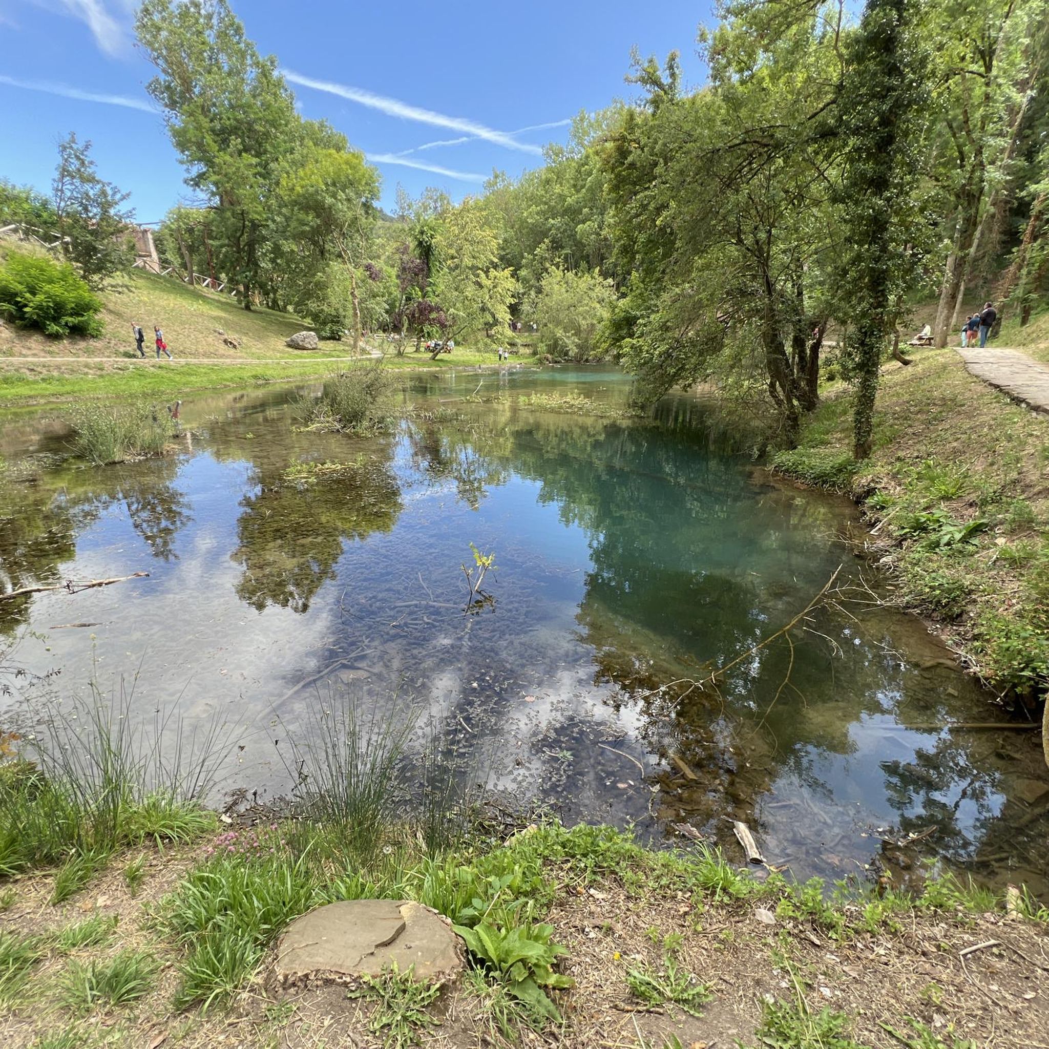
Here is the "official" source of the Ebro, even though it was proven about 40 years ago that only the water of the Rio Hijar, which seeps away at Paracuelles, re-emerges here. Strictly speaking, it is a karst spring. Not far below the spring, the Ebro is dammed by a small weir, creating a beautiful little pond here, which is obviously also popular with ducks. The circular path around the pond from the spring to the weir is only a few hundred meters long walk, a large visitor car park is directly above, so you don't have to make a long hike to visit - but you can, of course, also start the GR99 here and walk to the Mediterranean...
0
0

A cozy restaurant with a pleasant atmosphere and excellent service. We had a wonderful meal and rest. Dish of the day (red bean stew) €8, beer €2.20.
0
0
Espinilla Church. It culminates in a small bell tower with two bells that you can ring from below.
0
0
Officially, it's the source of the Ebro River, in Fontibre. However, according to what we were told at the tourist office, the waters of the spring pools come underground from the Hijar River, which rises in Alto Campoo. Specifically, in Tresmares, where the Hijar-Ebro begins, flowing into the Mediterranean; the Pisuerga (a tributary of the Duero) flows into the Atlantic; and the Nansa flows into the Cantabrian Sea.
0
0

Interesting to visit, if you are in the area.
3
0

This small town is one of the highest in the province. It has a beautiful Romanesque church called San Martín Obispo and beautiful narrow streets to visit.
0
0
There is a beautiful small waterfall hidden here in the dense vegetation. It is like entering another world.
0
0

Menhir 3.78 meters high located in the area of La Llaneda, hence its name, although it was demolished for a long time and located on a farm about 200 meters from the original point.
1
0
Frequently Asked Questions
What are the typical difficulty levels for mountain bike trails in Brañosera?
Brañosera offers a range of mountain bike trails, with 17 routes rated as moderate and 14 as difficult. There is also 1 easy trail available. The region's mountainous terrain and significant elevation changes mean many routes provide a challenging experience for riders.
Are there mountain bike trails suitable for beginners in Brañosera?
While many trails in Brañosera are moderate to difficult, there is 1 easy mountain bike trail available. These routes are generally characterized by less elevation gain and smoother terrain, making them more accessible for those new to mountain biking.
Where can I find parking for mountain bike trails in Brañosera?
Parking for mountain bike trails in Brañosera is typically available near common trailheads, such as in Barruelo de Santullán or other villages within the Montaña Palentina Natural Park. Specific parking details can often be found on individual route pages on komoot.
How long do mountain bike routes in Brañosera usually take to complete?
The duration of mountain bike routes in Brañosera varies depending on the trail's length and difficulty. For example, the difficult route Cordovilla de Aguilar a Brañosera circular desde Barruelo de Santullán — Parque Natural Montaña Palentina typically takes around 4 hours, while the moderate Pozo Merino Waterfall loop from Barruelo de Santullán can be completed in about 2 hours 40 minutes.
Are there any circular mountain bike routes in Brañosera?
Yes, Brañosera features several circular mountain bike routes. A notable option is El Golobar, Ujapero y Rojadillo — circular por Parque Natural Montaña Palentina, which offers a diverse exploration of the natural park's landscapes.
What kind of views can I expect on mountain bike trails around Brañosera?
Mountain bike trails in Brañosera offer panoramic views of the Montaña Palentina Natural Park, characterized by its mountainous terrain and dense forests. You can also find specific viewpoints like the Piedrasluengas Viewpoint, which provides expansive vistas of the surrounding landscape.
Are there any waterfalls accessible on mountain bike trails in Brañosera?
Yes, you can explore trails that lead to natural attractions like waterfalls. The Pozo Merino Waterfall loop from Barruelo de Santullán is a moderate mountain bike route that takes you to the Pozo Merino Waterfall.
What do other mountain bikers enjoy most about the trails in Brañosera?
The mountain bike trails in Brañosera are highly rated by the komoot community, with an average score of 4.6 stars from over 140 reviews. Riders often praise the diverse landscapes within the Montaña Palentina Natural Park, the challenging climbs, and the rewarding descents.
What is the best time of year for mountain biking in Brañosera?
The best time for mountain biking in Brañosera is typically during the spring, summer, and early autumn months when the weather is milder and trails are generally dry. The region's mountainous nature means conditions can vary, so checking local weather forecasts before heading out is always recommended.
Are there any historical sites or landmarks to see along mountain bike routes?
Yes, some mountain bike routes in Brañosera pass by historical sites. For instance, the Corvio Necropolis – Golobar Refuge loop from Barruelo de Santullán leads through historical sites and natural refuges, offering a blend of cultural and natural exploration.
How many mountain bike trails are available around Brañosera?
There are over 30 mountain bike trails available around Brañosera, offering a wide variety of options for different skill levels and preferences within the Montaña Palentina Natural Park.
Can I find trails that pass by significant natural features like river sources?
Yes, some routes offer access to significant natural features. The Alto del Bardal – Source of the Ebro River loop from Barruelo de Santullán is a challenging route that takes you towards the Source of the Ebro River.
Most popular routes around Brañosera
Most popular attractions around Brañosera

Get inspired with the komoot mobile app


Explore more
Browse the best MTB trails in other regions.
