The best road cycling routes around Saint-Thomas-En-Royans
4.6
(345)
8,840
riders
130
rides
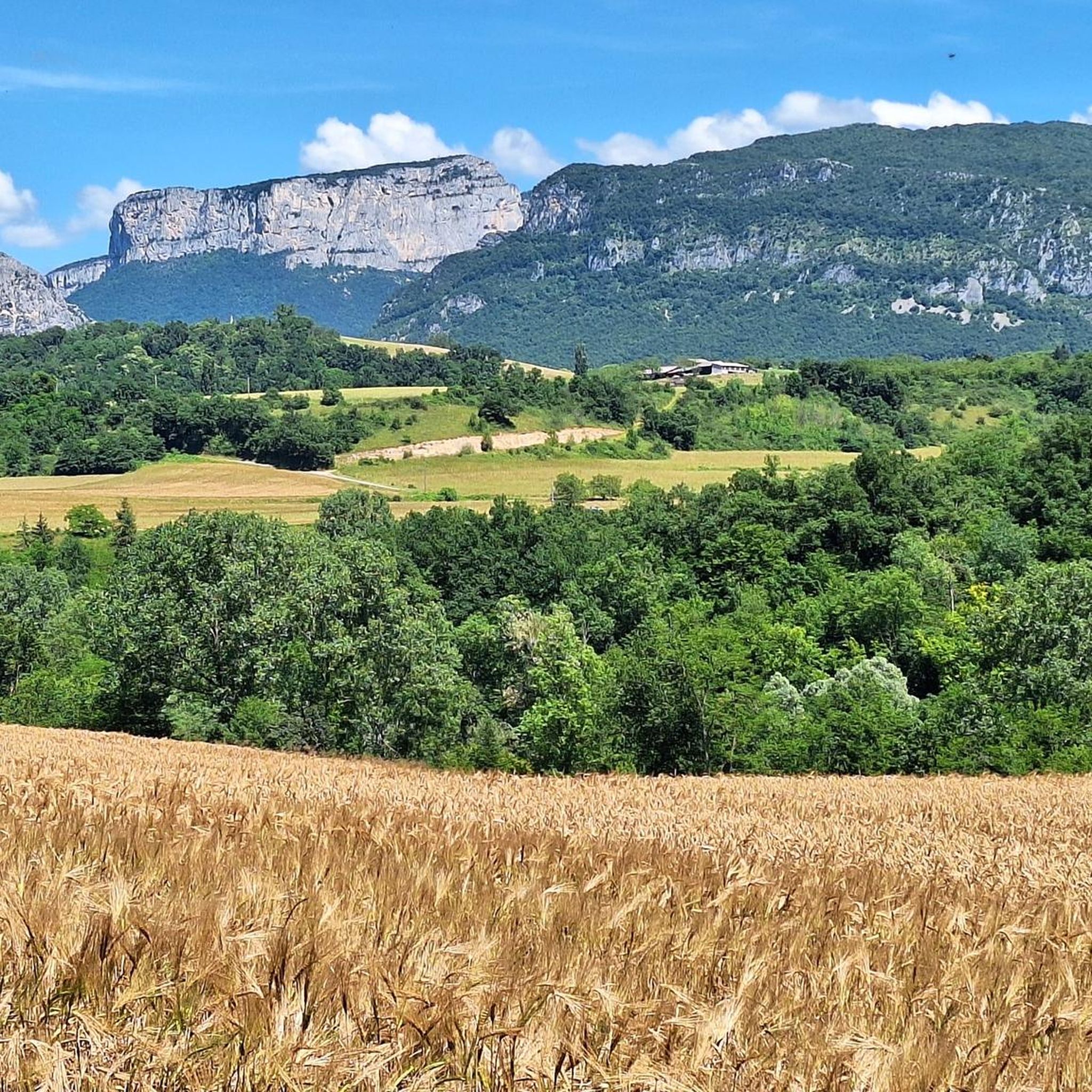
Road cycling around Saint-Thomas-En-Royans, located in the Drôme department of southeastern France, offers diverse landscapes for cyclists. The region is characterized by its natural features, including gorges, mountain passes, and the proximity to the Vercors Natural Park. Cyclists can expect varied terrain with smooth tarmac and quiet roads, providing a range of experiences from scenic loops to challenging climbs. The area is known as the Royans region, distinct for its unique cycling environments.
Best road cycling routes around Saint-Thomas-En-Royans
- The…
Last updated: October 4, 2026
4.8
(15)
546
riders
90.9km
05:20
2,220m
2,220m
Hard road ride. Very good fitness required. Mostly well-paved surfaces and easy to ride.
4.9
(20)
436
riders
67.8km
03:53
1,510m
1,510m
Hard road ride. Very good fitness required. Mostly well-paved surfaces and easy to ride.

5.0
(4)
128
riders
87.3km
05:08
2,220m
2,220m
Hard road ride. Very good fitness required. Mostly well-paved surfaces and easy to ride.
5.0
(2)
117
riders
60.7km
03:29
1,430m
1,430m
Hard road ride. Very good fitness required. Mostly well-paved surfaces and easy to ride.
4.7
(12)
286
riders
87.2km
05:00
2,070m
2,070m
Hard road ride. Very good fitness required. Mostly well-paved surfaces and easy to ride.
Get access to more routes and recommendations from other explorers.
Already have an account?
Our route recommendations are based on thousands of hikes, rides, and runs completed by other people on komoot.
Start today with a free account
Your next adventure awaits.

Tips from the Community

The climb is particularly appreciated for its tranquility, low vehicular traffic, and the beauty of the surrounding rural landscape, characterized by Clairette de Die vineyards in the lower part and forests typical of the French pre-Apennines.
18
0
Fresh and drinkable water.
12
0
The Vercors Plateau (also known as the Vercors Massif) is one of the most spectacular natural jewels of the French Prealps, located straddling the departments of Isère and Drôme, a short distance from Grenoble. This vast limestone mountainous area, which extends over more than 206,000 hectares, is famous for its unique geological conformation that earned it the nickname of "fortress": an immense rocky block surrounded by impressive vertical cliffs, deep canyons, and spectacular internal plateaus. [1] (https://turismo-it.saintmarcellin-vercors-isere.com/i-10-principali-elementi-essenziali/parco-naturale-regionale-del-vercors/), [2] (https://it.wikipedia.org/wiki/Prealpi_del_Vercors), [3] (https://www.france.fr/it/articolo/scoprite-varieta-naturale-del-massiccio-del-vercors/), [4] (https://mapy.com/it/?source=osm&id=1209791721)
12
0
Prepare to experience one of the most spectacular and exciting road routes in Europe! The Combe Laval road, nestled in the Vercors massif, is a true engineering masterpiece of the 19th century. Also known as the "road of dizziness," it winds for about 4 kilometers literally carved into the limestone rock, offering passages through suggestive tunnels and natural balconies with breathtaking drops that will take your breath away.
12
0
Get ready to experience one of the most spectacular and exciting road routes in Europe! The Combe Laval road, nestled in the Vercors massif, is a true masterpiece of 19th-century engineering. Also known as "the road of dizziness," it winds for about 4 kilometers literally carved into the limestone rock, offering passages through suggestive tunnels and natural balconies with breathtaking overhangs that will leave you breathless.
9
0
The Col de la Machine (1,011 m) is one of the most spectacular and famous access gates to the entire Vercors massif. World-renowned for being the highest point of the legendary Combe Laval, this pass offers a steady climb (around 6% average gradient from Saint-Jean-en-Royans) that winds through a dense and majestic forest.
9
0
La Combe Laval is one of the most spectacular scenic roads in the Vercors massif. The D76 was carved into the rock face between the 19th and 20th centuries and passes through a succession of tunnels, ledges, and sections suspended over the valley.
11
0
AI Mode Conversation: Col de la Bataille in the Vercors ParkCol de la Bataille in the Vercors ParkThe Col de la Bataille, situated at an altitude of 1,313 meters, is one of the most spectacular and important mountain passes in the Vercors Regional Natural Park, in the French department of Drôme. Together with the Col de Rousset, it represents one of the very rare road communication routes that allow direct access to the South-Vercors area.
4
0
Frequently Asked Questions
What are the general difficulty levels for road cycling routes around Saint-Thomas-En-Royans?
The region offers a wide range of routes to suit different abilities. You'll find approximately 14 easy routes, 52 moderate routes, and 61 difficult routes, ensuring options for both casual riders and experienced cyclists seeking a challenge.
What kind of landscapes and natural features will I encounter on road cycling routes?
Road cycling around Saint-Thomas-En-Royans is defined by dramatic natural beauty. You can expect to ride through spectacular areas like the Gorges de la Bourne and the Grands Goulets. The region is also known for its challenging mountain passes and the stunning suspended road of Combe Laval. Many routes offer views of the nearby Vercors Natural Park, providing diverse ecosystems and impressive scenery.
Are there any notable landmarks or attractions along the road cycling routes?
Yes, several routes pass by significant natural and historical sites. You might encounter the dramatic Combe Laval Cirque, the picturesque White Waterfall, or the charming village of Pont-en-Royans with its unique houses built into the rock. The area also features several mountain passes, such as the Machine Pass, offering panoramic views.
What do other road cyclists enjoy most about cycling in Saint-Thomas-En-Royans?
The area is highly rated by the komoot community, with an average score of 4.6 stars from over 260 reviews. Cyclists often praise the diverse landscapes, from challenging mountain passes to quiet roads with smooth tarmac, and the unique natural features like the dramatic gorges and the famous Route de Combe Laval.
Are there any long-distance road cycling options available?
Yes, for those looking for a longer ride, the La Sône Bridge – Isère Cycle Route loop from Auberives-en-Royans is a challenging 132.6-mile (213.4 km) route that explores the wider region, including sections of the Isère Cycle Route.
What is the best time of year for road cycling in Saint-Thomas-En-Royans?
The Drôme department generally offers favorable conditions for cycling from spring through autumn. Spring brings lush greenery and comfortable temperatures, while autumn provides cooler weather and beautiful foliage. Summers can be warm, so early morning rides are often preferred during peak season.
Are there any family-friendly road cycling routes in the area?
While many routes feature significant elevation, there are easier options available. With 14 routes classified as 'easy', families can find suitable paths, particularly those that stick to flatter valley sections or designated cycle paths. Always check the route's elevation profile and distance to ensure it matches your family's ability.
Where are common starting points or trailheads for road cycling routes?
Many popular routes begin from towns like Saint-Jean-en-Royans and Auberives-en-Royans. These locations often provide convenient access to the varied terrain and scenic loops of the Royans region.
Can I find cafes or amenities along the road cycling routes?
The region has charming villages and towns, such as Pont-en-Royans, where you can find cafes, restaurants, and other amenities. Planning your route to pass through these settlements will allow for convenient stops to refuel and rest.
What is the most challenging road cycling route in the area?
Among the more challenging options, the Combe de Beauregard-Baret – Abbaye de Léoncel loop from Saint-Jean-en-Royans stands out. This difficult 39.3-mile (63.3 km) route features significant elevation gain and takes approximately 3 hours 25 minutes to complete, offering a substantial test for experienced riders.
Are there any circular road cycling routes available?
Yes, many of the routes in the region are designed as loops, allowing you to start and finish in the same location. Examples include the Pont-en-Royans – Route des Petits Goulets loop from Saint-Jean-en-Royans and the Saint-Jean-en-Royans – Pioneer Pass loop from Saint-Jean-en-Royans, providing convenient round trips.
How many road cycling routes are available around Saint-Thomas-En-Royans?
There are over 120 road cycling routes available around Saint-Thomas-En-Royans, offering a diverse selection for all skill levels and preferences.
Most popular routes around Saint-Thomas-En-Royans
Most popular attractions around Saint-Thomas-En-Royans

Get inspired with the komoot mobile app


Explore more
Browse the best Road cycling routes in other regions.
