The best road cycling routes around Wolfisheim
4.5
(1994)
35,063
riders
754
rides
Road cycling around Wolfisheim offers a network of routes primarily characterized by flat terrain and scenic waterways. The region is situated near the Bruche Canal, providing numerous opportunities for easy road bike trails Wolfisheim. These routes often follow the canal paths, offering smooth surfaces and minimal elevation changes. The landscape is generally open, with agricultural fields and occasional wooded sections, making it suitable for accessible road cycling.
Best road cycling routes around Wolfisheim
- The most popular road cycling route is…
Last updated: September 27, 2026
4.4
(22)
607
riders
65.5km
03:16
350m
350m
Moderate road ride. Good fitness required. Mostly well-paved surfaces and easy to ride.
4.7
(17)
203
riders
49.7km
02:00
130m
130m
Moderate road ride. Good fitness required. Mostly well-paved surfaces and easy to ride.

4.4
(16)
248
riders
Moderate road ride. Good fitness required. Some segments of this route may be unpaved and difficult to ride.
4.7
(25)
470
riders
81.2km
03:41
720m
720m
Moderate road ride. Good fitness required. Mostly well-paved surfaces and easy to ride.
4.1
(9)
144
riders
36.5km
01:34
210m
210m
Moderate road ride. Great for any fitness level. Some segments of this route may be unpaved and difficult to ride.
Get access to more routes and recommendations from other explorers.
Already have an account?
Our route recommendations are based on thousands of hikes, rides, and runs completed by other people on komoot.
Start today with a free account
Your next adventure awaits.
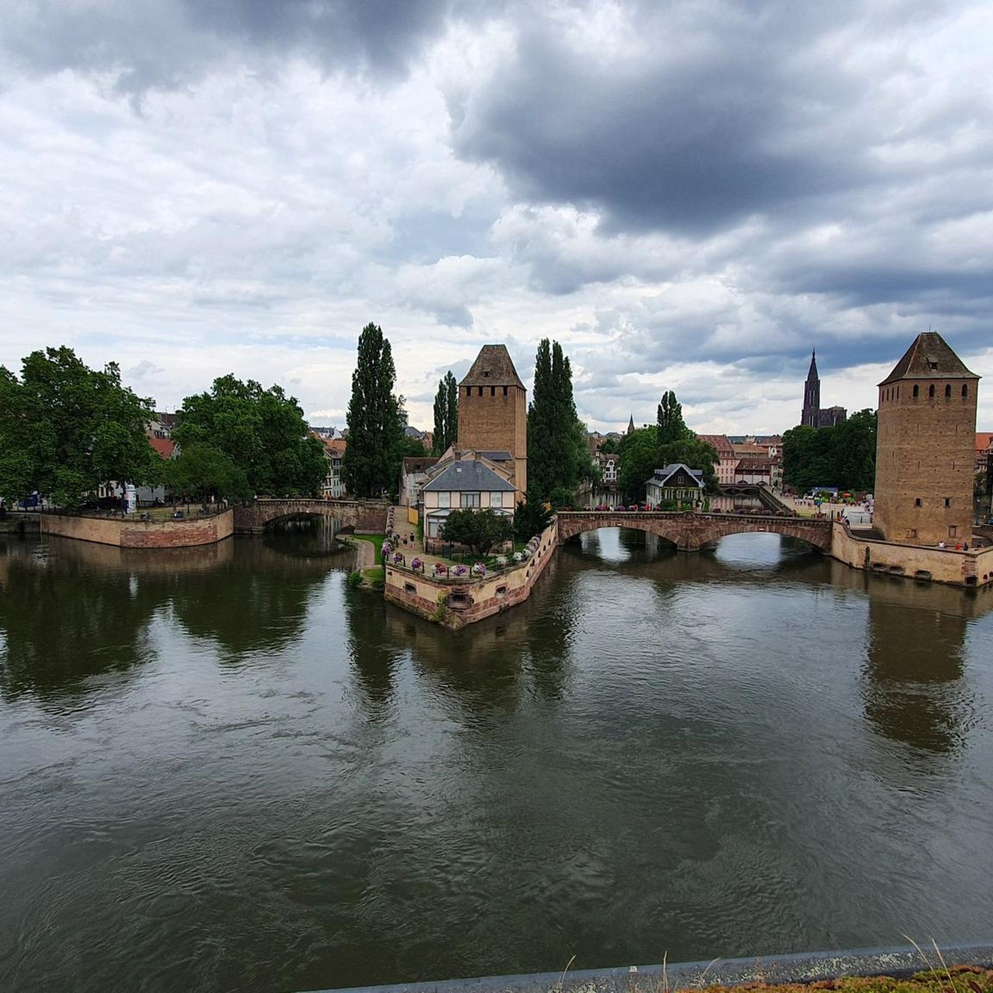
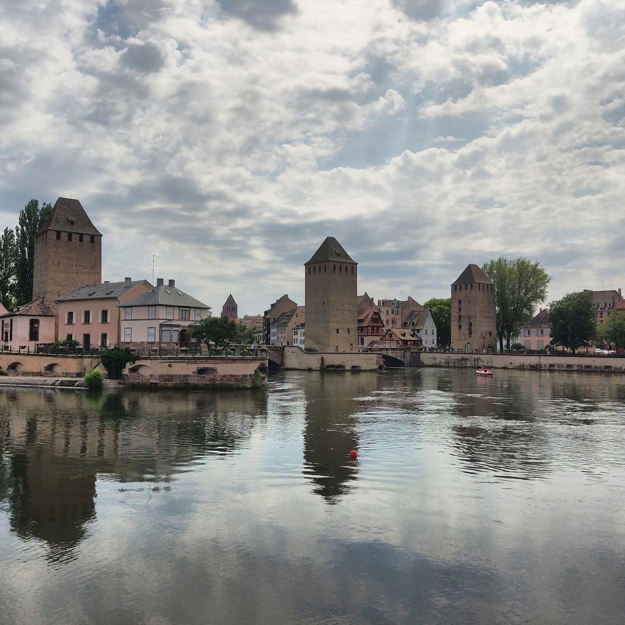
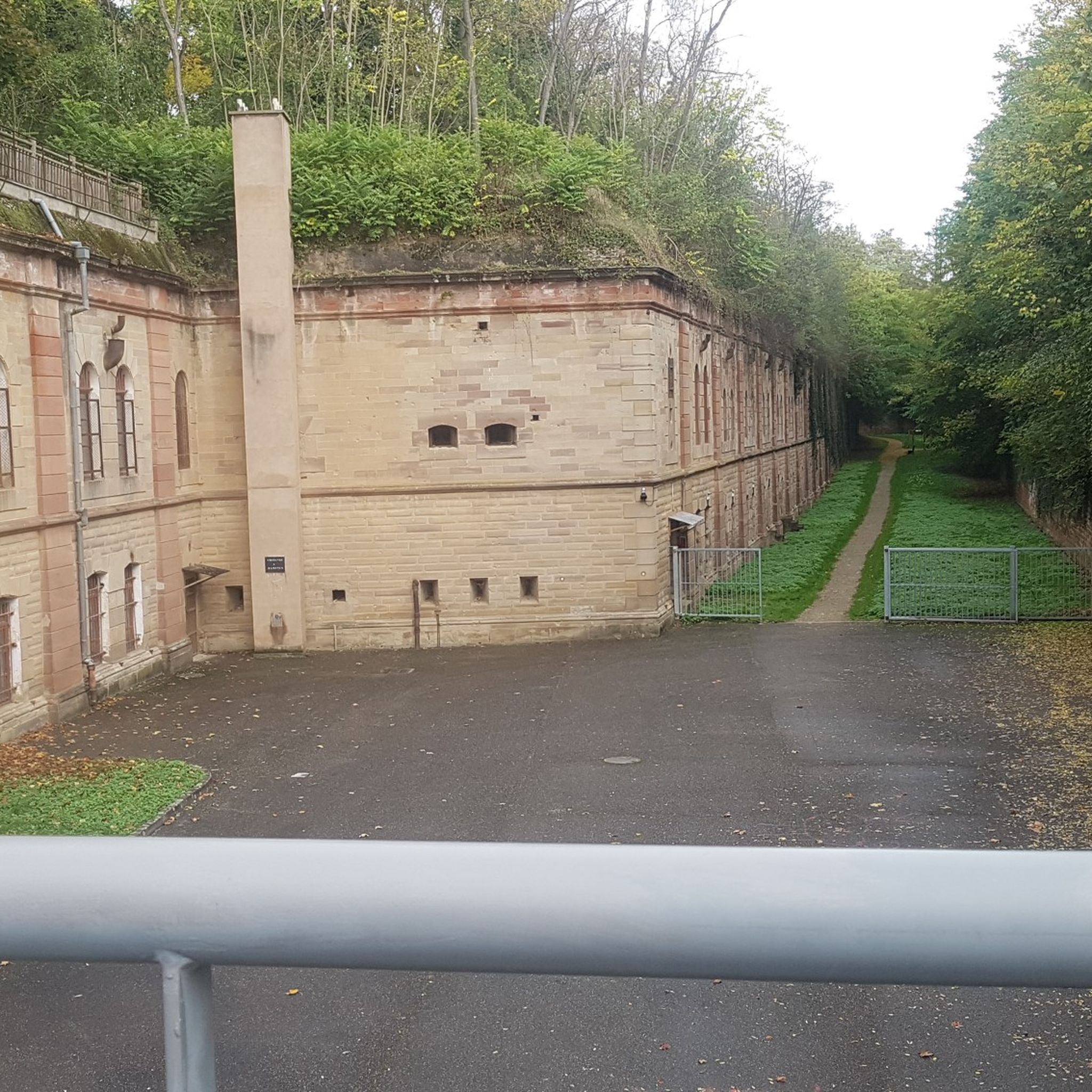

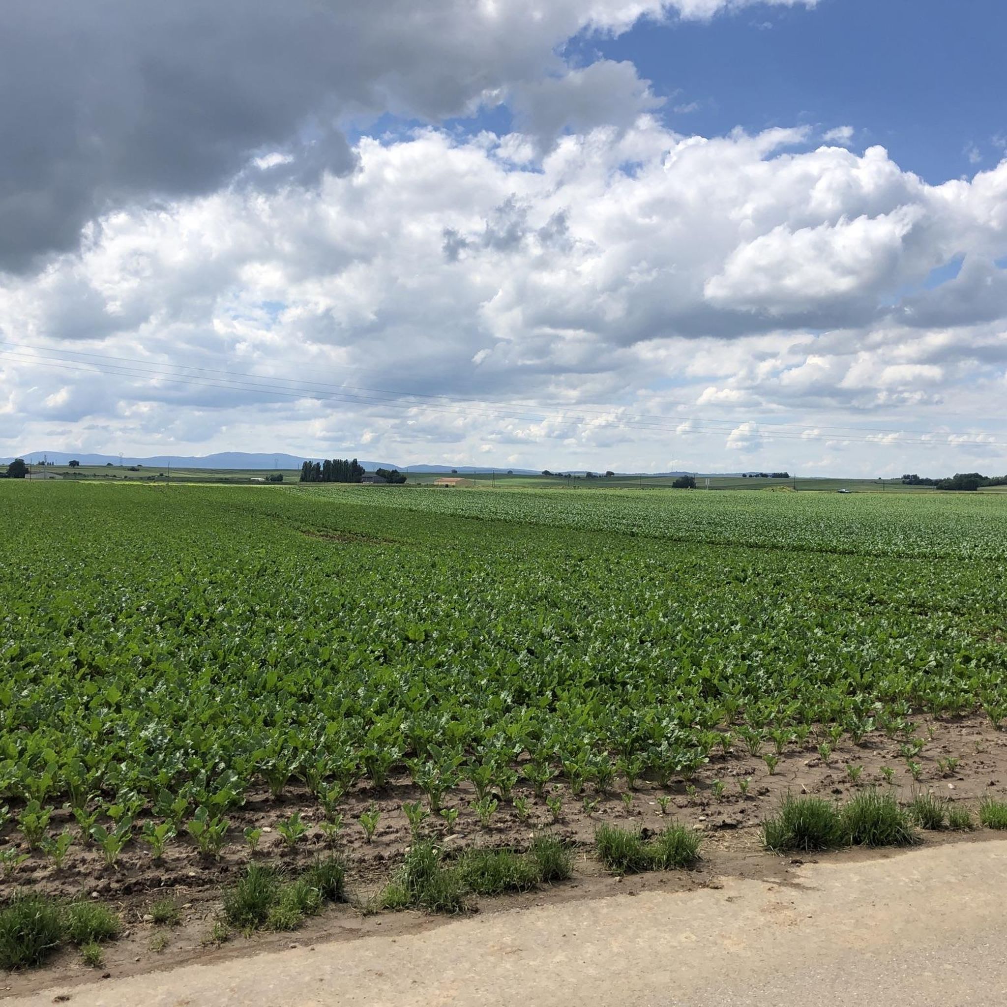
Tips from the Community

The Odilienberg (763 m) in Alsace is the most important spiritual center of the region. Founded around 690 by Saint Odilia, the monastery attracts hundreds of thousands of pilgrims annually. The centerpiece of the complex is the Basilica of the Assumption of Mary (1687–1692) with the burial chapel, where the relics of the patron saint rest in an 8th-century sandstone sarcophagus. Directly on the panoramic terrace are the Chapel of Tears and the Chapel of Angels (12th century), known for their luminous gold mosaics from 1935. Inside the basilica, there is also a fine wooden inlaid Way of the Cross by Charles Spindler. Below the monastery rocks runs a magnificent hiking trail. It leads past the monumental, colorful ceramic Way of the Cross (14 stations) and the Lourdes Grotto, both integrated directly into the red sandstone by Léon Elchinger in the 1930s. About a 15-minute walk further down, the Odilien spring emerges in the forest, its water traditionally sought for eye ailments. The entire mountain plateau is enclosed by the Heidenmauer, a mysterious, 11-kilometer-long prehistoric defensive wall. Following the hiking trails further south, you reach the Maennelstein (817 m), the highest point of the ridge, which offers a wide panoramic view over the Rhine plain to the Black Forest. The monastery grounds are open all year round and admission is free. Would you like to use this short text for a brochure or are you still looking for information on how to get there for your tour? AI answers may contain errors. For legal advice, you should consult an expert. More information
0
1

Wrong location and duplicate - here is the correct place: https://www.komoot.com/de-DE/highlight/1057103?ref=ihd&t_s=referral&t_cid=highlight_share&t_ref_username=1065335028189
0
0

Great landscape and beautiful cycle path.
0
0
Very nice cycle path along the canal.
0
0

The Canal de la Bruche is a canal in eastern France that originally connected Soultz-les-Bains near Molsheim with the city of Strasbourg. It was built in 1682 by the famous military engineer Vauban, primarily to transport sandstone from the Soultz quarries for the construction of Strasbourg's fortifications.
0
0
Dachstein lies off the main roads in Alsace and is therefore less developed for tourism. The village nevertheless boasts some noteworthy buildings, such as: the medieval city gate, the Porte de la Bruche, the Church of St. Martin (Église Saint-Martin), which still retains Gothic elements, a nave, and a Baroque altar; the Renaissance castle (extended in the 19th century in the Neo-Renaissance style) of the de Turckheim family, the Château de Turckheim, or the Vieux Château. It was formerly a summer residence for some of the bishops of Strasbourg; the old washhouse, and the Château Hervé Bourcart, or "La Magnanerie." It is located closer to the village center and was built in 1750 as a private villa that housed the royal silkworm breeding school. It has been owned by the Hervé family since 1838. In the 1990s, the castle and its idyllic surroundings served as the setting for the film saga "The Alsatians." Magnan is an Occitan word meaning mulberry. The Magnanerie is the headquarters of a silkworm farm. The streets of Dachstein are lined with several traditional half-timbered houses, some with carved wooden galleries.
0
0

We really enjoyed the cycle path along the Canal de la Bruche
0
0

Frequently Asked Questions
Are there easy or family-friendly road cycling routes around Wolfisheim?
Yes, the region around Wolfisheim is well-suited for easy and family-friendly road cycling. Many routes follow the tranquil Bruche Canal, offering flat terrain and smooth surfaces with minimal elevation changes. An excellent option is the Canal de la Bruche cycle path – Canal de la Bruche loop from Wolfisheim, which is 12.1 miles (19.5 km) and very accessible.
How many road cycling routes are available in the Wolfisheim area?
There are over 750 road cycling routes available around Wolfisheim on komoot. This includes a wide variety of options, with nearly 200 easy routes, over 480 moderate routes, and close to 90 more challenging options.
What kind of terrain can I expect on road cycling routes near Wolfisheim?
Road cycling around Wolfisheim is primarily characterized by flat terrain, especially along the scenic waterways like the Bruche Canal. The landscape features open agricultural fields and occasional wooded sections. Some routes, such as those incorporating the Piste des Forts, might include very gentle undulations but generally remain accessible.
Are there any challenging road bike climbs around Wolfisheim?
The Wolfisheim region is generally known for its flat terrain, particularly along the canals. While there are no significant mountain climbs, some routes might offer slightly more varied terrain or longer distances for a greater challenge. For instance, the Bruche Canal – Piste des Forts loop from Oberhausbergen offers a longer ride of 22.6 miles (36.5 km) with slightly more elevation gain than purely canal-side paths.
What are the best times of year for road cycling in Wolfisheim?
The spring, summer, and early autumn months generally offer the most pleasant conditions for road cycling in Wolfisheim. During these seasons, you can expect milder temperatures and less precipitation, making for comfortable rides along the canals and through the countryside. Winter cycling is possible, but be prepared for colder temperatures and potentially icy conditions on some paths.
Are there any scenic viewpoints or attractions along the road cycling routes?
Yes, several routes offer scenic views and pass by interesting attractions. The Bruche Canal – Piste des Forts loop from Oberhausbergen showcases local fortifications and green spaces. For historical and cultural sights, you can extend your ride towards Strasbourg to see landmarks like the magnificent Strasbourg Cathedral or the charming district of La Petite France.
Can I find loop routes for road cycling around Wolfisheim?
Yes, many road cycling routes in the Wolfisheim area are designed as loops, allowing you to start and end at the same point. Examples include the popular Canal de la Bruche cycle path – Canal de la Bruche loop from Wolfisheim and the Fort Kléber – Tour de Kolbsheim loop from Eckbolsheim, which offers varied terrain.
What do other road cyclists enjoy most about road cycling in Wolfisheim?
The road cycling experience in Wolfisheim is highly rated by the komoot community, with an average score of 4.4 stars from over 1,500 reviews. Reviewers often praise the region's flat, well-maintained canal paths, the peaceful scenery, and the accessibility for all skill levels. The combination of natural landscapes and historical elements, like the Piste des Forts, is also frequently highlighted.
Are there cafes or places to stop for refreshments near the road cycling routes?
While specific cafes directly on every route are not listed, the proximity of Wolfisheim to larger towns and villages means you'll find various options for refreshments. Routes that pass through or near urban areas, or those that venture closer to Strasbourg, will offer more opportunities for cafes and restaurants. Planning your route with komoot allows you to discover points of interest, including eateries, along your chosen path.
What is the typical duration for road cycling routes in Wolfisheim?
The duration of road cycling routes in Wolfisheim varies depending on the distance and your pace. Many popular routes, like the Piste des Forts – Oberhausbergen telecom antenna loop from Oberhausbergen (14.5 km), can be completed in under an hour. Longer routes, such as the Piste des Forts – European Parliament Strasbourg loop from Oberhausbergen (31 km), might take around 1.5 to 2 hours, offering options for both quick spins and longer excursions.
Are there any routes that combine canal-side riding with other points of interest?
Absolutely. The region is known for its blend of natural and historical elements. The Bruche Canal – Piste des Forts loop from Oberhausbergen is a prime example, combining the serene canal paths with sections of the historic Piste des Forts, allowing you to experience both the waterways and local fortifications.
Most popular routes around Wolfisheim
Most popular attractions around Wolfisheim

Get inspired with the komoot mobile app


Explore more
Browse the best Road cycling routes in other regions.
