The best MTB trails around Loisieux
4.3
(327)
1,810
riders
82
rides
Mountain biking around Loisieux is characterized by a landscape of hills and low mountains, with significant forest and agricultural areas. The region offers panoramic views of the Rhône Valley, including notable viewpoints like Belvédère de Recorba. While specific mountain bike trails directly within Loisieux are limited, the broader Savoie department, where Loisieux is situated, is renowned for extensive mountain biking opportunities. The area's terrain includes varied elevations and proximity to natural features like Lac du Bourget.
Best mountain bike trails…
Last updated: October 1, 2026
4.5
(18)
36
riders
27.2km
02:27
620m
620m
Moderate mountain bike ride. Good fitness required. Advanced riding skills necessary.
5.0
(3)
42
riders
28.0km
03:40
800m
800m
Hard mountain bike ride. Good fitness required. Advanced riding skills necessary. Some portions of the route may require you to push your bike.

4.8
(4)
20
riders
15.0km
01:18
280m
280m
Easy mountain bike ride. Great for any fitness level. Suitable for all skill levels.
4.9
(7)
32
riders
Moderate mountain bike ride. Good fitness required. Suitable for all skill levels.
3.0
(3)
16
riders
28.8km
02:46
560m
560m
Hard mountain bike ride. Good fitness required. Advanced riding skills necessary. Some portions of the route may require you to push your bike.
Get access to more routes and recommendations from other explorers.
Already have an account?
Our route recommendations are based on thousands of hikes, rides, and runs completed by other people on komoot.
Start today with a free account
Your next adventure awaits.


Tips from the Community

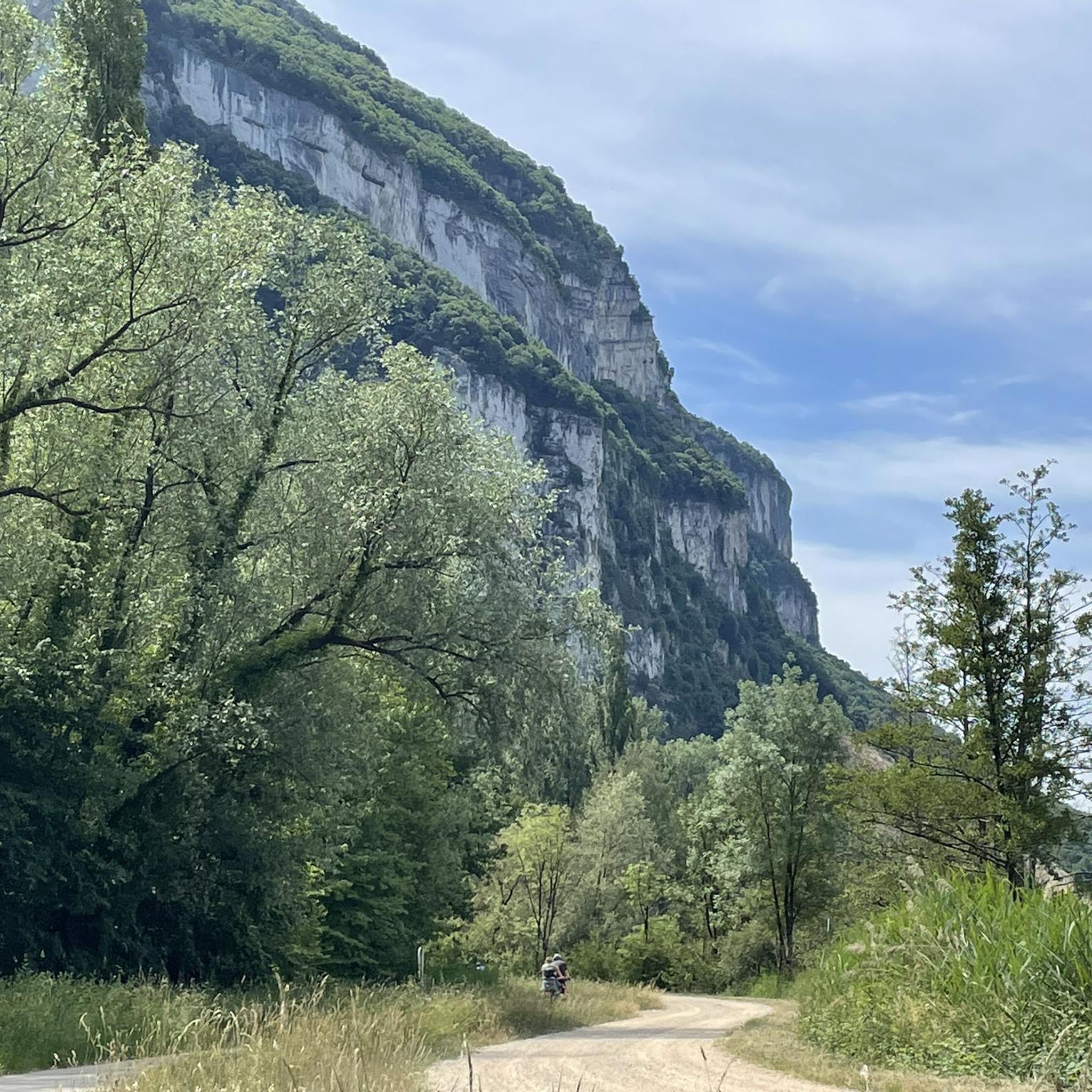
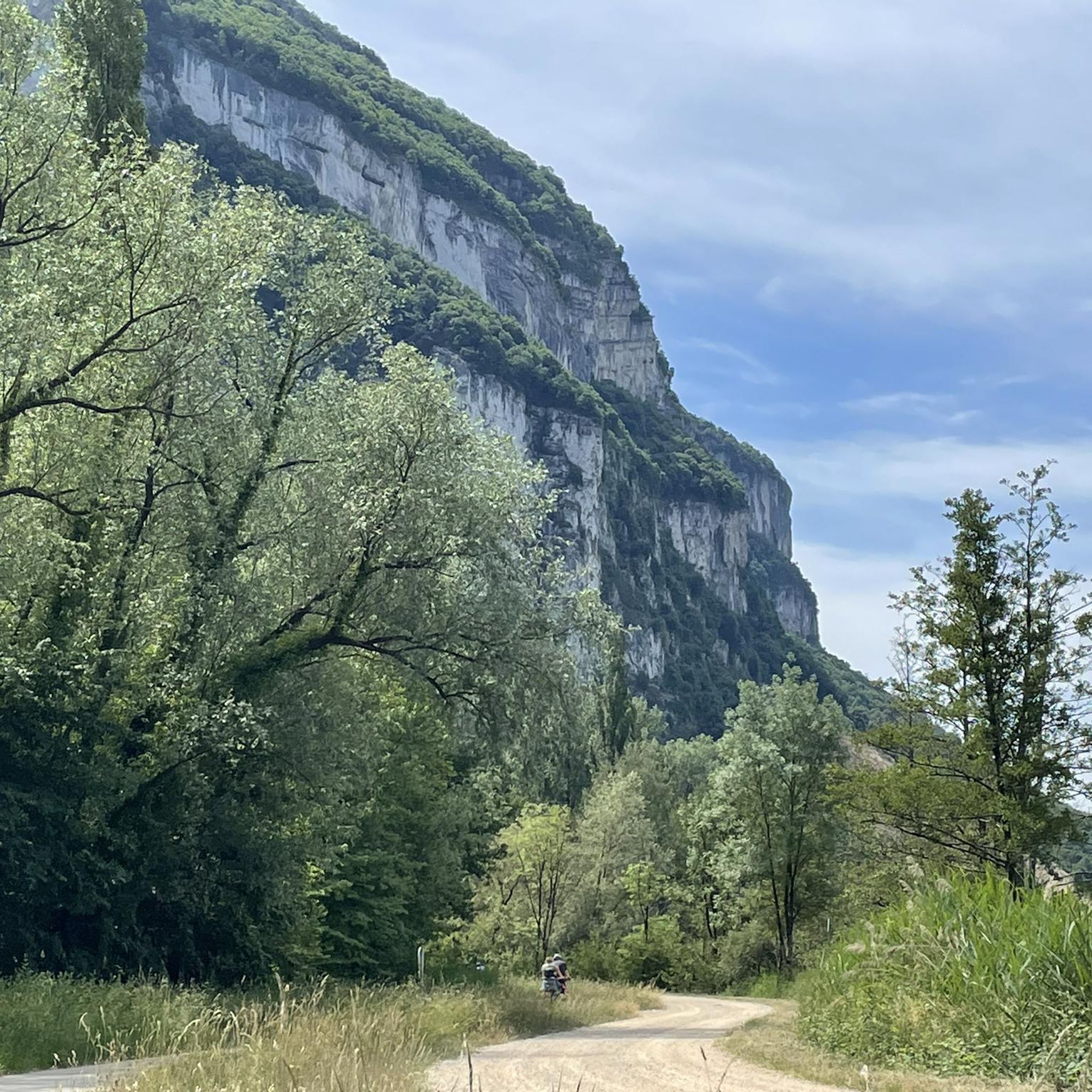
The trail runs along the Guiers river to its confluence with the Rhône, on the edge of Savoie.
0
0
Col de la Lattaz is a mountain pass located at an altitude of 754 meters in the Savoie department, in the heart of the Avant-Pays savoyard. Although it is administratively located in Savoie, it geologically belongs to the Jura Massif. It is a popular spot for cyclists and hikers for its rural landscapes and its numerous access variants.
0
0
This is a spot highly appreciated by local cyclists for its tranquility, its little-used roads, and its shaded forest paths. Several slopes allow access to it
0
0
This forest is particularly appreciated for the richness of its trails and its exceptional viewpoints
0
0
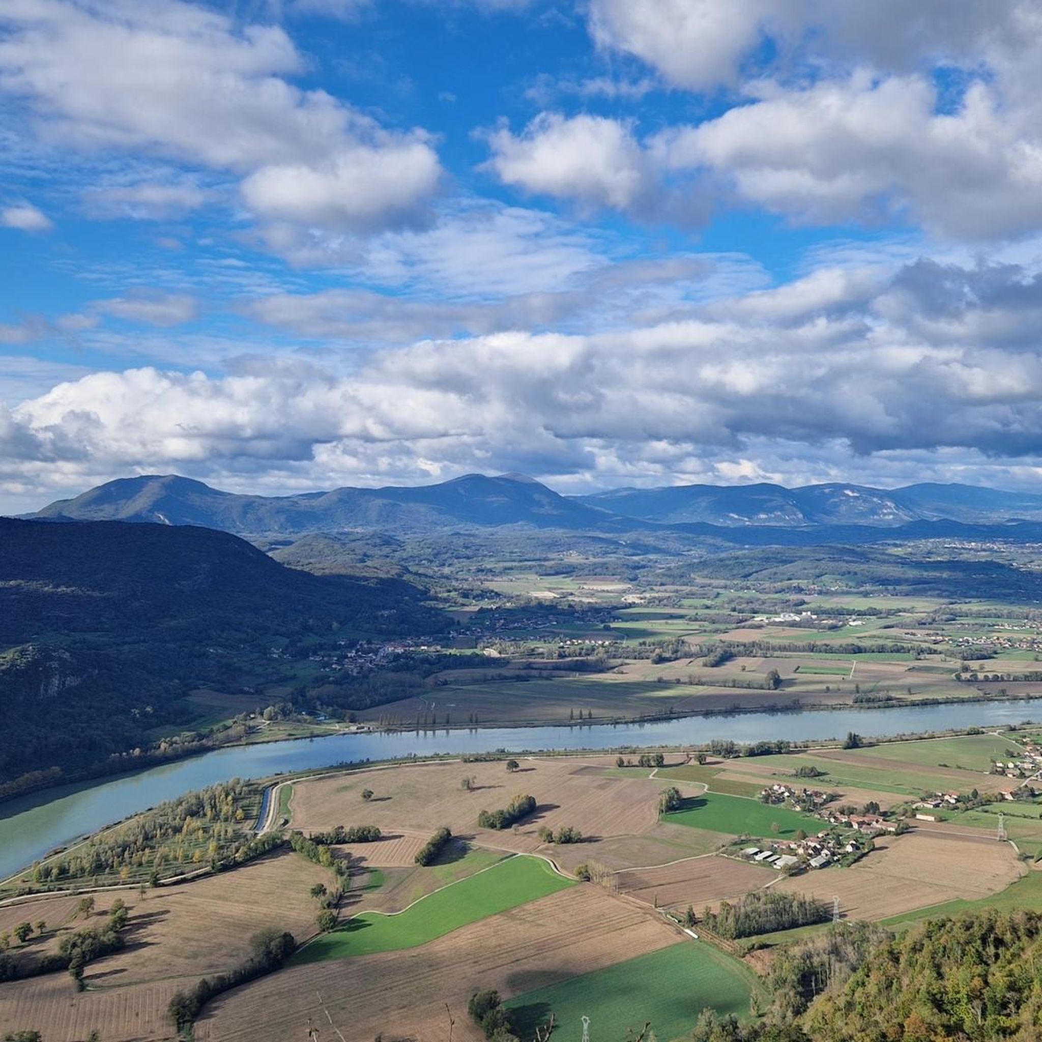
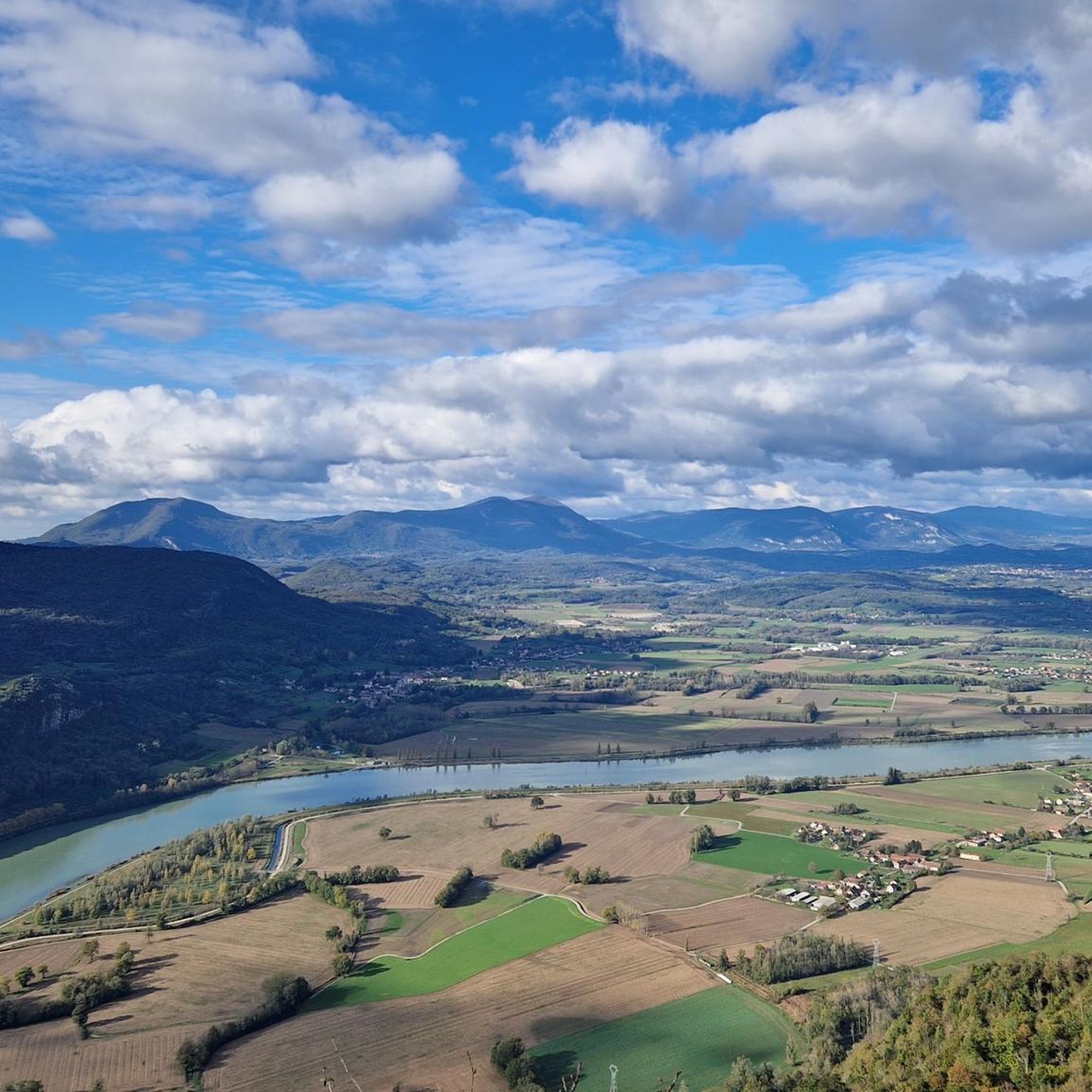
The commune of Champagneux, nestled in the Avant-Pays savoyard, is surrounded by magnificent viewpoints over the Rhône valley and the Mont Tournier chain. Belvédère du Recorba (Rocher des Corbeaux) Belvédère du Site des Fils Le Belvédère de Crozet
0
0
The commune of Champagneux, nestled in the Avant-Pays savoyard, is surrounded by magnificent viewpoints over the Rhône valley and the Mont Tournier chain. Belvédère du Recorba (Rocher des Corbeaux) Belvédère du Site des Fils Le Belvédère de Crozet
0
0
For a long time, this bridge marked the political border between the Kingdom of France (Dauphiné side) and the States of Savoy. In 1822, a border stone (stone no. 5) had been set in its center to demarcate the two territories. This historic stone has since been moved to the Place des Tilleuls in the village, where it serves as a fountain.
0
0

The Via Rhona in the direction of Belley. Magnificent cycle path
1
0
Frequently Asked Questions
How many mountain bike trails are available around Loisieux?
There are over 80 mountain bike trails around Loisieux, offering a diverse range of options for all skill levels. These include 16 easy, 42 moderate, and 22 difficult routes.
Are there easy mountain bike trails suitable for beginners or families in Loisieux?
Yes, Loisieux offers 16 easy mountain bike routes perfect for beginners or families. A great option is the Forest Stream loop from Yenne, which is 15.0 km long and takes about 1 hour 17 minutes to complete, leading through pleasant forested areas.
What kind of terrain can I expect on mountain bike trails in Loisieux?
Mountain biking around Loisieux is characterized by rolling hills, dense forests, and scenic viewpoints. The terrain includes varied elevations, from gentle slopes to more challenging climbs, with significant portions covered by forests and agricultural land. You'll find paths that wind through woodlands and along ancient routes.
Are there any challenging mountain bike trails for experienced riders?
Absolutely. For experienced riders seeking a challenge, there are 22 difficult routes. The Mount Tournier – Recorba Viewpoint loop from Yenne is a difficult 24.8 km path featuring challenging climbs and rewarding views over the Rhône Valley. Another demanding option is the Lake Lit au Roi – The Via Rhôna near Belley loop from Yenne, which covers 29.5 km.
What are the best trails for panoramic views in the Loisieux area?
Many trails in the Loisieux area offer stunning panoramic views, particularly over the Rhône Valley. The Mount Tournier – Recorba Viewpoint loop from Yenne is highly recommended, as it specifically leads to the Recorba Viewpoint, known for its magnificent vistas. The Belvédère du Site des Fils also provides superb views of the Rhône's meanders and the Jura mountains.
Are there any mountain bike trails that are loop routes?
Yes, many mountain bike trails around Loisieux are designed as loops, offering convenient starting and ending points. Examples include the Crusille Pass (573 m) – Col du Mont Tournier (851 m) loop from Gerbaix, the Mount Tournier – Recorba Viewpoint loop from Yenne, and the Forest Stream loop from Yenne.
What natural attractions or landmarks can I see along the mountain bike trails near Loisieux?
While mountain biking, you can encounter several natural attractions. You might pass by the Lac d'Aiguebelette, a beautiful lake, or even the impressive Glandieu Waterfall. The area also features viewpoints like Pierre Nioule, offering views of Lake Bourget and Aix-les-Bains, and the dramatic Rochefort Cliffs.
What do other mountain bikers enjoy most about the trails in Loisieux?
The mountain bike trails around Loisieux are highly rated by the komoot community, with an average score of 4.3 stars from over 250 reviews. Riders often praise the varied terrain, the scenic views over the Rhône Valley, and the diverse options available for different skill levels, from easy forest paths to challenging mountain passes.
Are there any mountain passes accessible by bike near Loisieux?
Yes, the region around Loisieux features several mountain passes that can be incorporated into your rides. Notable passes include Col du Chat (638 m), Épine Pass, Col du Banchet, and Col de la Lattaz (754 m). The Crusille Pass (573 m) – Col du Mont Tournier (851 m) loop from Gerbaix specifically includes significant elevation changes and mountain passes.
What is the best time of year to go mountain biking in Loisieux?
The best time for mountain biking in Loisieux is typically during the spring, summer, and autumn months when the weather is mild and trails are dry. While specific winter conditions are not detailed for Loisieux, the broader Savoie region can experience snow, making some trails inaccessible or requiring specialized equipment during colder months. Always check local weather conditions before heading out.
Are there any longer mountain bike routes for full-day adventures?
Yes, for those looking for longer rides, there are several options. The La Roche Percée – Lac d'Armaille loop from Peyrieu is a moderate 39.7 km route, taking approximately 3 hours 4 minutes to complete. Other difficult routes like the Lake Lit au Roi – The Via Rhôna near Belley loop from Yenne also offer extended riding experiences.
Most popular routes around Loisieux
Most popular attractions around Loisieux

Get inspired with the komoot mobile app


Explore more
Browse the best MTB trails in other regions.
