The best MTB trails around Oberbruck
4.4
(540)
3,867
riders
181
rides
Mountain biking around Oberbruck offers a diverse landscape characterized by forested hills, mountain passes, and scenic lakes. The region features varied terrain, including singletrack trails and longer loops that ascend to viewpoints. Elevations reach over 1000 meters, providing challenging climbs and rewarding descents. This area is well-suited for mountain biking, with a network of routes traversing natural environments.
Best mountain bike trails around Oberbruck
- The most popular mountain bike trail is Roche Marchal (1022m) – Singletrack loop from Sewen,…
Last updated: October 8, 2026
4.0
(4)
19
riders
48.8km
04:13
1,170m
1,170m
Hard mountain bike ride. Very good fitness required. Suitable for all skill levels.
23
riders
29.8km
02:21
730m
730m
Moderate mountain bike ride. Good fitness required. Suitable for all skill levels.

4.3
(3)
14
riders
44.0km
04:31
1,260m
1,260m
Hard mountain bike ride. Very good fitness required. Advanced riding skills necessary. Some portions of the route may require you to push your bike.
4.0
(5)
13
riders
31.0km
03:02
820m
820m
Moderate mountain bike ride. Good fitness required. Advanced riding skills necessary.
5.0
(4)
17
riders
30.7km
03:11
1,060m
1,060m
Hard mountain bike ride. Very good fitness required. Advanced riding skills necessary.
Get access to more routes and recommendations from other explorers.
Already have an account?
Our route recommendations are based on thousands of hikes, rides, and runs completed by other people on komoot.
Start today with a free account
Your next adventure awaits.


Tips from the Community

Of the three sides of the Ballon d'Alsace, this is clearly the most difficult (the only one with gradients of 9-10%)... but it is certainly the most beautiful! The hairpin bends at the start of the climb before the Alfeld lake are sublime. The road then evolves along the mountainside, unfortunately no more hairpin bends, this section can seem long for some, the gradient remains between 8 and 9%. It decreases when you reach the Langenberg... you have done the difficult part, there are still 4 km to the top. After that, there is a mix of flat sections and climbs with a natural clearing 1 km from the top, from where you have a panoramic view of the valley.
3
0
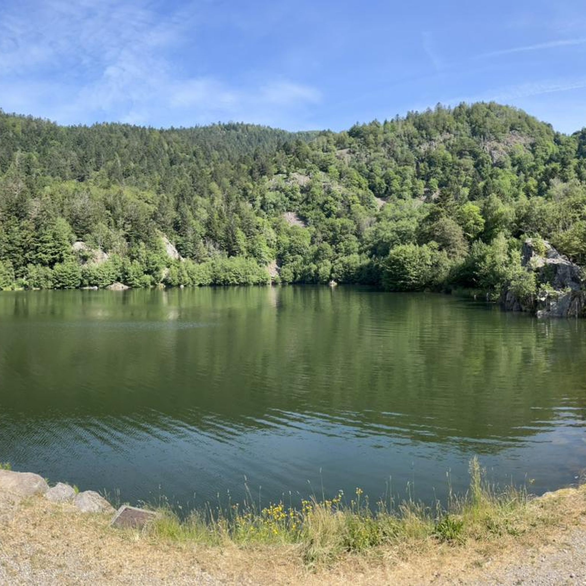
Een schilderachtig stuwmeer langs de beklimming van de Ballon d'Alsace, omringd door de beboste hellingen van de Vogezen. 🚴⛰️🌲
4
0
Dit monument herinnert aan de aanleg van het stuwmeer van Alfeld in 1888. Het markeert een belangrijk hoofdstuk in de waterbeheersing van de Dollervallei en vormt een opvallend historisch herkenningspunt langs de route.
3
0
A picturesque mountain lake at the foot of the Ballon d'Alsace, surrounded by forests and steep slopes. 🚴♂️🏞️⛰️
3
0
The Doller-fietspad (Voie Verte de la Vallée de la Doller) between Masevaux and Sewen largely follows a former railway line through the Doller valley in the southern Vosges. The route is approximately 10 to 12 km long, almost entirely car-free and asphalted. The gradient towards Sewen is very gradual, around 1%, making it a pleasant approach to the surroundings of the Ballon d'Alsace.
4
0

The Graber discovery trail starts from the center of Dolleren, which is lulled by the sound of the river that gave the village its name, the Doller. Before setting off, you can go to the town hall or the tourist office in Masevaux to pick up a booklet for children. Playful equipment can also be found along the route.
0
0
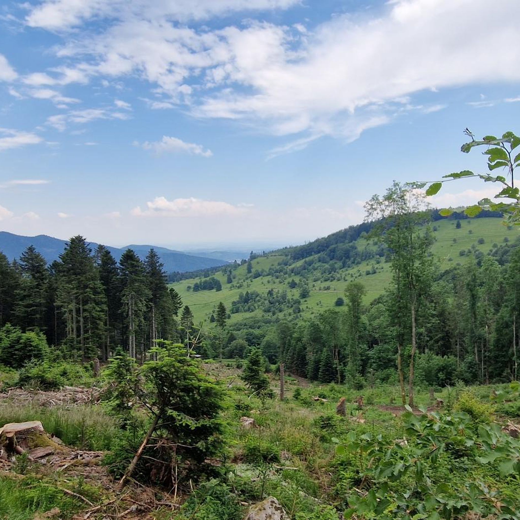
The Baerenkopf is a well-known summit in the Masevaux valley. Located on the wooded ridge around 1,000 meters that borders the Territoire de Belfort and Haut-Rhin, it nevertheless reveals a beautiful view of the valley, especially in the months when the vegetation is sparser. A refuge is located right next to it, in a slightly more open landscape.
1
0
Above the Lachtelweiher lake, the Lochberg farm inn allows you to refuel with good dishes made from products from the farm. Its terrace offers a beautiful view of the valley. There is also a stele in memory of Francis Dollfus, who died skiing at this spot on January 13, 1935. E-MTB riders will also appreciate the charging station provided.
1
0
Frequently Asked Questions
How many mountain bike trails are there around Oberbruck?
Oberbruck offers a wide selection of mountain biking opportunities, with over 160 routes available. These trails cater to various skill levels, from moderate loops to challenging, long-distance rides through forested hills and mountain passes.
Are there mountain bike trails suitable for beginners in Oberbruck?
Yes, Oberbruck has options for less experienced riders. While many trails feature significant climbs, there are 23 routes classified as easy. These typically involve less elevation gain and smoother terrain, making them ideal for those new to mountain biking.
What are some challenging mountain bike trails for advanced riders?
For experienced mountain bikers seeking a challenge, Oberbruck offers 72 difficult routes. A notable option is the Roche Marchal (1022m) – Singletrack loop from Sewen, which is 30.1 miles (48.4 km) long with over 1,100 meters of elevation gain and features demanding singletrack sections. Another is the Lochberg Inn – Beautiful path along the stream loop from Dolleren, a difficult 31.3-mile (50.4 km) route with over 1,000 meters of climbing.
Are there any family-friendly mountain bike routes in the Oberbruck area?
While many routes in Oberbruck involve significant elevation, families with some biking experience can find suitable options among the easier trails. These routes often follow forest paths or less technical terrain. Always check the route details for distance and elevation to ensure it matches your family's ability.
What is the best season for mountain biking in Oberbruck?
The best season for mountain biking in Oberbruck is typically from spring through autumn. During these months, the weather is generally milder, and the trails are free of snow and ice, offering optimal riding conditions. Summer provides lush green landscapes, while autumn brings vibrant foliage.
Are there circular mountain bike routes around Oberbruck?
Yes, many of the mountain bike trails in Oberbruck are designed as circular loops, allowing you to start and finish at the same point. Examples include the Belacker Gsang – Rimbach Pass (940 m) loop from Kirchberg, a moderate 19.9-mile (32.1 km) route, and the Lac des Perches (Star Lake) – View of Lac des Perches loop from Sewen, a challenging 27.3-mile (43.9 km) ride.
What kind of views or natural attractions can I expect along the trails?
Mountain biking in Oberbruck offers diverse scenery, including forested hills, mountain passes, and scenic lakes. You can enjoy expansive views of natural landmarks like Lac des Perches (Star Lake) and Neuweiher Lake. Some routes also pass through significant mountain areas such as Ballon d'Alsace and Ballon de Servance.
Where can I find parking and access points for mountain biking in Oberbruck?
Access points and parking are typically available in the villages and towns surrounding the trailheads, such as Sewen, Kirchberg, and Dolleren. Many routes, like the Sewen Lake – View of Lac de Afeld loop from Dolleren, start directly from these locations, offering convenient parking options. Always check specific route details for recommended starting points.
What do other mountain bikers enjoy most about the trails in Oberbruck?
The mountain bike trails in Oberbruck are highly rated by the komoot community, with an average score of 4.4 stars from over 380 reviews. Riders often praise the diverse landscape, including challenging climbs, rewarding descents, and the scenic beauty of the forested hills and lakes. The variety of routes for different skill levels is also frequently highlighted.
Are there any less crowded mountain bike trails in Oberbruck?
While popular routes can see more traffic, Oberbruck's extensive network of over 160 trails means you can often find quieter paths, especially on weekdays or by exploring some of the less-trafficked moderate or difficult routes. Look for trails that venture deeper into the forested areas for a more secluded experience.
What should I pack for a mountain bike trip in Oberbruck?
Given the varied terrain and potential for significant elevation changes, it's advisable to pack essentials such as a helmet, appropriate cycling clothing, plenty of water, snacks, a basic repair kit (including a spare tube and pump), and navigation tools. Weather can change quickly in mountainous regions, so a lightweight rain jacket is also recommended.
Are there cafes or places to eat near the mountain bike trails?
You'll find cafes and restaurants in the villages and towns around Oberbruck, such as Sewen, Kirchberg, and Dolleren, which are common starting or ending points for many trails. Some routes might also pass by mountain inns or refuges, offering opportunities for a break and refreshments. It's always a good idea to check opening hours in advance.
Most popular routes around Oberbruck
Most popular attractions around Oberbruck

Get inspired with the komoot mobile app


Explore more
Browse the best MTB trails in other regions.
