The best walks and hikes around Quaix-En-Chartreuse
4.5
(3469)
37,956
hikers
613
hikes
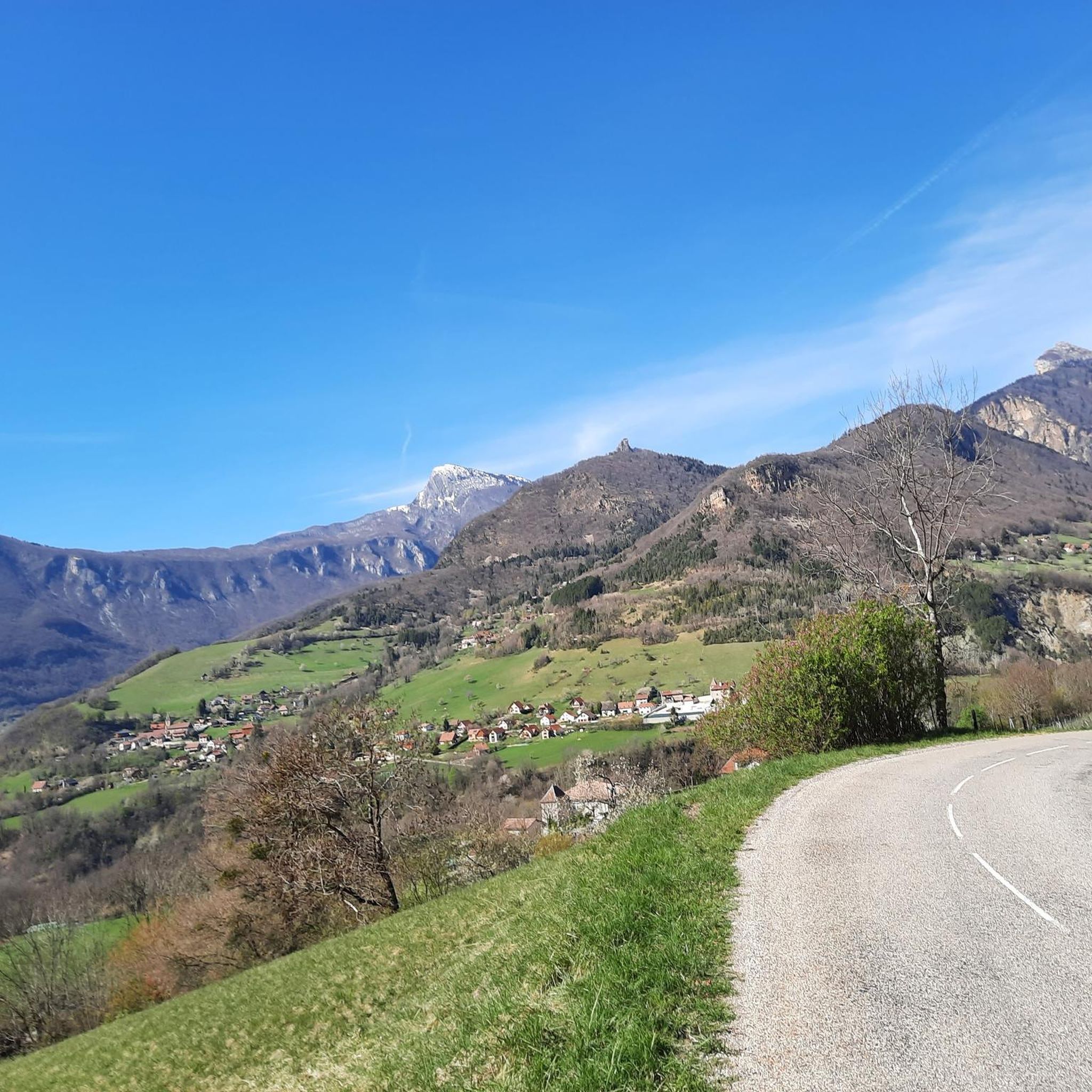
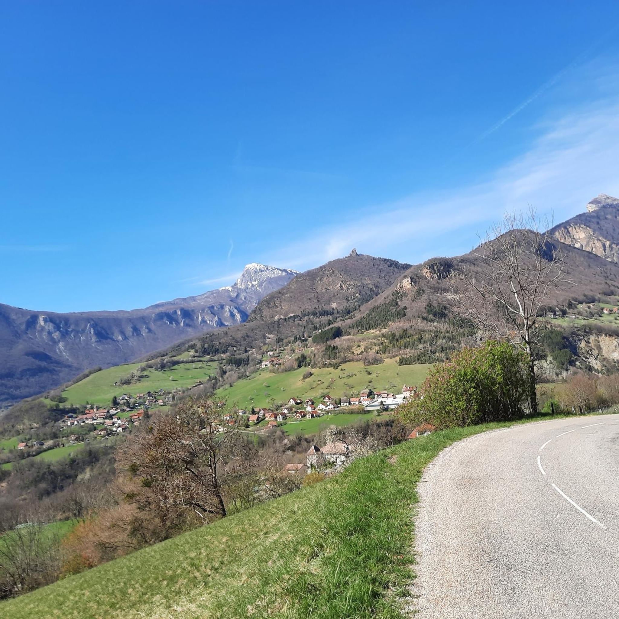
Hiking around Quaix-En-Chartreuse is centered within the Chartreuse Regional Natural Park, characterized by its dramatic limestone massif, diverse forests, and steep cliffs. The region features deep woodlands, including unique Mediterranean-type forests, and expansive alpine pastures. Hikers can expect varied terrain, from rushing torrents to high-altitude peaks, offering a range of experiences. This landscape provides numerous trails with significant elevation changes and panoramic viewpoints.
Best hiking trails around Quaix-En-Chartreuse
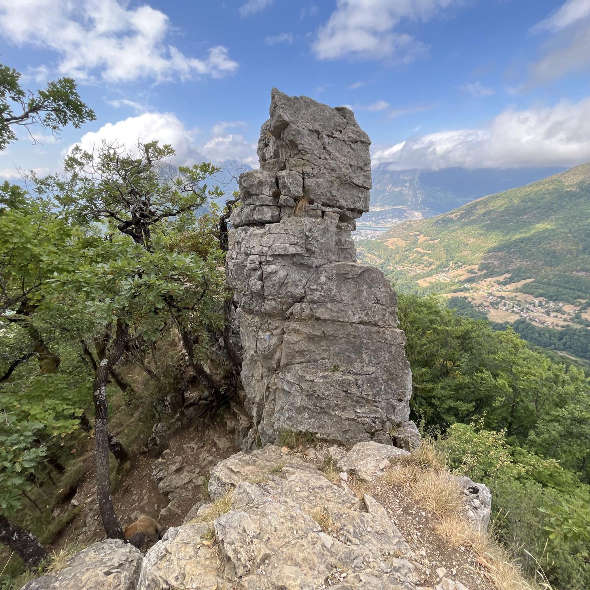
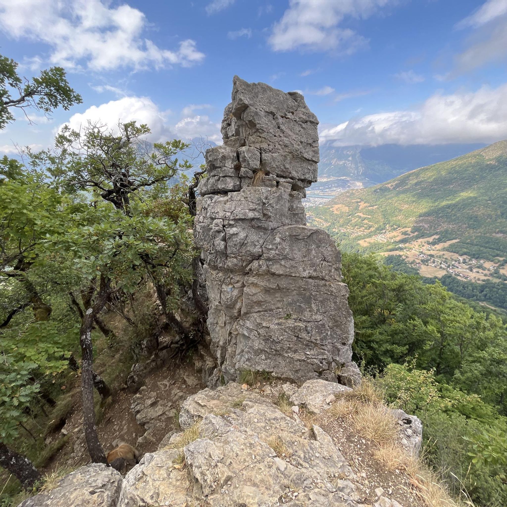
- The most popular hiking route is Quaix Needle loop from Quaix-en-Chartreuse,…
Last updated: September 28, 2026
4.5
(21)
300
hikers
10.6km
03:28
350m
350m
Hard hike. Good fitness required. Sure-footedness, sturdy shoes and alpine experience required.
4.3
(21)
184
hikers
9.24km
03:29
560m
560m
Hard hike. Good fitness required. Sure-footedness, sturdy shoes and alpine experience required.

4.8
(13)
92
hikers
10.6km
04:04
560m
560m
Hard hike. Good fitness required. Sure-footedness, sturdy shoes and alpine experience required.
4.0
(3)
28
hikers
10.1km
04:21
640m
640m
Moderate hike. Good fitness required. Mostly accessible paths. Sure-footedness required.
4.3
(7)
75
hikers
6.93km
02:21
280m
280m
Hard hike. Good fitness required. Sure-footedness, sturdy shoes and alpine experience required.
Get access to more routes and recommendations from other explorers.
Already have an account?
Our route recommendations are based on thousands of hikes, rides, and runs completed by other people on komoot.
Start today with a free account
Your next adventure awaits.


Tips from the Community


This spot offers a wider view of the Chartreuse mountains. Although still accessible, the trails begin to resemble those found in the Chartreuse mountains once you pass the Bastille.
0
0
The appeal of climbing Rachais lies in these ridges. They offer views of the Chartreuse mountains and invite you to venture further into the massif.
0
0

Anyone visiting the fortress should also walk through the caves.
1
0

Take the time to climb a little higher than at the Bastille, because it's impressive.
1
0


Frequently Asked Questions
How many hiking trails are available around Quaix-En-Chartreuse?
The Quaix-En-Chartreuse area, nestled within the Chartreuse Regional Natural Park, offers a vast network of trails. You can find over 580 hiking routes on komoot, catering to various skill levels, from easy forest walks to challenging mountain ascents.
Are there easy hiking trails suitable for beginners or families in Quaix-En-Chartreuse?
Yes, there are plenty of options for beginners and families. Over 120 easy routes are available, often winding through the region's diverse forests and offering gentle elevation changes. These trails provide a great way to experience the natural beauty without strenuous effort.
What is the typical duration of hikes in the Quaix-En-Chartreuse area?
Hike durations vary significantly depending on the route's length and difficulty. For example, a moderate trail like the Fort of Saint-Eynard – Izon Cross loop from Le Sappey-en-Chartreuse typically takes around 2 hours 30 minutes. More challenging routes, such as the La Pinéa Summit – Piénom (1615 m) loop from Sarcenas, can take over 4 hours.
What kind of landscapes can I expect to see while hiking in Quaix-En-Chartreuse?
Hikers in Quaix-En-Chartreuse will encounter a dramatic and varied landscape. The region is characterized by its unique limestone massif, emerald green forests (including Mediterranean-type forests), steep cliffs, and expansive alpine pastures. You'll often find rushing torrents and breathtaking panoramic views of the Grésivaudan valley, the Belledonne mountain range, and even Mont Blanc from higher elevations.
Are there any circular walking routes available?
Yes, many of the trails in Quaix-En-Chartreuse are designed as circular routes, allowing you to start and end at the same point. Examples include the Quaix Needle loop from Quaix-en-Chartreuse, which offers views of the Isère valley, or the Mount Jalla – Grottes de Mandrin loop from Corenc, traversing varied forest and rocky terrain.
What are some notable peaks or viewpoints I can reach on a hike?
The area boasts several significant peaks and viewpoints. Chamechaude, the highest peak in the Chartreuse massif, offers exceptional region-wide views. Other prominent spots include Dent de Crolles, known for its extensive views over the Grésivaudan valley, and the Belvédère de l'Aiguille, accessible via the Quaix Needle loop.
Can I reach hiking trailheads in Quaix-En-Chartreuse using public transport?
Yes, the region is well-connected. You can utilize buses from nearby cities like Grenoble and Chambéry to reach various starting points for hikes, making it convenient to explore the area even without a car.
What do other hikers enjoy most about hiking in Quaix-En-Chartreuse?
The hiking experience in Quaix-En-Chartreuse is highly rated by the komoot community, with an average score of 4.5 stars from over 2,800 reviews. Hikers frequently praise the diverse terrain, from serene forests to challenging peaks, and the consistently rewarding panoramic views of the surrounding mountains and valleys.
Are there any historical or cultural sites to explore along the trails?
Some hiking routes in the region pass by interesting historical sites. For instance, the Fort of Saint-Eynard is a notable landmark offering exceptional panoramic views that can be visited. The trails also reflect the history of Carthusian monks, charcoal burners, and shepherds who once inhabited these mountains.
What is the best season for hiking in Quaix-En-Chartreuse?
The Chartreuse Regional Natural Park offers hiking opportunities throughout much of the year. Spring and autumn provide pleasant temperatures and vibrant foliage, while summer is ideal for higher-altitude trails and alpine pastures. Even in winter, some lower-elevation forest paths may be accessible, though specific gear and conditions should be checked.
Are there any gorges or waterfalls to discover?
Yes, the unique limestone formations of the Chartreuse massif create breathtaking gorges. You can explore areas like the Gorges du Guiers Mort or the Coup de Sabre Gorge. While specific large waterfalls directly in Quaix-En-Chartreuse are less prominent, the region's rushing torrents and rocky streams, such as those near the Waterfall and Rocky Stream in Parc Naturel Régional du Vercors, offer scenic water features.
Most popular routes around Quaix-En-Chartreuse
Most popular attractions around Quaix-En-Chartreuse

Get inspired with the komoot mobile app


Explore more
Browse the best Hikes in other regions.
