The best walks and hikes around Roquefort-La-Bédoule
4.4
(277)
2,224
hikers
28
hikes
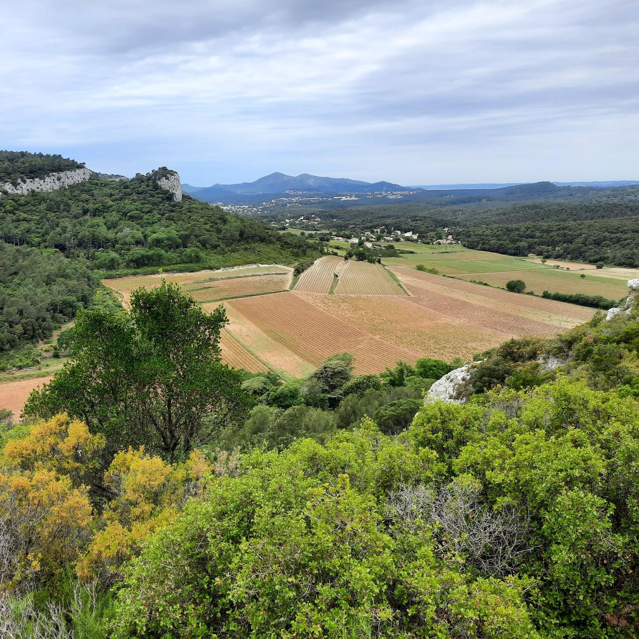
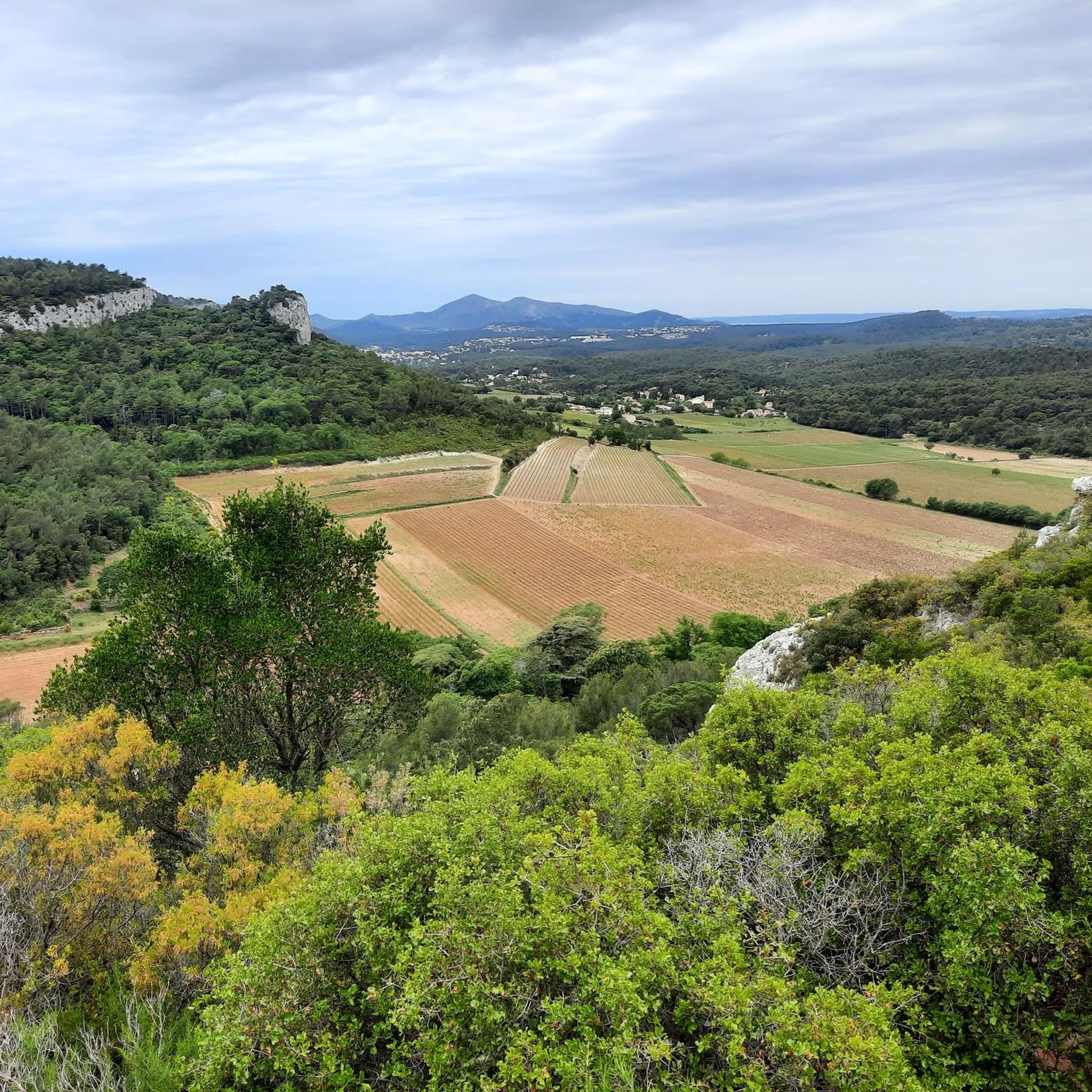
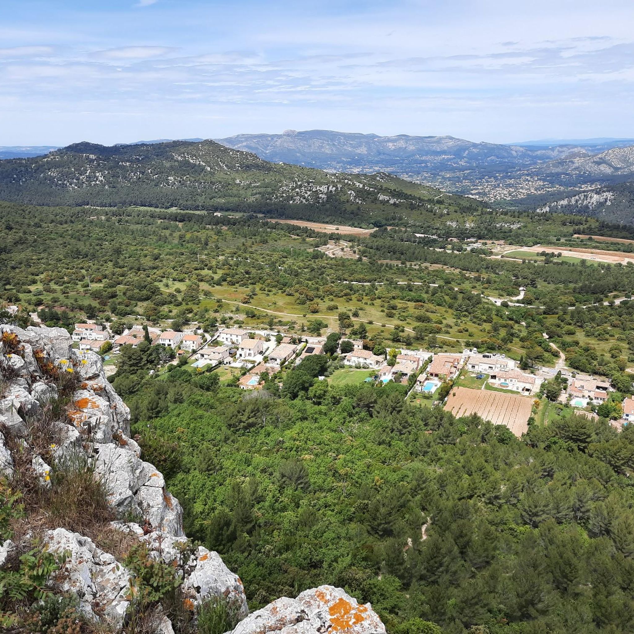
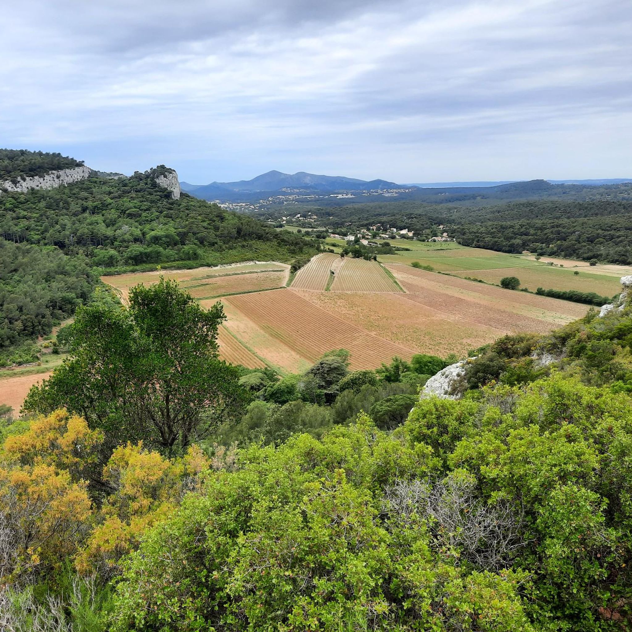
Hiking around Roquefort-La-Bédoule offers diverse landscapes, ranging from rolling vineyards and pine-filled hills to rugged mountainous terrain. The commune features altitudes from 185 meters to 563 meters, with over half its area covered in pine forests. Its location provides access to both Mediterranean coastal environments, including nearby Calanques National Park, and the imposing Sainte-Baume and Garlaban massifs. The region is characterized by notable limestone rock formations and the Gorges de la Petite Sainte-Baume.
Best hiking trails around Roquefort-La-Bédoule
- The most…
Last updated: May 12, 2026
4.9
(18)
85
hikers
16.0km
04:44
490m
490m
Moderate hike. Good fitness required. Easily-accessible paths. Suitable for all skill levels.
4.5
(8)
62
hikers
8.25km
02:24
210m
210m
Moderate hike. Good fitness required. Mostly accessible paths. Sure-footedness required.

Sign up for free
5.0
(3)
59
hikers
11.4km
03:20
320m
320m
Moderate hike. Good fitness required. Easily-accessible paths. Suitable for all skill levels.
5.0
(5)
48
hikers
9.60km
02:52
290m
290m
Moderate hike. Good fitness required. Easily-accessible paths. Suitable for all skill levels.
5.0
(1)
26
hikers
8.99km
02:39
260m
260m
Moderate hike. Good fitness required. Easily-accessible paths. Suitable for all skill levels.
Get access to more routes and recommendations from other explorers.
Sign up for free
Already have an account?
Our route recommendations are based on thousands of hikes, rides, and runs completed by other people on komoot.
Start today with a free account
Your next adventure awaits.
Login or Signup

Tips from the Community

Free parking, ideal for starting a bike tour. Be careful, the parking lot fills up quickly!
0
0

Magnificent view of the harbor of La Ciotat
1
0

Great road, wide and of good quality. Be careful, there can be traffic during rush hour. On weekends, it's rarely a problem.
0
0


The end of the exit, before diving back into La Ciotat 😅
0
0

Beautiful 360° panorama with sea view but that's not all because it is the starting point for several descents
0
0

Easier via Roquefort than via the Pas de Bellefille, this pass offers a superb view of La Ciotat and its bay.
0
0
Frequently Asked Questions
What types of landscapes can I expect to see while hiking in Roquefort-La-Bédoule?
Roquefort-La-Bédoule offers a diverse terrain, from rolling vineyards and pine-filled hills to rugged mountainous areas. You'll encounter notable limestone rock formations, deep gorges like the Gorges de la Petite Sainte-Baume, and panoramic views stretching from the Mediterranean coast to the Sainte-Baume and Garlaban massifs. Over half the commune is covered in scenic pine forests.
Are there any easy hiking trails suitable for beginners or families?
Yes, Roquefort-La-Bédoule has a good selection of trails suitable for various fitness levels. Out of the 27 available routes, 7 are classified as easy. The region's local circuits are often clearly marked and designed to be family-friendly, with some even featuring designated picnic areas. For example, the 5.3km "La source de Ratataigne" (Light green circuit) is a gentle loop that meanders through a valley.
What are some notable viewpoints or natural features to look out for on the trails?
The region is rich in stunning viewpoints. From the Chapelle Saint André, you can see the Bay of Marseille, the Garlaban, Sainte-Victoire, and Sainte-Baume massifs. La Vigie offers magnificent vistas of the bays of La Ciotat and Cassis. The Montounier, the highest point in the commune, provides remarkable views encompassing Marseille harbor and the calanques. You can also explore the Gorges de la Petite Sainte-Baume with its lush vegetation and intriguing caves, or visit the Ratataigne spring.
Are there any historical or cultural sites accessible by foot?
Yes, hikers can explore several historical and cultural points of interest. The ruins of "Vieux Roquefort" (Old Roquefort) are accessible, as is the 13th-century Chapelle Saint-André. Other significant sites include chapels like Notre-Dame-des-Pieds Noirs and the Château de Julhans, often integrated into the extensive trail network.
What is the best time of year to go hiking in Roquefort-La-Bédoule?
The region is enjoyable for hiking for much of the year. However, it's crucial to be aware that access to natural spaces is regulated between June 1st and September 30th due to fire risks. It is always advisable to verify local conditions before planning your hike during this period. Spring and autumn generally offer pleasant temperatures and vibrant scenery.
Are there any long-distance hiking routes that pass through Roquefort-La-Bédoule?
Yes, Roquefort-La-Bédoule is crisscrossed by renowned long-distance routes. These include the GR51, famously known as the "Balcons de la Méditerranée," and the GR98, which links the Jura to the Mediterranean. These routes offer opportunities for multi-day treks or longer sections of hiking.
Can I find trails with coastal views or access to the sea?
Absolutely. The strategic location of Roquefort-La-Bédoule between the Mediterranean Sea and the massifs provides access to captivating coastal environments, including the nearby Calanques National Park. Some viewpoints, like La Vigie, offer magnificent vistas of the bays of La Ciotat and Cassis. While not directly on the coast, many trails provide stunning glimpses of the sea.
What do other hikers enjoy most about hiking in Roquefort-La-Bédoule?
The area is highly rated by the komoot community, with an average score of 4.5 stars from over 250 reviews. Hikers often praise the diverse landscapes, from pine-filled hills to rugged limestone formations, and the extensive network of well-maintained trails that cater to various ability levels. The panoramic views from points like Montounier are frequently highlighted.
Are there any specific trails that offer a unique geological experience?
Yes, for those interested in the region's natural history, there is a specific "circuit géologique" (Dark blue circuit) available among the hiking trails. This 7km loop is designed for geological exploration, allowing you to observe the impressive limestone rock formations characteristic of the area.
Are there any trails that lead to swimming spots or beaches?
While the trails in Roquefort-La-Bédoule itself are more inland, the nearby coastline boasts picturesque coves like Port-Pin Beach and En-Vau Beach, which offer refreshing swimming opportunities. These are part of the Calanques National Park and can be reached via hikes from nearby starting points.
What is the difficulty level of the trails in Roquefort-La-Bédoule?
The trails in Roquefort-La-Bédoule cater to a wide range of abilities. Out of 27 routes, you'll find 7 easy trails, 17 moderate trails, and 3 difficult trails. This variety ensures that both casual walkers and experienced hikers can find suitable options, from gentle loops to more challenging ascents with significant elevation changes.
Is there a recommended trail for experiencing the 'Little Grand Canyon' features mentioned in the intro?
Yes, the Cabanon du Marquis – Little Grand Canyon loop from Le Grand Caunet is a moderate 16.0 km trail that takes approximately 4 hours 43 minutes to complete. This route specifically offers varied terrain, including the unique canyon-like features you're looking for.
Most popular routes around Roquefort-La-Bédoule
Most popular attractions around Roquefort-La-Bédoule

Get inspired with the komoot mobile app


Explore more
Browse the best Hikes in other regions.
