The best cycling routes around Castelnau-Pégayrols
4.4
(374)
4,097
riders
183
rides
Touring cycling around Castelnau-Pégayrols is characterized by its varied terrain, featuring deep river valleys, limestone plateaus, and rolling hills. The region offers routes that navigate through the Grands Causses Regional Natural Park, providing a mix of open landscapes and forested sections. Elevation changes are common, with routes often including significant climbs and descents. The area's geology contributes to diverse scenic viewpoints.
Best touring cycling routes around Castelnau-Pégayrols
- The most popular touring cycling route is Millau Viaduct – Old bridge loop…
Last updated: October 11, 2026
3.0
(1)
41
riders
103km
06:51
1,460m
1,460m
Hard bike ride. Very good fitness required. Mostly paved surfaces. Suitable for all skill levels.
3.8
(5)
47
riders
27.5km
01:39
200m
200m
Moderate bike ride. Good fitness required. Mostly paved surfaces. Suitable for all skill levels.

18
riders
55.1km
05:21
1,410m
1,410m
Hard bike ride. Very good fitness required. Mostly paved surfaces. Suitable for all skill levels.
4.3
(3)
14
riders
Hard bike ride. Very good fitness required. Mostly paved surfaces. Suitable for all skill levels.
3.0
(1)
7
riders
51.2km
03:36
1,000m
1,000m
Hard bike ride. Very good fitness required. Mostly paved surfaces. Suitable for all skill levels.
Get access to more routes and recommendations from other explorers.
Already have an account?
Our route recommendations are based on thousands of hikes, rides, and runs completed by other people on komoot.
Start today with a free account
Your next adventure awaits.

Tips from the Community

In the heart of Creissels, the Pesquié basin forms a surprisingly vast body of water (1,000 m²) compared to the modest stream that feeds it. Its name, which comes from Occitan and means "fish pond", recalls the ancient purpose of the place, linked to fish farming. The town hall now occupies the premises of a former fish farm. The basin is fed by the Creissels waterfall, a typical resurgence of the karst functioning of the Larzac: the water infiltrated into the limestones of the plateau reappears after an underground journey. In September 2023, the municipality dredged the basin and created a spawning ground for brown trout (Salmo trutta). The restoration has borne fruit, as trout have since recolonized the body of water, alongside amphibians and other aquatic organisms that find refuge in the surrounding wetland.
2
0
Built between 1818 and 1821, the Lerouge bridge became one of the main structures for crossing the Tarn in Millau. It replaced the Pont Vieux, several arches of which had been destroyed by a flood in 1758, leaving the town without a permanent bridge for over sixty years. During this long period, crossing the Tarn was mainly done by ferry. The project was launched on the initiative of the prefect of Aveyron, d’Estourmel. The plans were drawn up by Pierre-Jacques Le Rouge, an engineer for the district. The first stone was laid on June 20, 1818, and the bridge was opened to traffic in January 1821. Its name therefore comes from its designer, not from the color of its stones. A curious detail: its construction was largely financed by private individuals, and a toll was collected until 1875. This tax even caused tensions with the inhabitants of Creissels, some of whom continued to cross the Tarn on foot or by boat to avoid paying it.
3
0

recharge your batteries
0
0
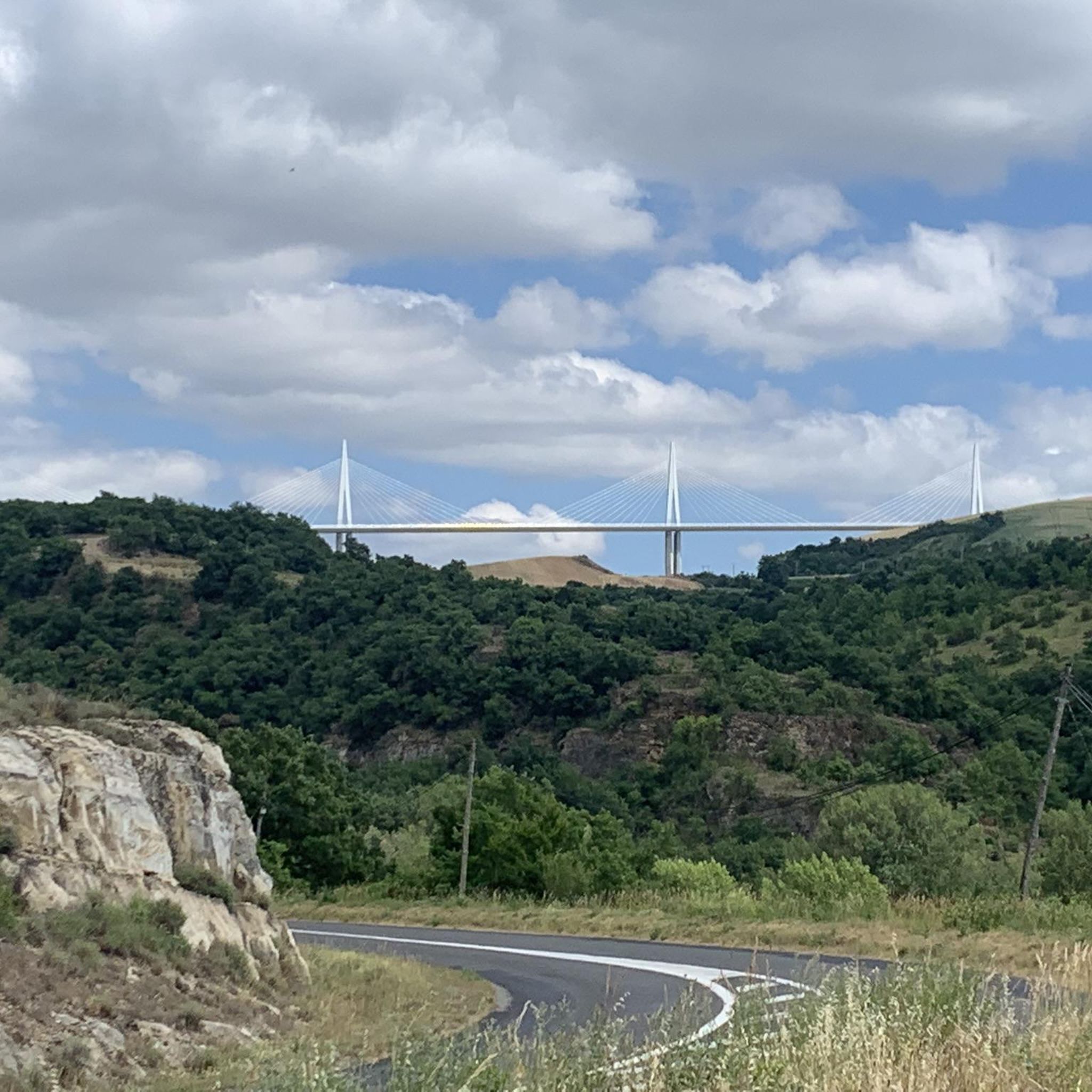
Horeca, water tap, view of Viaduct de Millau, medieval village.
0
0
As a local and a cyclist, I can confirm that the scenery is magnificent and the small roads are ideal for cycling, provided you avoid the peak period from July 15th to August 15th. However, I regret that you only mention the village of Le Rozier in the route descriptions, while the photos are mostly of Peyreleau, a superb, unspoiled village, away from the traffic of the gorges, which it faces on the other side of the Jonte River! Note: Le Rozier is in Lozère, while Peyreleau is in Aveyron.
0
0

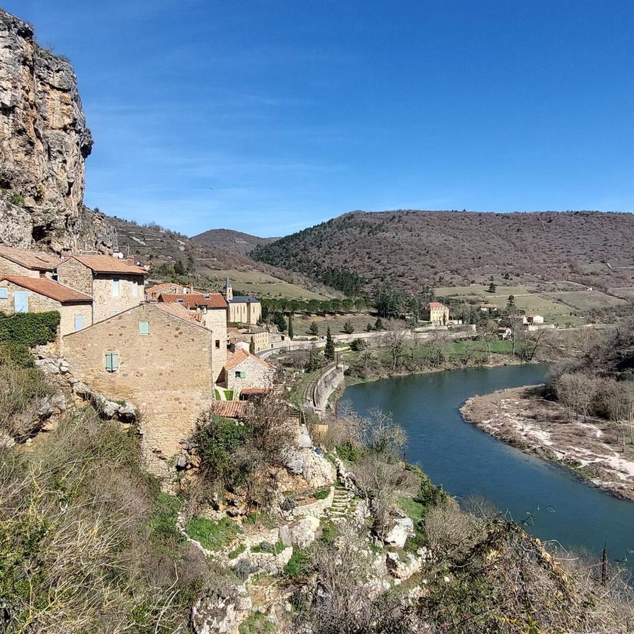
One of many beautiful views in the Tarn Valley
1
0

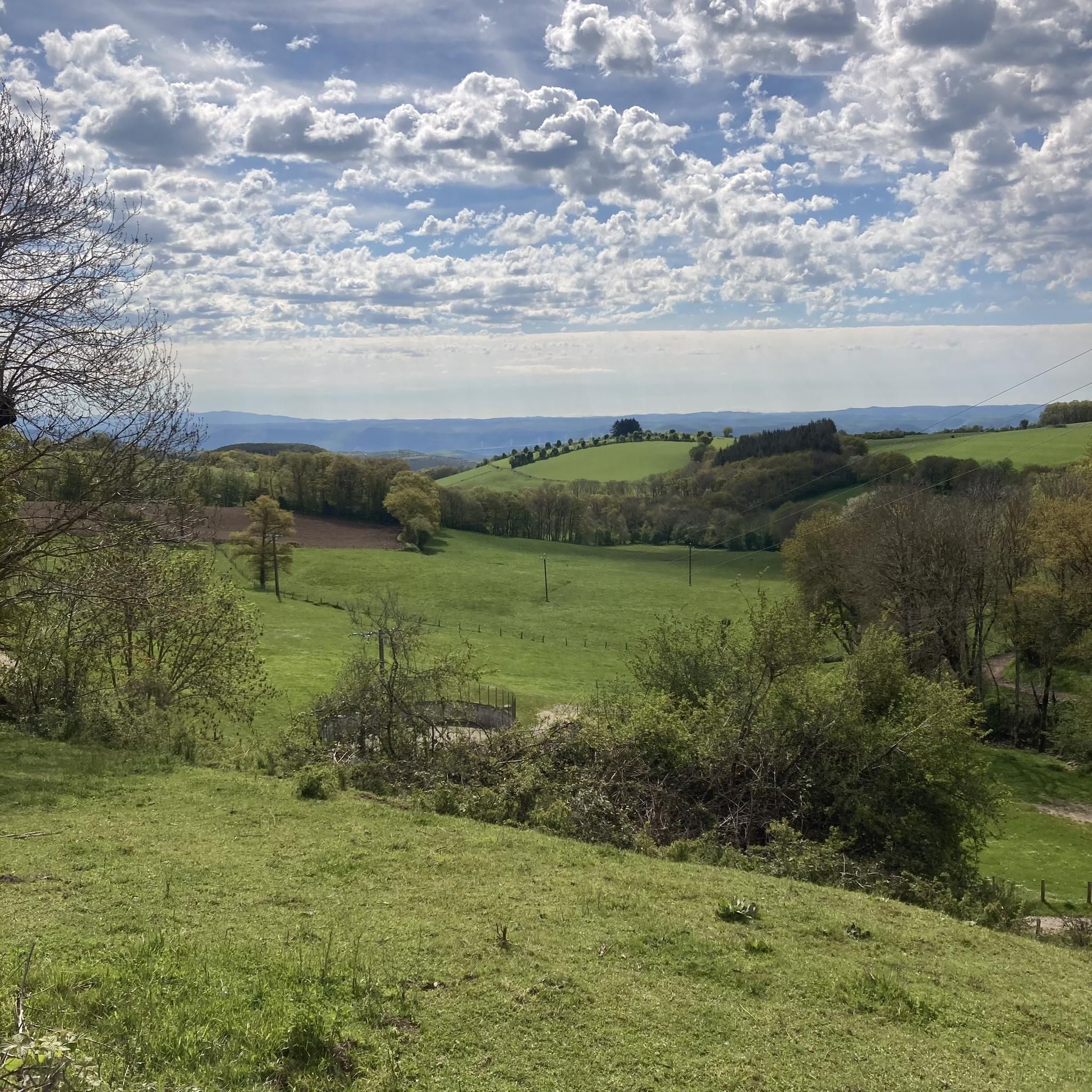
Beautiful gravel route, partly category S1
1
0

Frequently Asked Questions
How many touring cycling routes are available around Castelnau-Pégayrols?
There are over 180 touring cycling routes around Castelnau-Pégayrols, offering a wide range of options for exploring the region's diverse landscapes. These routes cater to various skill levels, from easy to difficult.
What is the general difficulty level of touring cycling routes in Castelnau-Pégayrols?
The touring cycling routes around Castelnau-Pégayrols are predominantly challenging, with 119 out of 185 routes rated as difficult. However, there are also 28 easy and 38 moderate routes available, ensuring options for different experience levels. The terrain often includes significant climbs and descents due to the deep river valleys and rolling hills.
Are there any family-friendly touring bike routes near Castelnau-Pégayrols?
While many routes are rated difficult, there are 28 easy touring cycling routes around Castelnau-Pégayrols that could be suitable for families or those seeking a more relaxed ride. These routes typically feature less elevation gain and shorter distances, allowing for a more enjoyable experience for all ages.
What kind of scenery can I expect on the touring cycling routes?
The routes in Castelnau-Pégayrols offer diverse scenery, characterized by deep river valleys, limestone plateaus, and rolling hills within the Grands Causses Regional Natural Park. You'll encounter open landscapes, forested sections, and numerous scenic viewpoints. For example, the Cap de Coste Viewpoint – Millau Viaduct loop from Saint-Georges-de-Luzençon provides panoramic vistas.
What are some notable landmarks or attractions I can see along the touring cycling routes?
Many routes pass by significant landmarks. You can cycle past the iconic Millau Viaduct, or visit the Cap de Coste Viewpoint for stunning views. Other attractions include the Cascade des Raspes du Tarn waterfall, the Dinosaur Footprints of Peyre, and the historic village of Sainte-Eulalie-de-Cernon.
Are there any circular touring bike routes available?
Yes, many of the touring cycling routes around Castelnau-Pégayrols are designed as loops, allowing you to start and end at the same point. Examples include the Millau Viaduct – Old bridge loop from Saint-Georges-de-Luzençon and the Sainte-Eulalie-de-Cernon – Tour du Viala-du-Pas-de-Jaux loop from Saint-Georges-de-Luzençon.
What is the best season for touring cycling in Castelnau-Pégayrols?
The region generally offers pleasant cycling conditions from spring through autumn. Spring brings blooming landscapes, while summer is ideal for longer days, though it can be warm. Autumn provides cooler temperatures and beautiful fall foliage. Always check local weather forecasts before heading out, especially for routes with significant elevation changes.
What do other touring cyclists say about the routes in Castelnau-Pégayrols?
The touring cycling routes around Castelnau-Pégayrols are highly rated by the komoot community, with an average score of 4.4 stars from over 340 reviews. Cyclists often praise the varied terrain, the stunning views of the Millau Viaduct, and the opportunity to explore the Grands Causses Regional Natural Park.
How long do the touring cycling routes typically take to complete?
The duration of routes varies significantly based on distance and difficulty. For instance, the Castelnau pegayroles loop from Montjaux, at 25 km, takes approximately 1 hour 50 minutes. More challenging and longer routes, like the 57.6 km Sainte-Eulalie-de-Cernon – Tour du Viala-du-Pas-de-Jaux loop, can take around 3 hours 40 minutes.
Are there options for advanced touring cyclists seeking a challenge?
Absolutely. The majority of routes (119 out of 185) are rated as difficult, featuring significant elevation gains and longer distances. Routes such as the Castelnau pegayroles – Monjaux view of the viaduct loop from Castelnau-Pégayrols, with over 840 meters of ascent, provide a substantial challenge for experienced touring cyclists.
Where can I find parking for touring bike trails in Castelnau-Pégayrols?
Many routes start from villages or towns like Saint-Georges-de-Luzençon or Castelnau-Pégayrols itself, where public parking is generally available. It's advisable to check specific starting points for designated parking areas, especially in smaller hamlets, to ensure convenient access to the trails.
What is the difference between touring cycling in Castelnau-Pégayrols versus Millau?
While both areas offer excellent touring cycling, Castelnau-Pégayrols provides a more direct immersion into the varied terrain of the Grands Causses Regional Natural Park, with routes often starting directly from smaller, historic villages. Millau, being a larger town, serves as a hub with more amenities and routes that might focus more on the immediate surroundings of the viaduct and the Tarn Gorge. Both offer challenging rides with stunning views.
Most popular routes around Castelnau-Pégayrols
Most popular attractions around Castelnau-Pégayrols

Get inspired with the komoot mobile app


Explore more
Browse the best Cycling routes in other regions.
