The best cycling routes around Mornac-Sur-Seudre
4.4
(1781)
13,341
riders
15
rides
Touring cycling around Mornac-Sur-Seudre offers a network of routes through a landscape characterized by the Seudre estuary, coastal areas, and some woodlands. The terrain is generally flat, making it suitable for various skill levels, with gentle elevation changes. Many circular bike routes Mornac-Sur-Seudre explore the marshlands and oyster farming regions. The area provides numerous opportunities for easy touring bike trails Mornac-Sur-Seudre, often following dedicated piste cyclable mornac-sur-seudre.
Best touring cycling routes around Mornac-Sur-Seudre
- The most popular touring cycling route is…
Last updated: September 30, 2026
4.5
(13)
116
riders
Moderate bike ride. Good fitness required. Mostly paved surfaces. Suitable for all skill levels.
5.0
(1)
59
riders
33.6km
02:33
130m
130m
Hard bike ride. Good fitness required. You may need to push your bike for some segments of this route.

4.2
(5)
23
riders
Moderate bike ride. Good fitness required. Mostly paved surfaces. Suitable for all skill levels.
4.5
(4)
47
riders
Moderate bike ride. Good fitness required. Mostly paved surfaces. Suitable for all skill levels.
4.0
(2)
3
riders
Easy bike ride. Great for any fitness level. Mostly paved surfaces. Suitable for all skill levels.
Get access to more routes and recommendations from other explorers.
Already have an account?
Our route recommendations are based on thousands of hikes, rides, and runs completed by other people on komoot.
Start today with a free account
Your next adventure awaits.

Tips from the Community

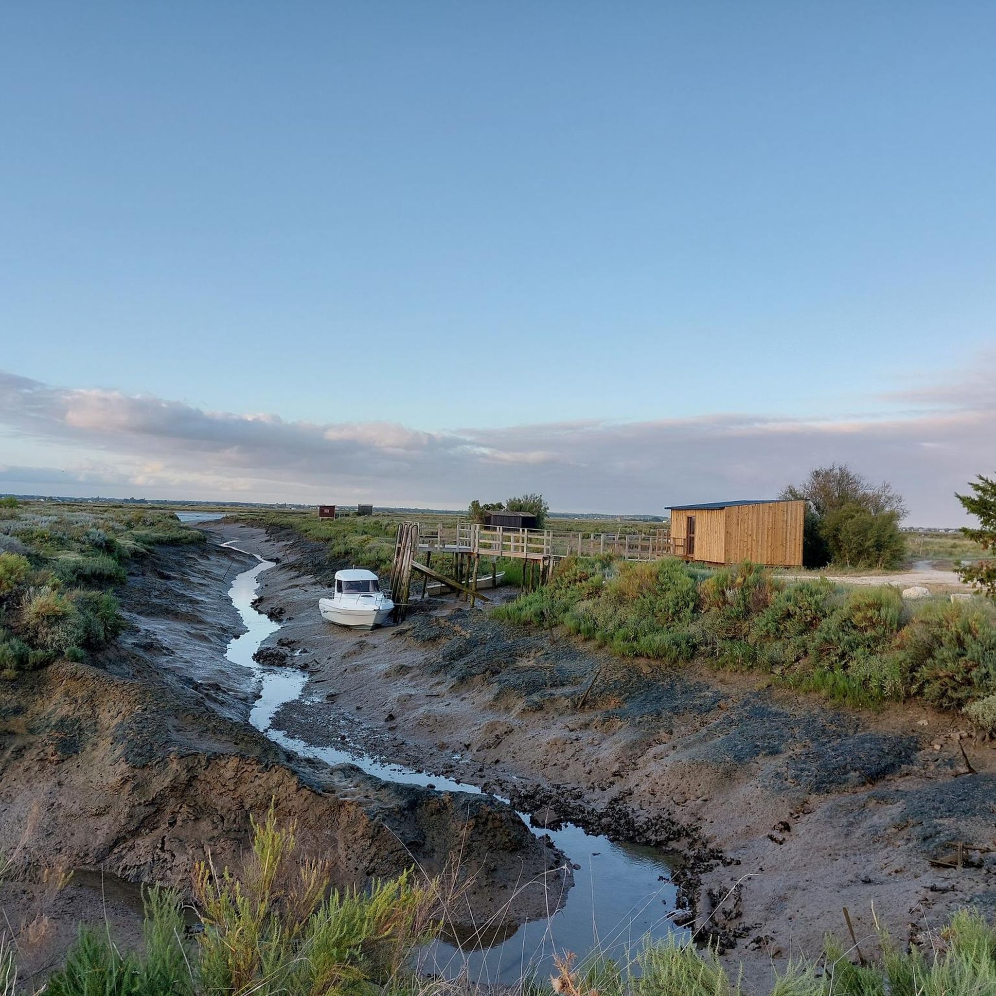
The carrelets are today part of the emblematic images of Royan and the Côte de Beauté. However, contrary to what the current landscape might suggest, the large pontoons with huts are relatively recent. A much older fishing The word carrelet originally designates the square net used for very simple fishing. Fishing with a carrelet has been attested in the region since at least the 18th century. At that time, these were not yet the elegant huts on stilts that we know today. The fisherman used a square frame with a net, which he lowered into the water and then quickly pulled up. This fishing was particularly practiced by women and could provide a dietary supplement. The turning point of 1900: the birth of the pontoons It was around 1900 that the carrelet began to change its nature. With the development of sea bathing and seaside tourism in Royan, fixed structures appeared on the quays, rocks, and cliffs. In Royan, they can be found in particular on the rocks of Pigeonnier and at Pontaillac. Initially, they were essentially simple masts equipped with a winch. The users were often merchants, liberal professions, retirees, or wealthy owners rather than professional fishermen. A particularly interesting old photograph shows the conche de Pontaillac in 1918, with fishing installations. The carrelets become leisure spots Between the two wars, and especially after 1945, the carrelets multiplied. The generalization of paid holidays, the increase in free time, and the development of popular holidays favored their transformation into real small holiday resorts. The installations gradually became more substantial: cliff → footbridge → pontoon → hut → mast and winch → square net Owners often built their own installations with wood or salvaged materials. In the 1950s, this practice experienced a real boom around Royan. Why are there so many carrelets around Royan? The relief of the Côte de Beauté is particularly well-suited for this. They can be found in particular: * in Royan, at the Pointe du Chay, at Pigeonnier and at Pontaillac; * in Vaux-sur-Mer, particularly towards the conche de Gilet; * in Saint-Palais-sur-Mer, along the headlands of Terre-Nègre and Perrières, towards the Pont du Diable and the Concié; * in Saint-Georges-de-Didonne, particularly towards Suzac; * in Meschers-sur-Gironde, along the cliffs and coves. The carrelet is indeed identified today as a viewpoint in Royan. The 1999 storm: a catastrophe The carrelets are extremely vulnerable to storms. The storms of 1996 and especially 1999 destroyed a very large part of the installations in Charente-Maritime. On the coasts of Aunis and Saintonge, nearly 90% of the approximately 700 carrelets had been destroyed during the January 2000 storm. They were then gradually rebuilt, with the help of owners and public schemes. Today: a heritage of Royan The carrelet is therefore not just a fishing equipment. It has become an element of the maritime and landscape heritage of Royan. The Musée du patrimoine du Pays Royannais classifies it as 20th-century maritime heritage and points out that the current installations are essentially the result of the development of this practice in the 20th century. An interesting historical point: the carrelets that we spontaneously associate with Royan today are therefore mainly the result of the evolution of seaside tourism after 1900 and their extraordinary development after 1945, and not the intact survival of a very old tradition of fishing huts.
0
0

The Halles of Mornac first appeared in the Middle Ages. It was only in 1664 that the first written proof attested to their existence. They are likely older and could date back to the 1550s. The Halles are generally timber-framed shelters supported by stone pillars and covered with tiles. It can be assumed that, like those of Cozes and Pisany, they suffered the vicissitudes of the Wars of Religion and were damaged, or even destroyed, then rebuilt when peace returned. The site of the Halles of Mornac was a renowned fairground and allowed the inhabitants to sell their products in exchange for a fee paid to the Lord. It was an important source of income for him, which also obliged him to maintain these Halles in perfect condition. An act engaging the Lord and the seller sealed a contract signifying the rights to sell unpacked goods and the maintenance of the said Halles.
0
0

The port of La Palmyre is a must-see on the Charente coast. Nestled in the heart of the Bonne Anse bay, it offers a peaceful setting where pleasure boats, calm waters, and preserved natural landscapes blend together. It is an ideal place to take a break during a cycling or mountain biking trip, admire the panorama, and enjoy the maritime atmosphere. With its remarkable viewpoints over the bay and the ocean, the port of La Palmyre is an essential stop for discovering the coastline.
0
0
It was formed during the 19th century following the disappearance of the island of Armote. Its richness in coastal biotopes makes it one of the largest natural sites in Charente-Maritime. Its formation is due to the confrontation between the Atlantic currents sweeping the coasts and the currents of the Gironde flowing into the ocean. The marine current, heavily loaded with sand, slows down as it passes Pointe de la Coubre, which allows the sand to be deposited massively around and in Bonne-Anse. The bay is thus in perpetual evolution, so much so that the site could become an inland lake. The extent of the dune environments is remarkable.
0
0
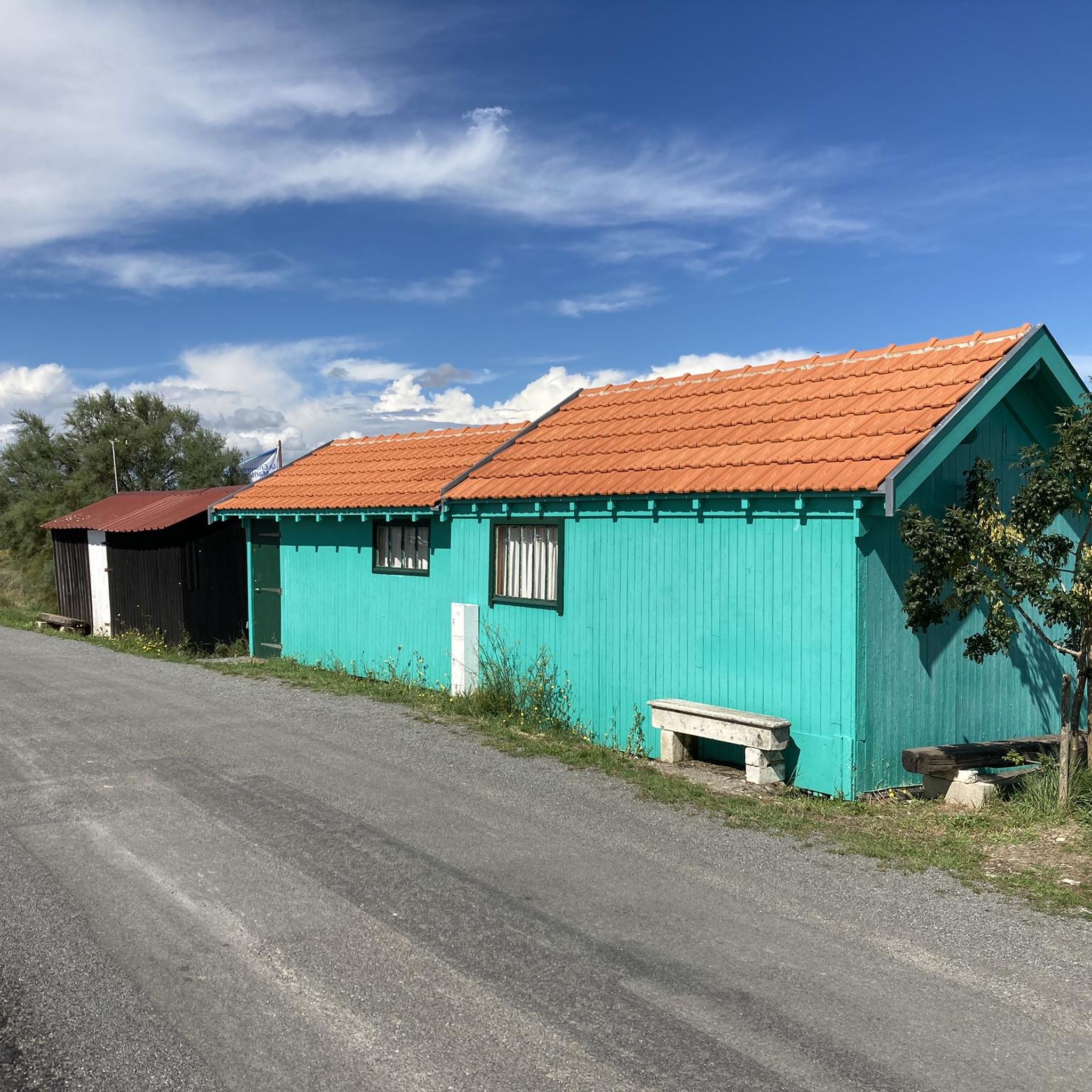
The port of Ribérou is a major heritage site in Saujon, bearing witness to a prosperous maritime past linked to the salt and wine trade. Transformed in the 19th century by ambitious works, it has now been reinvented as a place for living, relaxation, and preserving local history. 🛶 Origins and the Middle Ages The port of Ribérou takes its name from the Latin word ripa ("riverbank") or the Occitan word ribèira ("river"). It is located at the head of the Seudre estuary. It existed as early as the 11th century and became an important river and sea port thanks to its strategic position at the head of the estuary, used particularly for the salt trade—then called "white gold"—a highly sought-after product for preserving food. 🚢 Medieval Period and International Trade With the opening of British markets during the reigns of Eleanor of Aquitaine and Henry II Plantagenet, ships laden with wool, salt, wine, and other goods flocked to Ribérou. In the 16th century, the port exported local wines (such as cognac and pineau) throughout Europe. In 1577, during the Wars of Religion, the port was a strategic site: troops were stationed there, and battles took place. 🏗️ Decline, Reconstruction, and the 19th Century The estuary gradually silted up, making navigation difficult. By 1691, only smaller vessels could dock there. During the French Revolution, the sale of the tidal mill, which helped remove sediment, worsened the silting, leading to the port's decline. A modernization project began in 1822, but it wasn't until 1839 that an ambitious program was launched under the impetus of Jules Dufaure—a native of Saujon and Minister of Public Works—with the construction of sturdy quays, slipways, a lock bridge (marking the boundary between fresh and salt water), and reception facilities. In 1842, the work was completed, and the main quay was named Quai Dufaure in honor of this political support. 📉 Gradual Decline and Modernization The arrival of the railway in 1876 and the persistent problems of silting led to a decline in the port's traditional commercial activity, already facing competition from other transport networks. In the 20th century, the port gradually lost its economic importance but remained active for traditional fishing and became a place for pleasure boating, leisure, and local culture. Urban and tourism development projects (particularly in 2011–2012) modernized the port while preserving its historical charm. 🌊 Today The port of Ribérou is now a small fishing and pleasure port, much appreciated for its walks along the Seudre River, water sports (canoeing, kayaking, paddleboarding, etc.), and seasonal events.
0
0
🏖️ General Overview Chay Beach is a family-friendly, fine sandy beach located in Royan (Charente-Maritime), on the Côte d’Argent promenade between Pigeonnier Beach and Pointe du Chay. It stretches for approximately 200 meters and boasts a pleasant natural setting, with a cove bordered by rocks typical of the Charente coastline. 🏝️ Features • 🌊 Beach type: fine sand, sheltered cove. • 🏄♂️ Atmosphere: relatively calm and family-friendly, ideal for children and vacationers seeking relaxation away from the large urban beaches. • 🐾 Pets: prohibited from April 1st to September 30th. • 🫧 Water quality: excellent (Blue Flag label awarded for 2025). 🧭 Lifeguard and Safety • Swimming is supervised during the season (June to early September), with areas marked by red and yellow flags. • The area is classified as a Category 3 "Supervised Beach" and lifeguards are present during the indicated hours. 🪑 Amenities On-site, you can find: • 🏖️ Sun loungers, parasols, and mattresses for rent. • 🚿 Foot rinse and public restrooms. • 📶 Wi-Fi access, first aid station, and an area accessible to people with reduced mobility (assistance may be required depending on the slope). • 🍴 Beachfront restaurant ("Le Chay" bar-restaurant with sea views). 🚶♂️ Atmosphere and Activities • 🎈 Ideal for families and leisurely strolls. • 🌞 People come here for swimming, playing on the sand, flying kites, or simply relaxing by the ocean. • 🅿️ Parking is available nearby, and the beach is easily accessible on foot or by bike from Royan town center in just a few minutes. 🧭 Practical Tips • 📆 Best time to visit: summer for supervised swimming and full services, but also during the off-season for a more peaceful atmosphere. • ☀️ Arriving early in the morning makes parking easier during peak season. • 🐶 Dogs are not allowed during the summer season; check the signs on site during the off-season.
0
0

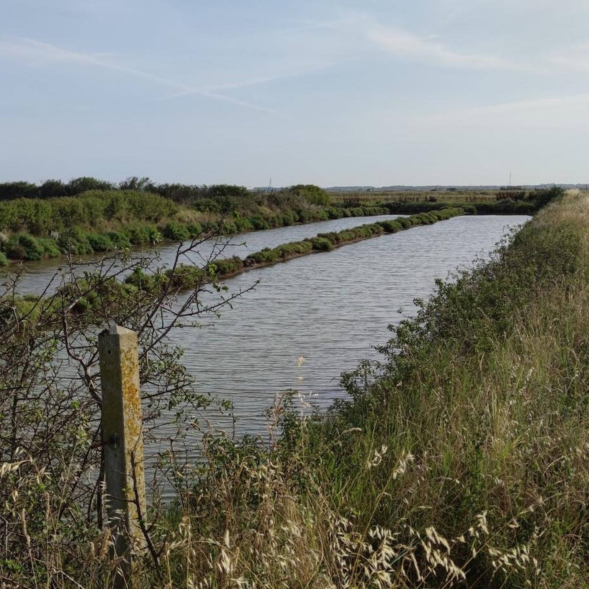
The flushing lock is located at the head of the port, between the north bank's embankment and the south bank's quay. A retention basin, occupying the non-navigable Seudre riverbed as far as Saujon, follows the flushing lock. Within the retention basin, rubble stone embankments extend the lock's return walls for a few meters. The lock itself forms a bridge carrying a road. The lock bridge consists of two piers, forming three arches, each housing two gates. On the upstream side of the lock, the piers have semicircular cutwaters. The three bands are stacked and terminate in clamps. The lock ends with a cornice resting on modillions. The cornice follows the shape of the cutwaters. A metal balustrade, also semicircular in shape, is fixed to the top of the lock. This balustrade is framed by two stone moldings. The sluice gate and its upstream and downstream return walls are constructed of dressed stone. The masonry is of medium and regular quality, except for the coping of the return walls, which features large and regular masonry. The upstream north return wall is lower than the one on the south bank. A small parapet of recently constructed white rubble masonry surmounts it. The sluice gate is equipped with metal gates, the modern racks of which are visible. The first sluice gate was built around 1825 on the site of a former tidal mill. During the works carried out between 1839 and 1842, the sluice gate's embankment was modified to allow the passage of vehicles. Between 1847 and 1853, the lock was enlarged to allow for larger flushes, and the reservoir was excavated. Return walls were also built to connect the flushing lock to the riprap. It was then restored in 1865 and completely rebuilt between 1868 and 1869. The lock is 10.50 m wide, and its gates are each 1.50 m wide. The reservoir is 700 m long and has an average width of 30 m.
0
0
Frequently Asked Questions
How many touring cycling routes are available in Mornac-Sur-Seudre?
There are 13 touring cycling routes around Mornac-Sur-Seudre, offering a variety of experiences for different skill levels.
What is the best time of year for touring cycling in Mornac-Sur-Seudre?
The region is generally pleasant for cycling from spring through autumn. The coastal climate means mild temperatures, but summer can be busy. Spring and early autumn offer comfortable weather and fewer crowds, making them ideal for exploring the marshlands and coastal paths.
What kind of terrain can I expect on touring cycling routes around Mornac-Sur-Seudre?
The terrain around Mornac-Sur-Seudre is predominantly flat, characterized by the Seudre estuary, coastal areas, and marshlands. You'll find gentle elevation changes, making it suitable for a relaxed touring cycling experience. Many routes follow dedicated cycle paths (piste cyclable).
Are there easy touring cycling routes suitable for beginners or families?
Yes, Mornac-Sur-Seudre offers several easy touring cycling routes. There are 4 routes specifically rated as easy, perfect for beginners or families looking for a relaxed ride through the scenic marshlands and along the coast.
Are there more challenging touring cycling routes for experienced cyclists?
While the region is generally flat, there is one route rated as difficult for those seeking a more challenging touring cycling experience. Additionally, 8 routes are rated as moderate, offering longer distances or slightly more varied terrain.
Are there circular touring cycling routes in Mornac-Sur-Seudre?
Many of the touring cycling routes in Mornac-Sur-Seudre are circular, allowing you to start and end your journey in the same location. For example, the The market halls in Mornac-sur-Seudre – Port of La Tremblade loop is a popular circular option.
What interesting places can I explore along the touring cycling routes?
The routes often pass by charming coastal features and historical sites. You might encounter places like Chay Beach, the Port of Royan, or even the German Bunkers of La Grande Côte. The Chay Beach – Carrelets de Royan loop is a great option for coastal views.
What kind of views or natural features can I expect on the routes?
You can expect diverse scenery including the tranquil Seudre estuary, expansive marshlands, and picturesque coastal views. Routes like the Côte sauvage loop offer stunning coastal vistas, while others delve into the unique ecosystem of the oyster farming regions.
What do other touring cyclists say about the routes in Mornac-Sur-Seudre?
The touring cycling routes in Mornac-Sur-Seudre are highly rated by the komoot community, with an average score of 4.3 stars from over 1100 reviews. Cyclists often praise the well-maintained paths, the flat terrain suitable for all levels, and the beautiful, varied scenery of the estuary and coast.
Are there routes that pass through woodlands?
Yes, some routes venture into wooded areas, offering a change of scenery from the coastal and marshland paths. The Bois de la Roche loop is an example of a route that takes you through woodland landscapes.
Can I access the touring cycling routes by public transport?
Mornac-Sur-Seudre is served by local public transport options, including the 'Train des Mouettes' (a heritage steam train) which connects to various points in the region. While specific bike carriage policies vary, it's advisable to check with local transport providers for the most current information on bringing bikes.
Is it possible to rent a bike in Mornac-Sur-Seudre?
Yes, bike rental services are available in Mornac-Sur-Seudre and the surrounding towns. You can find various options, including traditional bikes and electric bikes, to explore the local touring cycling routes.
Most popular routes around Mornac-Sur-Seudre
Most popular attractions around Mornac-Sur-Seudre

Get inspired with the komoot mobile app


Explore more
Browse the best Cycling routes in other regions.
