The best cycling routes around Vaux-Sur-Mer
4.4
(1737)
13,816
riders
22
rides
Touring cycling around Vaux-Sur-Mer offers routes through a diverse natural landscape characterized by limestone cliffs, sandy beaches, and areas of woods and marshland. The coastline features maritime pines and holm oaks, with green cliffs providing a scenic backdrop. Situated at the mouth of the Gironde estuary, the region benefits from extensive cycle paths, including sections of the Vélodyssée. These paths traverse varied terrain, from coastal routes to inland wooded areas.
Best touring cycling routes around Vaux-Sur-Mer
- The most popular touring…
Last updated: November 3, 2026
4.6
(35)
230
riders
40.6km
02:05
120m
120m
Moderate bike ride. Good fitness required. Mostly paved surfaces.
4.7
(11)
135
riders
13.2km
00:48
100m
100m
Easy bike ride. Mostly paved surfaces.

4.4
(17)
99
riders
Moderate bike ride. Good fitness required. Mostly paved surfaces.
5.0
(5)
167
riders
16.4km
01:01
110m
110m
Easy bike ride. Mostly paved surfaces.
75
riders
8.20km
00:29
50m
50m
Easy bike ride. Mostly paved surfaces.
Get access to more routes and recommendations from other explorers.
Already have an account?
Our route recommendations are based on thousands of hikes, rides, and runs completed by other people on komoot.
Start today with a free account
Your next adventure awaits.
Tips from the Community

Very beautiful natural arch carved by marine erosion with the tides, which gives a special air to this fishing hut (carrelet) that is worth stopping for a look. A typical snapshot of the Charente coastline.
0
0
The carrelets are today part of the emblematic images of Royan and the Côte de Beauté. However, contrary to what the current landscape might suggest, the large pontoons with huts are relatively recent. A much older fishing The word carrelet originally designates the square net used for very simple fishing. Fishing with a carrelet has been attested in the region since at least the 18th century. At that time, these were not yet the elegant huts on stilts that we know today. The fisherman used a square frame with a net, which he lowered into the water and then quickly pulled up. This fishing was particularly practiced by women and could provide a dietary supplement. The turning point of 1900: the birth of the pontoons It was around 1900 that the carrelet began to change its nature. With the development of sea bathing and seaside tourism in Royan, fixed structures appeared on the quays, rocks, and cliffs. In Royan, they can be found in particular on the rocks of Pigeonnier and at Pontaillac. Initially, they were essentially simple masts equipped with a winch. The users were often merchants, liberal professions, retirees, or wealthy owners rather than professional fishermen. A particularly interesting old photograph shows the conche de Pontaillac in 1918, with fishing installations. The carrelets become leisure spots Between the two wars, and especially after 1945, the carrelets multiplied. The generalization of paid holidays, the increase in free time, and the development of popular holidays favored their transformation into real small holiday resorts. The installations gradually became more substantial: cliff → footbridge → pontoon → hut → mast and winch → square net Owners often built their own installations with wood or salvaged materials. In the 1950s, this practice experienced a real boom around Royan. Why are there so many carrelets around Royan? The relief of the Côte de Beauté is particularly well-suited for this. They can be found in particular: * in Royan, at the Pointe du Chay, at Pigeonnier and at Pontaillac; * in Vaux-sur-Mer, particularly towards the conche de Gilet; * in Saint-Palais-sur-Mer, along the headlands of Terre-Nègre and Perrières, towards the Pont du Diable and the Concié; * in Saint-Georges-de-Didonne, particularly towards Suzac; * in Meschers-sur-Gironde, along the cliffs and coves. The carrelet is indeed identified today as a viewpoint in Royan. The 1999 storm: a catastrophe The carrelets are extremely vulnerable to storms. The storms of 1996 and especially 1999 destroyed a very large part of the installations in Charente-Maritime. On the coasts of Aunis and Saintonge, nearly 90% of the approximately 700 carrelets had been destroyed during the January 2000 storm. They were then gradually rebuilt, with the help of owners and public schemes. Today: a heritage of Royan The carrelet is therefore not just a fishing equipment. It has become an element of the maritime and landscape heritage of Royan. The Musée du patrimoine du Pays Royannais classifies it as 20th-century maritime heritage and points out that the current installations are essentially the result of the development of this practice in the 20th century. An interesting historical point: the carrelets that we spontaneously associate with Royan today are therefore mainly the result of the evolution of seaside tourism after 1900 and their extraordinary development after 1945, and not the intact survival of a very old tradition of fishing huts.
0
0
Operation Frankton was a British raid during World War II against German ships stationed in Bordeaux. Its objective was to destroy the "blockade runners", merchant ships that maintained links between occupied Europe and the Far East. On the night of December 7, 1942, the British submarine HMS Tuna arrived off the estuary of the Gironde. The commandos launched their small folding kayaks, nicknamed "Cockles". They then had to paddle up the estuary at night to Bordeaux. Of the ten men engaged, only two – Major Herbert "Blondie" Hasler and Marine William Sparks – would survive the operation and eventually make it back to Great Britain. Six were captured and then executed by the Germans, and two died at sea. Why is Royan associated with Frankton? It is particularly interesting for Royan: the Royan coast is on the operation's maritime route, near the mouth of the Gironde and the Cordouan sector. The memory of the operation is today commemorated in Royan by a stele dedicated to the "heroes of Operation Frankton", located on the esplanade of the 5th Marching Battalion of the West Indians and Guyanese, in the sector of Fort du Chay. The City of Royan also organized a major commemoration in 2012-2013 for the 70th anniversary: laying the first stone of the memorial, inauguration, exhibition, conferences, and even a kayak raid on the estuary symbolically retracing the operation. The route around Royan A particularly interesting point if you are in the area is to retrace the commandos' geographical route: HMS Tuna → off Cordouan / entrance to the Gironde → upstream along the estuary → Bordeaux → escape to Spain → return to Great Britain. The Royan – Saint-Georges-de-Didonne – Pointe de Grave – Cordouan sector therefore allows us to understand the first part of this incredible operation. A true "Frankton path of remembrance" now exists and also includes commemorative sites in Gironde and Charente-Maritime. An important historical clarification Different figures are sometimes found regarding the number of kayaks and participants, as sources do not all describe the preparation and launch phase in the same way. Royal Navy sources record 10 Royal Marines actually engaged in the five operational kayaks, while some tourist sources present six kayaks at the start, one of which could not be used. The film The Cockleshell Heroes, released in 1955, then made the story famous in the United Kingdom, under the name "Cockleshell Heroes" ("heroes of the cockleshells"). The film, however, takes liberties with historical reality.
0
0

Some magnificent houses date from the Belle Époque
0
0

Located on the commune of St-Palais-sur-Mer, at the tip of Terre-Nègre, it is intended to mark the southern passage of the Gironde estuary and to signal the presence of a dangerous sandbank, the la barre à l'Anglais.
0
0
The carrelets of Saint-Palais-sur-Mer are among the most emblematic elements of the Charente coastline. Their history blends traditional fishing, tourist development, and local heritage. 🐟 Origin of the carrelets Originally, the word "carrelet" referred to a square fishing net used since the 17th century. A precise description can be found as early as 1769, in the writings of the scholar Henri-Louis Duhamel du Monceau, who mentioned this type of fishing on the Saintonge coast. 👉 At that time, these were not yet the current huts, but simply a net operated from rudimentary structures. ⚓ Artisanal fishing structures The first local carrelets were simple wooden platforms, built by the fishermen themselves to stand above the water. They were mainly used to catch shrimp, fish, and crabs near the shore, without going out to sea. 👉 It was a family and coastal fishery, less dangerous than sea fishing. 🏖️ 19th – early 20th century: transition to a leisure activity At the turn of the 20th century, with the rise of seaside resorts like Saint-Palais, the carrelets evolved. Holidaymakers and notable figures adopted this practice: construction of fixed jetties, appearance of huts on stilts. The carrelets then became places for relaxation as much as for fishing. 👉 They already contributed to the postcard image of the coast. 🪵 After 1945: democratization and multiplication After the Second World War, the number of carrelets increased sharply. They became a symbol of popular leisure and conviviality. The transition was gradually made from a means of subsistence to a recreational activity. 🌊 Storms and reconstruction The carrelets are fragile in the face of storms: 1999: massive destruction (up to 90% in some areas) 2010 (Xynthia storm): new damage Many have been rebuilt identically, respecting tradition. 🏛️ Today: protected heritage In Charente-Maritime, there are about 400 carrelets. They are: integrated into the public maritime domain allocated by administrative authorization (often renewed every 5 years) Since 2018, they have been recognized as cultural heritage of the department. 👉 In Saint-Palais, they can be observed in particular: at Pont du Diable at the conche du Concié at the Puits de l’Auture
0
0
The puits de l’Auture is an emblematic natural site located in Puits de l’Auture, north of the commune of Saint-Palais-sur-Mer. Its name often intrigues, and its history blends geology, local traditions, and maritime observation. 🌊 Origin and formation The puits de l’Auture is not a man-made well, but a natural formation: It is a cavity carved into the limestone rock by marine erosion. Under the effect of waves and infiltrations, the rock gradually collapsed, forming a sort of vertical chasm open to the sea. During strong swells or tides, water rushes in violently, creating spectacular eddies. 📜 Origin of the name The term “Auture” probably comes from Old French or the local dialect: It could derive from “hauteur” (height) or “autre” (other), evoking a high or separate place. Another hypothesis suggests a deformation of an old word related to a natural cavity or opening. No completely certain origin has been formally established, which adds to the mystery of the place. ⚓ Local historical role The site has had several uses or functions over time: 👀 Observation point Located on the rocky cornice, it served as a natural observation post to monitor the sea. Locals and fishermen could spot boats, storms, or dangers. 🎣 Fishing activities As elsewhere on the coast of Royan, particularly near the famous carrelets (fishing huts on stilts), the area was frequented by fishermen. The rocks around the well allowed for shore fishing or line fishing. 🌿 A remarkable natural site Today, the puits de l’Auture is mainly: A popular walking spot along the coastal path. A listed site for its landscape and geological interest. A remarkable viewpoint over the Atlantic Ocean, especially at sunset. ⚠️ Caution The site remains fragile and potentially dangerous: Unstable cliffs Powerful waves during storms It is advisable to stay on the marked trails.
0
0
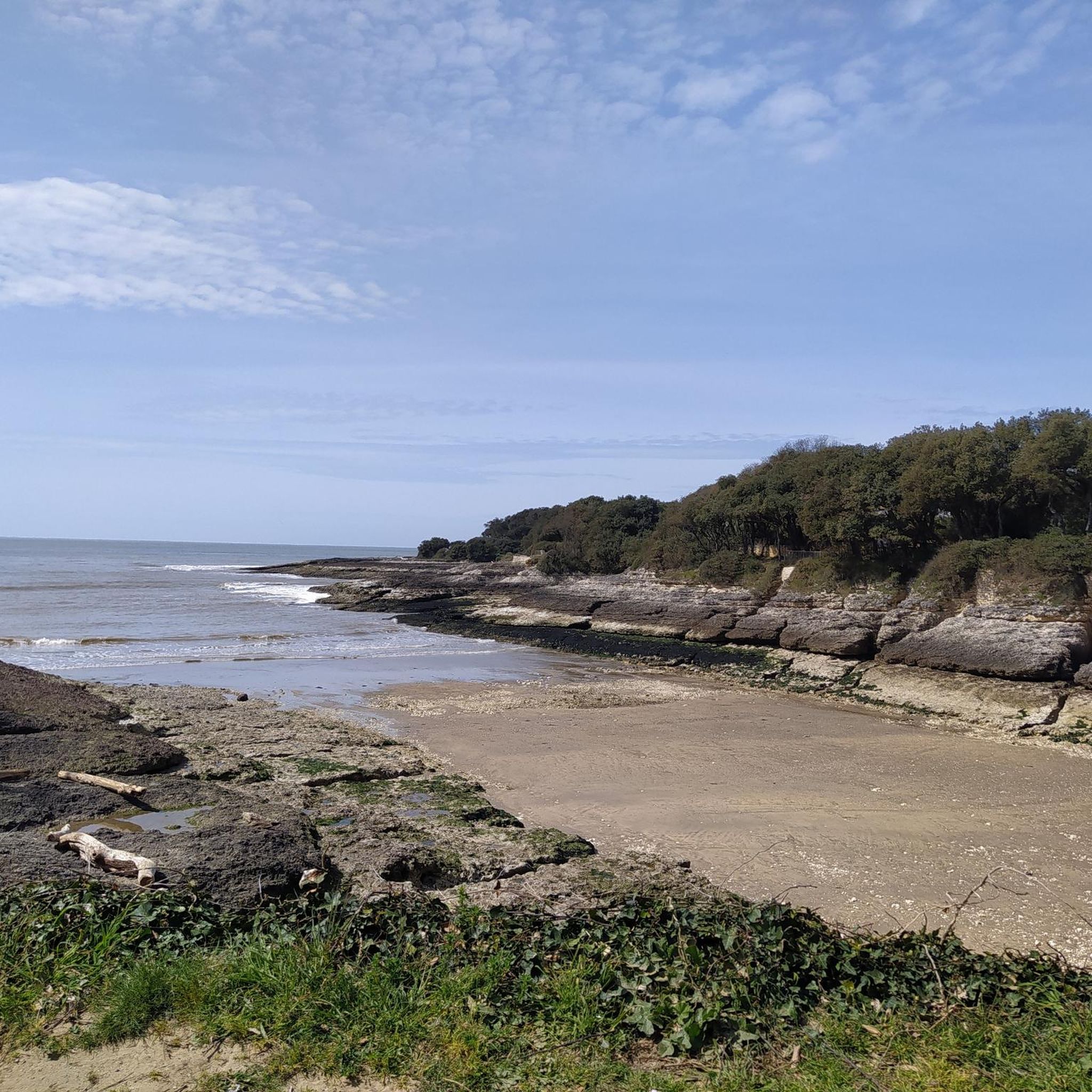
📍 Introducing the Gilet Cove The Gilet Cove is a small, natural beach on the oceanfront, located on Boulevard de la Conche de Gilet / Boulevard de la Falaise, in the town of Vaux-sur-Mer, just before Royan. 🌿 It's a sheltered, rocky cove, appreciated for its tranquility and more intimate setting compared to the larger urban beaches nearby. 🏖️ At high tide, the sea can completely cover this small beach, making the space very limited; at low tide, you can enjoy a patch of sand and rocks for relaxing or swimming. 🧭 Features & Tips 📍 Type of place: small, unsupervised beach, nestled among the rocks with sand and cliffs. 🏖️ Tides: access is best at low tide — at high tide the beach can disappear underwater. 🐶 Animals: prohibited from April 1st to September 30th (subject to municipal regulations). 👣 Access: via stairs from the boulevard above, surrounded by villas with sea views. 🚫 Lifeguard services: no lifeguard station or marked services. 📍 Location La Conche de Gilet is often considered the last small beach in Vaux-sur-Mer before reaching Royan/Pontaillac when following the coastline from Saint-Palais-sur-Mer.
0
0
Frequently Asked Questions
How many touring cycling routes are available around Vaux-sur-Mer?
There are 17 touring cycling routes around Vaux-sur-Mer, offering a variety of experiences. These include 8 easy routes perfect for a relaxed ride and 9 moderate routes for those seeking a bit more challenge.
What kind of terrain can I expect on touring cycling routes in Vaux-sur-Mer?
The terrain around Vaux-sur-Mer is quite diverse, featuring limestone cliffs, sandy beaches, and areas of woods and marshland. You'll cycle along scenic coastlines adorned with maritime pines and holm oaks, with green cliffs providing a picturesque backdrop. Many routes offer stunning views of the Gironde estuary, the largest estuary in Europe.
Are there easy touring cycling routes suitable for beginners or families in Vaux-sur-Mer?
Yes, Vaux-sur-Mer is well-suited for family-friendly cycling. There are 8 easy routes, many of which are on dedicated cycle paths or greenways, ensuring a safe and traffic-free experience. For example, the Chay Beach – Carrelets de Royan loop from Vaux-sur-Mer is an easy 12.5 km path featuring coastal scenery, and the Concié Beach and Carrelets – Auture Well loop from Vaux-sur-Mer is another easy option leading through coastal areas.
Are there any longer touring cycling routes for more experienced cyclists?
For those looking for a longer ride, the Gironde Ferry to Royan – Dune landscape and EV1 loop from Vaux-sur-Mer is a moderate 41.7 km route that takes approximately 2 hours and 8 minutes to complete. This route offers expansive views of the Gironde estuary and dune landscapes, and includes a section of the Vélodyssée.
What natural features or landmarks can I see along the touring cycling routes?
Cycling routes in Vaux-sur-Mer often pass by stunning natural features and landmarks. You can expect to see the impressive Gironde estuary, limestone cliffs, and beautiful sandy beaches like Chay Beach and Saint-Georges-de-Didonne Beach. The Suzac Forest and the Bois des Fées offer wooded sections, while viewpoints like the View of the estuary and white cliffs at Parc de l'Estuaire provide panoramic vistas.
Are there any circular touring cycling routes in the area?
Yes, many of the touring cycling routes around Vaux-sur-Mer are designed as loops, allowing you to start and finish in the same location. Examples include the Chay Beach – Carrelets de Royan loop from Vaux-sur-Mer and the Terre-Nègre Lighthouse – Gravel Climb loop from Vaux-sur-Mer, which offers a moderate challenge.
What is the best time of year to go touring cycling in Vaux-sur-Mer?
Vaux-sur-Mer is an excellent destination for touring cycling from spring through autumn. The mild coastal climate makes for pleasant riding conditions, especially when enjoying the extensive network of cycle paths and greenways. Summer offers warm weather perfect for combining cycling with beach visits, while spring and autumn provide cooler temperatures and beautiful scenery.
What do other touring cyclists enjoy most about cycling in Vaux-sur-Mer?
The touring cycling routes in Vaux-sur-Mer are highly rated by the komoot community, with an average score of 4.3 stars from over 495 reviews. Cyclists frequently praise the diverse natural landscape, the stunning coastal views, and the well-maintained cycle paths that make exploring the region a joy. The mix of easy and moderate routes also caters to a wide range of abilities.
Is public transport available to access the cycling routes in Vaux-sur-Mer?
Vaux-sur-Mer is well-integrated into the local transport network. While specific details on bike-friendly public transport directly to trailheads might vary, the town itself is accessible, and many routes start directly from Vaux-sur-Mer. The Vélodyssée, which passes through the commune, is a major cycling route, and public transport options in the wider Royan area often cater to cyclists.
Are there any cafes or restaurants along the cycling paths in Vaux-sur-Mer?
Given Vaux-sur-Mer's popularity as a tourist destination, you'll find various cafes, restaurants, and accommodations within the town and along the coast. Many cycling routes pass through or near populated areas and beaches, providing opportunities for refreshment stops. The beaches, such as Nauzan, often have facilities available, especially during the summer season.
Are there any specific permits required for cycling on trails in Vaux-sur-Mer?
Generally, no specific permits are required for touring cycling on the designated cycle paths and greenways around Vaux-sur-Mer. The region is very welcoming to cyclists, with an extensive network of public paths designed for recreational use. Always respect local signage and regulations, especially in protected natural areas like the Bois des Fées.
Can I cycle with my dog on the routes in Vaux-sur-Mer?
While many outdoor areas in France are dog-friendly, it's always best to check specific regulations for each route or natural park. On general cycle paths and greenways, dogs on a leash are often permitted. However, some protected natural areas or beaches might have restrictions. It's advisable to keep your dog on a leash and ensure they are comfortable with the distance and terrain.
Most popular routes around Vaux-Sur-Mer
Most popular attractions around Vaux-Sur-Mer

Get inspired with the komoot mobile app


Explore more
Browse the best Cycling routes in other regions.
