The best running trails around Dambenois
4.4
(155)
6,117
runners
372
runs
Jogging around Dambenois offers diverse routes through natural landscapes and accessible trails. The region features a mix of canal towpaths, tranquil forests, and open countryside, providing varied terrain for runners. Key natural features include the Étang du Pâquis and Gravière de Dambenois, which offer scenic loop runs, often with mostly paved surfaces. The Savoureuse Valley Nature Reserve also provides a natural environment for running, with routes catering to different fitness levels.
Best jogging routes around Dambenois
- The most popular jogging…
Last updated: November 4, 2026
4.3
(16)
191
runners
Easy run. Mostly paved surfaces.
5.0
(1)
28
runners
9.74km
01:00
20m
20m
Moderate run. Good fitness required. Mostly paved surfaces.

18
runners
10.4km
01:05
60m
60m
Moderate run. Good fitness required. Mostly paved surfaces.
12
runners
14.8km
01:33
100m
100m
Moderate run. Good fitness required. Mostly paved surfaces.
10
runners
7.17km
00:45
10m
20m
Moderate run. Good fitness required. Mostly paved surfaces.
Get access to more routes and recommendations from other explorers.
Already have an account?
Our route recommendations are based on thousands of hikes, rides, and runs completed by other people on komoot.
Start today with a free account
Your next adventure awaits.

Tips from the Community

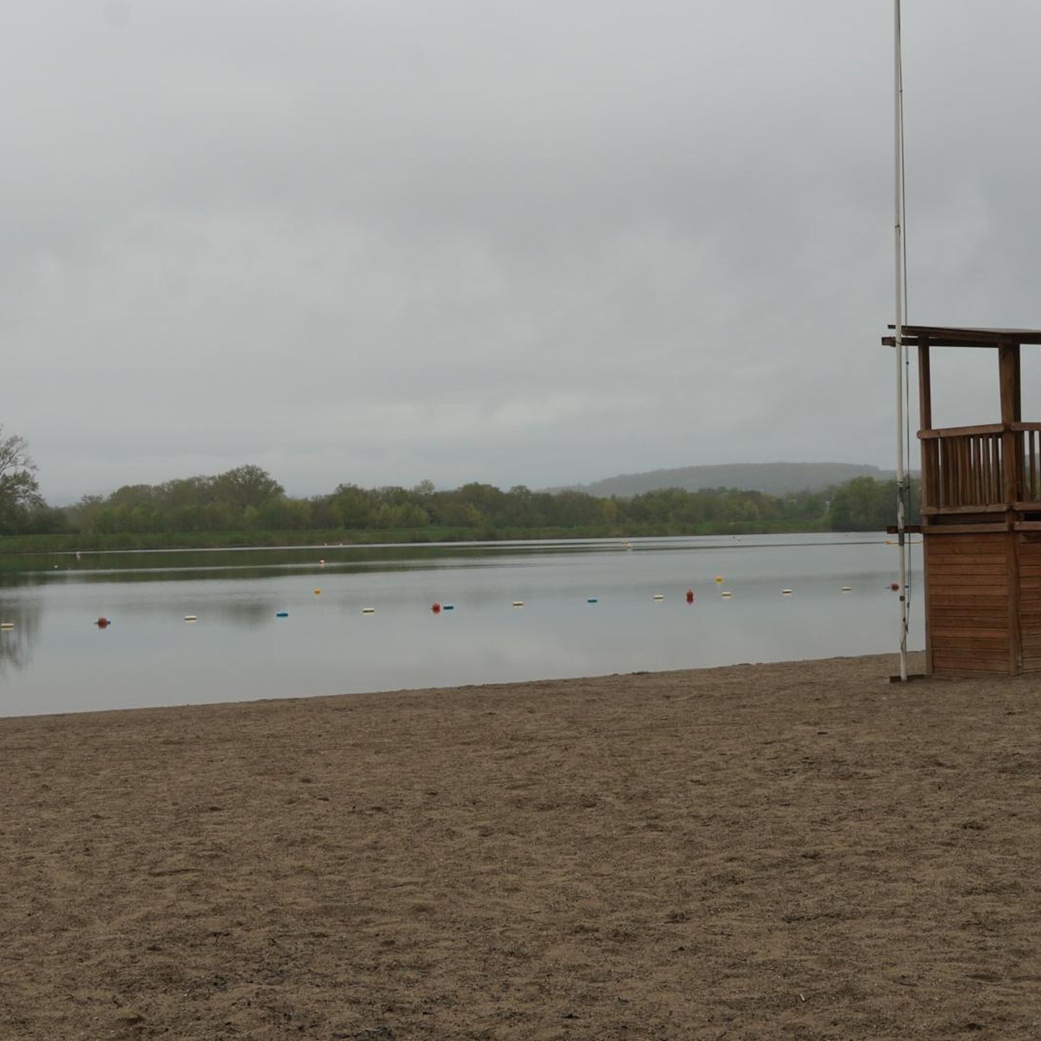
The Base de loisirs du Pays de Montbéliard is a beautiful starting point for a relaxed tour by bike or on foot. The extensive facility is located near Brognard and offers nature-oriented paths around several lakes, which are particularly suitable for leisurely hikes, bike rides, and mountain bike tours.
0
0

A beautiful green paradise between the highway and the city. The birdsong even drowns out the highway noise.
0
0

Nestled between the city and the highway, the lake landscape offers sporting activities, both on water and on land. Whether swimming, cycling, hiking, or simply strolling along the shores and enjoying nature, there's something for everyone.
2
0
A beautiful strip of nature with waters and wet meadows, between the motorway and the city, for relaxation and enjoyment of nature.
3
0

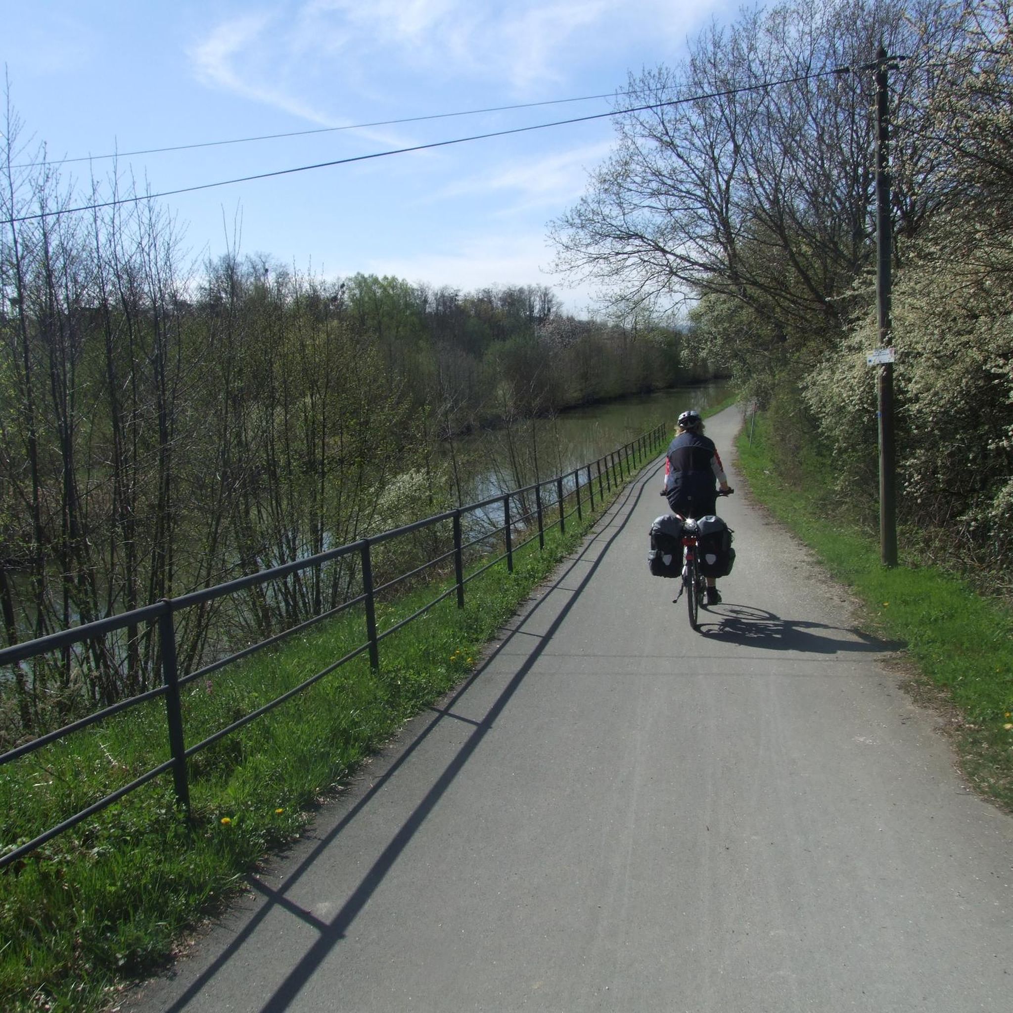
A "chemin de halage", in German "treidelpfad", which runs alongside the waterway right next to the bed of the river or canal, was an indispensable part of the transport infrastructure in earlier times. Before ships could move using motor power, horses ran along the bank and pulled the ship against the current. This was called "treideln", and this is how the "treidelpfads" got their name, which has been passed down to this day. Where these paths directly on the bank have been preserved, they are often used by hikers and cyclists.
0
1

Beautiful scenery and nice cycle path.
0
0
Beautiful cycle path along the canal, very pleasant cycling, even if the asphalt is a bit old.
0
0

Very nice and quiet place.
0
0
Frequently Asked Questions
What types of running trails can I expect around Dambenois?
The Dambenois area offers a diverse range of running trails. You'll find accessible canal towpaths, tranquil forest paths, and routes through the Savoureuse Valley Nature Reserve. These paths provide varied terrain, from flat, scenic routes along the Montbéliard–Haute-Saône Canal to more natural environments within the forests and countryside.
Are there many jogging routes available in the Dambenois region?
Yes, the Dambenois region boasts a substantial network for runners. There are over 370 jogging routes available, catering to various fitness levels and preferences.
What are some easy running options for beginners or a relaxed jog?
For an easy and relaxed run, consider routes like the Étang du Pâquis loop. This 3.0-mile (4.8 km) trail circles the Étang du Pâquis within the nature reserve and is generally completed in about 30 minutes. Another easy option is the Running loop from Brognard, which is about 3.7 km long.
Are there any circular running routes in Dambenois?
Absolutely. Many of the routes in Dambenois are designed as loops, offering convenient circular runs. Popular options include the Étang du Pâquis loop and the Gravière de Dambenois loop from Brognard, which is about 5.0 miles (8.0 km) long.
What natural features or landmarks can I see while running in Dambenois?
Jogging in Dambenois allows you to experience several natural and historical points of interest. You can run alongside the Montbéliard–Haute-Saône Canal, explore the Étang du Pâquis and the Gravière de Dambenois, or pass by the Étupes Lock on the EV6. The region also features pretty countryside and forest landscapes, such as the Bois de la Duchesse.
What do other runners say about the trails in Dambenois?
The running routes in Dambenois are highly regarded by the komoot community, with an impressive average rating of 4.6 stars from over 130 reviews. Runners often praise the varied terrain, the scenic canal towpaths, and the tranquil atmosphere of the forest paths and nature reserves.
Are there any longer or more challenging running routes for experienced runners?
Yes, for those seeking a more moderate challenge, routes like the Étang du Pâquis – Gravière de Dambenois loop from Dambenois offer a longer distance of 6.0 miles (9.6 km) with some elevation changes, providing varied scenery and a good workout.
Is Dambenois a good place for family-friendly running or walking?
Dambenois is well-suited for family outings. The flat and accessible canal towpaths, such as those along the Montbéliard–Haute-Saône Canal, are ideal for families with children. Many of the easy loops, like those around the Étang du Pâquis, also offer a pleasant and safe environment for family-friendly activities.
Can I bring my dog on the running trails in Dambenois?
While specific regulations for every trail can vary, generally, the natural landscapes and open spaces around Dambenois, including forest paths and canal towpaths, are welcoming for dogs. It's always recommended to keep your dog on a leash and clean up after them to ensure a pleasant experience for everyone.
What is the best time of year to go jogging in Dambenois?
The diverse landscapes of Dambenois make it suitable for jogging throughout much of the year. Spring and autumn offer pleasant temperatures and beautiful scenery with changing foliage. Summer is also enjoyable, especially on shaded forest paths or along the canal. Winter running is possible, though conditions may vary.
Are there any historical sites or cities nearby that I can visit after a run?
Yes, Dambenois's location provides easy access to several historical sites. You can visit the impressive Citadel of Belfort and see the iconic Lion of Belfort, or explore the significant castle in the nearby city of Montbéliard. These make for interesting cultural stops post-jogging.
Most popular attractions around Dambenois

Get inspired with the komoot mobile app


Explore more
Browse the best Running Trails & Routes in other regions.
