The best running trails around Saint-Cirgues-De-Jordanne
4.7
(88)
2,049
runners
134
runs
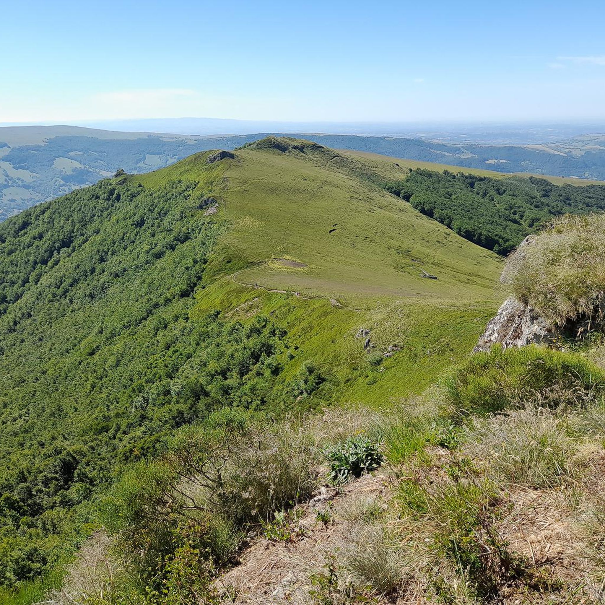
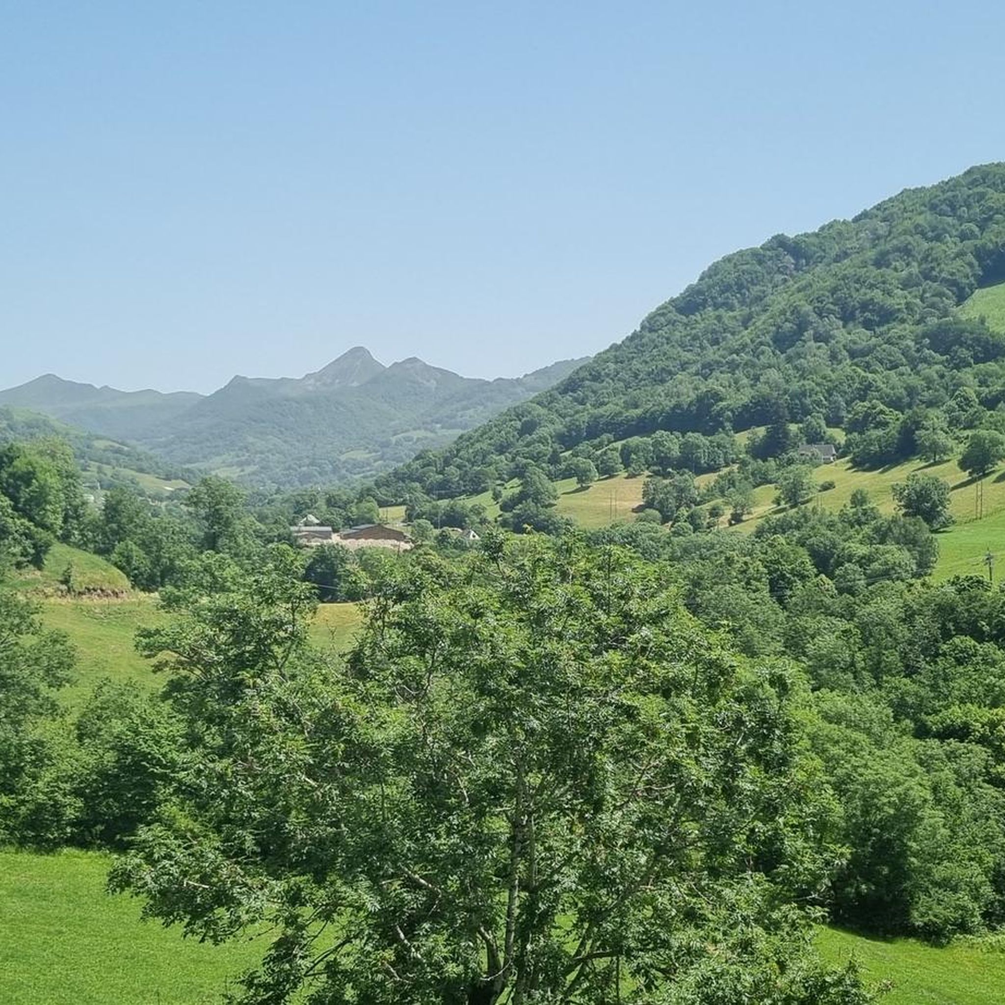
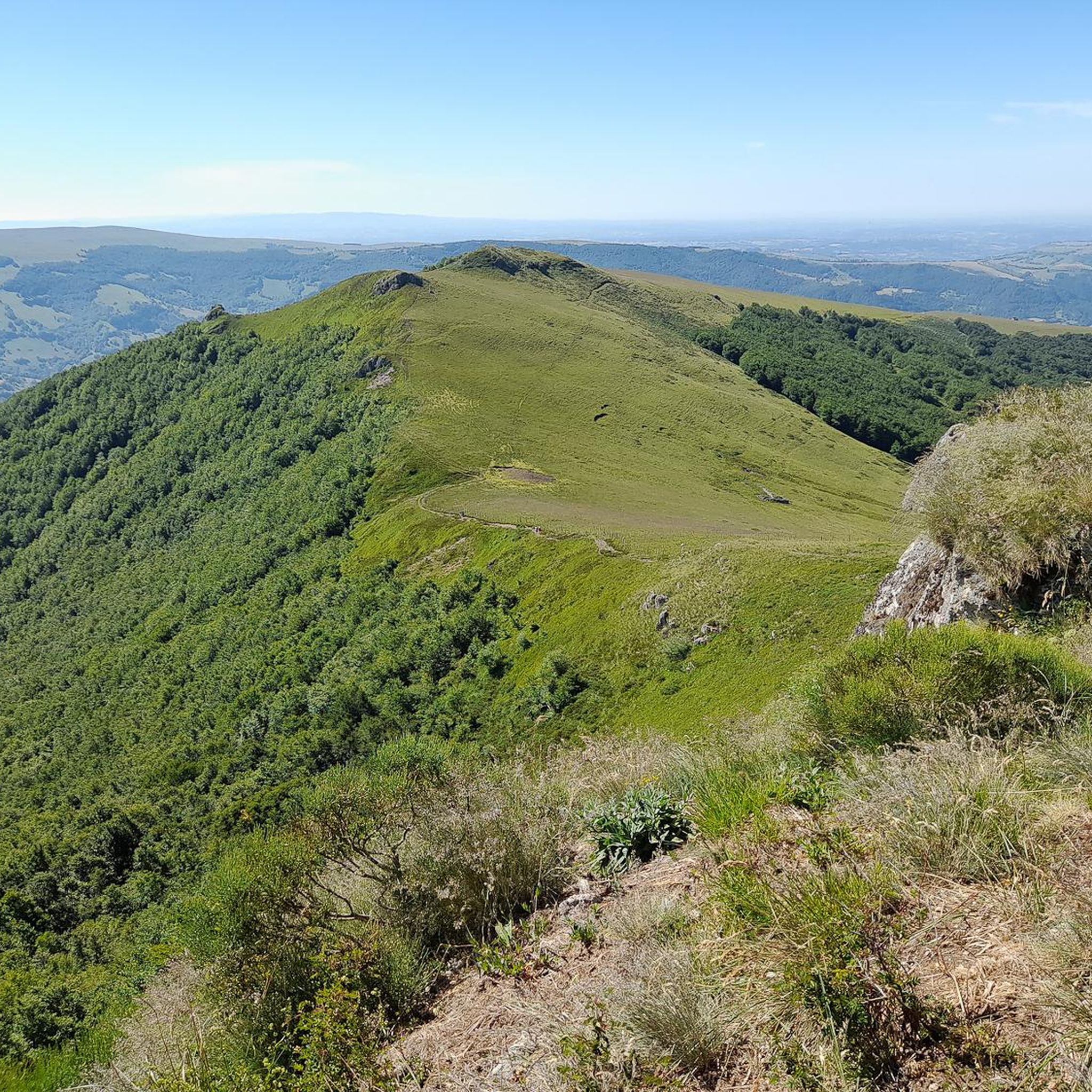
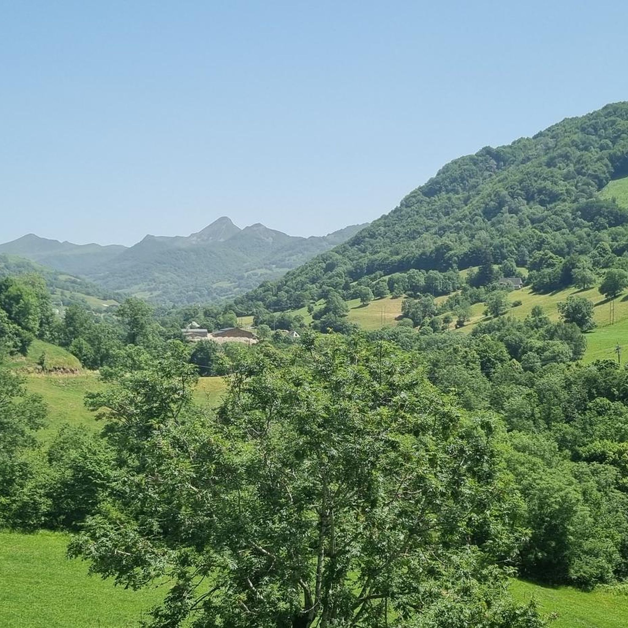
Jogging routes around Saint-Cirgues-De-Jordanne traverse a landscape shaped by its volcanic origins in the Cantal mountains, offering varied terrain for runners. The region features dramatic gorges, such as the Gorges de la Jordanne, and significant peaks like Puy Mary and Puy Chavaroche. Runners can explore a mix of shaded forests, open pastures, and trails with notable elevation changes. This diverse environment provides a range of running experiences from challenging mountain paths to more accessible routes.
Best jogging routes around Saint-Cirgues-De-Jordanne
…Last updated: May 18, 2026
21
runners
16.6km
02:25
690m
690m
This difficult 10.3-mile jogging trail offers panoramic views of the Cantal mountains and Puy Mary, passing Puy Chavaroche and Buron de Cabr
4.7
(3)
45
runners
8.49km
01:03
240m
240m
Moderate run. Good fitness required. Mostly paved surfaces. Suitable for all skill levels.

Sign up for free
11
runners
13.5km
02:06
760m
760m
Hard run. Very good fitness required. Sure-footedness, sturdy shoes and alpine experience required.
5.0
(1)
13
runners
7.97km
00:56
70m
70m
Hard run. Good fitness required. Sure-footedness, sturdy shoes and alpine experience required.
5.0
(4)
11
runners
6.41km
00:41
60m
60m
Moderate run. Good fitness required. Mostly paved surfaces. Suitable for all skill levels.
Get access to more routes and recommendations from other explorers.
Sign up for free
Already have an account?
Our route recommendations are based on thousands of hikes, rides, and runs completed by other people on komoot.
Start today with a free account
Your next adventure awaits.
Login or Signup

Tips from the Community

A magnificent site where the panoramas are breathtaking!!!
0
0

Small entrance fee (2024): Adult 4.00 EUR Child 1.50 EUR Set price group adults 3.50 EUR Set price group children 1.00 EUR
0
0

nice climb and good visibility over the valley
0
0

The Jordanne Valley is a lush green valley that was formed as a glacial valley of the Puy Mary. A path through the dense greenery runs through the Jordanne Gorge, stretching for more than 3 km between the communities of Saint-Julien and Saint-Cirgues. A path with small footbridges and bridges allows visitors to discover this beautiful place and takes them deep into the gorge. There is a fee to enter.
1
0

Located in the heart of the Jordanne valley, Lac des Graves displays an exceptional and preserved setting. It's an ideal place for a walk or nap by the water!
0
0

The cairn was originally nicknamed the nickname bonhomme due to its shape seen from afar. But since the man it is well deformed
0
0

The Redondet pass, between the Jordanne and Mars valleys (Falgoux circus), offers magnificent views of the latter.
0
0
Unlike the Burons, which also served as a living space for cowherds and cheese dairies, the Béledat du Cassaïre (at an altitude of 1600m on the GR400) was only used to shelter sick animals and the herd during bad weather. A buron located a few dozen meters away therefore fulfilled its function for the cowherd. Part of the pastoral heritage and dating from the 18th century, it has recently been restored.
0
0
Frequently Asked Questions
How many running routes are available around Saint-Cirgues-De-Jordanne?
There are over 120 jogging routes available around Saint-Cirgues-De-Jordanne, offering a wide range of options for different skill levels and preferences. You'll find everything from easy strolls to challenging mountain ascents.
What makes the running experience in Saint-Cirgues-De-Jordanne unique?
The region's unique volcanic origins in the Cantal mountains provide a dramatic and varied landscape for runners. You can expect to jog through impressive features like the Gorges de la Jordanne, past significant peaks such as Puy Mary and Puy Chavaroche, and across a mix of shaded forests and open pastures.
What do other runners say about the trails in Saint-Cirgues-De-Jordanne?
The jogging routes in Saint-Cirgues-De-Jordanne are highly rated by the komoot community, with an average score of 4.8 stars from over 60 reviews. Runners often praise the diverse terrain, the stunning volcanic scenery, and the well-maintained paths that offer a rewarding outdoor experience.
Are there running routes suitable for beginners or those looking for an easy jog?
Yes, Saint-Cirgues-De-Jordanne offers several routes suitable for beginners or those seeking an easier run. While many trails involve elevation, there are at least 3 easy routes and 30 moderate routes available, providing gentler options to enjoy the scenery.
Can I find challenging trail running options with significant elevation gain?
Absolutely. For experienced trail runners seeking a challenge, Saint-Cirgues-De-Jordanne boasts over 90 difficult routes. A prime example is the Col de Légal to Puy Chavaroche Trail, a 16.6 km route with significant elevation gain and expansive views of the volcanic landscape.
What kind of terrain can I expect on the jogging paths?
The terrain varies significantly, reflecting the region's volcanic nature. You'll encounter mountain paths with inclines and declines, shaded forest trails, and open alpine pastures. Some routes, like those through the Gorges de la Jordanne, feature unique geological formations and footbridges.
Are there any routes that pass through the Gorges de la Jordanne?
Yes, the impressive Gorges de la Jordanne are a highlight of the region. You can explore them on routes such as the Jordanne gorges – Lake des Graves loop from Lascelle, a 17.5 km trail that takes you through this natural wonder. The gorges feature passages up to 60 meters deep, with bridges and footbridges adding an adventurous element.
What natural landmarks or viewpoints can I see while running?
Many routes offer stunning views and pass by notable landmarks. You can spot peaks like Puy Mary Summit and Puy Chavaroche. The region is also home to the beautiful Cascade de Faillitoux, a waterfall descending forty meters over basaltic organs, which can be incorporated into longer runs.
Are there any circular jogging routes available?
Yes, many of the jogging routes around Saint-Cirgues-De-Jordanne are circular, allowing you to start and finish at the same point. For example, the Lake des Graves loop from Lascelle is a moderate 8.5 km circular path offering scenic views.
Are the jogging trails in Saint-Cirgues-De-Jordanne dog-friendly?
While many natural areas in France welcome dogs, it's always best to check specific trail regulations, especially within protected natural parks or reserves. Generally, dogs are permitted on trails if kept on a leash, but some areas might have restrictions during certain seasons or in sensitive wildlife habitats. Always ensure your dog is well-behaved and that you clean up after them.
Are there family-friendly jogging paths suitable for children?
Yes, there are paths that are more accessible and suitable for families. While the Gorges de la Jordanne discovery trail is a popular option, it's important to note that parts can be adventurous with footbridges. Look for routes designated as 'easy' or 'moderate' on komoot, which typically have less challenging terrain and elevation, making them more enjoyable for families.
What is the best time of year for jogging in Saint-Cirgues-De-Jordanne?
The best time for jogging is generally from spring to autumn (May to October) when the weather is milder and trails are most accessible. Summer offers lush landscapes, but can be warm. Autumn provides beautiful foliage. Winter jogging is possible but requires appropriate gear due to snow and colder temperatures, especially at higher elevations like Puy Mary.
Is parking available near the trailheads?
Yes, parking is generally available near popular trailheads and points of interest. For instance, the Gorges de la Jordanne typically has dedicated parking facilities. It's advisable to check specific route details on komoot for parking information related to your chosen running path.
Can I reach the jogging trails using public transport?
Public transport options directly to all trailheads in the mountainous Cantal region can be limited. While Saint-Cirgues-De-Jordanne itself may have some local bus services, reaching more remote trail starting points often requires a car. It's recommended to check local transport schedules in advance if you plan to rely on public transport.
Most popular routes around Saint-Cirgues-De-Jordanne
Most popular attractions around Saint-Cirgues-De-Jordanne

Get inspired with the komoot mobile app


Explore more
Browse the best Running Trails & Routes in other regions.
