The best road cycling routes around La Salle
4.4
(76)
1,294
riders
107
rides
Road cycling routes around La Salle traverse a landscape characterized by rolling hills, dense forests, and river valleys. The region features numerous passes and climbs, offering varied elevation profiles suitable for different skill levels. Roads are generally well-maintained, winding through natural areas and past small villages. This provides a diverse environment for road cyclists seeking both challenging ascents and scenic valley rides.
Best road cycling routes around La Salle
- The most popular road cycling route is Rabodeau Valley – Prayé…
Last updated: May 24, 2026
4.6
(14)
146
riders
78.4km
03:37
770m
770m
Moderate road ride. Good fitness required. Some segments of this route may be unpaved and difficult to ride.
2.9
(14)
70
riders
58.4km
02:37
610m
610m
Moderate road ride. Good fitness required. Mostly well-paved surfaces and easy to ride.

Sign up for free
5.0
(1)
38
riders
54.8km
02:28
530m
530m
Moderate road ride. Good fitness required. Mostly well-paved surfaces and easy to ride.
4.8
(4)
30
riders
53.9km
02:32
600m
590m
Moderate road ride. Good fitness required. Mostly well-paved surfaces and easy to ride.
4.3
(3)
26
riders
58.4km
02:47
730m
730m
Moderate road ride. Good fitness required. Mostly well-paved surfaces and easy to ride.
Get access to more routes and recommendations from other explorers.
Sign up for free
Already have an account?
Our route recommendations are based on thousands of hikes, rides, and runs completed by other people on komoot.
Start today with a free account
Your next adventure awaits.
Login or Signup



Tips from the Community

Beautiful road in the middle of the forest. Quite little traffic on the weekend.
0
0
Beautiful route, pleasant but lots of bikers...
0
0

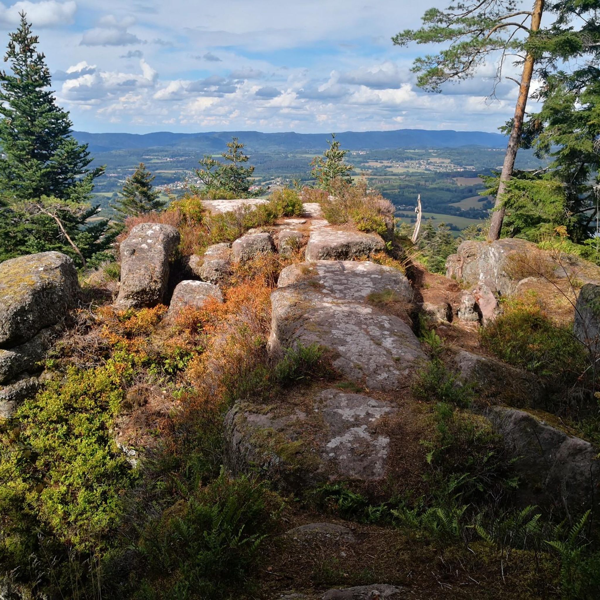
yes up there you have a good view
1
0

Beautiful hiking destination, there is also a cycling route
0
0

A long and beautiful forest road. However, it's bumpy in places on a road bike!
0
0

Beautiful climb and lovely view at the pass - Altitude 728m Restaurants (inns) at the pass
0
0

Lac de la Plaine is a picturesque lake in the Vosges, located near Celles-sur-Plaine, near the larger Lac de Pierre-Percée. The lake is an artificial water reservoir of about 0.5 million m³ and serves as a supply basin for the reservoir above.
1
0

As in Germany, most fountains are merely decorative and labeled "Water not suitable for drinking." It's therefore all the more pleasant to find a fountain here that even explicitly says "drinking water." One of the few fountains in the area has drinking water.
0
0
Frequently Asked Questions
What kind of terrain can I expect on road cycling routes around La Salle?
Road cycling routes around La Salle are characterized by rolling hills, dense forests, and river valleys. You'll encounter numerous passes and climbs, offering varied elevation profiles. The roads are generally well-maintained, winding through natural areas and past small villages, providing a diverse environment for both challenging ascents and scenic valley rides.
How many road cycling routes are available in the La Salle region?
There are over 110 road cycling routes available in the La Salle region, catering to various skill levels. This includes 22 easy routes, 67 moderate routes, and 22 difficult routes, ensuring options for every cyclist.
Are there any routes suitable for beginners or those looking for an easier ride?
Yes, the La Salle region offers 22 easy road cycling routes. While specific beginner routes aren't detailed, these easier options generally feature less elevation gain and shorter distances, making them ideal for those new to road cycling or seeking a more relaxed experience.
What are some challenging road cycling routes for experienced riders?
For experienced riders seeking a challenge, consider routes with significant elevation gain. The region features 22 difficult routes. An example is the Rabodeau Valley – Prayé Forest Road loop from St-Michel-sur-Meurthe, which covers 48.7 miles (78.4 km) with substantial climbing through forested valleys and over passes.
What are the typical distances and durations for road cycling routes in La Salle?
Routes vary significantly in distance and duration. For example, the Fave Valley – Saint-Dié Cathedral loop from St-Michel-sur-Meurthe is a moderate 36.3 miles (58.4 km) path, while the Chipotte Pass – Abbaye Notre-Dame d'Autrey loop from Housseras is 34.1 miles (54.8 km) and typically takes about 2 hours 28 minutes.
What kind of landmarks or attractions can I see along the road cycling routes?
Along the routes, you can discover various points of interest. Notable landmarks include the historic Saint-Dié Cathedral, the ancient La Bure Celtic Camp, and the scenic The Calling Stone viewpoint. The region also features natural monuments like the La Roche Saint-Martin and View of Saint-Dié.
What do other road cyclists say about the routes in La Salle?
The road cycling routes in La Salle are highly rated by the komoot community, with an average score of 4.4 stars from over 70 reviews. Cyclists often praise the diverse terrain, from challenging passes to scenic valley rides, and the well-maintained roads that wind through natural areas and charming villages.
Are there any loop routes available for road cycling?
Yes, many routes in the La Salle region are designed as loops, allowing you to start and finish in the same location. Examples include the Climb of Haut du Bois – Chipotte Pass loop from St-Michel-sur-Meurthe and the Vieux-Pré Dam – Lac de la Plaine loop from St-Michel-sur-Meurthe.
What is the best time of year to go road cycling in La Salle?
The Southern French Alps, where La Salle-les-Alpes is located, are best for road cycling during the warmer months, typically from late spring to early autumn. This avoids the snow and ice of winter, especially on higher mountain passes, and offers pleasant temperatures for riding through valleys and forests.
Is public transport available to access the road cycling routes?
While specific public transport links directly to every trailhead are not detailed, the region's focus on connecting communities suggests that some areas may be accessible by local transport. For routes starting from towns like St-Michel-sur-Meurthe or Housseras, local bus services might offer connections, though it's advisable to check schedules and bicycle transport policies in advance.
Are there options for parking near the road cycling trails?
For routes starting from towns and villages such as St-Michel-sur-Meurthe or Housseras, you can typically find public parking facilities. It's recommended to check local signage for specific parking regulations and availability, especially during peak seasons.
Most popular attractions around La Salle

Get inspired with the komoot mobile app


Explore more
Browse the best Road cycling routes in other regions.
