The best running trails around Sachseln
4.3
(27)
1,906
runners
36
runs
Jogging around Sachseln offers diverse terrain, from flat lakeside paths along Lake Sarnen to more challenging routes in the surrounding alpine foothills. The region is characterized by its pre-Alpine landscape, featuring forests, alpine meadows, and the dramatic Melchaa and Ranft Gorges. Elevation gains vary, providing options for different fitness levels, with views of the Alps and the tranquil lake.
Best jogging routes around Sachseln
- The most popular jogging route is View of Lake Sarnen – View of Lake Sarnen loop…
Last updated: October 1, 2026
4.5
(2)
786
runners
26.3km
02:52
160m
160m
Hard run. Very good fitness required. Mostly paved surfaces. Suitable for all skill levels.
4.8
(4)
211
runners
Moderate run. Good fitness required. Mostly paved surfaces. Suitable for all skill levels.

5.0
(1)
95
runners
9.33km
01:02
30m
30m
Moderate run. Good fitness required. Mostly paved surfaces. Suitable for all skill levels.
4.0
(2)
91
runners
Moderate run. Good fitness required. Mostly paved surfaces. Suitable for all skill levels.
4.0
(2)
44
runners
14.3km
01:39
40m
40m
Moderate run. Good fitness required. Mostly paved surfaces. Suitable for all skill levels.
Get access to more routes and recommendations from other explorers.
Already have an account?
Our route recommendations are based on thousands of hikes, rides, and runs completed by other people on komoot.
Start today with a free account
Your next adventure awaits.
Popular around Sachseln

Trans Swiss Trail – Hiking across Switzerland

Via Jacobi – Following the Way of St James across Switzerland

On the Tell Trail over the Big 6 of Central Switzerland
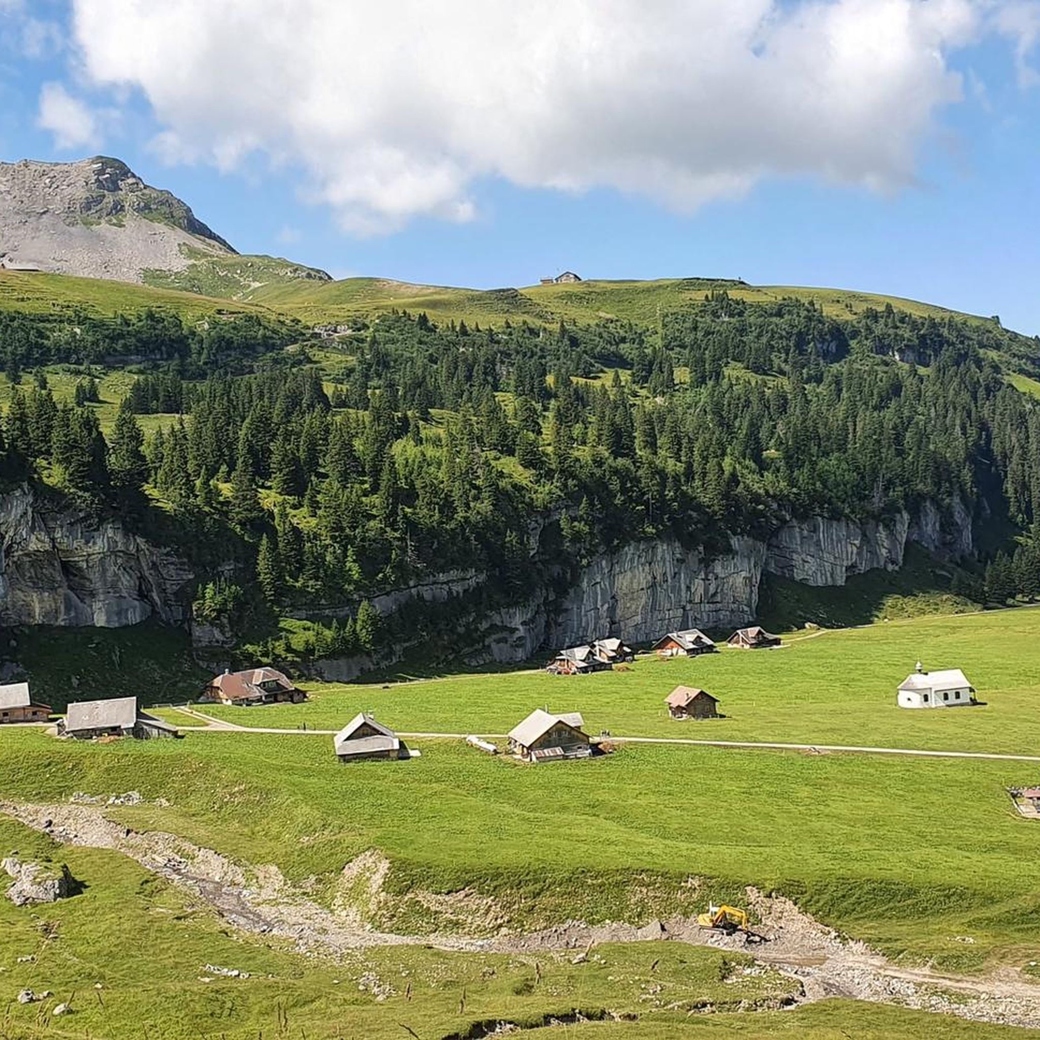
Road Cycling Routes around Sachseln
Hiking around Sachseln
MTB Trails around Sachseln
Cycling around Sachseln

Mountain Hikes around Sachseln
Gravel biking around Sachseln
Other adventures around Sachseln


Tips from the Community

Sarnersee The Sarnersee is the largest lake in the canton of Obwalden. It is located in the area of the municipalities of Sarnen, Sachseln and Giswil. The lake, which lies 469 meters above sea level, is fed by the Grosse Melchaa, the Dreiwässerkanal and the Sarner Aa, among others. The latter flows out of the lake at the northern end near Sarnen before flowing into the Alpnachersee at the valley exit. The Sarnersee is a good six kilometers long, between one and one and a half kilometers wide and thus has an area of approximately 7.5 square kilometers. Text / Source: Schweizersee.ch https://www.schweizersee.ch/sarnersee/
12
0
Sarnersee The Sarnersee is the largest lake in the canton of Obwalden. It is located in the area of the municipalities of Sarnen, Sachseln and Giswil. The lake, which lies 469 meters above sea level, is fed by the Grosse Melchaa, the Dreiwässerkanal and the Sarner Aa, among others. The latter flows out of the lake at the northern end near Sarnen before flowing into the Alpnachersee at the valley exit. The Sarnersee is a good six kilometers long, between one and one and a half kilometers wide and thus has an area of approximately 7.5 square kilometers. Text / Source: Schweizersee.ch https://www.schweizersee.ch/sarnersee/
12
0

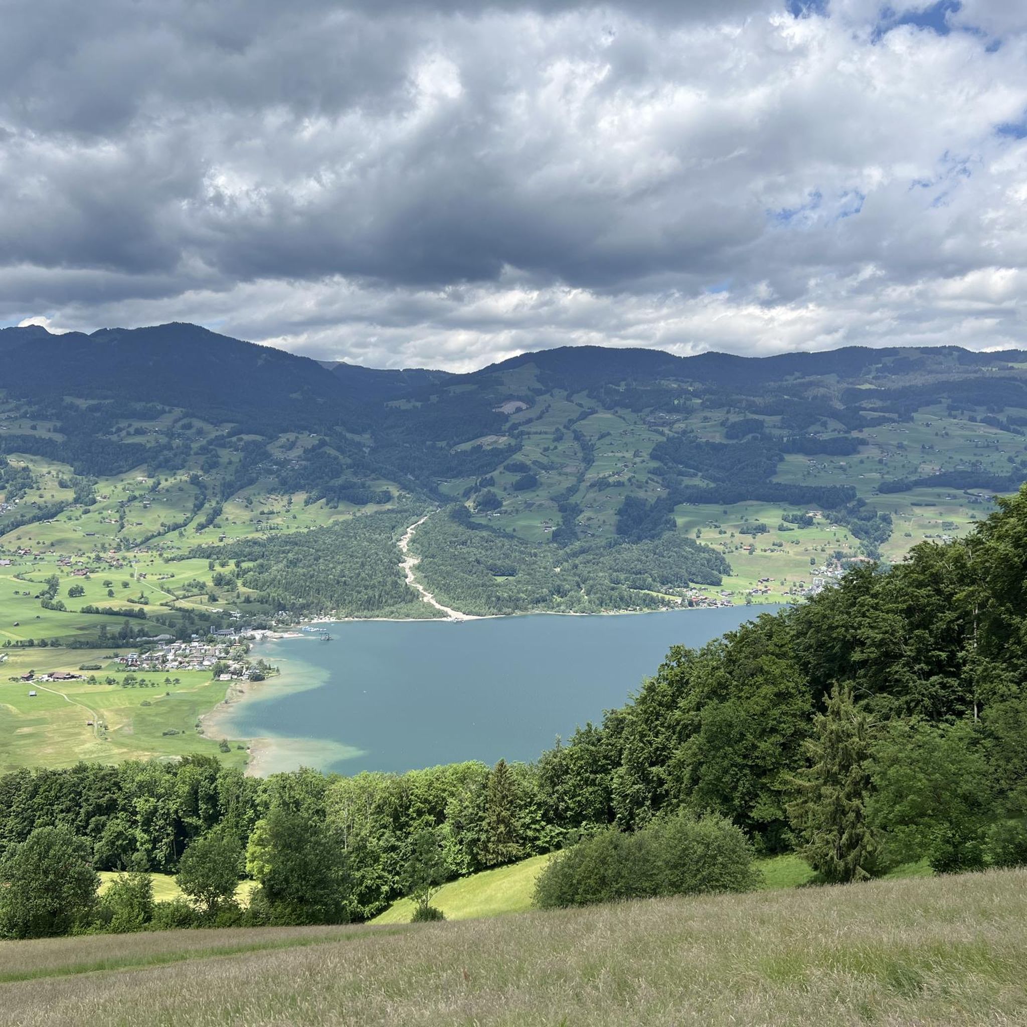
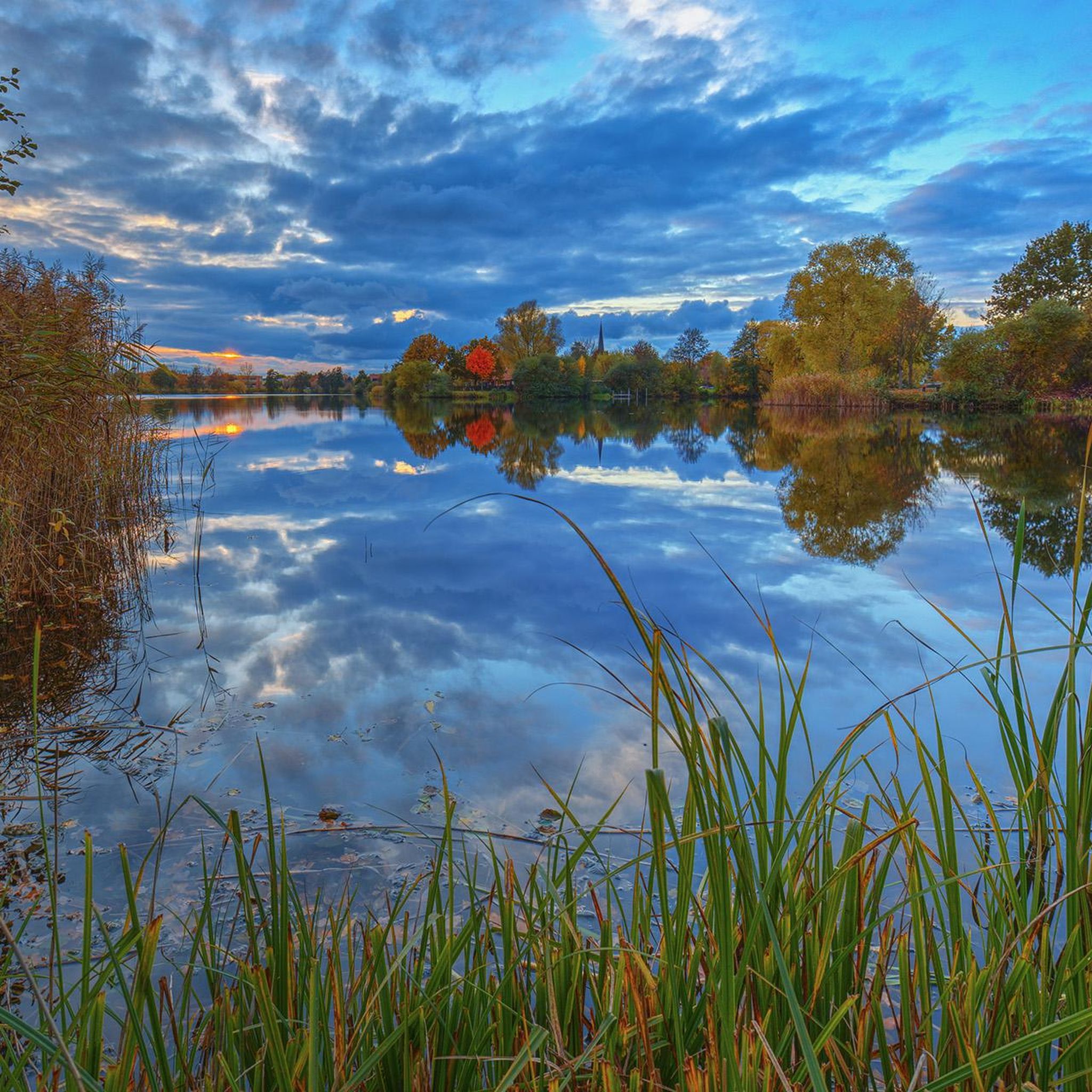
From here you can enjoy panoramic views of Lake Sarnen, framed by lush forests and rolling mountains. The peaceful blue of the lake contrasts beautifully with its green valley setting, giving you a perfect vantage point to admire the picturesque Swiss landscape.
0
0

Lake Sarnen is a lake in the heart of Oblalden
1
0
Wonderfully beautiful view of the lake
1
0
Beautiful renatured stream. It's great for cooling down after a run.
1
0


A beautifully landscaped lake. From the height it looks like a pearl with its blue-green color. There are many recreational opportunities here.
0
0
Frequently Asked Questions
How many running routes are available in Sachseln?
Sachseln offers a wide variety of running routes, with over 35 different trails available. These range from easy lakeside jogs to more challenging runs in the alpine foothills, catering to all fitness levels.
What kind of terrain can I expect on running trails around Sachseln?
The running trails in Sachseln feature diverse terrain. You'll find flat, scenic paths along the shores of Lake Sarnen, as well as routes with gentle ascents and descents through forests and alpine meadows. Some trails venture into the pre-Alpine landscape, offering more varied and challenging surfaces.
Are there running routes suitable for beginners or those looking for an easy run?
Yes, Sachseln has several easy running routes. For instance, the View of Lake Sarnen – Sarnen Lakeside Promenade loop from Sachseln is a moderate 6.9 km path with minimal elevation gain, perfect for a relaxed run along the lake.
What are the more challenging running options in Sachseln?
For those seeking a challenge, Sachseln offers routes with significant distance and elevation. The St. Antonius Church, Sarnen – Lake Sarnen loop from Ewil Maxon is a difficult 26.3 km path that circles Lake Sarnen, providing a demanding and rewarding experience.
Can I find circular running routes in Sachseln?
Many of the running routes in Sachseln are circular, allowing you to start and finish at the same point. A great example is the View of Lake Sarnen – Sarnen Lakeside Promenade loop from Ewil Maxon, a 9.9 km loop that takes you along the Sarnen Lakeside Promenade.
Are there running trails that pass by interesting landmarks or cultural sites?
Absolutely. Some routes offer a blend of natural beauty and cultural interest. For example, the St. Antonius Church, Sarnen – Lake Sarnen loop from Ewil Maxon passes by the historic St. Antonius Church. Additionally, routes connecting Sachseln to Flüeli-Ranft, the home of Brother Klaus, offer cultural insights. You can also find highlights like the Tannalp Chapel and Mountain Lodge in the wider area.
What natural features can I see while running in Sachseln?
The region is rich in natural beauty. You'll enjoy stunning views of Lake Sarnen, run through serene forests, and cross alpine meadows. The dramatic Melchaa Gorge and Ranft Gorge are also notable natural formations in the vicinity, offering unique backdrops for your run.
Are there family-friendly running trails in Sachseln?
While specific stroller-friendly routes aren't detailed, many of the easier, flatter paths along Lake Sarnen are suitable for families. These routes offer a gentle experience with beautiful scenery, perfect for a family outing.
Are dogs allowed on the running trails in Sachseln?
Generally, dogs are welcome on trails in Switzerland, but it's always recommended to keep them on a leash, especially in nature reserves, agricultural areas, or where wildlife might be present. Always be mindful of local signage.
What is the best time of year for running in Sachseln?
The spring, summer, and autumn months offer ideal conditions for running in Sachseln, with pleasant temperatures and vibrant scenery. While winter running is possible, some higher trails might be covered in snow, so lakeside paths are often the best option during colder months.
Is parking available near the trailheads in Sachseln?
Yes, parking is generally available in Sachseln and near popular trailheads, especially around Lake Sarnen. Specific parking information for individual routes can often be found on their respective komoot tour pages.
How can I access the running trails using public transport?
Sachseln is well-connected by public transport, making it easy to reach trailheads. The village has a train station, and bus services operate in the area. Many routes, particularly those around Lake Sarnen, are accessible from public transport stops.
Are there any cafes or places to eat near the running routes?
Yes, you'll find various cafes and restaurants in Sachseln and along the shores of Lake Sarnen, perfect for a refreshment before or after your run. For example, the Stanserhorn Summit Cable Car Station & Revolving Restaurant and Käserstatt Mountain Restaurant are notable options in the wider region.
What do other runners say about the trails in Sachseln?
The running routes in Sachseln are highly rated by the komoot community, with an average score of 4.3 stars from over 20 reviews. Runners often praise the continuous views of Lake Sarnen, the varied terrain, and the well-maintained paths that make for an enjoyable experience.
Most popular routes around Sachseln
Most popular attractions around Sachseln

Get inspired with the komoot mobile app


Explore more
Browse the best Running Trails & Routes in other regions.
