The best mountain hikes around Lungern
4.7
(49)
443
hikers
23
hikes
Mountaineering routes around Lungern offer access to the alpine landscapes of Obwalden, characterized by prominent peaks, high-altitude pastures, and deep valleys. The region features a mix of challenging ascents and demanding traverses, providing varied terrain for experienced mountaineers. Elevations range significantly, with routes often leading through rocky sections and open alpine meadows.
Best mountaineering routes around Lungern
- The most popular mountaineering route is Alp Breitenfeld – Turren Restaurant loop from Turren, a 7.3 miles (11.7 km) trail that takes…
Last updated: September 26, 2026
5.0
(5)
21
hikers
11.6km
04:31
700m
700m
Hard mountaineering route. Good fitness required. Sure-footedness, sturdy shoes and alpine experience required.
5.0
(2)
23
hikers
14.7km
06:27
830m
830m
Hard mountaineering route. Very good fitness required. Sure-footedness, sturdy shoes and alpine experience required.

4.0
(1)
15
hikers
8.36km
03:45
670m
670m
Hard mountaineering route. Good fitness required. Sure-footedness, sturdy shoes and alpine experience required.
4.0
(1)
8
hikers
13.0km
04:26
410m
410m
Moderate mountaineering route. Good fitness required. Mostly accessible paths. Sure-footedness required.
10
hikers
11.2km
04:24
580m
580m
Hard mountaineering route. Good fitness required. Sure-footedness, sturdy shoes and alpine experience required.
Get access to more routes and recommendations from other explorers.
Already have an account?
Our route recommendations are based on thousands of hikes, rides, and runs completed by other people on komoot.



Tips from the Community

The panoramic tower resembles a candle and, in addition to the viewing platform at a height of 32m, also houses a passenger lift that transports visitors free of charge and self-service to or from the lake shore.
0
0
The Melchsee is an alpine pearl, where the mountains are reflected in calm winds. It's just a shame that harmony was sacrificed in the planning of the local hotel industry. Nevertheless, the Melchsee remains a worthwhile hiking destination.
0
0

Pretty little open chapel.
0
0
Narrow steep gravelly section, partly very exposed (T3) defective rope securing in autumn 2026. Beautiful view of Lake Brienz.
0
0

The Berghaus Schönbüel is the perfect stop with a real postcard backdrop! 🏔️🧀 Whether for a cozy break, homemade specialties, or a cool drink: On the fantastic panoramic terrace, you can enjoy an overwhelming view of Lake Brienz and the surrounding mountains 💙☕ Pro-tip: Plan it perfectly as a stage destination or intermediate stop to recharge your batteries for the onward hike and let your soul dangle with the best view! ☀️🍰
0
0
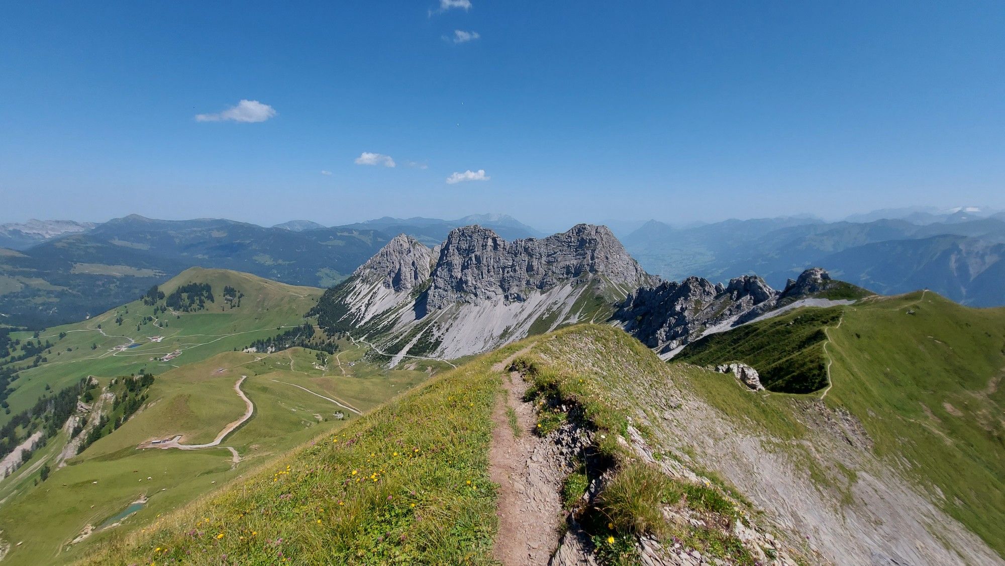
The Turrenbahn mountain station at 1,562 m is the perfect starting point for unforgettable adventures high above the turquoise-blue Lungerersee! 🚠✨ Whether you lace up your hiking boots or pack your MTB: Some of the region's most beautiful tours start from here, such as the panoramic trail up to Schönbüel or the spectacular ridge hike towards Brienzer Rothorn 🥾🚲 For the necessary refreshment, the Turren restaurant right at the station offers a brilliant sun terrace 🧀☕ Pro tip: Definitely take the first cable car in the morning – the light over the lake is magical and you'll have the paths almost to yourself! 📸🌄
1
0

Spätbüel offers magnificent views of the mountain world around Melchsee-Frutt and is a beautiful stopover on the tour. The quiet alpine landscape makes this place particularly charming – perfect for a short break before continuing.
0
0
The Blausee enchants with its crystal-clear, turquoise-blue water and the impressive mountain backdrop. A beautiful spot for a short break and a real highlight on any MTB tour around Melchsee-Frutt.
0
0
Frequently Asked Questions
How many mountaineering routes are available around Lungern?
There are over 20 mountaineering routes in the Lungern area, offering a diverse range of experiences. The majority, 16 routes, are classified as difficult, while 7 are moderate, catering primarily to experienced mountaineers.
Are there any moderate mountaineering routes suitable for those looking for a less strenuous challenge?
Yes, Lungern offers 7 moderate mountaineering routes. One such option is the Melchsee – Höfli loop from Melchsee-Frutt, which covers about 7.9 miles (12.8 km) and takes around 4 hours 20 minutes to complete, featuring manageable elevation gains.
What are some challenging mountaineering routes in the Lungern region?
For experienced mountaineers seeking a challenge, the Lungern area has 16 difficult routes. A notable option is the Glogghüs Ridge Traverse – Rothorn (Melchsee-Frutt) loop from Melchsee-Frutt, a demanding 9.3-mile (14.9 km) path featuring a challenging ridge traverse with panoramic alpine scenery.
Are there any circular mountaineering routes around Lungern?
Yes, many routes in Lungern are designed as loops. For example, the Alp Breitenfeld – Turren Restaurant loop from Turren is a popular 7.3-mile (11.7 km) difficult route that offers alpine views and leads to a mountain restaurant. Another option is the Breitenfeld Alpine Chapel – Alp Breitenfeld loop from Turren, a 5.3-mile (8.5 km) trail through alpine pastures.
What kind of views can I expect on mountaineering routes in Lungern?
Mountaineering routes around Lungern are renowned for their stunning alpine vistas. You can expect panoramic views of prominent peaks, deep valleys, and high-altitude pastures. Routes often lead through rocky sections and open alpine meadows, providing diverse scenic backdrops. The Hochstollen Summit – Abgschütz Pass loop from Melchsee-Frutt offers particularly rewarding summit views.
Are there any attractions or points of interest along the mountaineering routes?
Yes, the region around Lungern is rich in natural beauty and interesting landmarks. You might encounter highlights such as the Melchsee-Frutt lake, the historic Tannalp Chapel and Mountain Lodge, or even the impressive Brienzer Rothorn Summit on some extended tours.
Can I find routes with waterfalls or gorges nearby?
While the mountaineering routes themselves focus on higher alpine terrain, the broader Lungern region is home to spectacular natural features. The famous Giessbach Falls and the dramatic Aare Gorge are notable attractions in the vicinity, offering impressive sights if you extend your exploration beyond the immediate mountaineering trails.
What is the best season for mountaineering in Lungern?
The prime season for mountaineering in Lungern is typically from late spring through early autumn (June to September), when the alpine trails are generally free of snow and weather conditions are more stable. Always check local weather forecasts and trail conditions before heading out, as high-altitude weather can change rapidly.
Is public transport accessible for reaching mountaineering trailheads in Lungern?
Yes, Switzerland has an excellent public transport network. Many trailheads in the Lungern region, especially those near villages or mountain resorts like Melchsee-Frutt or Turren, are accessible by post bus, train, or cable car connections. It's advisable to check specific route starting points and plan your journey using local transport schedules.
What do other mountaineers say about their experience in Lungern?
The mountaineering routes in Lungern are highly regarded by the komoot community, boasting an average rating of 4.7 stars from over 40 reviews. Users frequently praise the challenging nature of the trails, the breathtaking alpine scenery, and the well-maintained paths that lead to rewarding summits and mountain restaurants.
Are there any mountaineering routes that can be completed in a half-day?
Yes, some of the shorter, more moderate routes can be completed within a half-day, depending on your fitness level. For instance, the Breitenfeld Alpine Chapel – Alp Breitenfeld loop from Turren is about 5.3 miles (8.5 km) and typically takes around 3 hours 47 minutes, making it a good option for a shorter excursion.
Most popular routes around Lungern
Most popular attractions around Lungern

Get inspired with the komoot mobile app


Explore more
Browse the best Mountain Hikes & Routes in other regions.
