The best running trails around Surpierre
4.6
(33)
1,942
runners
95
runs
Jogging routes Surpierre offer a diverse landscape for runners, situated in the Fribourg canton of Switzerland. The region features varied terrain, including broad plateau areas, Molasse hills, and a small valley carved by the Flon stream. Extensive forested sections and agricultural lands provide a mix of shaded paths and open routes, with some trails offering views towards the Broye valley.
Best jogging routes around Surpierre
- The most popular jogging route is Running loop from Nuvilly, a 4.8 miles (7.8…
Last updated: September 27, 2026
4.0
(1)
41
runners
7.79km
00:53
170m
170m
Moderate run. Good fitness required. Mostly paved surfaces. Suitable for all skill levels.
30
runners
Hard run. Very good fitness required. Mostly paved surfaces. Suitable for all skill levels.

11
runners
13.0km
01:27
80m
80m
Moderate run. Good fitness required. Mostly paved surfaces. Suitable for all skill levels.
9
runners
5.89km
00:43
160m
160m
Moderate run. Good fitness required. Mostly paved surfaces. Suitable for all skill levels.
3
runners
7.30km
00:49
150m
150m
Moderate run. Good fitness required. Mostly paved surfaces. Suitable for all skill levels.
Get access to more routes and recommendations from other explorers.
Already have an account?
Our route recommendations are based on thousands of hikes, rides, and runs completed by other people on komoot.
Start today with a free account
Your next adventure awaits.
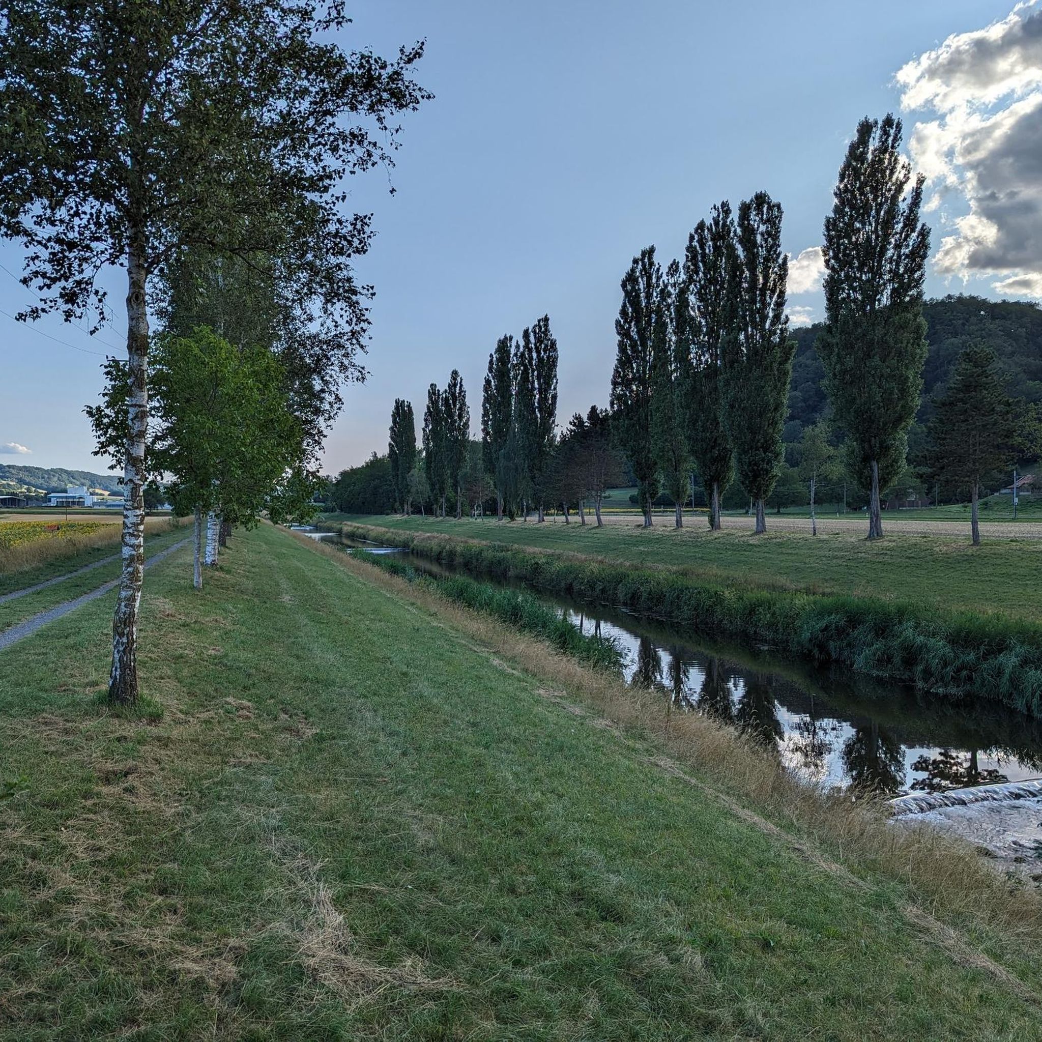
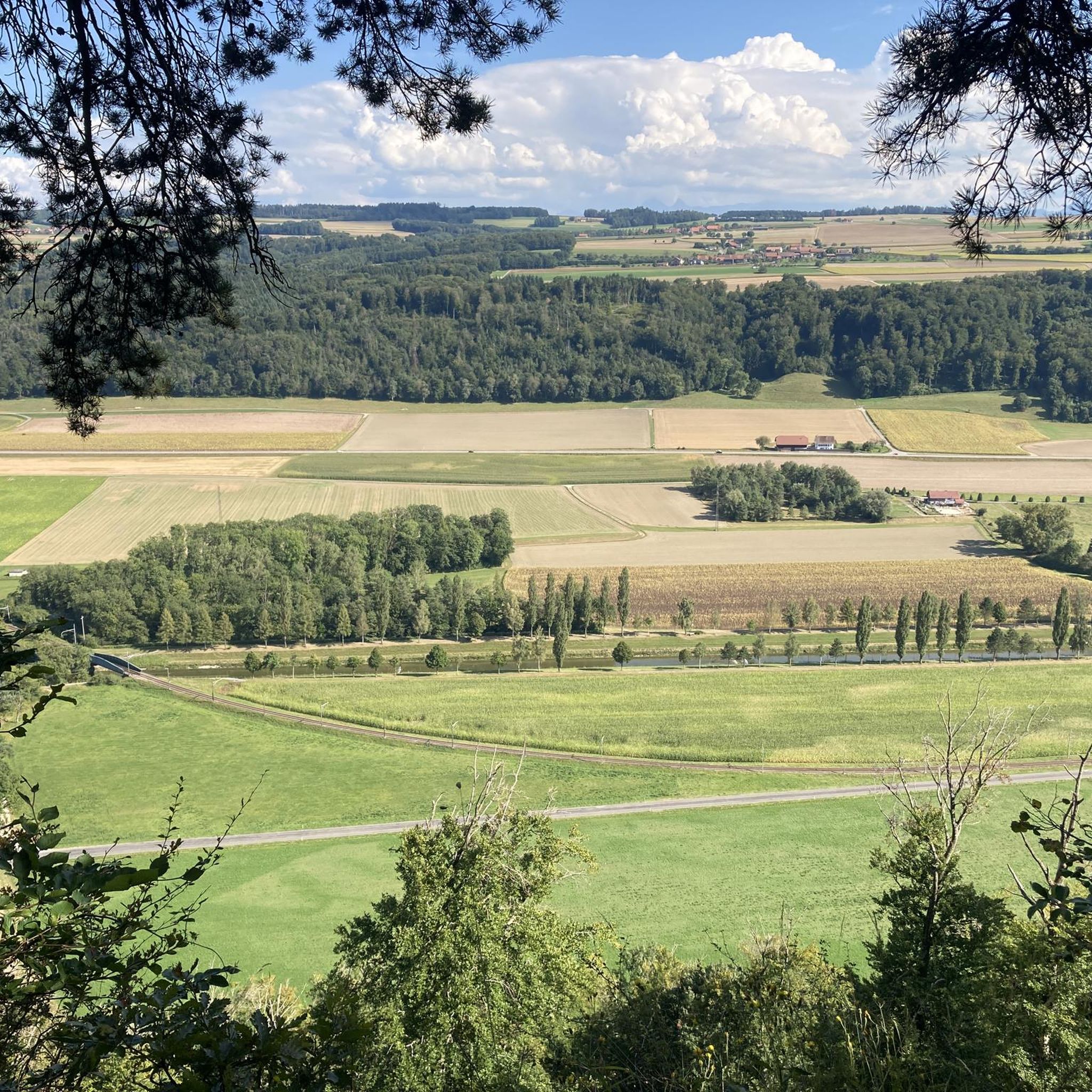
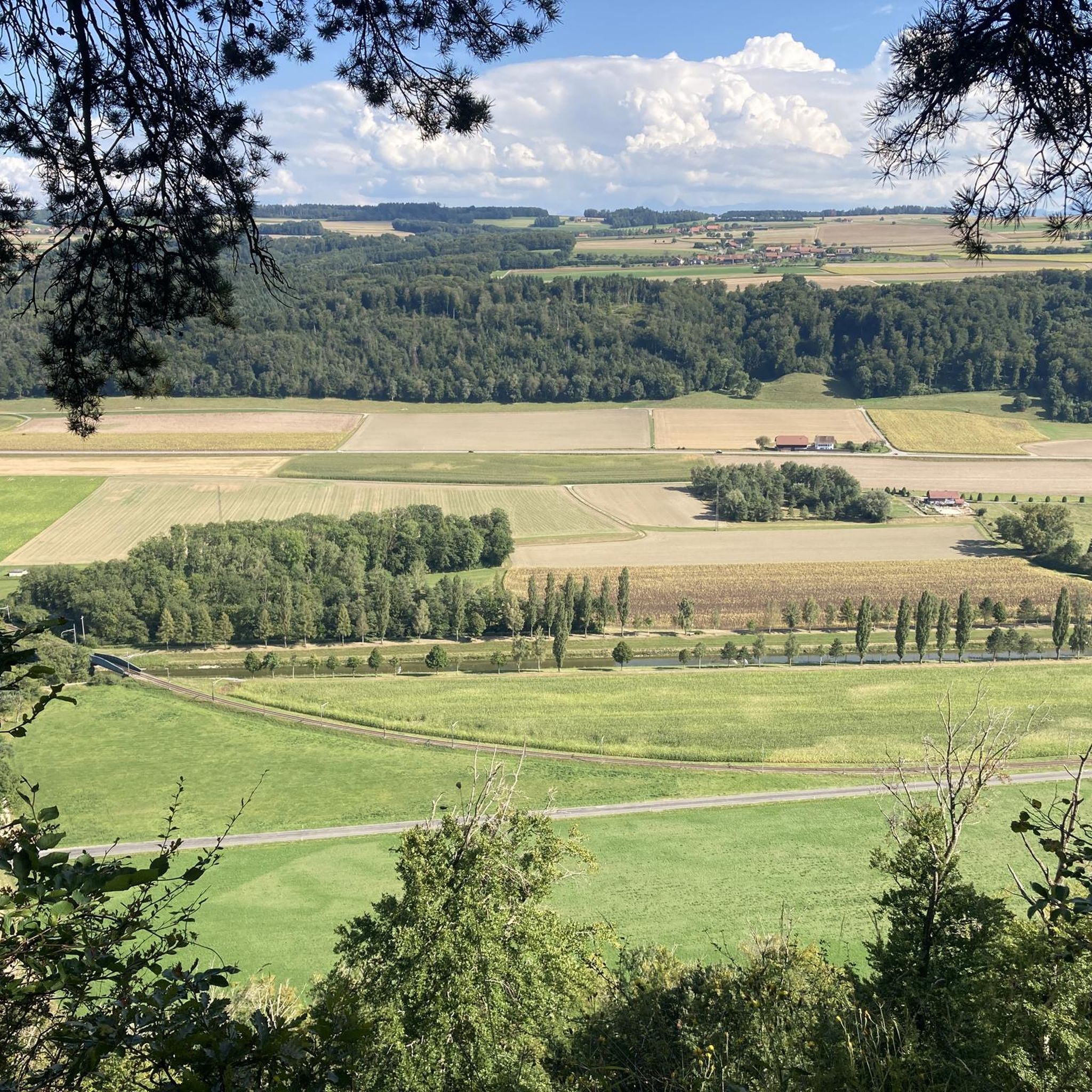
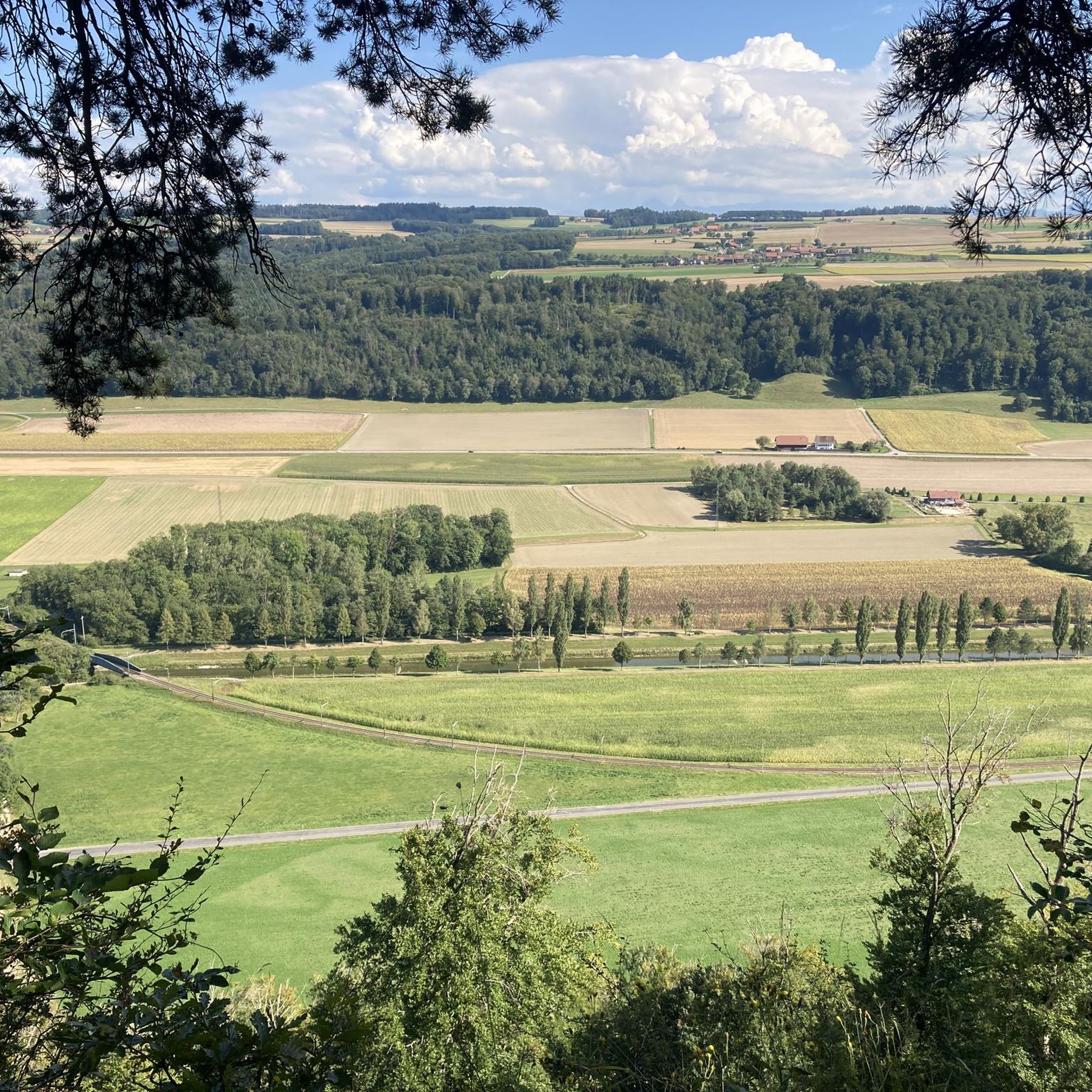
Tips from the Community

A relaxing spot at the edge of the forest
0
0

A very old temple, very well maintained... it's worth a look.
0
0

A drinking water fountain is available to fill your water bottles
0
0
Rebuilt in 1231. On the way to Santiago de Compostela
0
0

A lovely, relaxing spot for a break. There's a fire pit at one of the cabins. Picnic tables. No swimming.
0
0

beautiful trail along the Broye, more varied on the west side ...
0
0
(E) - Fountain with drinking water, table and barbecue, car park, little playground. (D) - Fountain with drinking water, table and barbecue (if no one has rented it), parking, small playground. (F) - Fontaine avec eau potable, table de pique-nique et grill (si persons ne les a loués), parking, petite place de jeu.
0
0
Frequently Asked Questions
How many running routes are available in the Surpierre area?
The Surpierre region offers a wide selection of running trails, with over 100 routes available for you to explore. These include options for various fitness levels, from easy jogs to more challenging runs.
Are there running routes suitable for beginners or those looking for an easy jog?
Yes, Surpierre has several running routes perfect for beginners or those seeking a relaxed pace. There are 8 easy routes available, allowing you to enjoy the scenic landscape without excessive difficulty. For example, many routes navigate through agricultural lands and along the Flon stream, offering gentle terrain.
What kind of terrain can I expect on running trails around Surpierre?
Running trails around Surpierre feature a diverse landscape. You can expect varied terrain including broad plateau areas, sections of the Molasse hills, and paths through extensive forested areas. Many routes also wind through peaceful agricultural lands, and some offer picturesque views towards the Broye valley.
Can I find challenging running routes near Surpierre?
Absolutely. For runners seeking a challenge, Surpierre offers difficult routes. One notable option is the Route des Broyons – Trail Along the Broye loop from Granges-Marnand, a 9.5-mile (15.3 km) path that follows the Broye river, providing both scenic views and a demanding experience.
What are some interesting places to see along the running trails in Surpierre?
Many running routes in the Surpierre area pass by interesting landmarks and natural features. You might encounter historical sites and castles. For instance, the Château de Lucens – Lucens Refuge loop from Lucens passes near the impressive Château de Lucens. Other highlights in the broader region include the Payerne Old Town and Abbey Church, and the Saint-Étienne Reformed Church, Moudon.
Are there running routes that follow water features like streams or rivers?
Yes, the region offers several running routes that incorporate water features. The Flon stream flows through a small valley in Surpierre, providing pleasant paths alongside the water. Additionally, routes like the Pond by the Broye – Temple of Curtilles loop from Lucens lead through areas with water features and agricultural landscapes, and the Route des Broyons – Trail Along the Broye loop from Granges-Marnand follows the Broye river.
Are there circular running routes available in Surpierre?
Yes, many of the running routes in Surpierre are designed as loops, offering convenient circular paths. A popular example is the Running loop from Nuvilly, which is a moderate 4.8-mile (7.8 km) trail that takes about an hour to complete and navigates through the varied local landscape.
What do other runners say about the trails in Surpierre?
The running routes in Surpierre are highly regarded by the komoot community, holding an impressive average rating of 4.6 stars from over 20 reviews. More than 1800 runners have used komoot to explore the area, often praising the varied terrain, from quiet woodlands to open agricultural fields, and the scenic views of the Broye valley.
When is the best time of year to go running in Surpierre?
Surpierre's diverse landscape, with its forested sections and open agricultural lands, makes it suitable for running throughout much of the year. Spring and autumn offer pleasant temperatures and beautiful scenery. Even in summer, the significant portion of forested areas provides shaded and tranquil paths, ideal for a refreshing natural environment.
Are there any running routes that pass by historical sites or castles?
Yes, the Surpierre region is rich in history and features several castles and historical sites. For example, the Château de Lucens – Lucens Refuge loop from Lucens is a running route that takes you near the historic Château de Lucens. Other nearby historical attractions include La Tour à Boyer and the Saint-Martin Tower.
Are there running routes suitable for families in Surpierre?
While specific 'family-friendly' designations are not always explicit for running routes, the presence of 8 easy routes and paths through agricultural lands and along the Flon stream suggests many options suitable for families. These routes often have gentler gradients and provide a pleasant environment for a family jog or walk.
Can I bring my dog on the running trails in Surpierre?
The natural and varied landscape of Surpierre, with its extensive forested areas and agricultural paths, generally offers a welcoming environment for dogs. While specific dog-friendly rules can vary by exact location, many outdoor trails in Switzerland are accessible to well-behaved dogs on a leash. It's always advisable to check local signage for any specific restrictions.
Most popular attractions around Surpierre

Get inspired with the komoot mobile app


Explore more
Browse the best Running Trails & Routes in other regions.
