Saint-Andéol-De-Fourchades
Saint-Andéol-De-Fourchades
The 7 Most Amazing Peaks around Saint-Andéol-De-Fourchades
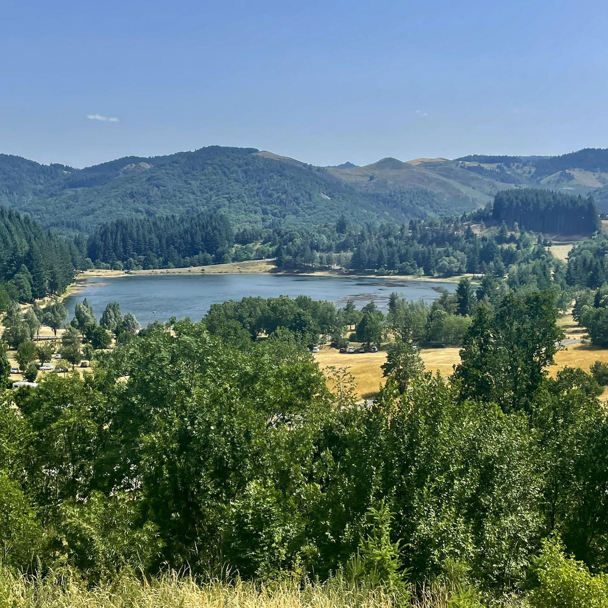
Best mountain peaks around Saint-Andéol-De-Fourchades are found in a rural commune nestled in the eastern Cévennes mountains, within the Ardèche department. This region offers access to several notable peaks, each with distinct features. The area is characterized by its volcanic landscape and provides opportunities for exploring both natural beauty and historical sites. Visitors can discover a variety of terrain elevation difficulty Saint-Andéol-De-Fourchades hiking experiences, from local high points to iconic regional summits.
Best mountain peaks around Saint-Andéol-De-Fourchades
- The most popular mountain peaks is South summit of Mont Mézenc, a summit that offers an incredible view of the departments of Ardèche and Haute-Loire. This summit is precisely on the watershed line, providing a unique geographical perspective.
- Another must-see spot is Mount Gerbier de Jonc, a volcanic summit. Visitors can expect a distinctive sugarloaf shape and a magnificent 360-degree panorama encompassing the Alps, the Cévennes, and the volcanoes of the Massif Central.
- Visitors also love East facing table - Mont Mézenc, a summit that is the higher of this two-part mountain. This location offers a very beautiful 360° view from the top of Mont Mézenc on all the surrounding mountains, with views extending into the Alps on clear days.
- Saint-Andéol-De-Fourchades is known for volcanic peaks, high-altitude summits, and historical sites. These offer diverse opportunities for hiking, nature observation, and appreciating the geological and historical heritage of the Ardèche region.
- The mountain peaks around Saint-Andéol-De-Fourchades are appreciated by the komoot community, with more than 130 upvotes and over 60 photos shared.
Last updated: May 11, 2026
South summit of Mont Mézenc
Highlight • Summit
You are also precisely on the watershed line.
Translated by Google •
Tip by

Mount Gerbier de Jonc
Highlight • Summit
At the height of the mountain lies an important watershed: the official source of the Loire is located here, and not far away rises the Ardèche, which winds its way through the department of the same name towards the Rhône.
Even if there is a lot going on here, the climb is worth it and is also recommended with children.
Translated by Google •
Tip by

Sign up now to discover places like this
Get recommendations on the best single tracks, peaks, & plenty of other exciting outdoor places.
Sign up for free
North summit of Mont Mézenc
Highlight • Summit
At 1744m, it is the highest point in the Haute-Loire department. The southern peak already belongs to the department of Ardèche. The iron cross on the north summit was erected by French prisoners upon their return from German camps.
Like so many peaks in this region, the plateau is of volcanic origin. If you are lucky, you can see marmots on the mountain slopes.
Translated by Google •
Tip by
Suc de Sara
Highlight • Mountain Hut
Translated by Google •
Tip by

East facing table - Mont Mézenc
Highlight • Summit
Both on the west and on the east side panels are set up, with which the near and distant peaks and places can be assigned, and in good weather, the view extends into the Alps.
As there are more parking spaces at the foot of the mountain, it gets quite crowded in good weather. Nevertheless, recommended!
Translated by Google •
Tip by
Sign up for free to discover even more peaks around Saint-Andéol-De-Fourchades.
Sign up for free
Already have an account?
Start today with a free account
Your next adventure awaits.
Login or Signup
Popular around Saint-Andéol-De-Fourchades
Tips from the Community

Lots of hikers. Be polite and share the trail. The descent with the small steps is a treat.
0
0

The paths on Mont Mezenc have recently been renovated. Not all of the paths shown are still there. The remaining paths are relatively wide for a mountain peak and easy to walk.
0
0

Mont Gerbier-de-Jonc is one of the highest peaks of the Monts d'Ardèche in the south-eastern Massif Central. The mountain itself is a striking, extinct volcanic cone with a good view over the Massif Central. The ascent and descent require some fitness and good footwear. There are a few short climbing rocks that cannot be avoided. But the view is worth it.
0
0

The Suc de Sara is a summit of volcanic origin located at 1,521 m. No surface volcanic activity has taken place on this peak, but it was created as a result of an underground magma chamber 6-8 million years ago. Fragments of concentric rings are all that remain to suggest its existence. From this summit, the view is magnificent.
2
0
The Suc de Sara is a summit of volcanic origin located at 1,521 m. No surface volcanic activity has taken place on this peak, but it was created as a result of an underground magma chamber 6-8 million years ago. Fragments of concentric rings are all that remain to suggest its existence. From this summit, the view is magnificent.
2
0

Mont Mézenc offers an exceptional 360° panorama over the entire Massif Central and the Alps to the east. From the south of Mézenc, a large part of the South-East of France is visible up to Ventoux.
0
0
Mont Mézenc is the highest point of the Ardèche and the Haute-Loire (1,753m). On the same crest line as Mont Gerbier-de-Jonc (a few kilometers further south), it forms the watershed line between the Mediterranean (via the Rhône) and the Atlantic (via the Loire). It is also an exceptional 360° view over the entire Massif Central and the Alps to the east.
0
0

Superb panorama once at the top. Two possible accesses, by the cross of Boutières or by the cross of Pecata.
0
0
Frequently Asked Questions
What are the most notable mountain peaks to visit around Saint-Andéol-de-Fourchades?
The region offers several distinct peaks. Within the commune, you can explore Suc d'Ourseyre, the highest point, and Oppidum de La Fare, an archaeological site with panoramic views. Nearby, don't miss the iconic Mount Gerbier de Jonc, known as the source of the Loire River, and Mont Mézenc, the highest point of both the Haute-Loire and Ardèche departments, offering extensive 360-degree vistas.
Are there any historical sites among the peaks near Saint-Andéol-de-Fourchades?
Yes, the Oppidum de La Fare, rising to 1,107 meters within Saint-Andéol-de-Fourchades, is a significant archaeological site. This fortified peak dates back to the Bronze and Iron Ages and is classified as a historic monument, offering a unique blend of ancient history and scenic beauty.
What kind of views can I expect from the mountain peaks in this area?
The peaks around Saint-Andéol-de-Fourchades offer diverse and often spectacular views. From Suc d'Ourseyre, you get a nice view of the local 'sucs region'. Mount Gerbier de Jonc provides a magnificent 360-degree panorama encompassing the Alps, the Cévennes, and the volcanoes of the Massif Central. Mont Mézenc, especially from its East facing table, offers exceptional 360-degree views that can extend to the Alps, Vercors, and Mont Ventoux on clear days.
Are there family-friendly hiking options among these peaks?
Many of the peaks offer accessible trails suitable for families. For instance, the ascent to Mount Gerbier de Jonc, though steep in parts, is often recommended with children due to its engaging path and rewarding views. The tips suggest it's a fun climb with some light scrambling, making it an adventure for all ages.
What is the difficulty level for hiking Mont Gerbier de Jonc?
The ascent to Mount Gerbier de Jonc is considered relatively easy to intermediate. It typically takes about 30 minutes to reach the summit. While there are narrow paths and some sections that involve light climbing, it's generally safe and enjoyable, even with children, provided you wear comfortable shoes with a sturdy profile.
Which peak is the highest in the region?
Mont Mézenc is the highest point of both the Haute-Loire and Ardèche departments, reaching 1,753 meters. Its southern summit, specifically, is the higher of its two parts.
What unique natural features can be found on these mountain peaks?
The region is characterized by its volcanic landscape. Mount Gerbier de Jonc is famous as the source of the Loire River and has a distinctive sugarloaf shape. Mont Mézenc sits on the watershed divide between the Atlantic and the Mediterranean, and its surroundings feature unique phonolite rock. Suc de Sara and Suc de la Lauzière are also ancient volcanoes, offering insights into the area's geological past.
Are there cycling routes available near the mountain peaks of Saint-Andéol-de-Fourchades?
Yes, there are several cycling opportunities. For road cycling, you can find routes like the 'Col du Gerbier de Jonc – La Dolce Via loop' or 'Lake Saint-Martial loop'. For mountain biking, options include 'Beautiful view loop from Dornas' or 'Cirque des Boutières – Boutières Cross Pass loop'. Gravel biking is also popular, with routes such as 'Viewpoint on the Dolce Via – Viaduc de Chabranç loop'. You can explore more options on the Cycling around Saint-Andéol-De-Fourchades, MTB Trails around Saint-Andéol-De-Fourchades, and Gravel biking around Saint-Andéol-De-Fourchades guide pages.
What do visitors particularly enjoy about the peaks around Saint-Andéol-de-Fourchades?
Visitors frequently highlight the incredible 360-degree panoramic views from summits like Mont Mézenc and Mount Gerbier de Jonc, which can extend to the Alps on clear days. The unique volcanic landscapes, the historical significance of sites like Oppidum de La Fare, and the sense of being on a watershed divide also contribute to a memorable experience. Many find the climbs rewarding and suitable for families.
Is there a peak that offers a more challenging hike?
While many trails are accessible, Suc de Sara is noted for having a trail that is 'a little technical', suggesting a slightly more challenging experience compared to other, easier ascents in the area. However, it is still described as not dangerous, offering a magnificent 360-degree view as a reward.
What is the best time of year to hike the mountain peaks near Saint-Andéol-de-Fourchades?
The region is generally pleasant for hiking during spring, summer, and autumn. Summer offers warmer temperatures, but higher altitudes provide cooler air. Clear days are ideal for enjoying the extensive panoramic views. Winter conditions can bring snow and ice, especially on higher peaks like Mont Mézenc, which may require specific gear and experience.
Are there any specific tips for hiking Mont Mézenc?
When hiking Mont Mézenc, be prepared for potentially crowded conditions on good weather days, especially around the more accessible parking areas. The views from both the southern and northern summits are exceptional, with panels helping identify distant peaks. On clear days, the vista can extend into the Alps, making it a highly recommended experience.
Most popular routes around Saint-Andéol-De-Fourchades
Most popular attractions around Saint-Andéol-De-Fourchades

Get inspired with the komoot mobile app


Explore more
See even more amazing summits around Saint-Andéol-De-Fourchades with these guides:
