The best walks and hikes around Luc-Sur-Aude
4.5
(251)
1,175
hikers
92
hikes
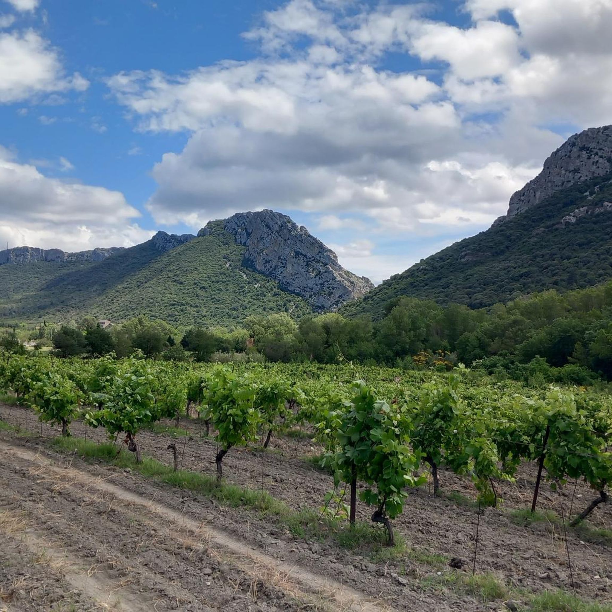
Hiking around Luc-Sur-Aude offers diverse landscapes within the Aude department of France's Occitanie region. The area is characterized by calcareous hills, wooded sections, and meadows, with elevations ranging from 217m to 561m. It provides access to the rugged Corbières massif and is drained by the Aude river, featuring scenic gorges nearby. This varied topography creates a range of hiking experiences for outdoor enthusiasts.
Best hiking trails around Luc-Sur-Aude
- The most popular hiking route is Ritou Trail, a 7.9 miles…
Last updated: October 7, 2026
4.2
(6)
46
hikers
12.7km
03:44
370m
360m
Moderate hike. Good fitness required. Mostly accessible paths. Sure-footedness required.
5.0
(5)
23
hikers
9.41km
02:42
230m
230m
Moderate hike. Good fitness required. Easily-accessible paths. Suitable for all skill levels.

4.8
(11)
40
hikers
7.79km
02:14
190m
190m
Moderate hike. Good fitness required. Easily-accessible paths. Suitable for all skill levels.
4.8
(4)
26
hikers
10.6km
03:09
330m
330m
Moderate hike. Good fitness required. Easily-accessible paths. Suitable for all skill levels.
5.0
(2)
25
hikers
12.9km
03:47
360m
350m
Moderate hike. Good fitness required. Easily-accessible paths. Suitable for all skill levels.
Get access to more routes and recommendations from other explorers.
Already have an account?
Our route recommendations are based on thousands of hikes, rides, and runs completed by other people on komoot.
Start today with a free account
Your next adventure awaits.


Tips from the Community


Located in the Corbières massif, Rennes-le-Château offers lovely views of the Corbières massif from its belvedere. This hilltop town has been famous since Father Saunière (village priest) undertook work at his expense, revealing a mysterious personal fortune. The media hype that followed placed the village at the heart of numerous more or less conspiracy theories and myths of forgotten treasures (ranging from a Gallic treasure from the Volques to the treasure of the Templars).
2
0
Located in the Corbières massif, Rennes-le-Château has been famous since the Abbé Saunière (village priest) undertook work at his own expense, thus revealing a mysterious personal fortune. The ensuing media frenzy placed the village at the heart of many more or less conspiracy theories and myths of forgotten/supposed treasures (ranging from a Gallic treasure from the Volques to the Templar treasure). In any case, it offers pretty views of the Corbières massif from its belvedere.
0
0
Magnificent viewpoint on the Ritou trail (“priest” in Occitan), whose name refers to the sulphurous Abbé Saunière (whose mysterious personal enrichment is at the origin of many speculations).
1
0


Frequently Asked Questions
What kind of terrain can I expect when hiking around Luc-sur-Aude?
The region around Luc-sur-Aude offers a diverse landscape, characterized by calcareous hills, wooded sections, and open meadows. You'll find yourself exploring the rugged Corbières massif, with elevations ranging from 217m to 561m. The area is also shaped by the Aude river, featuring scenic gorges that add dramatic flair to many routes.
Are there any easy hiking trails suitable for beginners or a relaxed stroll?
Yes, Luc-sur-Aude offers a good selection of easier trails. Out of 82 available routes, 23 are classified as easy, perfect for beginners or those looking for a more relaxed walk. These trails often wind through the local hills and meadows, providing gentle gradients and pleasant scenery.
Can I find circular hiking routes in the area?
Absolutely. Many of the trails around Luc-sur-Aude are designed as loops, allowing you to start and finish at the same point. For example, the Great views on Pyrenees – View of Château de Coustaussa loop from Couiza offers expansive vistas, while the Crossing water loop from Serres provides varied terrain. Another popular option is the Crêtes loop from Rennes-le-Château.
What are some notable natural attractions or landmarks to see while hiking?
The region is rich in natural beauty and historical sites. You can explore dramatic river gorges like the Gorges de la Pierre-Lys, known for its towering cliffs, or the Gorges de Galamus, a protected site with a deep canyon and the unique Hermitage of Saint-Antoine built into the rock. The Gorges de l'Orbieu are also popular, offering natural pools and family-friendly trails. For a unique geological experience, consider visiting the Fontaine Intermittente de Fontestorbes, a captivating natural phenomenon. Additionally, the Rennes-le-Château Village and Church is a nearby historical attraction with walking opportunities.
Are there any challenging or difficult hikes for experienced trekkers?
Yes, for those seeking a greater challenge, there are 5 difficult routes available. One such demanding trail is the Very nice view – Rennes-le-Château loop from Espéraza, which covers approximately 18 km and features significant elevation changes, rewarding hikers with extensive views.
What do other hikers say about the trails around Luc-sur-Aude?
The hiking trails around Luc-sur-Aude are highly regarded by the komoot community, holding an impressive average rating of 4.4 stars from over 200 reviews. Hikers often praise the varied terrain, the stunning panoramic views, and the well-maintained paths that cater to different skill levels.
Are there any trails that offer views of the Pyrenees?
Yes, several routes provide spectacular distant views of the Pyrenees. A particularly recommended trail for this is the Great views on Pyrenees – View of Château de Coustaussa loop from Couiza, which is known for its expansive vistas across the landscape towards the mountain range.
What is the best time of year to go hiking in Luc-sur-Aude?
The Aude department, where Luc-sur-Aude is located, offers pleasant hiking conditions for much of the year. Spring and autumn are particularly ideal, with mild temperatures and vibrant natural colors. Summer can be warm, but many trails offer shaded sections, especially in wooded areas or gorges like Le Labyrinthe Vert in Nébias. Winter hiking is also possible, though some higher or more exposed routes might require checking local conditions.
Are there any family-friendly hiking options with natural pools or shallow areas?
The Gorges de l'Orbieu, located about 17 km from Luc-sur-Aude, are renowned as an exceptional natural site for families. They feature magnificent rock formations and offer shallow areas and natural pools, making them a great spot for children to enjoy the water after a walk.
Where can I find more information about the Aude region's hiking opportunities?
For broader information on hiking across the Aude department, you can visit the official tourism website: audetourisme.com. This resource provides additional context and details about the diverse landscapes and trails available in the wider region.
What are the typical elevations and distances for hikes in this area?
Hikes around Luc-sur-Aude vary significantly. Elevations on trails can range from 217m to 561m, providing a good mix of ascents and descents. Distances range from shorter, easy strolls to longer, more challenging routes. For instance, the Ritou Trail is about 12.7 km with an elevation gain of around 368m, while the Crossing water loop from Serres is shorter at 7.8 km with about 195m of ascent.
Most popular routes around Luc-Sur-Aude
Most popular attractions around Luc-Sur-Aude

Get inspired with the komoot mobile app


Explore more
Browse the best Hikes in other regions.
