The best cycling routes around Curnier
4.5
(350)
4,226
riders
138
rides
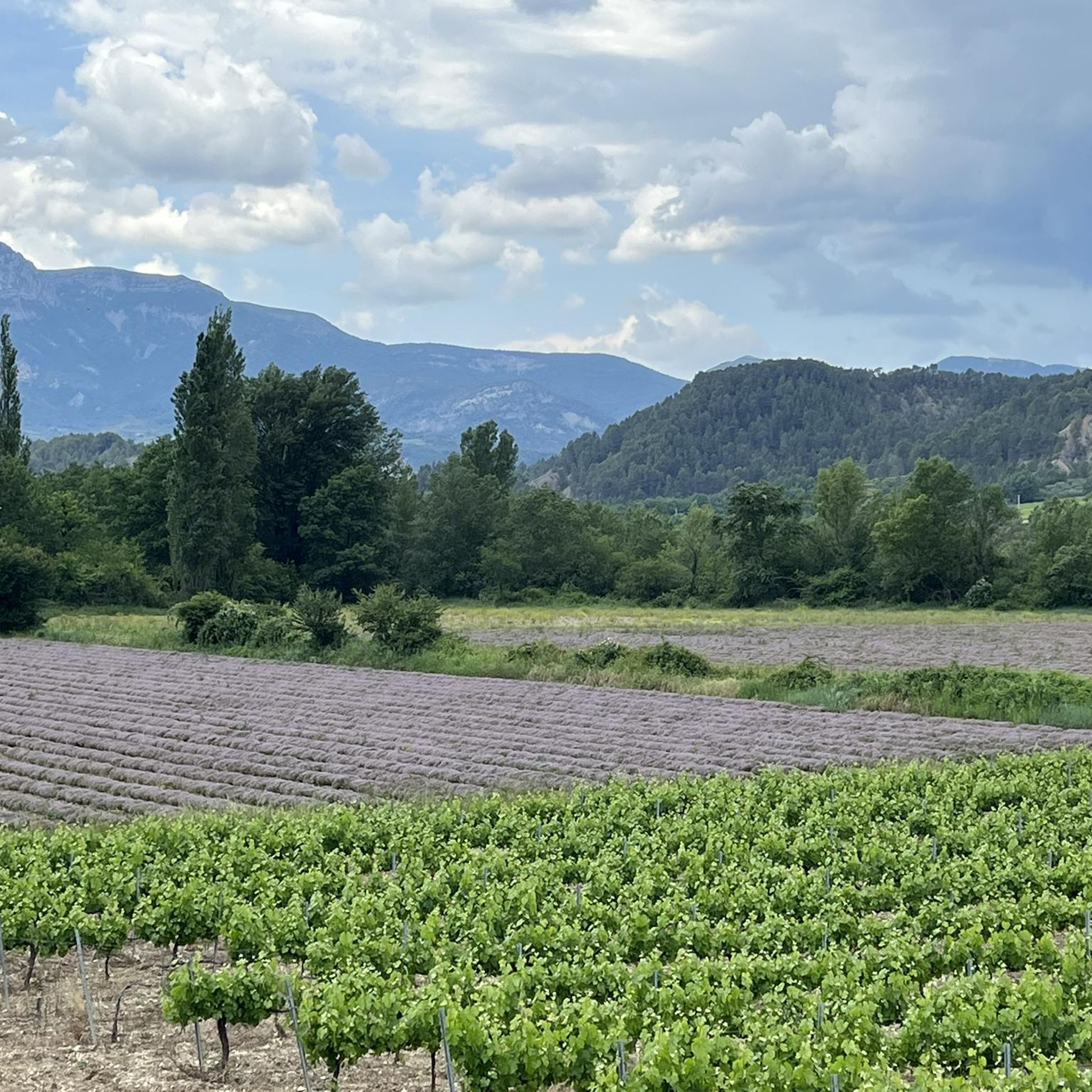
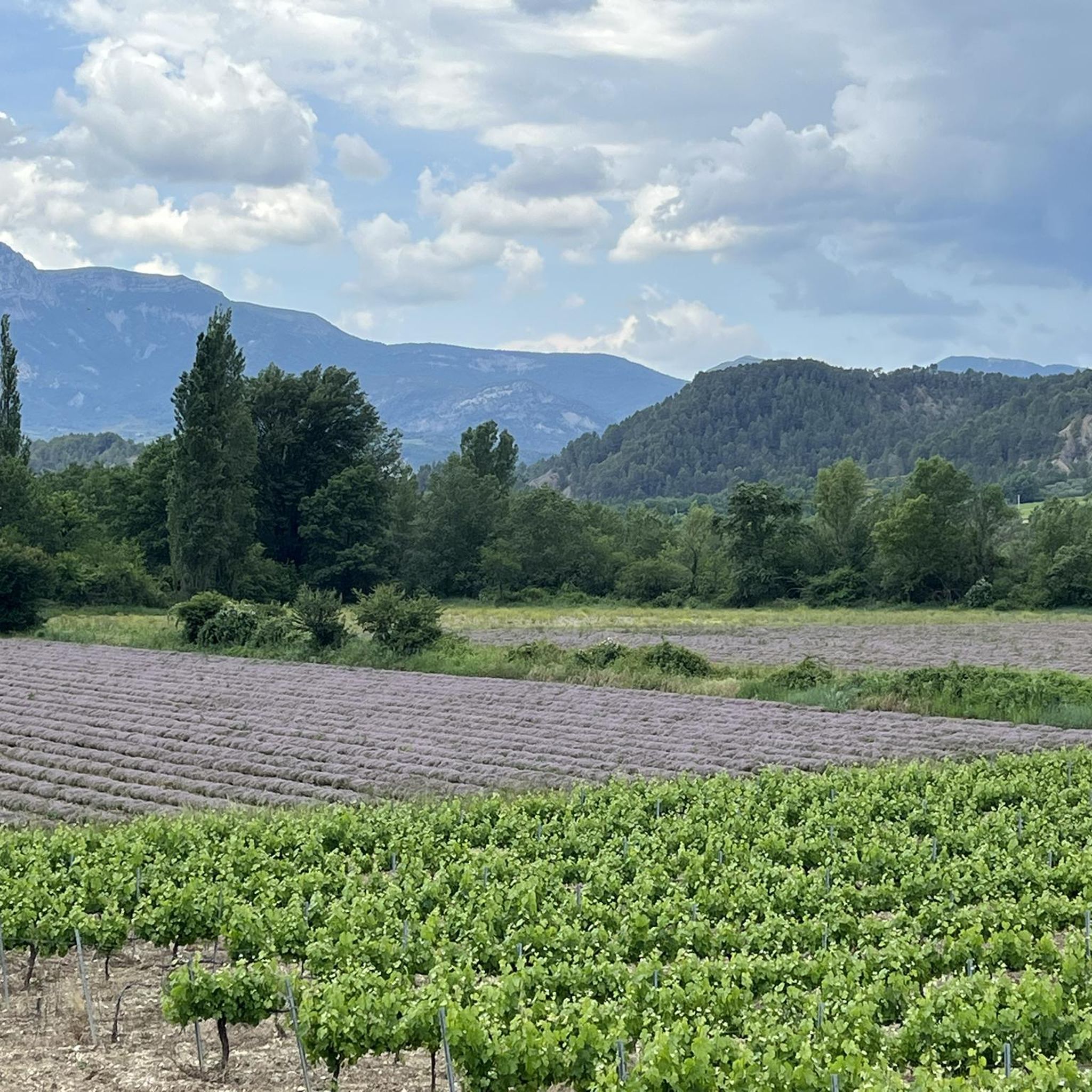
Touring cycling routes around Curnier traverse a diverse landscape situated between the foothills of the Alps and Provence. This region is characterized by picturesque lavender fields, wild river valleys, and vineyards. Cyclists can expect a blend of scenery, including both paved surfaces and some unpaved segments, within the Baronnies Provençales Regional Natural Park. The terrain offers varied elevation gains, from moderate climbs to challenging ascents.
Best touring cycling routes around Curnier
- The most popular touring cycling route is Trente-Pas gorge…
Last updated: July 23, 2026
4.9
(24)
278
riders
54.3km
03:50
1,000m
1,000m
Hard bike ride. Very good fitness required. Mostly paved surfaces. Suitable for all skill levels.
5.0
(2)
89
riders
54.0km
03:40
870m
870m
Hard bike ride. Very good fitness required. Mostly paved surfaces. Suitable for all skill levels.

Sign up for free
5.0
(10)
99
riders
55.4km
04:14
1,310m
1,310m
Hard bike ride. Very good fitness required. Mostly paved surfaces. Suitable for all skill levels.
4.3
(15)
107
riders
73.9km
05:02
1,260m
1,260m
Hard bike ride. Very good fitness required. Mostly paved surfaces. Suitable for all skill levels.
4.0
(2)
26
riders
44.3km
03:03
730m
730m
Hard bike ride. Very good fitness required. Mostly paved surfaces. Suitable for all skill levels.
Get access to more routes and recommendations from other explorers.
Sign up for free
Already have an account?
Our route recommendations are based on thousands of hikes, rides, and runs completed by other people on komoot.
Start today with a free account
Your next adventure awaits.
Login or Signup

Tips from the Community

Here nature has given its best.
7
0
Building maintained in excellent condition.
10
0
The ascent to Col de la Fromagère / Col de Pommerol from Rosans is located in the Hautes-Alpes region. This ascent is 6.6 km long, with a total elevation gain of 371 m. The average gradient of the ascent to Col de la Fromagère / Col de Pommerol from Rosans is 5.6%.
5
0
The Col de Pommerol is a climb located in the Hautes Alpes region. It has a length of 6.6 km, an elevation gain of 371 m, and an average gradient of 5.6%.
3
0
The Col de Soubeyrand (987–994 m, depending on the map source) is located in the Drôme department, in the Auvergne-Rhône-Alpes region, within the Baronnies provençales massif. It connects the Eygues valley with the Ennuye valley, between the villages of Rémuzat and Sainte-Jalle.
9
0
Verclause is a small commune in the Drôme, in the Auvergne-Rhône-Alpes region, in the southeast of France. It is located in the Eygues river valley, at the foot of the Prealps, in a quiet area much appreciated by cyclists and motorcyclists for its numerous scenic roads and mountain passes. It is close to the border with the Hautes-Alpes department, not far from locations such as Orpierre and Séderon.
8
0

Beautiful route, the arrival at the pass is a bit disappointing, not inviting for a stop.
0
0

Beautiful church, unfortunately closed because a wall collapsed.
0
0
Frequently Asked Questions
How many touring cycling routes are available around Curnier?
There are over 130 touring cycling routes around Curnier, offering a wide range of options for different skill levels. You'll find approximately 10 easy routes, 44 moderate routes, and 76 challenging routes.
What kind of landscapes can I expect to see while touring cycling in Curnier?
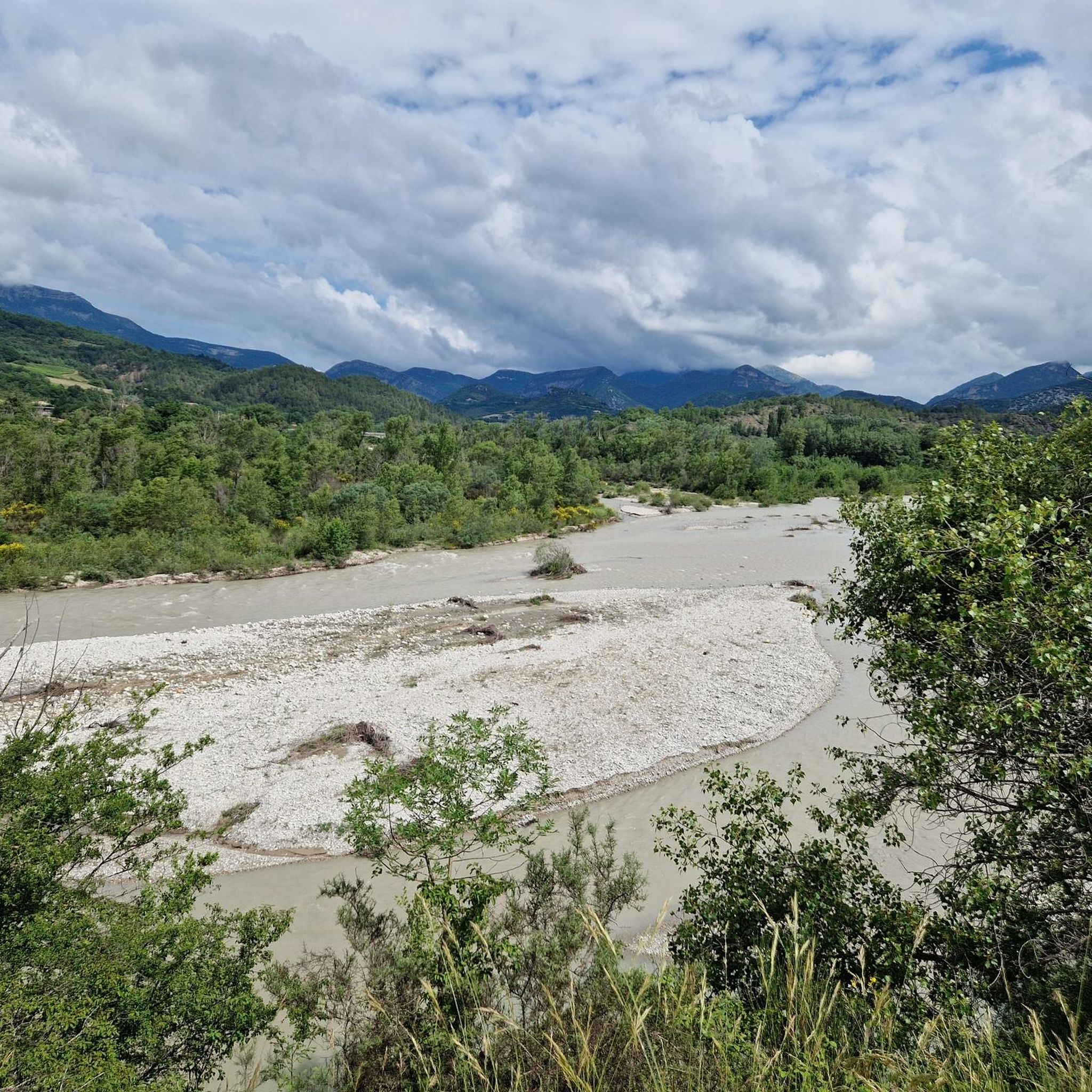
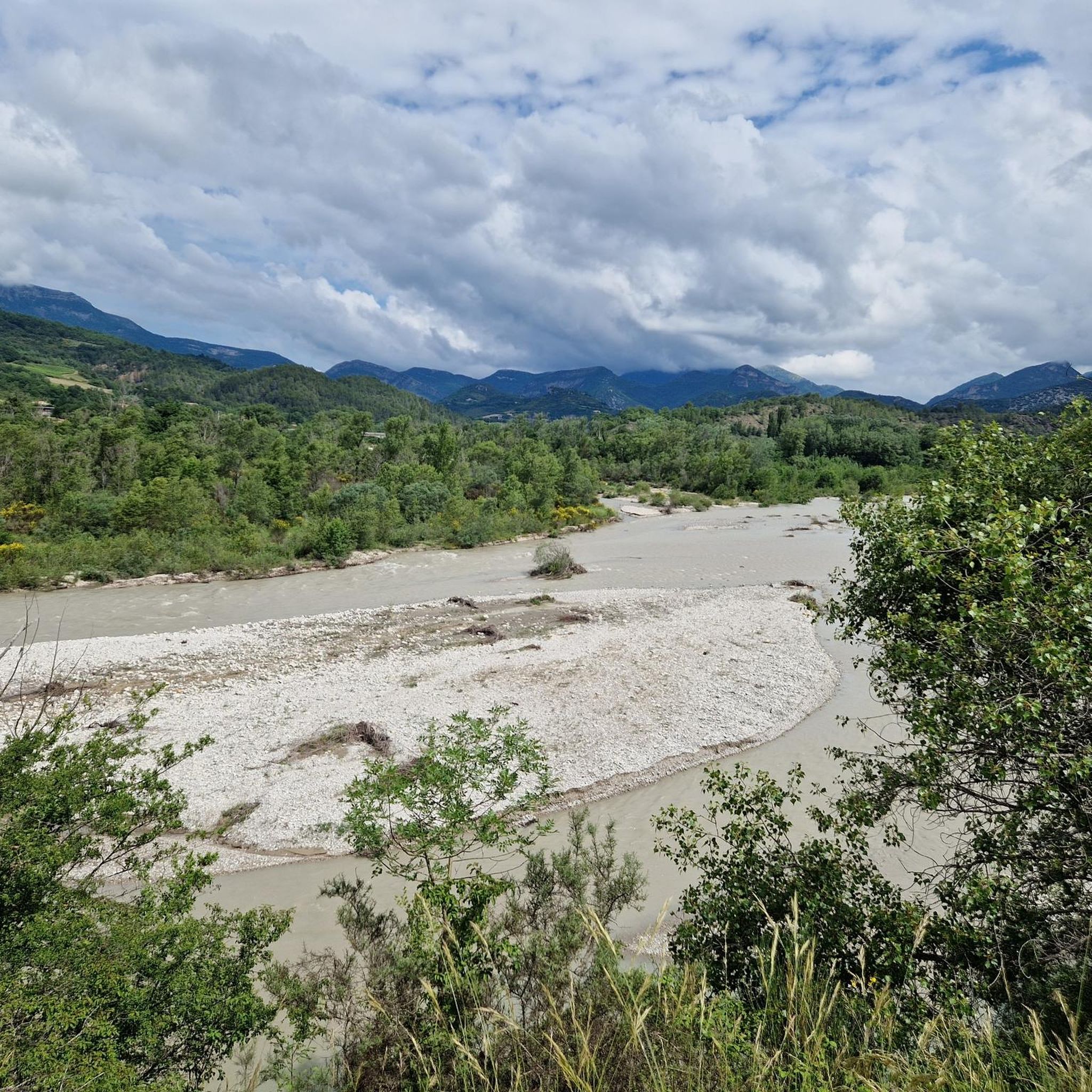
Curnier offers a unique blend of scenery, situated between the foothills of the Alps and Provence. Cyclists can expect to traverse picturesque lavender fields, explore wild river valleys like that of the Drôme River, and pass through vineyards. The area is also part of the Baronnies Provençales Regional Natural Park, ensuring stunning natural beauty.
Are there any circular touring cycling routes in the Curnier area?
Yes, many of the touring cycling routes around Curnier are circular. For example, the difficult Trente-Pas gorge – Col de la Sausse loop from Condorcet and the challenging Sainte-Jalle – Col de Soubeyrand (994 m) loop from Condorcet are both popular circular options.
What are some notable natural attractions or viewpoints along the touring cycling routes?
The region boasts several natural attractions. You can cycle past the dramatic Gorges de Trente-Pas, explore the Gorges de l’Eygues, or discover the unique Le Trou de Souris Rock Arch. For expansive views, consider routes that pass by Rocher du Caire or mountain passes like Col de la croix rouge (507m) and Col d'Ey.
Are there any family-friendly touring cycling routes in Curnier?
While many routes in Curnier involve significant elevation, there are moderate options suitable for families or those seeking a less strenuous ride. The Les Pilles Village – Les Pilles — village and bridge loop from Condorcet is a moderate 21.2 km route that offers a pleasant experience through villages and rural landscapes.
What is the best time of year for touring cycling in Curnier?
The Drôme Provençale region, where Curnier is located, is generally best for cycling in spring and autumn when temperatures are milder and the landscapes are vibrant with lavender blooms or autumn colors. Summer can be quite warm, but early mornings or late afternoons are still enjoyable.
What do other touring cyclists say about the routes in Curnier?
The touring cycling routes in Curnier are highly regarded by the komoot community, holding an average rating of 4.5 stars from over 270 reviews. Cyclists often praise the diverse scenery, from lavender fields to wild river valleys, and the opportunity to explore charming medieval villages.
Are there opportunities for wild swimming along the cycling routes?
Yes, the region is known for its wild river valleys, particularly the Drôme River. Many touring cyclists enjoy the opportunity for swimming in crystal clear rivers, providing a refreshing break during their rides. Look for routes that follow riverbeds for potential swimming spots.
What kind of terrain can I expect on the touring cycling routes?
The terrain around Curnier is diverse, featuring a mix of paved surfaces and some unpaved segments. You can expect varied elevation gains, from moderate climbs to challenging ascents, reflecting the region's position between the Alps and Provence.
Are there any historical or cultural landmarks to visit while cycling?
Absolutely. The region is dotted with quaint sleepy hamlets and historic medieval villages. You can also visit the Nyons Roman Bridge or the Chapel of Our Lady of Good Help of Nyons. The Les Pilles — village and bridge is another charming spot to explore.
What is the longest and most challenging touring cycling route in the area?
For experienced cyclists seeking a significant challenge, the Le Trou de Souris Rock Arch – Col de la Sausse loop from Les Pilles is a difficult route spanning 88.1 km with over 1550 meters of elevation gain, offering a demanding yet rewarding experience.
Most popular attractions around Curnier

Get inspired with the komoot mobile app


Explore more
Browse the best Cycling routes in other regions.
