The best road cycling routes around Les Plantiers
4.5
(118)
2,356
riders
49
rides
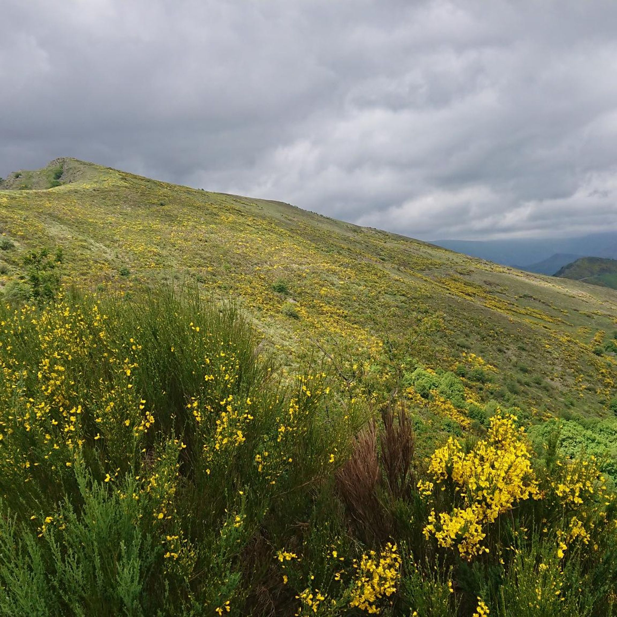
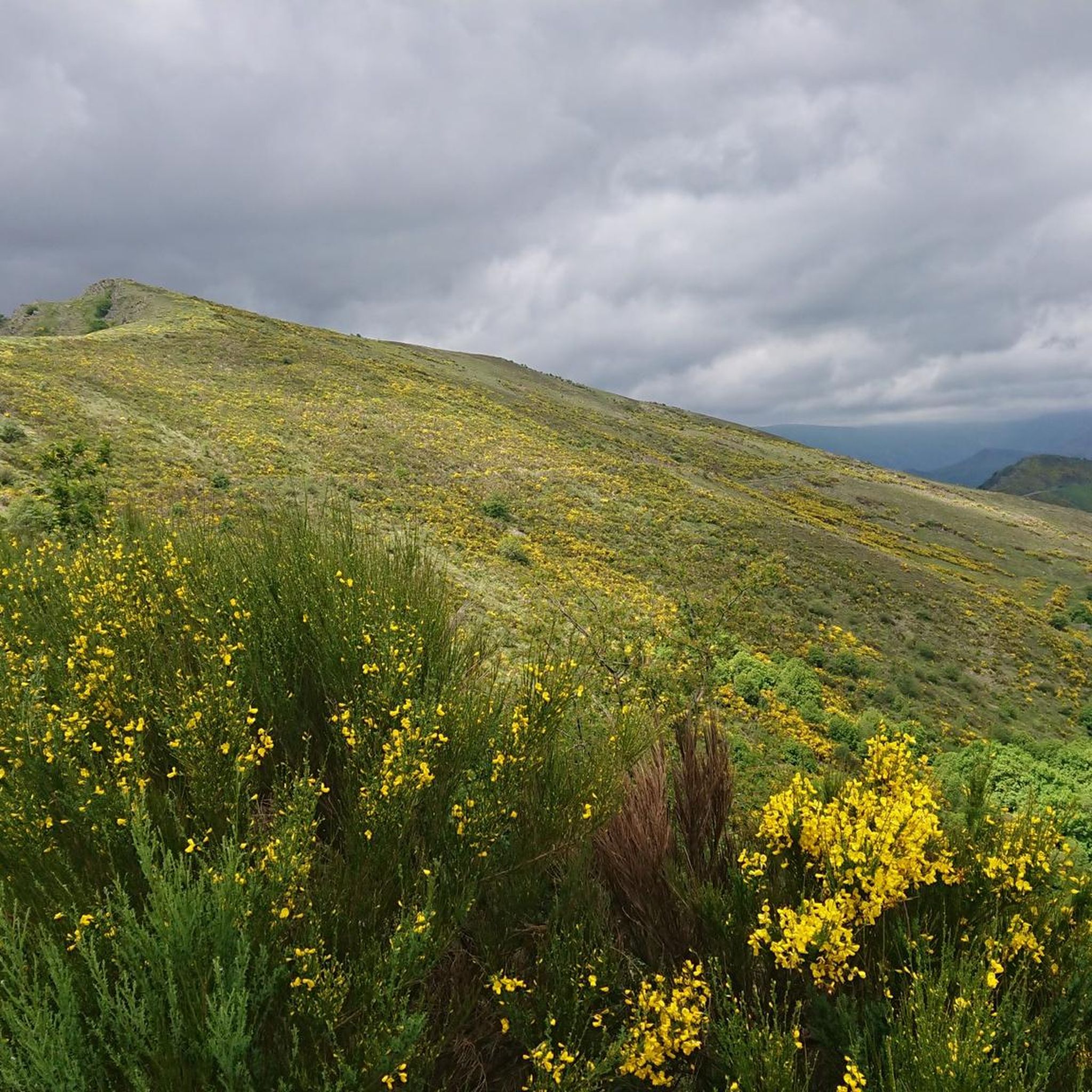
Road cycling routes around Les Plantiers are situated within the Cévennes National Park, a UNESCO World Heritage site. This region is characterized by its mountainous terrain, featuring numerous passes such as Col du Pas, Col de l'Espinasse, and Col de l'Asclier, alongside prominent peaks like Mont Aigoual. Cyclists encounter dramatic gorges, including the Gorges du Tarn, and limestone plateaus, with winding roads that offer varied elevation gains. The area provides a network of routes suitable for different fitness levels.
Best road cycling routes around Les Plantiers
- The most popular road cycling route is Col du Mercou (570 m) – Bridge over the Salindrenque loop from Saumane, a 30.5 miles (49.0 km) trail that takes 2 hours 32 minutes to complete. This moderate route features a significant climb over Col du Mercou.
- Another top favourite among local road cyclists is Col de la Tribale (612 m) loop from Valleraugue, a moderate 20.5 miles (32.9 km) path. This route offers views of the Cévennes landscape with a climb over Col de la Tribale.
- Local road cyclists also love the Roadbike loop from L'Estréchure - Maison ronde en bois dans les Cévennes, a 17.3 miles (27.8 km) trail leading through the Cévennes, often completed in about 1 hour 34 minutes.
- Road cycling around Les Plantiers is defined by mountain passes, dramatic gorges, and limestone plateaus. The network offers options for different ability levels.
- The routes in Les Plantiers are highly rated by the komoot community with an average score of 4.5 stars from over 70 reviews. More than 2,000 road cyclists have used komoot to explore Les Plantiers's varied terrain.
Last updated: October 30, 2026
5.0
(5)
200
riders
87.8km
04:58
1,990m
1,990m
Hard road ride. Very good fitness required. Some segments of this route may be unpaved and difficult to ride.
4.8
(13)
187
riders
47.7km
02:28
750m
750m
Moderate road ride. Good fitness required. Some segments of this route may be unpaved and difficult to ride.

5.0
(1)
81
riders
57.0km
03:09
1,180m
1,180m
Hard road ride. Very good fitness required. Some segments of this route may be unpaved and difficult to ride.
5.0
(1)
47
riders
76.0km
03:58
1,370m
1,370m
Hard road ride. Very good fitness required. Mostly well-paved surfaces and easy to ride.
4.3
(3)
45
riders
Moderate road ride. Good fitness required. Mostly well-paved surfaces and easy to ride.
Get access to more routes and recommendations from other explorers.
Already have an account?
Our route recommendations are based on thousands of hikes, rides, and runs completed by other people on komoot.
Start today with a free account
Your next adventure awaits.

Tips from the Community


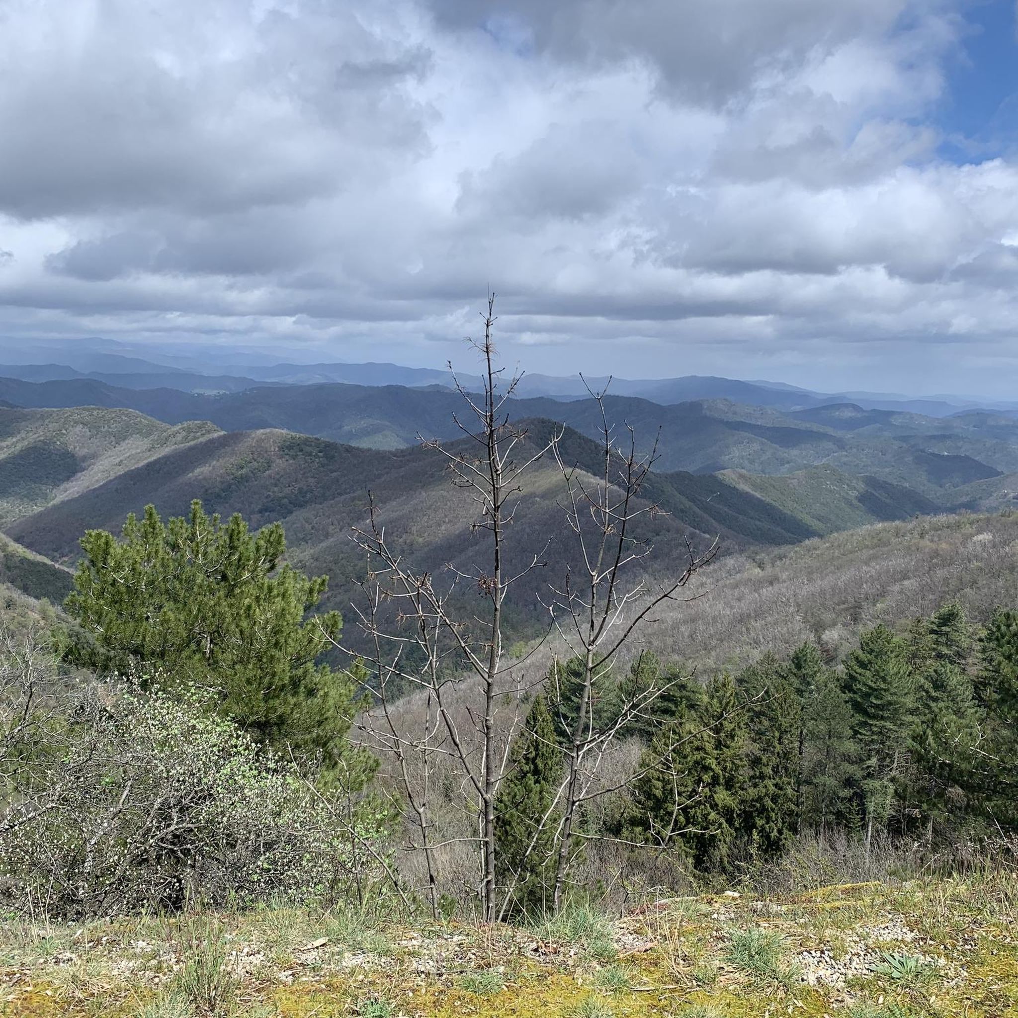
Sublime point, view of the Cévennes and the Mediterranean Sea in good weather
0
0

A bathing spot in the river and "UNESCO World Heritage Cevennes" I find really good 🤣
0
0

Under the title “France’s Wild South,” an episode of the British television series »National Parks – Protected Natural Wonders« on 3sat introduces the Cévennes. The accompanying text on the website states: “Lush green mountains, barren high plateaus, and deep gorges characterize this landscape, which, unlike France’s coasts, has not yet been discovered by mass tourism. Yet, it boasts what are probably the country’s most spectacular river landscapes.” The worthwhile film contribution in German can be accessed in the media library at the following link =>> https://www.3sat.de/dokumentation/nationalparks-geschuetzte-naturwunder/nationalparks-geschuetzte-naturwunder-cevennen-frankreichs-wilder-sueden-102.html
0
0
This small sacred monument, too, is a symbol of remembrance of the crucifixion and resurrection of Jesus Christ. However, its design is very unique and unlike the usual crosses that often crown mountain peaks. At the end of the triangular base plate, a small wall appears to have been built, its sides terminating in the shape of a stepped gable. In the center is a V-shaped cutout, the ends of which extend significantly beyond the height of the small wall. From this V emerges the longitudinal beam of the cross, which, however, has two crossbeams. This double crossbeam, as well as the lack of a corpus, is typical of the so-called "Lorraine Cross."
3
0

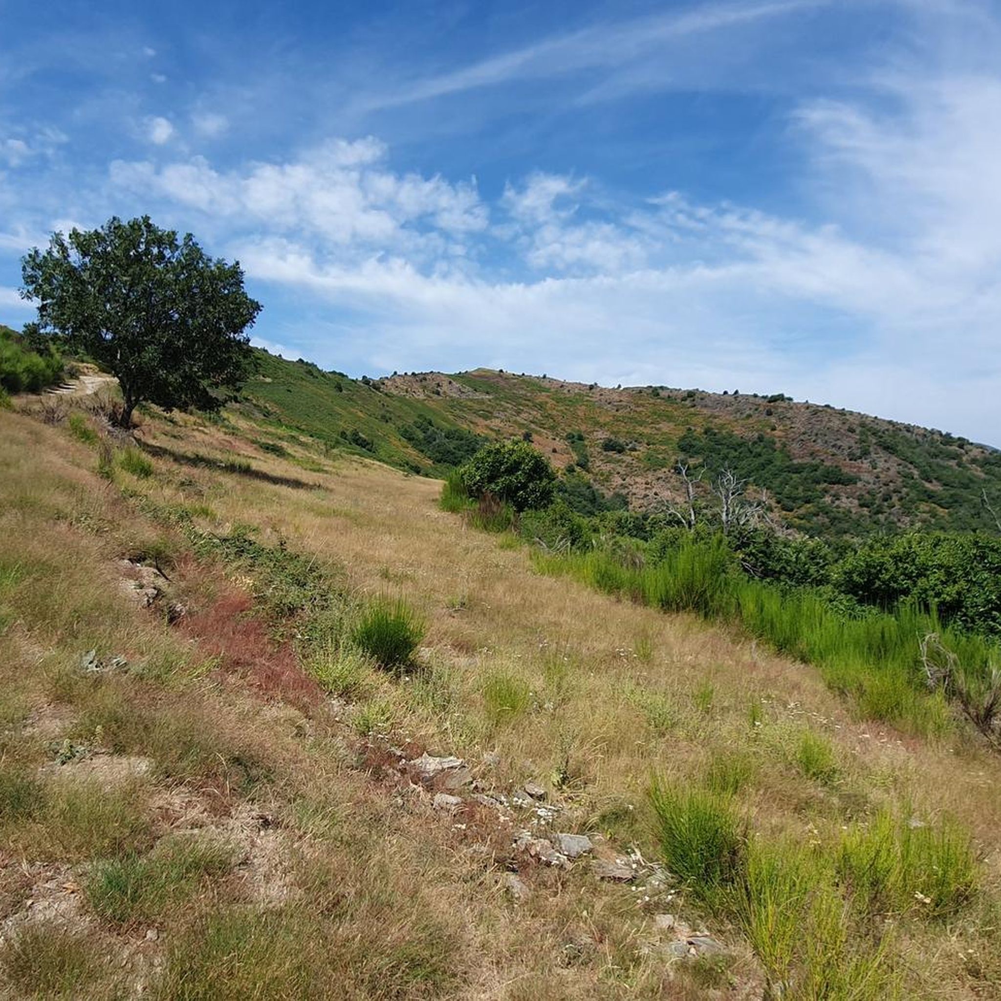
Lovely runnable climb, the start through the forest is nice for cycling. Afterwards the road surface becomes a bit worse. Nicely runnable climb.
0
0

Beautiful route through the Cévennes, along the river with a tunnel.
0
1
Frequently Asked Questions
How many road cycling routes are available around Les Plantiers?
There are over 45 road cycling routes around Les Plantiers, offering a wide range of options for different skill levels. The komoot community has explored more than 2,300 of these routes.
What kind of terrain can I expect when road cycling in the Cévennes near Les Plantiers?
The terrain around Les Plantiers is predominantly mountainous, characterized by numerous passes like Col du Pas, Col de l'Espinasse, and Col de l'Asclier. You'll encounter significant climbs, dramatic gorges such as the Gorges du Tarn, and limestone plateaus. The roads are often narrow and winding, providing a peaceful experience with less traffic.
What is the best time of year for road cycling in Les Plantiers?
The Cévennes region, including Les Plantiers, is generally best for road cycling from spring through autumn. During these seasons, the weather is more favorable, and the natural landscapes are at their most vibrant. Summer can be warm, but the higher elevations offer cooler temperatures.
How challenging are the road cycling routes around Les Plantiers?
The routes vary in difficulty, with 29 moderate and 15 difficult routes available. You can expect significant elevation gains, with some routes featuring climbs over prominent peaks like Mont Aigoual. For example, the Col du Mercou (570 m) – Bridge over the Salindrenque loop from Saumane includes an ascent of over 880 meters.
Are there routes suitable for beginners or less experienced road cyclists?
While many routes involve significant climbs, there are 2 easy road cycling routes available around Les Plantiers. These routes offer a gentler introduction to the region's beautiful scenery for those new to road cycling or looking for a more relaxed ride.
What natural features or landmarks can I see along the road cycling routes?
Road cycling routes often pass through stunning natural features and historical landmarks. You might encounter dramatic gorges, tranquil mountain villages, and ancient hamlets. Notable natural monuments include The 4000 Steps and Mount Aigoual. The region is also rich in diverse flora and fauna within the Cévennes National Park.
Are there any scenic viewpoints on the road cycling routes?
Yes, the mountainous terrain offers numerous opportunities for breathtaking views. You can find viewpoints such as the Signal de Saint-Pierre Orientation Table and the View of the Upper Hérault Valley, providing panoramic vistas of the Cévennes landscape.
Are there any circular road cycling routes available?
Yes, many routes are designed as loops, allowing you to start and end in the same location. Examples include the Col du Mercou (570 m) – Bridge over the Salindrenque loop from Saumane and the Roadbike loop from L'Estréchure - Maison ronde en bois dans les Cévennes.
What do other road cyclists enjoy most about the routes around Les Plantiers?
The routes in Les Plantiers are highly rated by the komoot community, with an average score of 4.5 stars from over 80 reviews. Cyclists often praise the tranquil, sparsely populated roads, the challenging climbs over mountain passes, and the dramatic, unspoiled natural beauty of the Cévennes National Park.
Is there parking available for cyclists in Les Plantiers?
While specific cycling parking facilities are not detailed, Les Plantiers is a small village within a national park. Parking is generally available in and around the village center, often near local amenities or trailheads, though it's advisable to check local signage upon arrival.
Can I find cafes or accommodation along the road cycling routes?
Many routes pass through small, unspoilt mountain villages where you can often find local cafes, restaurants, and guesthouses. Les Plantiers itself offers some options, and the wider Cévennes region is known for its hospitality. It's recommended to plan your stops in advance, especially in more remote areas.
Are the road cycling routes in Les Plantiers dog-friendly?
While the Cévennes National Park is generally welcoming to dogs, specific rules apply, especially regarding protected areas and wildlife. On road cycling routes, dogs should be kept on a leash, and it's important to consider their endurance and paw safety on paved surfaces. Always carry water for your pet.
Most popular routes around Les Plantiers
Most popular attractions around Les Plantiers

Get inspired with the komoot mobile app


Explore more
Browse the best Road cycling routes in other regions.
