The best road cycling routes around Sigy-En-Bray
4.8
(9)
867
riders
155
rides
Road cycling around Sigy-En-Bray offers diverse terrain within the Pays de Bray region of Normandy, France. The area is characterized by its distinctive "bocage" landscape, featuring rolling hills, valleys, and hedged farmlands. This geological "buttonhole" formation provides varied gradients and elevation changes, suitable for road cyclists. River valleys, such as that of the Andelle, offer relatively flatter sections, while the broader region includes access to the paved Avenue Verte London-Paris.
Best road cycling routes around Sigy-En-Bray
- The most popular road…
Last updated: May 21, 2026
6
riders
38.0km
01:37
300m
300m
Easy road ride. Great for any fitness level. Mostly well-paved surfaces and easy to ride.
6
riders
Moderate road ride. Good fitness required. Mostly well-paved surfaces and easy to ride.

Sign up for free
9
riders
94.2km
04:27
1,030m
1,030m
Hard road ride. Very good fitness required. Mostly well-paved surfaces and easy to ride.
5
riders
41.1km
01:50
350m
350m
Moderate road ride. Good fitness required. Some segments of this route may be unpaved and difficult to ride.
5
riders
126km
05:18
1,010m
1,010m
Hard road ride. Very good fitness required. Mostly well-paved surfaces and easy to ride.
Get access to more routes and recommendations from other explorers.
Sign up for free
Already have an account?
Our route recommendations are based on thousands of hikes, rides, and runs completed by other people on komoot.
Start today with a free account
Your next adventure awaits.
Login or Signup


Tips from the Community

Very nice park with informative exhibitions and a restaurant that makes excellent Quiche Lorraine, with very friendly service.
0
0

Taking tours of the park with a naturalist’s commentary is fantastic!
0
0
To refill your water bottle there is a water point in the cemetery.
0
0

The "Boutonnière" of the Pays de Bray is a depression 2 to 15 km wide, bordered on each side by more or less marked escarpments (cuestas). Soil erosion is uneven. Some resistance points have given rise to witness mounds. (The Monts de Sigy, Beauvoir en Lyons, etc.) In this depression, slight undulations create a varied landscape, composed of hedgerow meadows, wetlands, cultivated fields and vast forest massifs. There are clayey soils, suitable for pastures for dairy cattle breeding. On the summits and plateaus, the soil is made up of clay and flint, while the lowest areas are dominated by meadows and forests. The soil is very humid, with a ferruginous subsoil (thermal springs) and iron ore, as well as colored clays (ceramics) and glass industry linked to the forest.
0
0
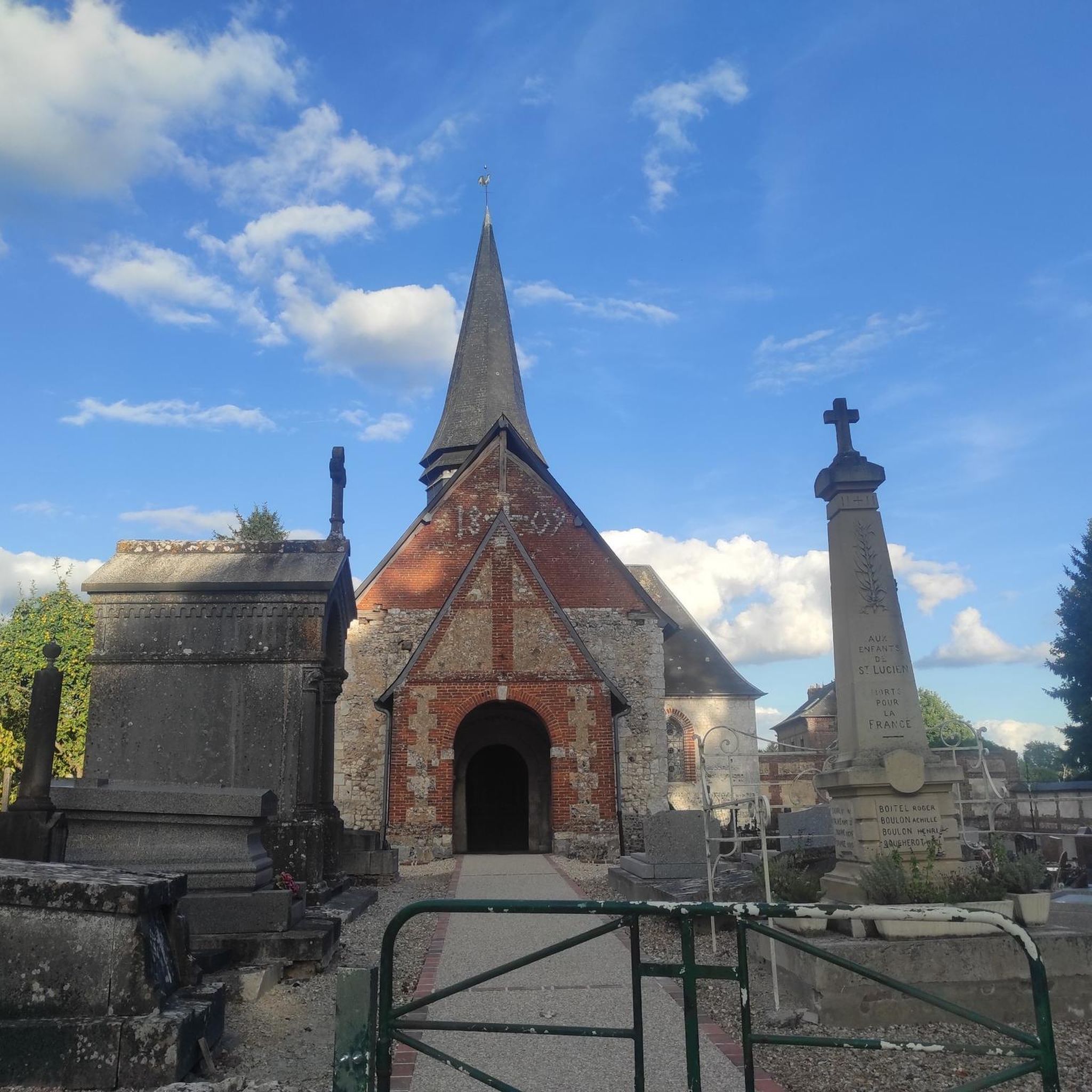
The Church of Saint-Martin, a former abbey church from the 11th century. The Abbey was founded by the Lord of La Ferté in 1040. Only the nave remains of the abbey church from that period. In the 13th century, the choir and the west façade of the building were built, remodeled in the 15th century. The bell tower was built in the 15th century. Inside, the baptistery dates from the 15th century. There is a primitive Gothic choir with a 7-sided apse. This monument is listed as a Historic Monument.
0
0

This former abbey church (MH) which became a parish church is a beautiful 13th century building. It has a primitive Gothic heart with a 7-sided apse. It has many details such as the (rare) statue of the seated Christ and a stone horse's head.
1
0
The church of Mesnil-Lieubray was built at various times. The oldest parts date back to the 13th century. In the 19th century, the church was annexed by a chapel on the south wall of the choir. It has a very slender bell tower which houses a bell blessed in 1849 and still rung by hand. On your way, you will appreciate pretty houses and a dovecote.
2
0
The original construction of the building dates back to the 11th and 12th centuries, partly destroyed by lightning on June 10, 1883. In 1896 it was decided to demolish and completely rebuild the church. In front of the church, you can admire the Dillard Fountain. This dates from 1901. Although he died about fifteen years before its construction, Mr. Dillard was keen to supply the city with drinking water and it was with this objective that he made a legacy in his will, a legacy which was contested by the family and whose lawsuit against the town of Saint-Saëns failed. The Dillard Fountain remained operational until 1960 when the city was connected to drinking water.
1
0
Frequently Asked Questions
What kind of terrain can I expect when road cycling around Sigy-En-Bray?
The region is characterized by its distinctive "bocage" landscape, featuring rolling hills, valleys, and lush hedged farmlands. This undulating topography provides varied gradients and turns, offering both challenging climbs and exhilarating descents. You'll also find relatively flatter sections along river valleys like the Andelle.
Are there road cycling routes suitable for beginners in Sigy-En-Bray?
Yes, Sigy-En-Bray offers a good selection of routes for those new to road cycling. Out of over 150 routes in the area, 35 are rated as easy, providing a gentler introduction to the region's charming countryside.
Are there challenging road cycling routes for experienced cyclists?
Absolutely. For experienced cyclists seeking a challenge, there are 9 difficult routes around Sigy-En-Bray. One such route is the Mondory Park – Gournay-en-Bray loop from Rouvray-Catillon, which covers 143.8 km with over 1000 meters of elevation gain, navigating the demanding rolling hills of the Pays de Bray.
How long are the road cycling routes typically around Sigy-En-Bray?
The routes vary significantly in length. For example, a moderate route like the The Buchy Market Halls – Outdoor Fitness Area loop from La Hallotière is around 41 km, while more challenging options like the Mondory Park – Gournay-en-Bray loop from Rouvray-Catillon can extend to nearly 144 km.
What natural features will I encounter on road cycling routes in the Pays de Bray?
You'll primarily experience the unique "bocage" landscape with its hedgerows and small fields, along with rolling hills and river valleys. The region is also known for its geological "buttonhole" formation, contributing to the diverse terrain. While dense forests like Eawy are nearby, road cycling routes typically offer views of these woodlands rather than passing directly through them.
Are there any historical sites or landmarks to see while cycling near Sigy-En-Bray?
Yes, the area is rich in cultural heritage. You can encounter sites such as the 13th-century church of St. Martin, the chateau of Imbleval, and the 11th-century church of St. Lucien. Notable highlights you might pass include Blainville-Crevon Castle and the charming village of Lyons-la-Forêt.
Are there circular road cycling routes available in Sigy-En-Bray?
Many of the road cycling routes around Sigy-En-Bray are designed as loops, allowing you to start and end at the same point. Examples include the Levavasseur Cotton Mill – Levavasseur Spinning Mill loop from Rouvray-Catillon and The Buchy Market Halls – Blainville-Crevon Castle loop from Rouvray-Catillon, which are popular choices for exploring the region.
What do other road cyclists enjoy the most about road cycling in Sigy-En-Bray?
The area is highly rated by the komoot community, with an average score of 4.8 stars from over 10 reviews. Reviewers often praise the diverse terrain, from challenging rolling hills to scenic river valleys, and the opportunity to explore the rural charm of the Pays de Bray on well-maintained local road networks.
Is there parking available for cyclists in Sigy-En-Bray?
While specific dedicated cycling parking facilities are not detailed, the rural nature of Sigy-En-Bray and surrounding villages often provides opportunities for parking in public areas or near local amenities, especially for those starting a route from a specific village or attraction.
What is the best time of year for road cycling in Sigy-En-Bray?
The spring and autumn months generally offer the most pleasant conditions for road cycling in the Pays de Bray, with milder temperatures and beautiful scenery. Summer can also be enjoyable, though it may be warmer, while winter can bring colder, wetter weather.
Are there any permits required for road cycling in the area?
No specific permits are generally required for road cycling on the public road networks around Sigy-En-Bray or within the Pays de Bray region. Cyclists are free to explore the local roads and dedicated routes like sections of the Avenue Verte.
Are there family-friendly road cycling routes around Sigy-En-Bray?
While many routes feature rolling hills, there are easier options suitable for families, particularly those looking for less strenuous rides. The dedicated Avenue Verte London-Paris, accessible in the broader Pays de Bray, offers a high-quality, asphalt surface ideal for family cycling away from traffic.
Most popular attractions around Sigy-En-Bray

Get inspired with the komoot mobile app


Explore more
Browse the best Road cycling routes in other regions.
