The best mountain hikes around Frankweiler
4.0
(4)
24
hikers
6
hikes
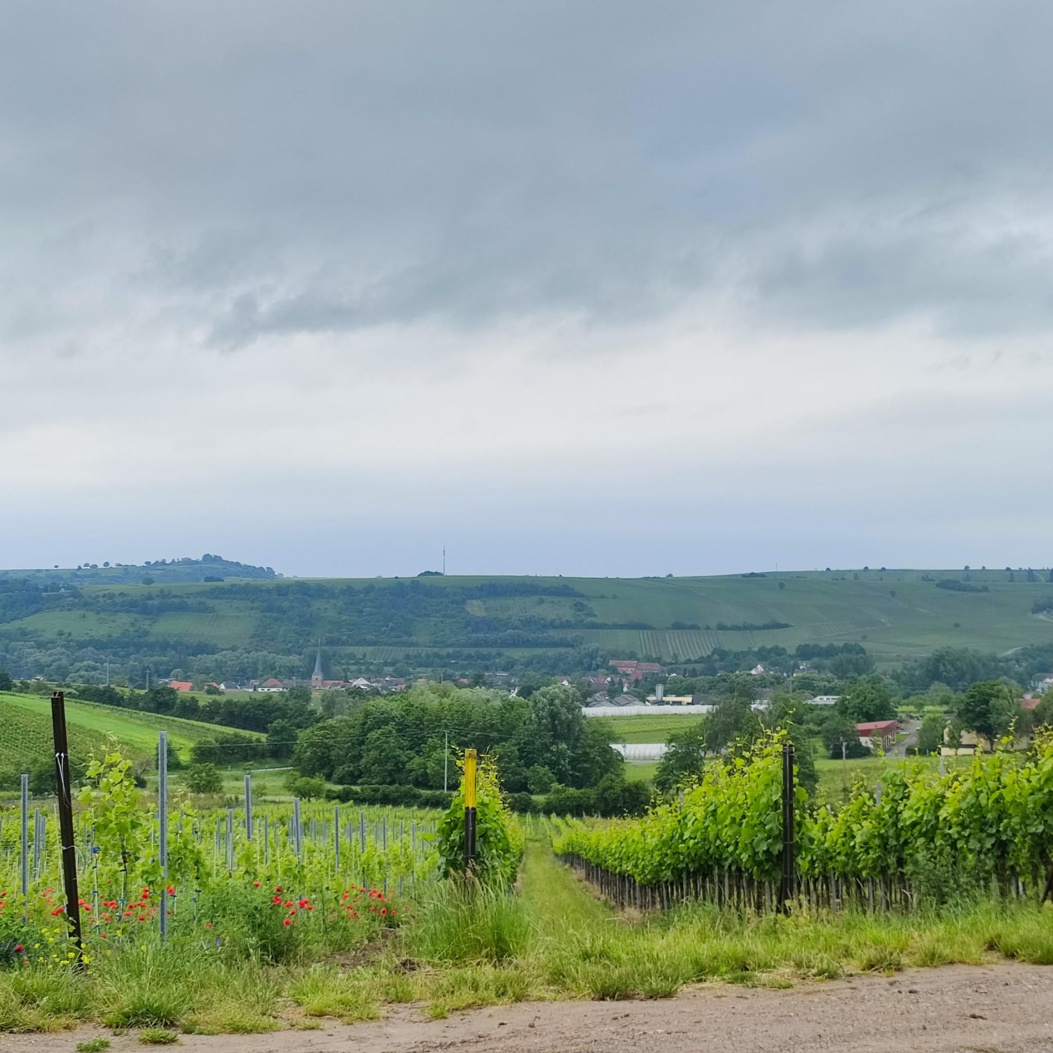
Mountaineering routes around Frankweiler traverse the diverse landscape of the Südliche Weinstraße region. The area is characterized by rolling hills, extensive forests, and vineyards, offering varied terrain for ascents and descents. Elevations are moderate, with routes often leading to scenic viewpoints over the Rhine Valley. The geology primarily consists of sandstone, contributing to the region's distinct natural features.
Best mountaineering routes around Frankweiler
- The most popular mountaineering route is Bishop’s Cross on Teufelsberg – Dreimärker Stone loop from Albersweiler (Pfalz)…
Last updated: November 1, 2026
4.0
(4)
9
hikers
Hard mountaineering route. Very good fitness required. Mostly walkable paths. Sure-footedness required.
6
hikers
10.7km
03:29
440m
450m
Moderate mountaineering route. Good fitness required. Mostly walkable paths. Sure-footedness required.

4
hikers
12.0km
03:33
340m
340m
Moderate mountaineering route. Good fitness required. Mostly walkable paths. Sure-footedness required.
2
hikers
8.09km
02:36
350m
350m
Moderate mountaineering route. Good fitness required. Easily walkable paths.
2
hikers
15.3km
04:47
560m
560m
Moderate mountaineering route. Good fitness required. Mostly walkable paths. Sure-footedness required.
Our route recommendations are based on thousands of hikes, rides, and runs completed by other people on komoot.
Start today with a free account
Your next adventure awaits.

Tips from the Community

Nice hut, nice view if the weather cooperates
0
0

On the occasion of an interview about the writings of Saint Augustine (354 to 430), one question was what would the Bishop of Hippo want to say to us people of today? „I believe he would call on us to allow ourselves the luxury of silence, because we are all in a perpetual vortex of noise. And this is now the true luxury: a space of silence… in which one simply listens to the voice of one's own heart… We never listen to our heart, which is the most precious thing we have.“ (Silvia Guidi, L'Osservatore Romano). The rest area set up at this small sacred monument located here can invite us to do just that.
0
0

After the observation tower from 1868 had collapsed, the Pfälzerwald-Verein built a new, 21 m high tower in 1928/29. It offered living spaces, electric light, and running water. From there, one could see far over the Pfälzerwald and the Vosges mountains to the Hunsrück, Taunus, Odenwald, and Black Forest. Therefore, the Kalmit was considered the "most beautiful vantage point in the Palatinate".
1
0
"600 m above sea level" means that the spot is 600 meters above sea level.
1
0

From Hambach Castle, you have a wonderful view of the Rhine plain. In good visibility, the Odenwald forest is also very clearly visible.
1
0

Locals often refer to it as the "Wetterkreuz" instead of the Bischofskreuz. The last approx. 100 m to the summit can be managed with a mountain bike, but older bikers should partially push their bikes due to numerous tree roots and stones.
0
0

A very beautiful path leads past the stone pyramid, which marks the highest point of the Blätterberg. But there are other markings here too. Ancient boundary stones and rocks with boundary marks can be found on the path. The cross stands for the Hochstift Speyer.
1
0
Frequently Asked Questions
What kind of terrain can I expect on mountaineering routes around Frankweiler?
The Frankweiler region, part of the Südliche Weinstraße, features diverse terrain. You'll encounter rolling hills, extensive forests, and picturesque vineyards. The routes often lead to scenic viewpoints over the Rhine Valley, with moderate elevations. The geology is primarily sandstone, contributing to the distinct natural features of the area.
Are there any challenging mountaineering routes in Frankweiler?
Yes, for those seeking a more demanding experience, the Bishop’s Cross on Teufelsberg – Dreimärker Stone loop from Albersweiler (Pfalz) is a difficult route. It spans 13.7 miles (22.1 km) with significant elevation gain and offers panoramic views from Teufelsberg.
Which routes are suitable for mountaineers looking for a moderate challenge?
Several routes offer a moderate challenge. The St. Martin Church – Weinstube Altes Rathaus loop from Sankt Martin is a popular choice, winding through historic villages and vineyards over 6.4 miles (10.3 km). Another option is the Sandwiesen Pond – House at the Firs loop from Sankt Martin, a 7.5-mile (12.0 km) trail through forests and tranquil ponds.
Are there any circular mountaineering routes available in the Frankweiler area?
Yes, many of the mountaineering routes around Frankweiler are designed as loops. For instance, the Ludwig Tower – Rietburg Chairlift loop from Rhodt unter Rietburg is a moderate 8.1 km (5.0 miles) circular route, offering varied scenery.
What are some scenic viewpoints or landmarks I can see along the routes?
The region is rich in scenic spots and landmarks. You can enjoy views from Teufelsberg on the challenging Bishop's Cross route. The Orensfels Viewpoint is another notable spot. Additionally, you might encounter historic sites like Trifels Castle or Landeck Castle, which are prominent features in the wider area.
Are there any routes that pass by lakes or ponds?
Yes, the Sandwiesen Pond – House at the Firs loop from Sankt Martin specifically leads through paths near tranquil ponds. You can also find highlights like Hilsch Pond and Sandwiesen Pond in the vicinity.
What do other mountaineers say about the routes in Frankweiler?
The mountaineering routes in Frankweiler are highly rated by the komoot community, with an average score of 4.0 stars from over 4 reviews. Mountaineers often appreciate the varied terrain, from forested paths to vineyard-lined slopes, and the options for both moderate and challenging ability levels.
Are there any routes that offer a chance to stop at a cafe or restaurant?
Routes that pass through or near historic villages, such as the St. Martin Church – Weinstube Altes Rathaus loop from Sankt Martin, often provide opportunities to visit local establishments like traditional Weinstubes for refreshments.
What is the best season for mountaineering in Frankweiler?
Given the region's vineyards and forests, spring and autumn are particularly beautiful for mountaineering in Frankweiler, with pleasant temperatures and vibrant scenery. Summer can also be enjoyable, though it's advisable to start early to avoid the midday heat. Winter mountaineering is possible but requires appropriate gear and caution due to potentially colder and wetter conditions.
Are the mountaineering routes around Frankweiler suitable for families?
While there are no specifically designated 'easy' routes, some of the moderate, shorter loop trails, like the Ludwig Tower – Rietburg Chairlift loop from Rhodt unter Rietburg, could be suitable for families with older children who are accustomed to hiking. Always check the distance and elevation gain to ensure it matches your family's fitness level.
Can I bring my dog on the mountaineering routes?
Generally, dogs are welcome on trails in the Frankweiler region. The forested paths and rolling hills provide a good environment for dogs. However, always keep your dog on a leash, especially near vineyards, livestock, or in areas where wildlife might be present, and be mindful of local regulations.
How many mountaineering routes are available in the Frankweiler area?
There are currently 6 mountaineering routes detailed for the Frankweiler area, offering a range of moderate to difficult options to explore the diverse landscape.
Most popular routes around Frankweiler
Most popular attractions around Frankweiler

Get inspired with the komoot mobile app


Explore more
Browse the best Mountain Hikes & Routes in other regions.
