The best running trails around Ouroux-Sous-Le-Bois-Sainte-Marie
4.7
(19)
333
runners
103
runs
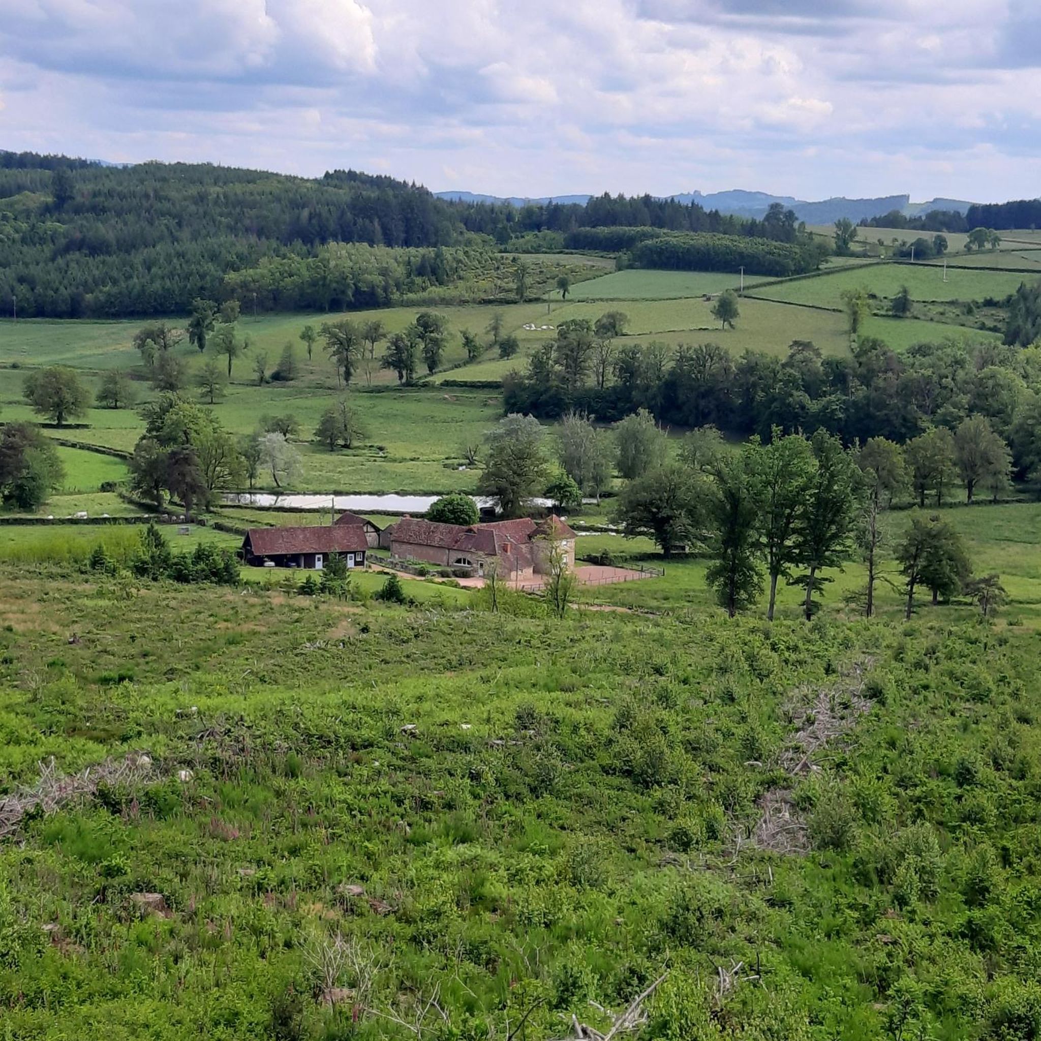
Jogging routes around Ouroux-Sous-Le-Bois-Sainte-Marie traverse an undulating landscape within the Brionnais region of Saône-et-Loire, France. The terrain features elevations ranging from 312 to 418 meters, providing varied running conditions. Routes often pass through traditional hamlets with stone houses, dovecote towers, and historical elements like washhouses and fountains. Natural features include the Fay woods, the Baise Stream, and dry stone walls that structure scenic views across the Charolais countryside.
Best jogging routes around Ouroux-Sous-Le-Bois-Sainte-Marie
- The most popular jogging route is Running…
Last updated: May 20, 2026
10
runners
13.0km
01:27
230m
230m
Moderate run. Good fitness required. Mostly paved surfaces. Suitable for all skill levels.
9
runners
10.5km
01:12
230m
230m
Moderate run. Good fitness required. Mostly paved surfaces. Suitable for all skill levels.

Sign up for free
7
runners
10.1km
01:06
110m
110m
Moderate run. Good fitness required. Mostly paved surfaces. Suitable for all skill levels.
4.0
(1)
9
runners
14.5km
01:42
440m
440m
Hard run. Very good fitness required. Mostly paved surfaces. Suitable for all skill levels.
8
runners
9.75km
01:10
190m
190m
Moderate run. Good fitness required. Mostly paved surfaces. Suitable for all skill levels.
Get access to more routes and recommendations from other explorers.
Sign up for free
Already have an account?
Our route recommendations are based on thousands of hikes, rides, and runs completed by other people on komoot.
Start today with a free account
Your next adventure awaits.
Login or Signup


Tips from the Community

Impressive views over southern Burgundy and Haut-Beaujolais
0
0

This ceremonial castle was built in the 17th century. A visit to this residence nicknamed “Little Versailles of Charolais” reveals a sumptuous interior. THE. French garden is classified as a Remarkable Garden by the DRAC (Regional Directorate of Cultural Affairs) of Burgundy.
1
0

A very steep climb from Montmelard, not much fun by bike. View is good, best very early or in the evening.
0
0

Mont Saint-Cyr, with its 771 m, is the highest point of the Mâconnais mountains. From its summit, you can enjoy a 360° view of the surroundings and even of the Alps when the weather allows it.
2
0
Mont Saint-Cyr, at 771 m, is the highest point of the Mâconnais mountains. From its summit, you can enjoy a 360° view of the surroundings and even of the Alps when the weather allows it.
3
0


It is a tough climb to the viewpoint, but the reward is a superior view on the landscape and a nice are to take a rest
1
0
Frequently Asked Questions
How many jogging routes are available in Ouroux-Sous-Le-Bois-Sainte-Marie?
There are over 90 running routes around Ouroux-Sous-Le-Bois-Sainte-Marie, offering a wide variety of options for different fitness levels and preferences. You'll find everything from easy jogs to more challenging trails.
What kind of terrain can I expect on the running trails in Ouroux-Sous-Le-Bois-Sainte-Marie?
The region features an undulating landscape with elevations ranging from 312 to 418 meters. Runners can expect varied terrain, including paths through traditional hamlets, past stone houses, and along natural features like the Fay woods and the Baise Stream. Dry stone walls also add to the rustic charm and structure the scenic views.
Are there any circular running routes in the area?
Yes, many of the running routes in Ouroux-Sous-Le-Bois-Sainte-Marie are circular. For example, the Running loop from Gibles is a popular 13 km circular trail, and the Étang des Clefs loop from Gibles offers a moderate 10.5 km circuit around the lake.
What are some notable landmarks or points of interest I might see while running?
The trails often pass through picturesque hamlets with traditional stone houses and dovecote towers. You might also encounter historical elements like a washhouse and fountain. Specific landmarks include the remains of a 16th-century tower near Lake Chassagne, and the area offers expansive views of the rolling Charolais countryside. For specific attractions, consider routes near Drée Castle or Mount St. Cyr.
Are there any difficult running routes for experienced runners?
Yes, Ouroux-Sous-Le-Bois-Sainte-Marie offers routes for all ability levels, including difficult ones. The Montagne Saint-Cyr – Mount St. Cyr loop from Gibles is a challenging 14.5 km route with significant elevation gain, ideal for experienced runners seeking a demanding workout.
What do other runners say about the trails in Ouroux-Sous-Le-Bois-Sainte-Marie?
The running routes in Ouroux-Sous-Le-Bois-Sainte-Marie are highly rated by the komoot community, with an average score of 4.5 stars from over 20 reviews. Runners often praise the varied terrain, the charming traditional hamlets, and the panoramic views of the Charolais countryside.
Are there any running routes that pass by lakes or water features?
Yes, several routes incorporate water features. The Étang des Clefs loop from Gibles circles the Étang des Clefs, providing views of local waterways. Another option is the Étang de Rambuteau loop from Gibles, which also features a lake.
Can I find family-friendly running paths in Ouroux-Sous-Le-Bois-Sainte-Marie?
While specific 'family-friendly' designations aren't always explicit, the region offers a range of easy to moderate routes that could be suitable for families. Look for shorter, less steep options among the 4 easy routes available, which provide a gentler introduction to the area's beauty.
Is there parking available near the trailheads?
While specific parking details for every trailhead are not provided, many routes, like the 'Circuit d'Ouroux' mentioned in regional information, typically start from central village points such as in front of the church, where parking is usually available. For routes starting from Gibles or Saint-Symphorien-des-Bois, you can generally find parking within the villages.
What is the best time of year for jogging in Ouroux-Sous-Le-Bois-Sainte-Marie?
The picturesque setting of Ouroux-Sous-Le-Bois-Sainte-Marie makes it appealing for jogging throughout much of the year. Spring and autumn offer pleasant temperatures and beautiful scenery with blooming flora or vibrant fall colors. Summer can be warm, so early morning or late afternoon runs are often preferred. Winter running is possible, but conditions may vary.
Are there any routes that offer historical insights into the region?
Absolutely. The region is rich in history. The 'Circuit d'Ouroux' itself incorporates an old pilgrimage lane dating back to the 8th century. Many routes pass through hamlets like La Croix, known for its oldest houses, and Chassagne, where you can see remains of a 16th-century fortified farm, offering a glimpse into the area's past.
Are dogs allowed on the running trails?
Generally, dogs are welcome on trails in rural French areas, especially if kept on a leash. However, specific rules can vary by private land or protected natural areas. It's always advisable to keep your dog under control and clean up after them to ensure a pleasant experience for all users and to respect local wildlife and livestock.
Most popular routes around Ouroux-Sous-Le-Bois-Sainte-Marie
Most popular attractions around Ouroux-Sous-Le-Bois-Sainte-Marie

Get inspired with the komoot mobile app


Explore more
Browse the best Running Trails & Routes in other regions.
