The best MTB trails around Spechbach
4.5
(596)
2,419
riders
320
rides
Mountain bike trails around Spechbach are situated in the Rhein-Neckar district of Baden-Württemberg, Germany, offering a diverse landscape for outdoor activities. The region is characterized by rolling hills and dense forests, bordering the Kleiner Odenwald and Kraichgau. This geographical setting provides varied terrain, from gentle paths to more challenging ascents, suitable for different mountain biking skill levels.
Best mountain bike trails in Spechbach
- The most popular mountain bike trail is MTB route no. 29: In the footsteps of Jean-Jacques Henner…
Last updated: November 7, 2026
5.0
(1)
4
riders
10.9km
00:40
40m
40m
Easy mountain bike ride.
4.8
(5)
11
riders
40.9km
03:27
570m
570m
Moderate mountain bike ride. Good fitness required. Advanced riding skills necessary.

4.7
(3)
30
riders
34.5km
01:45
80m
80m
Easy mountain bike ride.
4.8
(5)
9
riders
15.2km
01:20
240m
240m
Easy mountain bike ride.
4.0
(1)
13
riders
Easy mountain bike ride.
Get access to more routes and recommendations from other explorers.
Already have an account?
Our route recommendations are based on thousands of hikes, rides, and runs completed by other people on komoot.
Start today with a free account
Your next adventure awaits.

Tips from the Community

Ammertzwiller – destroyed front village and mine warfare Ammertzwiller was one of the particularly contested locations on the Sundgau front during World War I. From September 1914, the front line ran immediately west of the village. German troops held Ammertzwiller, while French positions were located near Gildwiller-le-Mont, among other places. On January 1, 1915, the entire population was evacuated. Shortly thereafter, the abandoned village itself became a combat zone. The church was destroyed on January 8, 1915. By the end of the war, Ammertzwiller was almost completely devastated. The place became particularly known for mine warfare. From May 1915, French sappers and German pioneers dug tunnels under the enemy positions and detonated them. The underground warfare lasted until early 1916 and left numerous explosion craters. A striking event was the German mine detonation on July 11, 1915. The explosion under the German outpost Sautter created a massive crater. The mine crater, now filled with water, is preserved as the "Entonnoir" and serves as a reminder of this form of warfare. German troops also built an extensive system of bunkers, shelters, and underground facilities. Today, the approximately 10.5 km long "Circuit de la mémoire d’Ammertzwiller" leads through this former front landscape. Around 15 information boards explain the local history. After the war, the residents returned to a largely destroyed village. Reconstruction left a lasting mark on Ammertzwiller. Today's Saint-Étienne church, with its depictions, preserves the memory of evacuation, war, and return. Particularly worth seeing: the water-filled mine crater and the Circuit de la mémoire d’Ammertzwiller.
0
0

Many walking opportunities nearby
0
0

The cannon must have been huge. It had a range of up to 40 km. It terrorized the inhabitants of Belfort. This was the response to the bombing of Freiburg, among other places. It was then used as a feint to distract from the attack on Verdun.
0
0
The German soldiers who died in the Battle of Mühlhausen in August 1914 are buried there, including the first casualty of World War I. It's a bit off the beaten track and very well maintained.
0
0

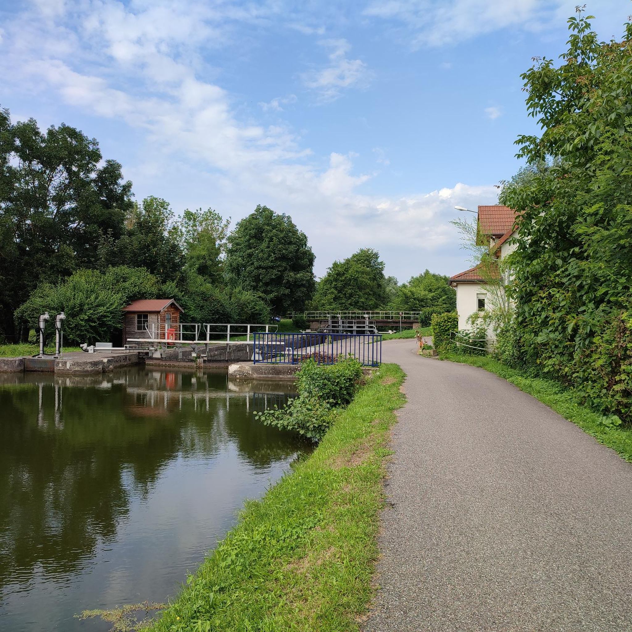
The French and European National Cycleway is a great cycleway winding along side of the Rhine Rhone Canal with very little climbing, for those who do not like to climb. However those who are climbing shy, must be aware of the wind in this area. A lot of the locks still have the former lock man’s house which adds a bit of charm to every lock. One is never alone on this route as there is a constant passing of bicycles, both leisure and racing bikes.
0
0

Beneath the forest canopy, you can discover numerous traces of bygone times, still visible or legible; only the "barracks" have disappeared. During a guided tour with one of the site's enthusiastic volunteers, you can explore the underground tunnels and discover the organization of this impressive military infrastructure. Of course, you can also visit the surface infrastructure yourself, following the marked route, where the panels provide detailed explanations. An application, "Site du Grand Canon de Zillisheim," is also available for download.
5
0
The Illfurth German War Cemetery was established by the French military authorities in April 1920. As a collective cemetery, it housed some of the fallen soldiers from the battles of August 7 and 17, 1914. The transfer of war dead to Illfurth, who had been provisionally buried in 64 municipalities and districts during the war or who had died in French captivity, ended in 1924. Among those reburied was the first German casualty of the 1914-1918 War on the Western Front, Lieutenant Albert Mayer, who fell on August 2, 1914, while on patrol. The first French soldier also lost his life in this battle. Several memorials erected in field cemeteries during the war were also relocated to Illfurth.
8
0

The 38 cm Schnellladekanone L/45 (38 cm S.K. L/45) was a gun used by the Imperial Navy and the German Army during World War I. Originally designed as a naval gun, it was also used on land under the designation 38 cm Geschütz Max or Langer Max. The "38 cm SK L/45" had a barrel with an inner diameter of 38 cm, making it one of the largest calibers used at the time. Its range was up to 48 km. Between 1915 and 1916, the German army installed a naval gun called the "Langer Max" in the Zillisheim Forest. This gun, designed to fire long bursts at Belfort and the Saint Amarin Valley, was actually a diversionary plan....
1
0
Frequently Asked Questions
How many mountain bike trails are available around Spechbach?
There are over 300 mountain bike routes around Spechbach, offering a diverse range of experiences for different skill levels. This includes 106 easy routes, 222 moderate routes, and 10 more challenging trails.
What kind of terrain can I expect on mountain bike trails in Spechbach?
The terrain around Spechbach is characterized by rolling hills and dense forests, situated at the border of the Kleiner Odenwald and Kraichgau regions. You'll find a mix of gentle paths and more challenging ascents, providing varied riding experiences.
Are there mountain bike trails suitable for beginners or families in Spechbach?
Yes, Spechbach offers a good selection of trails suitable for beginners and families. There are over 100 easy routes, such as MTB route no. 29: In the footsteps of Jean-Jacques Henner, which is 6.8 miles (10.9 km) long and offers a gentle introduction to the local landscape.
What are some scenic viewpoints or natural features I can see while mountain biking in Spechbach?
The region offers scenic views, particularly on clear days when you might even catch a glimpse of the Black Forest. The trails often wind through the dense woodlands of the Odenwald and along the picturesque Neckar valley. You can also explore areas near the Elsenz river for tranquil natural settings.
Are there any circular mountain bike routes in Spechbach?
Yes, many of the mountain bike trails around Spechbach are designed as circular routes, allowing you to start and end at the same point. An example of a moderate circular route is Singletrack Along the Water – Michelbach reserve loop from Ammertzwiller, which covers 23.7 miles (38.1 km).
What is the best time of year for mountain biking in Spechbach?
The best time for mountain biking in Spechbach is generally during spring, summer, and autumn when the weather is mild and the trails are dry. The dense forests provide good shade during warmer months, and the autumn foliage offers beautiful scenery. Winter riding is possible but may be affected by snow or ice, so checking trail conditions is advisable.
What do other mountain bikers enjoy most about the trails in Spechbach?
The mountain bike trails in Spechbach are highly rated by the komoot community, with an average score of 4.5 stars from over 400 reviews. Riders often praise the varied terrain, the beautiful natural landscapes, and the well-maintained paths that cater to different skill levels.
Are there any historical sites or attractions near the mountain bike trails?
Yes, the region around Spechbach offers several historical sites. You can find attractions such as the Port of Dannemarie, the Zillisheim Drawbridge and Lock No. 35, and the Mulhouse Historical Museum. The broader area also features historic sites like Waldangelloch Castle and St. Michael's Church.
Are there any lakes or water features accessible from the mountain bike routes?
Yes, some routes pass by or near water features. For instance, the Canal path – Port of Dannemarie loop from Heidwiller leads along waterways. You can also find natural lakes like Pond and Cabin between Fulleren and Carspach and Riedweiher Pond in the vicinity.
Are there any specific trails known for singletrack sections?
For those who enjoy singletrack, the Singletrack Along the Water – Michelbach reserve loop from Ammertzwiller is a popular choice. This moderate route features varied singletrack sections alongside natural reserves, providing an engaging riding experience.
Are there any moderate mountain bike trails that offer a good challenge without being overly difficult?
Absolutely. Routes like Heidwiller Castle – Bat cave. loop from Heidwiller offer a good balance of distance and elevation gain, making them suitable for riders looking for a moderate challenge. This route covers 12.9 miles (20.8 km) with over 350 meters of elevation gain.
Most popular routes around Spechbach
Most popular attractions around Spechbach

Get inspired with the komoot mobile app


Explore more
Browse the best MTB trails in other regions.
