The best walks and hikes around Älvsbyns kommun
4.5
(211)
998
hikers
20
hikes
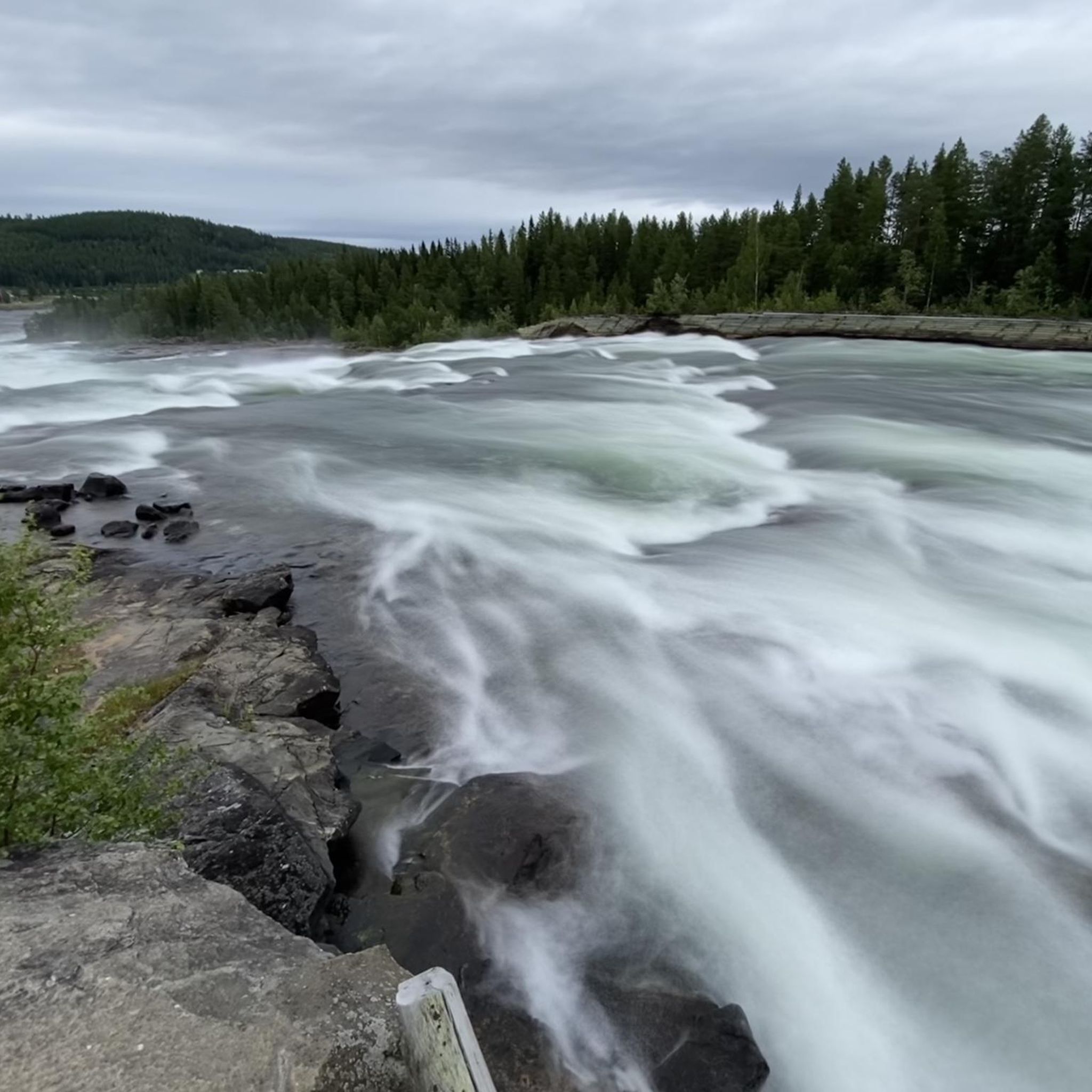
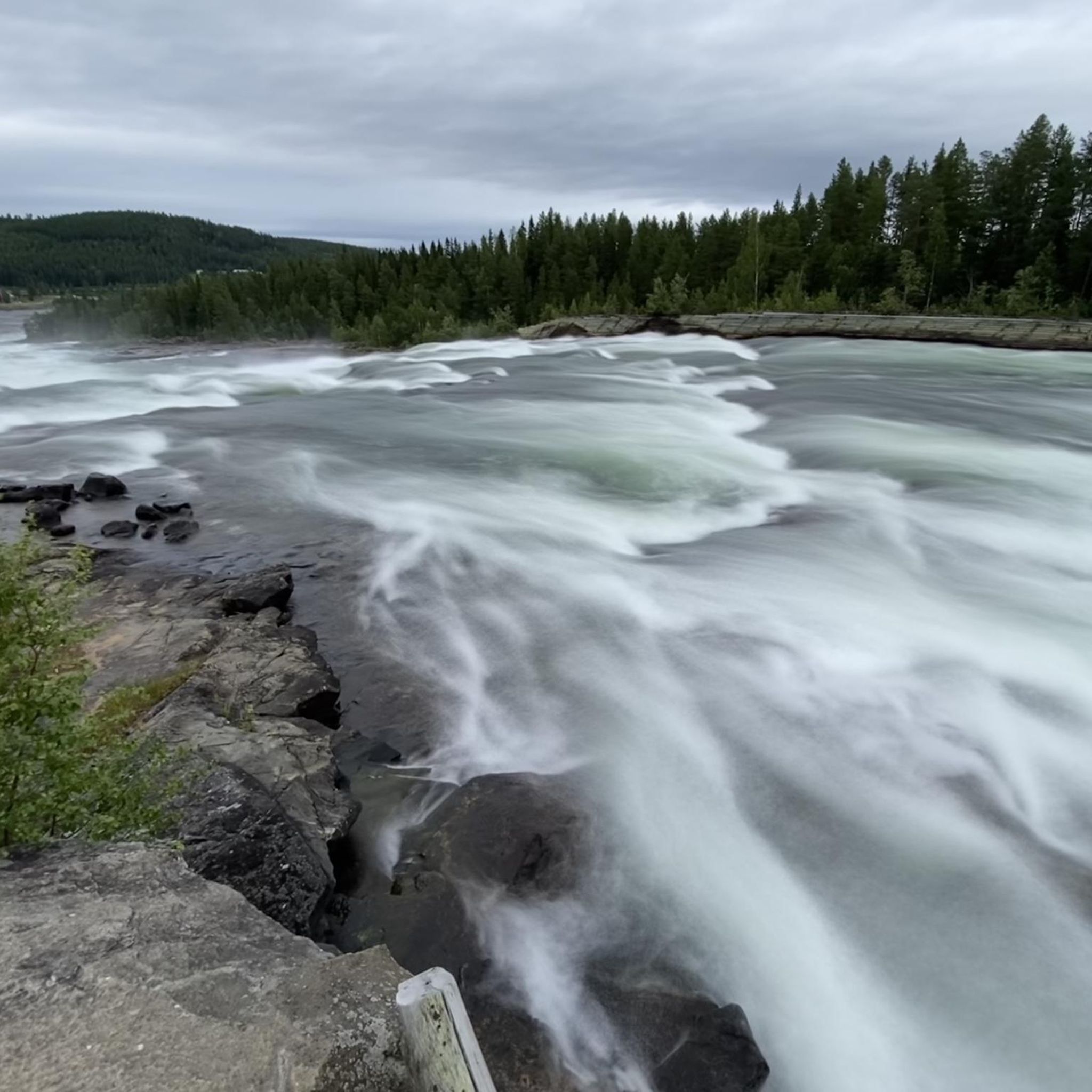
Hiking around Älvsbyns kommun offers access to a diverse and unspoiled natural landscape in Norrbotten County, Sweden. The region is characterized by mountains, green forests, and the Piteälven river, which features Europe's largest unharnessed rapids at Storforsen. Numerous nature reserves protect old-growth forests and unique geological formations, providing varied terrain for exploration. This area presents a mix of river valleys, forested hills, and higher peaks like Vitberget, the highest point in Norrbotten.
Best hiking trails around Älvsbyns kommun
- The most popular hiking route is Storforsen Coffee Cottage – Pite River Information Boards loop from Vidsel, a 7.3 miles (11.7 km) trail that takes 3 hours 44 minutes to complete. This moderate route explores the Pite River area near the Storforsen rapids.
- Another top favourite among local hikers is Storforsen Rapids – Storforsen Wooden Bridge loop from Storforsen, a moderate 5.8 miles (9.4 km) path. This trail offers views of the powerful Storforsen rapids and includes a wooden bridge crossing.
- Local hikers also love the Nature Trail Along the Rapids – Storforsen Rapids loop from Storforsen, a 1.3 miles (2.1 km) trail leading through the Storforsen Nature Reserve, often completed in about 35 minutes.
- Hiking around Älvsbyns kommun is defined by powerful river rapids, forested hills, and diverse nature reserves. The network offers options for various ability levels, from easy nature trails to more challenging mountain ascents.
- The routes in Älvsbyns kommun are highly rated by the komoot community with an average score of 4.7 stars from over 200 reviews. More than 900 hikers have used komoot to explore Älvsbyns kommun's varied terrain.
Last updated: July 28, 2026
4.7
(49)
176
hikers
Moderate hike. Good fitness required. Easily-accessible paths. Suitable for all skill levels.
4.7
(41)
144
hikers
9.36km
02:29
90m
90m
Moderate hike. Good fitness required. Easily-accessible paths. Suitable for all skill levels.

Sign up for free
5.0
(3)
22
hikers
Easy hike. Great for any fitness level. Easily-accessible paths. Suitable for all skill levels.
4.4
(5)
34
hikers
4.48km
01:32
150m
150m
Moderate hike. Great for any fitness level. Mostly accessible paths. Sure-footedness required.
5.0
(1)
20
hikers
Easy hike. Great for any fitness level. Easily-accessible paths. Suitable for all skill levels.
Get access to more routes and recommendations from other explorers.
Sign up for free
Already have an account?
Our route recommendations are based on thousands of hikes, rides, and runs completed by other people on komoot.
Start today with a free account
Your next adventure awaits.
Login or Signup
Popular around Älvsbyns kommun
Tips from the Community

beautiful waterfall Storvorsen enormous!
0
0


Bring sausages and matches. Wood is already there! (Also toilet)
1
0

The rapids of Storforsen are simply fascinating.
2
0
From here you can see the rapids of the Piteälven particularly well.
2
0
You can rest here.
0
0

A nice loop trail, along the rapids. Easy to walk on and partly also barrier-free.
1
0
Again and again nice resting places on the circular route.
1
0
Frequently Asked Questions
How many hiking trails are available in Älvsbyns kommun?
Älvsbyns kommun offers a diverse network of over 20 hiking trails, ranging from easy strolls to more challenging mountain ascents. This includes 11 easy routes and 9 moderate routes, ensuring options for various fitness levels.
Are there any family-friendly hiking options in Älvsbyns kommun?
Yes, Älvsbyns kommun has several family-friendly trails, particularly around the Storforsen area. The Nature Trail Along the Rapids – Storforsen Rapids loop from Storforsen is an easy 2.1 km path, often completed in about 35 minutes, perfect for families. The Storforsen Nature Reserve also features some wheelchair-accessible paths, making it inclusive for all.
Can I find circular hiking routes in Älvsbyns kommun?
Absolutely. Many trails in Älvsbyns kommun are designed as loops, allowing you to start and end at the same point. Examples include the popular Storforsen Coffee Cottage – Pite River Information Boards loop from Vidsel, which is 11.7 km, and the shorter Wooden Cabin Picnic Spot – Climb to Hundberget loop from Älvsbyn, covering 4.5 km.
What are the best trails for scenic views in Älvsbyns kommun?
For breathtaking views, consider trails leading to the area's mountains and hills. Hiking up Bredselsberget offers a beautiful panorama of Storforsen. The Wooden Cabin Picnic Spot – Climb to Hundberget loop from Älvsbyn provides exciting views from Hundberget, one of the prominent 'south mountains' in the region. Many nature reserves, such as Rackberget, also boast rewarding views from their peaks.
Are there any hiking trails that feature waterfalls?
Yes, the Storforsen area is famous for its powerful rapids, which are among Europe's largest unharnessed waterfalls. Trails like the Storforsen Rapids – Storforsen Wooden Bridge loop from Storforsen offer direct views of these magnificent rapids. You can also explore the Storforsen Rapids and the nearby Dead Falls (Döda Fallet) near Storforsen.
What do other hikers say about the trails in Älvsbyns kommun?
The hiking routes in Älvsbyns kommun are highly regarded by the komoot community, with an impressive average rating of 4.7 stars from over 200 reviews. Hikers frequently praise the powerful river rapids, the beauty of the forested hills, and the diverse nature reserves that define the area's unique outdoor experience.
Are there any accessible trails for wheelchairs or strollers?
Yes, the Storforsen Nature Reserve, a major attraction in Älvsbyns kommun, offers several trails that are wheelchair accessible. These paths allow visitors of all mobilities to experience the unique natural environment and the impressive rapids.
What kind of natural features can I expect to see while hiking?
Älvsbyns kommun is known for its diverse and unspoiled nature. You'll encounter mountains, green forests, and the majestic Piteälven river, home to the Storforsen rapids. The region also boasts 17 nature reserves with old-growth forests, boulder fields, forest tarns, and unique flora and fauna. Peaks like Vitberget (the highest in Norrbotten) and Hundberget offer varied terrain.
Are there any specific attractions or landmarks along the hiking routes?
Many trails lead to or pass by notable attractions. The Storforsen area is a hub for sights, including the Storforsen Rapids themselves, the Nature Trail Along the Rapids, and the Storforsen Museum. You'll also find picnic and barbecue areas by Pitsalen / Pine River, perfect for a break.
What is the best time of year to go hiking in Älvsbyns kommun?
Älvsbyns kommun offers unique hiking experiences throughout the year. Summer and early autumn provide lush green landscapes and comfortable temperatures, ideal for exploring forests and mountains. The powerful Storforsen rapids are a spectacle year-round. While winter brings snow, some routes may be suitable for winter hiking or snowshoeing, offering a different kind of beauty.
Are there opportunities for wild swimming after a hike?
The Piteälven river flows through Älvsbyns kommun, and the region is dotted with many clear lakes and rivers. While specific designated wild swimming spots aren't listed, the abundance of natural water bodies suggests opportunities for a refreshing dip after a hike, especially during warmer months. Always exercise caution and check local regulations.
Is there parking available at trailheads?
While specific parking details for every trailhead are not provided, popular hiking areas like Storforsen are generally well-equipped with visitor facilities, which typically include parking. For trails starting directly from Älvsbyn, such as the Wooden Cabin Picnic Spot – Climb to Hundberget loop from Älvsbyn, parking is usually available nearby.
Most popular routes around Älvsbyns kommun
Most popular attractions around Älvsbyns kommun

Get inspired with the komoot mobile app


Explore more
Browse the best Hikes in other regions.
